Continuing our tour of Utah National Parks — getting to the parks before the morons begin defacing them with the tacit or maybe explicit approval of the current administration – we did a leisurely drive from Cathedral City to Richfield, Utah and then into Moab on day two. We once again did the two-lane blacktop route from Cathedral City to almost the CA-NV border, enjoying desert landscape, geology everywhere and wildly uncrowded highways. We did not see the fat-arsed camo-commandos meeting at the Primm Casino and Hotel on the border this trip in their tricked out mini-van “transport vehicles”. It had been pretty entertaining to see four wildly overweight, 30–60-year-olds in full military field garb (with puckering buttons and bellies hanging far over the pants until it appeared that their wieners might sneak out over the top of their stretched to the limit waistbands) jump out of the mini-van and watch it bounce off the stops and hear the springs and shocks relax. It is always a surprise to see that place is still open based on the dearth of cars, the closed outlet mall and the general visible disrepair. The busiest places on the property are the gas station and the lottery sales/drug emporium/brothel (camo-commando hookers!!) store on the south side of the property. Just to be clear, the last two businesses that I think are operating in that particular location are my opinion based solely on visuals of the parking lot.
So, enough negativity! We arrived at the entrance to Arches NP around noon after the drive up from Richfield. I did get to show Joni where 38+ years ago, a Utah state trooper pulled me over while driving the Mazda RX-7 on the then two-lane portion of I-70 coming down off of the San Rafael Swell. He suggested that if I stopped in Green River at his brother-in-laws cafe, and promised not to speed in Utah, I could continue on to Denver with only a warning for doing 80 mph in a 55-mph zone at 7:00 AM on a Sunday morning. Since I had already expressed to him my surprise since my last glance at the speedometer indicated that I was going somewhere north of 110 mph, his offer seemed fair. As an aside, I-70 from the I-15 intersection east until Morrison, Co. is undoubtedly one of the prettiest stretches of fast-moving interstate highway in the country.
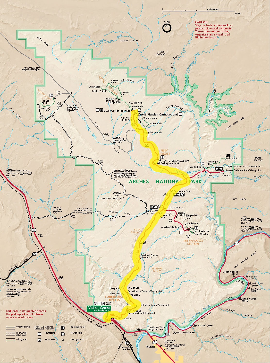
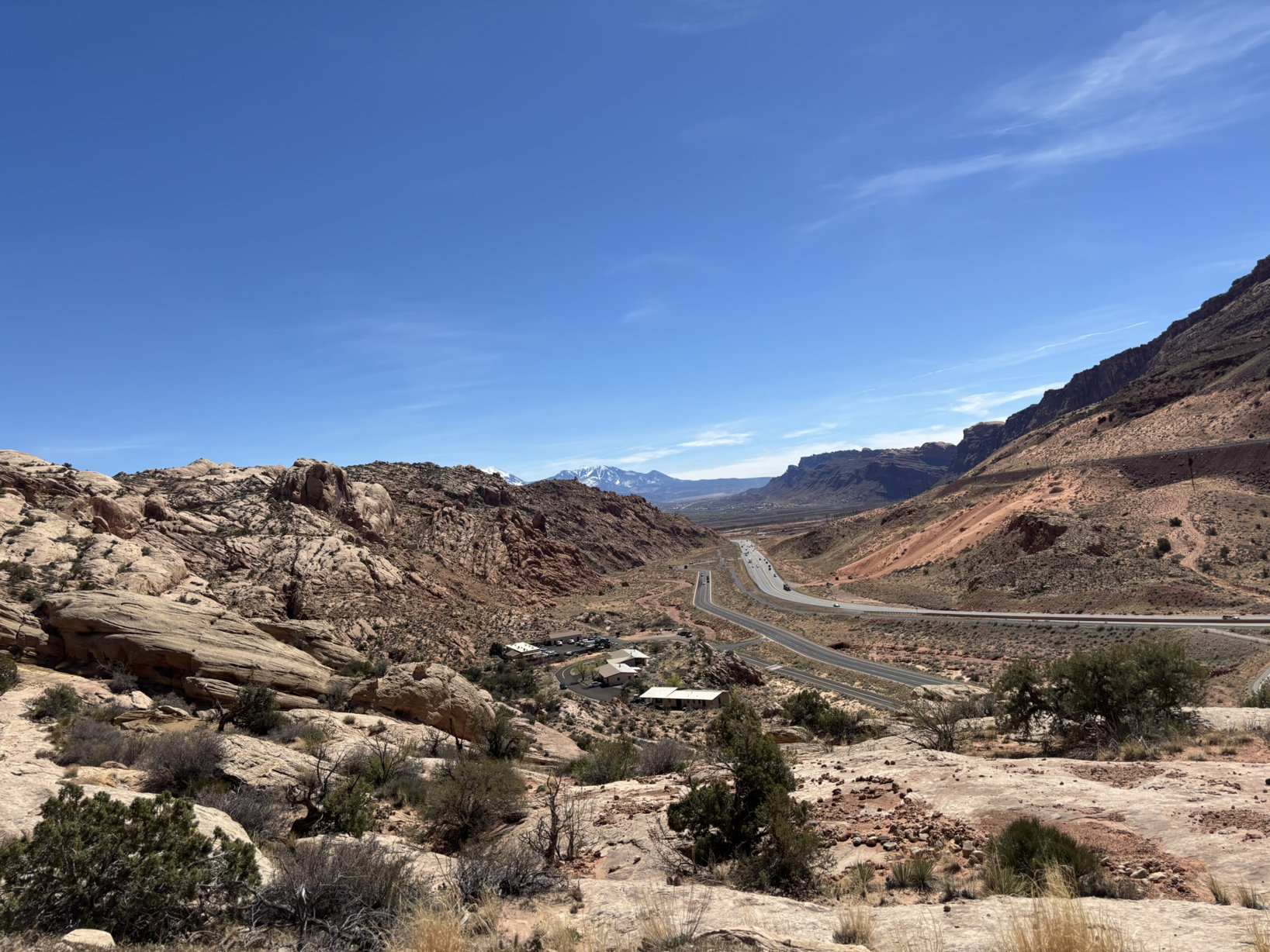
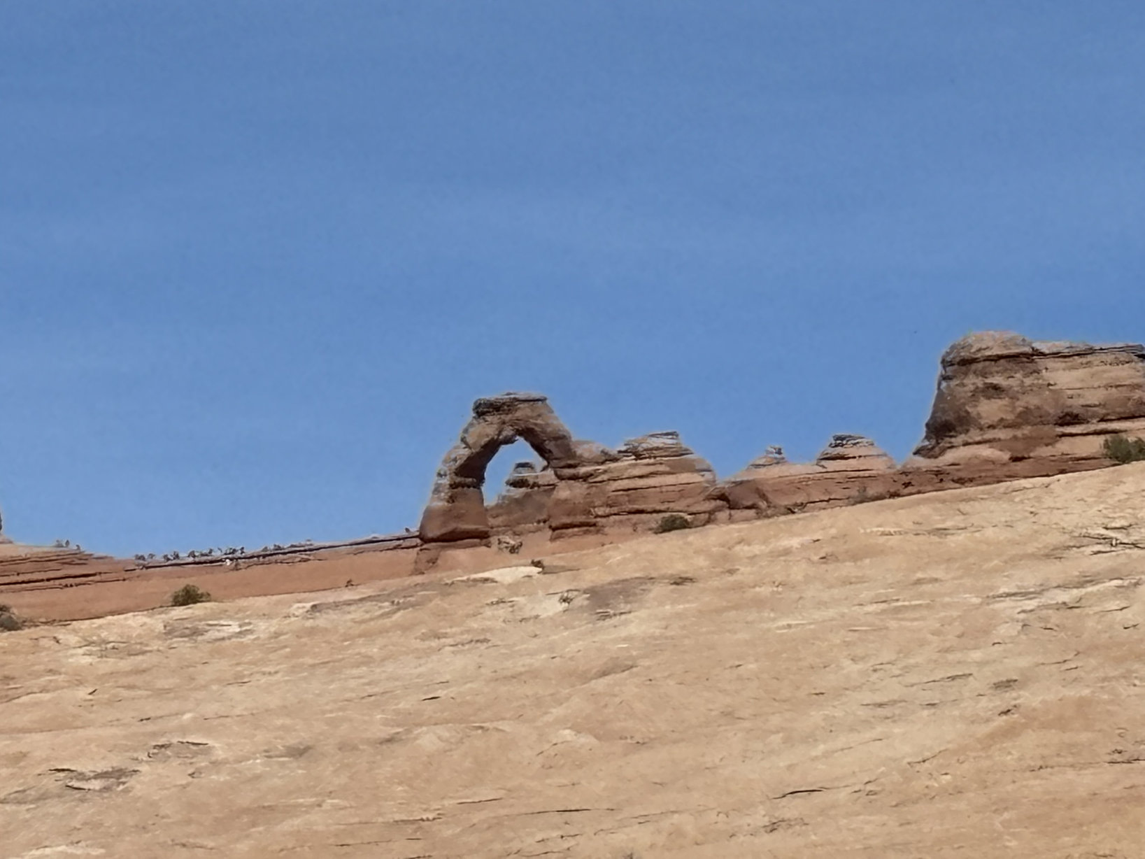
Our first afternoon was more of a reconnoitering of the park to see some of the sights and plan an early morning arrival on day 2 to help beat the crowds to the primo spots. The scenic road through Arches is about 18 miles one-way. It has been designed to get relatively easy access to the more scenic park features.
Geologically, Arches NP is within the Paradox Basin which is a subregion of the Colorado Plateau which we have looked at in several earlier posts. A cartoon, highly generalized, stratigraphic section is below with east on the left and west on the right (chat-gpt needs more geology training).
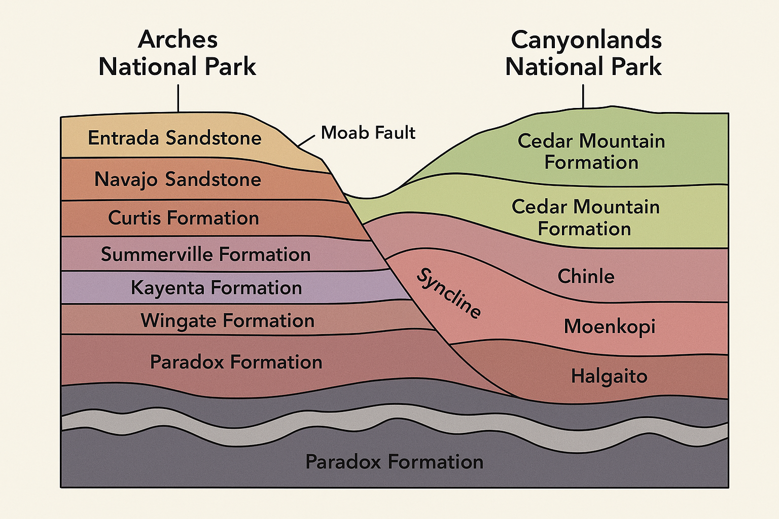
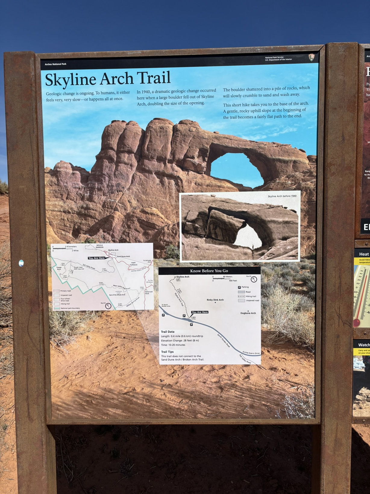
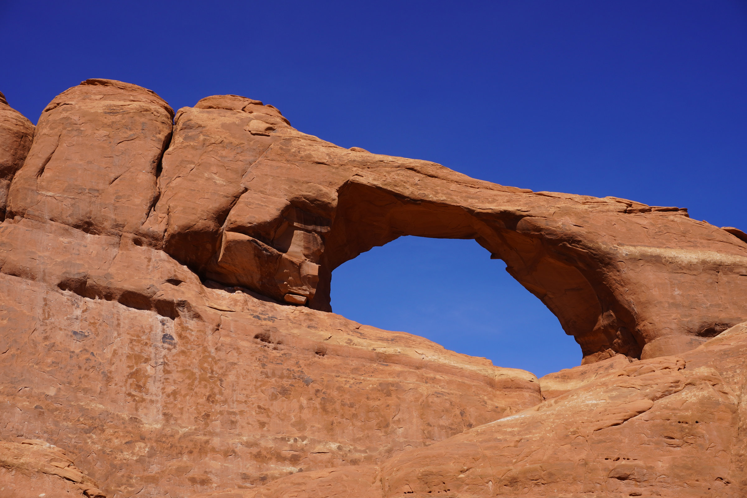
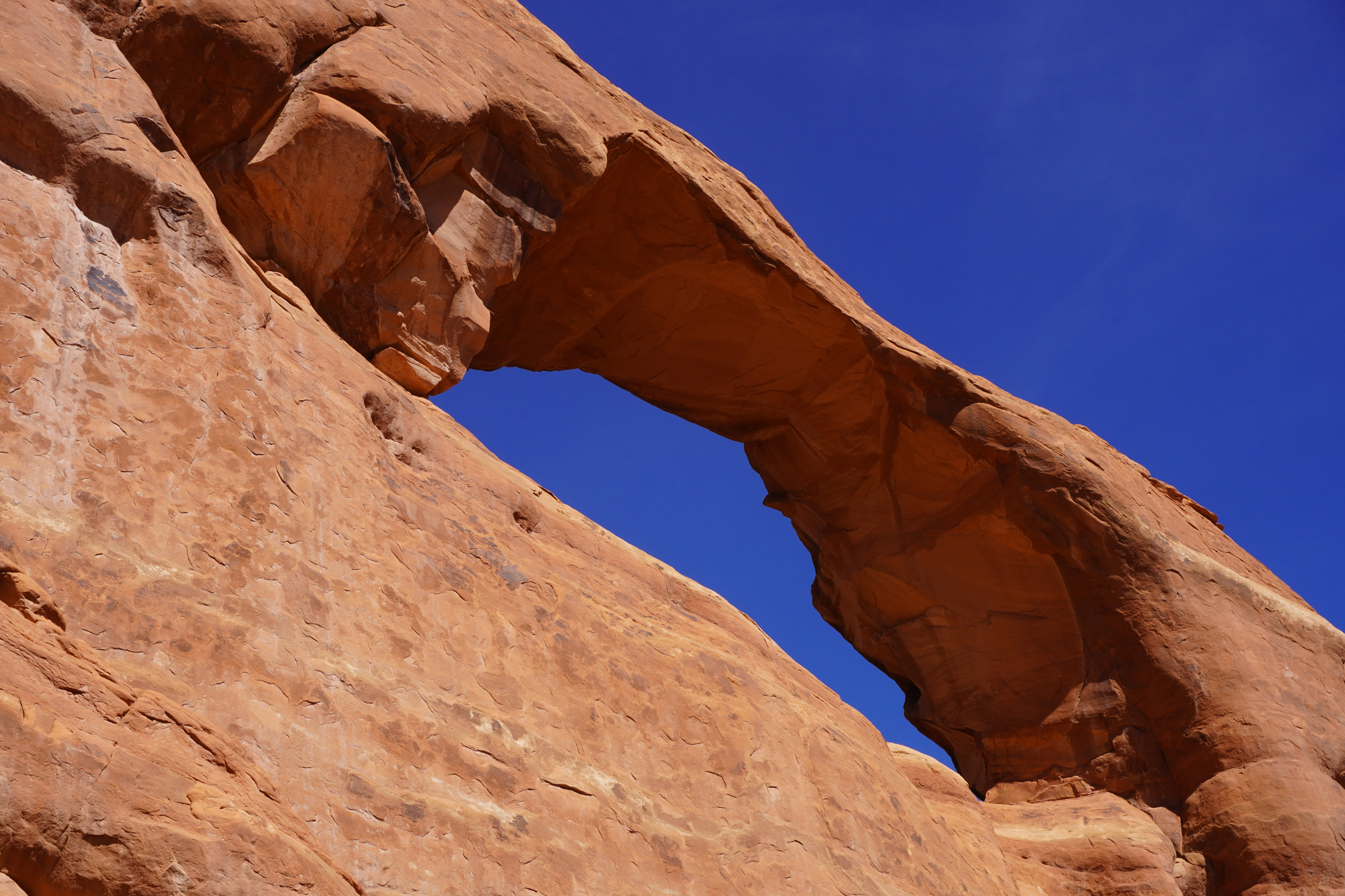
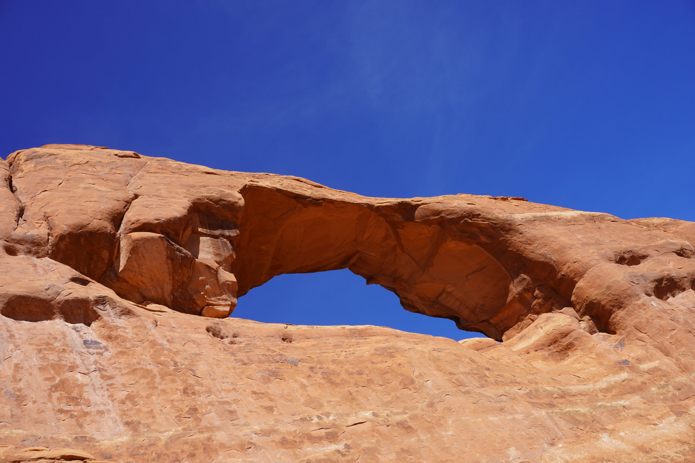
To help understand the arch forming process, I’ve highlighted important events or properties of the rock formations that enhance the arch forming ability of one type of rock over another. Most of the arches in the park are in the Entrada Sandstone which is a 170- to 160-million-year-old formation, deposited as sand and silts in dunes and in tidal flats. It includes thick rock units that are relatively porous and permeable, generally weakly cemented rock. Over time, the underlying Paradox Formation which has significant salt deposits experienced several episodes of uplift and deformation particularly in the salt layers which in turn, created uplift structures like domes, anticlines and synclines, enhancing the formation of joints in the overlying geologic formations including the Entrada Sandstone. With the subsequent uplift of the Colorado Plateau and longer-term stresses being applied to the formations from relatively the same directions, parallel jointing formed especially in the weaker cemented formations like portions of the Entrada Sandstone. Water, especially during freeze-thaw cycles, infiltrated joints in the formations and expanded them. Wind and occasional flash flooding removed loose grains from within the joints and chemical weathering enhanced and accelerated (geologically speaking) the rock disintegration, particularly in the joints. Vertical fins of rock formed between the joints as erosion exploited joint systems. From there, as the fins disintegrated, small windows opened, eventually enlarging and surviving as natural arches. The large arches take millions of years to form.
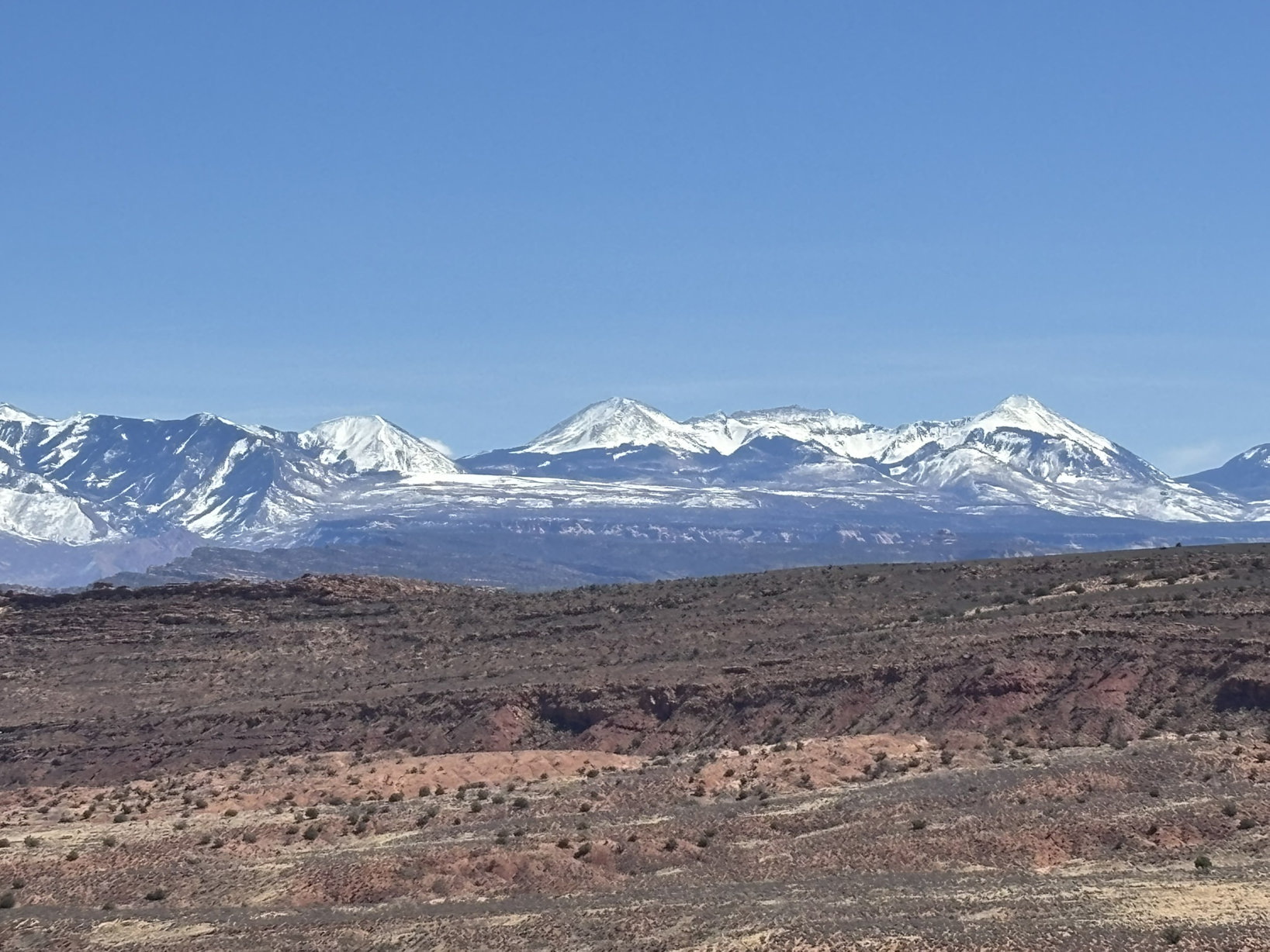
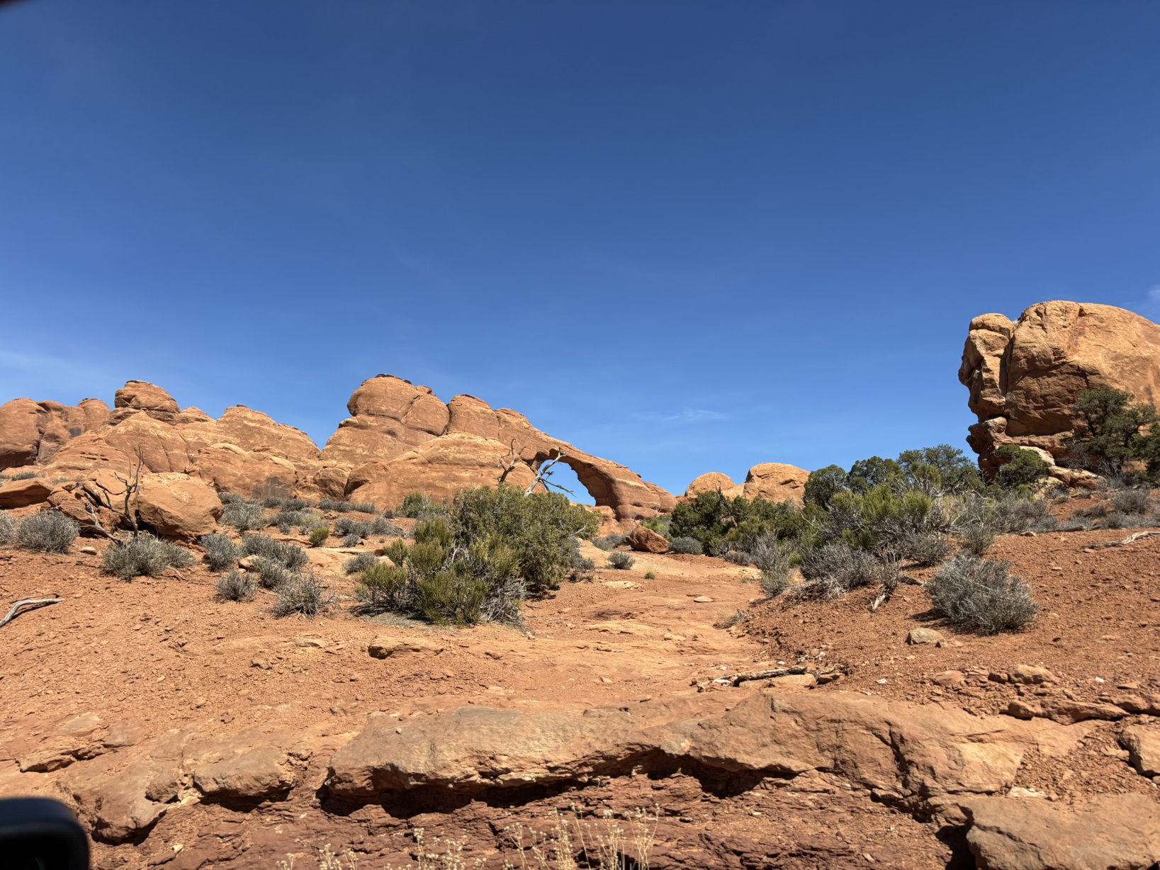
In the end, we get to enjoy stunning vistas. There are two groups of pictures below. If you double click on a picture it will enlarge. To get back to the blog, use the back arrow on your browser.
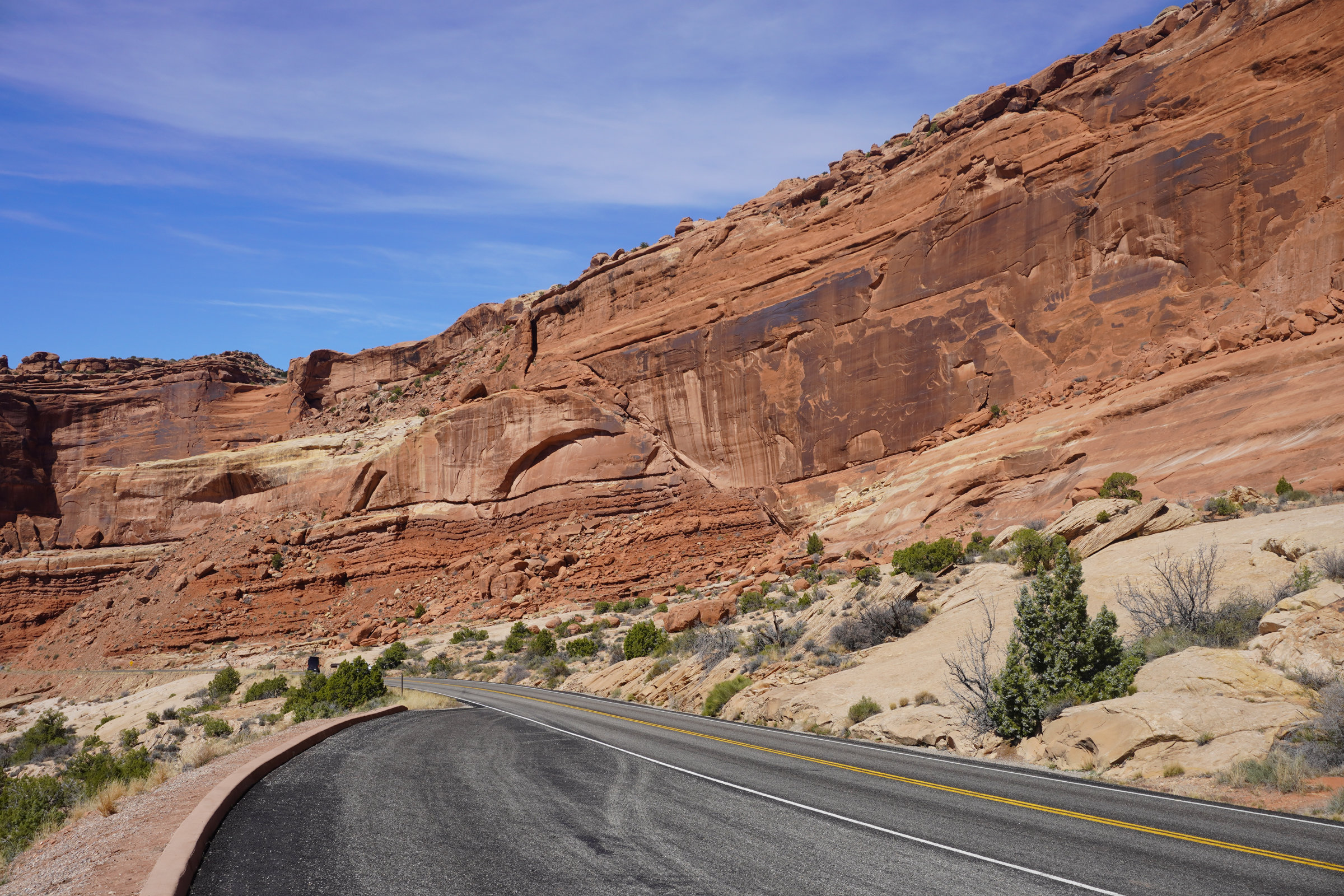
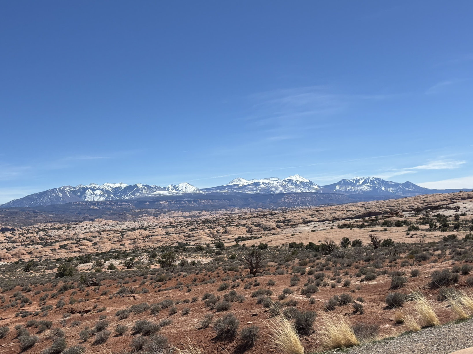
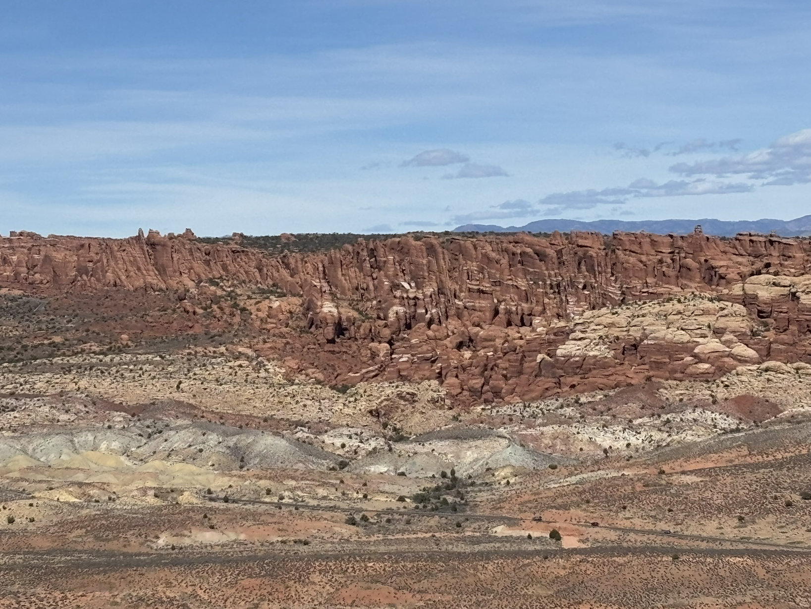
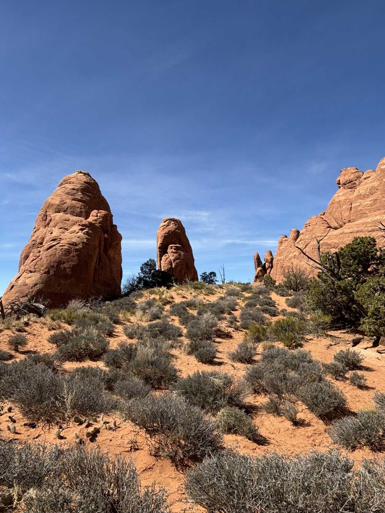
Group 1 – Day 1 – Red Rocks as Far as the Eye Can See

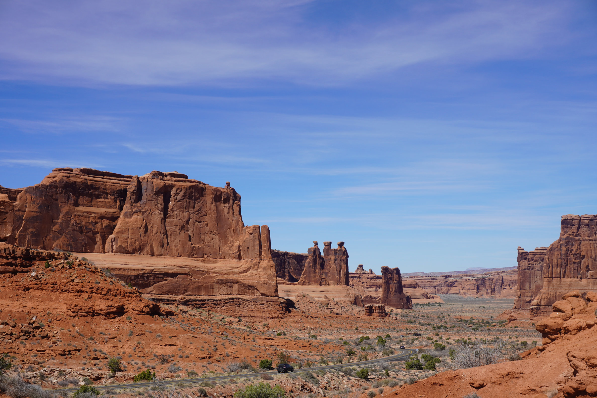
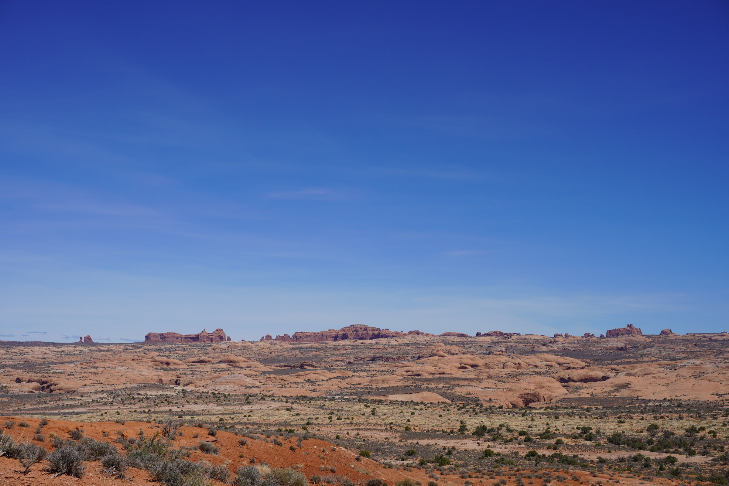
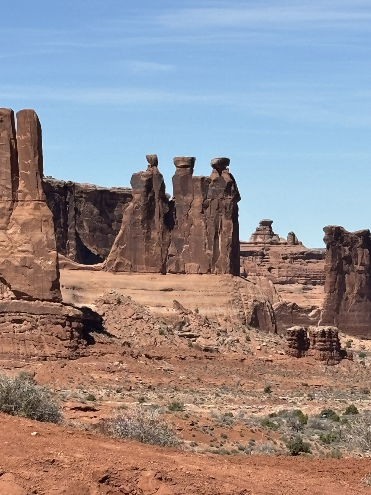
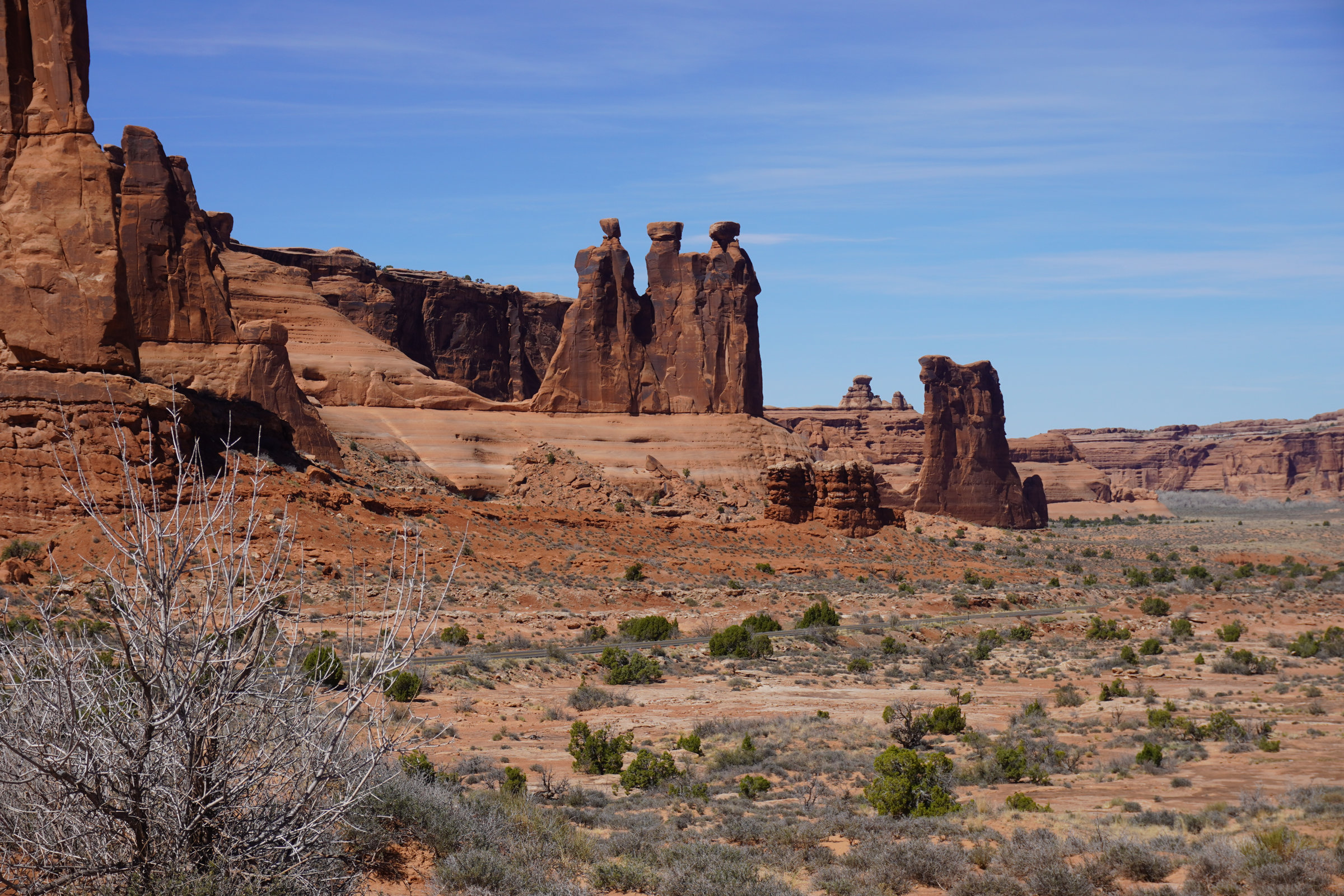

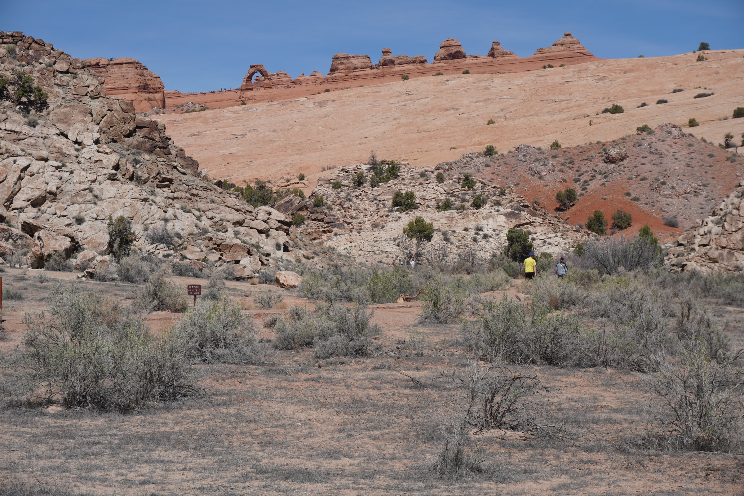
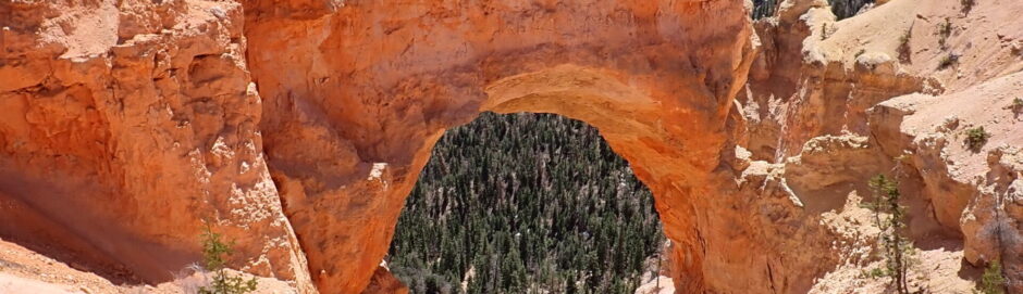
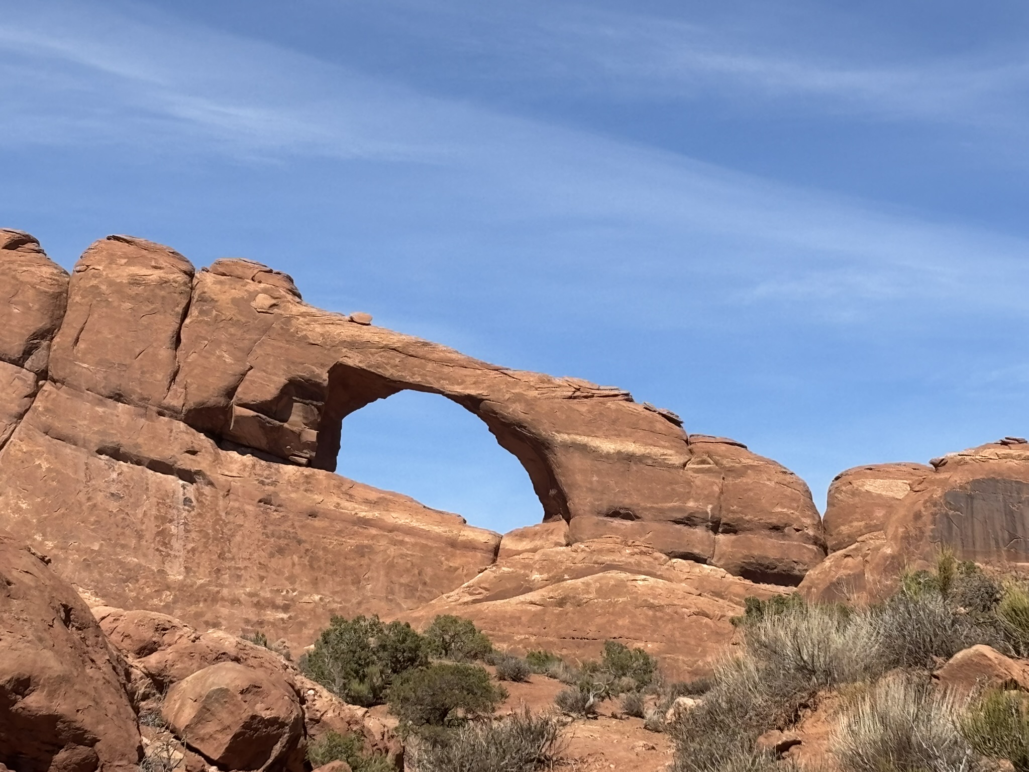
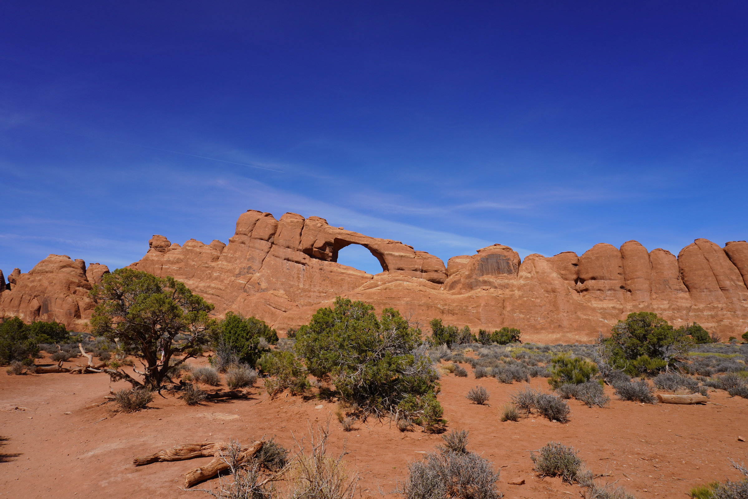
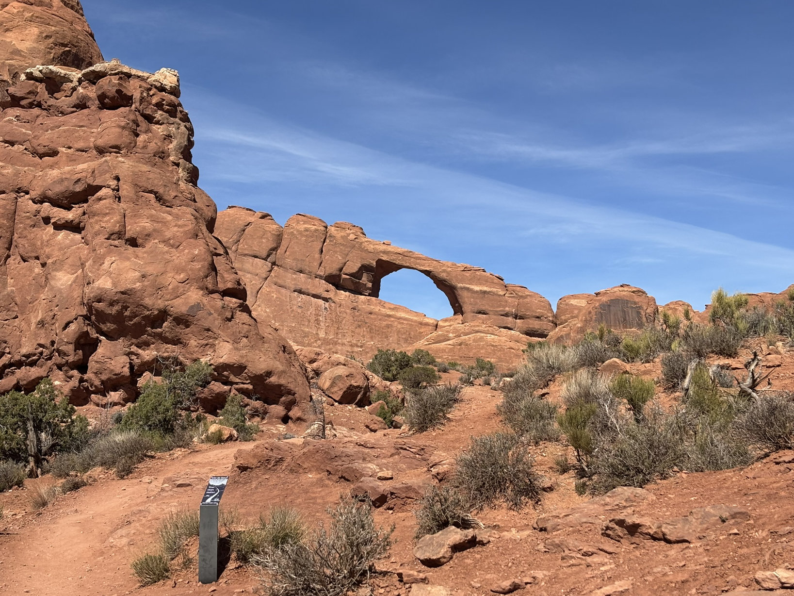
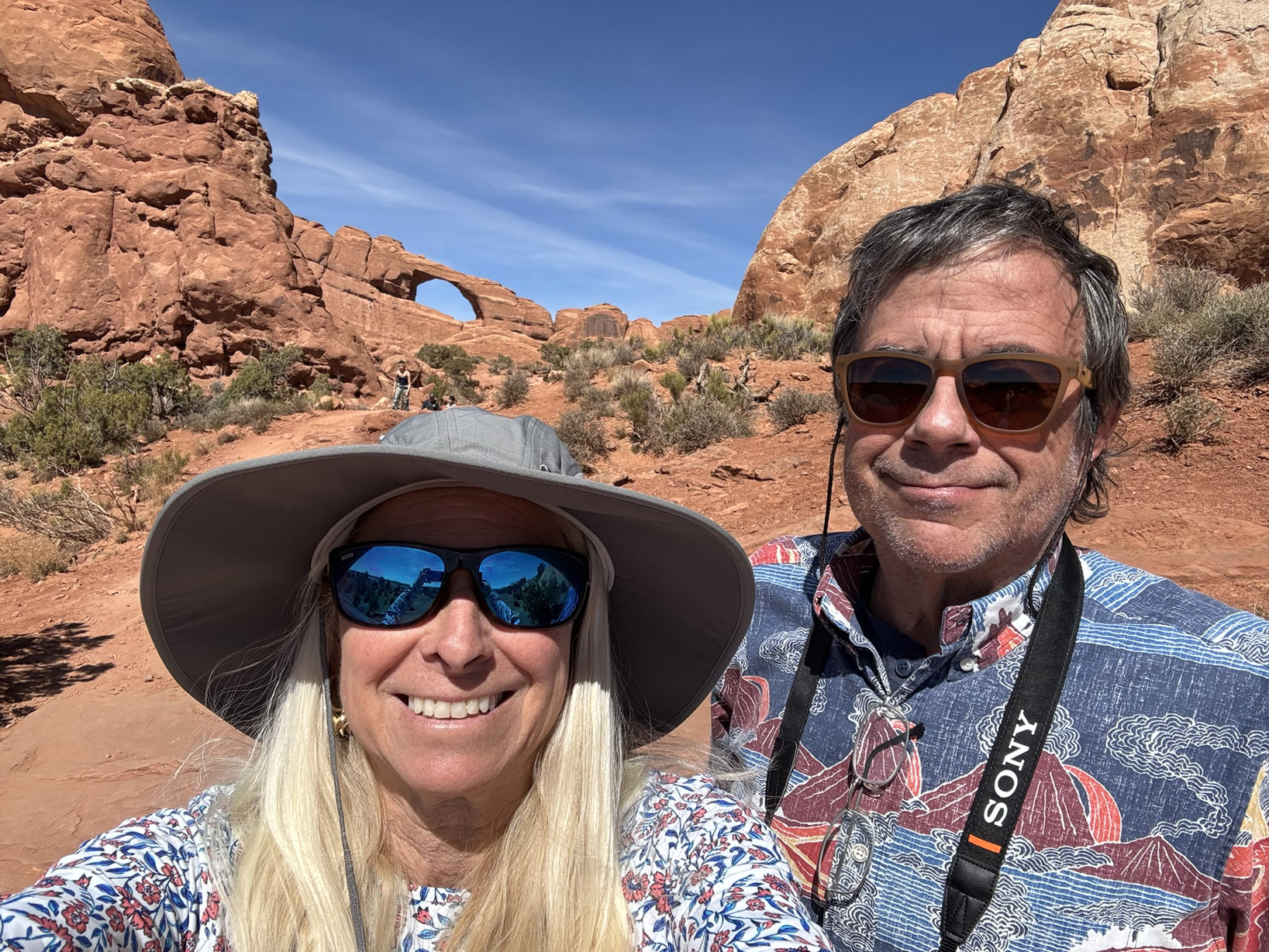
Group 2 – Day 1 – Arches
We had a plan for day 2 so we headed into Moab. We had reservations at the River Canyon Lodge. Can’t say enough good things about this spot. The rooms are small but comfortable. The AC/heater is more than adequate for both cooling and heating. The beds are comfortable with great bedding. The folks at the front desk are incredibly friendly, knowledgeable and forthcoming with recommendations and information. There is a large spa and a pool, plenty of parking and an elevator. The only thing missing was in-room coffee. However, they had an incredibly well stocked coffee bar just off the lobby and it was a great place to meet and chat with other guests. Best of all, at least for the time we were there, it was very reasonably priced. The front desk recommended Pasta Jay’s for dinner a very respectable Italian and pizza restaurant with great pricing and service and tasty fare. Apparently, there is also a Pasta Jay’s in Boulder, Co.
Back to the 45-year absence. At the northwest corner of Moab there was a uranium mill which came into existence in the mid-1950’s during the big uranium mining push in this area so that the US could bomb the bejesus out of the commie Pinkos before they bombed us. In 1962, Atlas Minerals acquired the mill and in about 1980, they hired the firm I worked for to start planning for the ultimate closure of the mill. Several of us spent a couple of months in Moab. This mill had not been operated in an environmentally friendly manner with the biggest problem being radioactive tailings generated in the milling process being placed within pissing distance of the Colorado River and on top of a recharge zone for the valley aquifer providing water from wells to many of the residents. We sampled all over the place, the soil, the tailings, the groundwater, the river water, the river sediment…. but not the air. Not to put it to gently, the place was a mess. There was some tailings reclamation that went on, but for the most part, Atlas Minerals was not widely known for their environmental activism. Fast forward and I’ll let the following excerpts from Wikipedia and AI bring everybody up to speed.
Atlas Minerals closed the mill in 1984 and began what they perceived as a reclamation plan. Fast forward… After Atlas Minerals ceased operations and declared bankruptcy in 1998, the responsibility for the site’s remediation was transferred to the U.S. Department of Energy (DOE) in 2001 under the Uranium Mill Tailings Radiation Control Act (UMTRCA). The DOE initiated the Moab Uranium Mill Tailings Remedial Action (UMTRA) Project, aiming to relocate approximately 16 million tons of radioactive tailings to a secure disposal site near Crescent Junction, about 30 miles north of Moab. Relocation began in 2009, utilizing rail transportation to move the tailings to the engineered disposal cell.
As of October 2023, over 14 million tons of tailings and contaminated soil have been successfully relocated. The disposal cell is designed with multiple protective layers to prevent environmental contamination and is expected to be completed by 2029. In addition to the tailings relocation, the DOE has implemented groundwater remediation efforts at the original mill site to address contamination concerns. These efforts include the installation of extraction and injection wells to manage and treat contaminated groundwater, thereby protecting the Colorado River from further pollution.
I could not help but notice as we drove back and forth over the next several days from Moab to the parks that the Mill Site is still under active remediation. What’s 70 years of exposure to high concentrations of radioactive soils, water and air? Arseholes.
By the way, Edward Abbey’s book, Desert Solitaire is more or less a chronicle of time he spent as a temporary park ranger in Arches back in the late 1950’s. One of my favorite Edward Abbey quotes bears current significance; “A patriot must always be ready to defend his country against his government.”