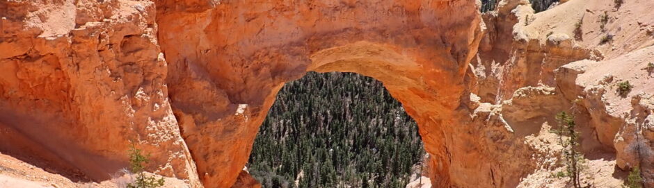
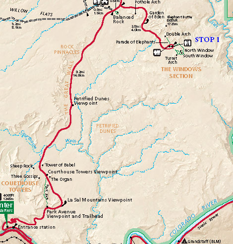
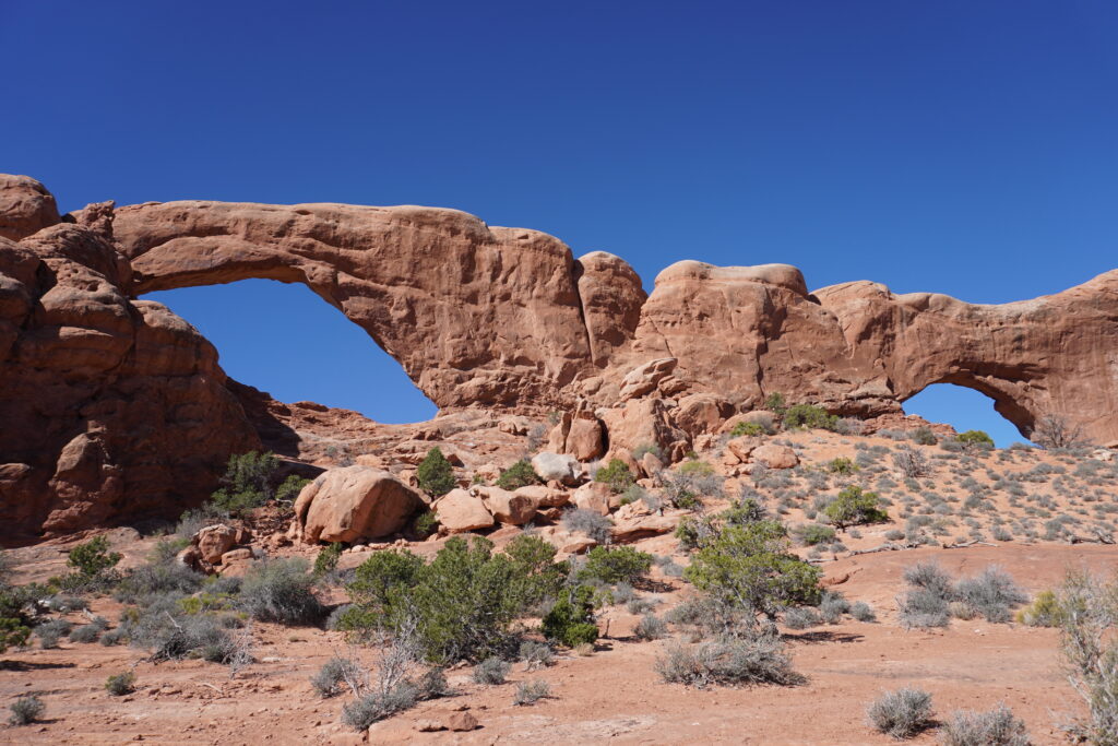
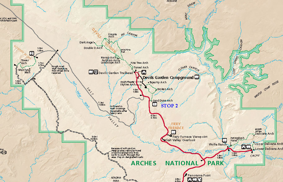
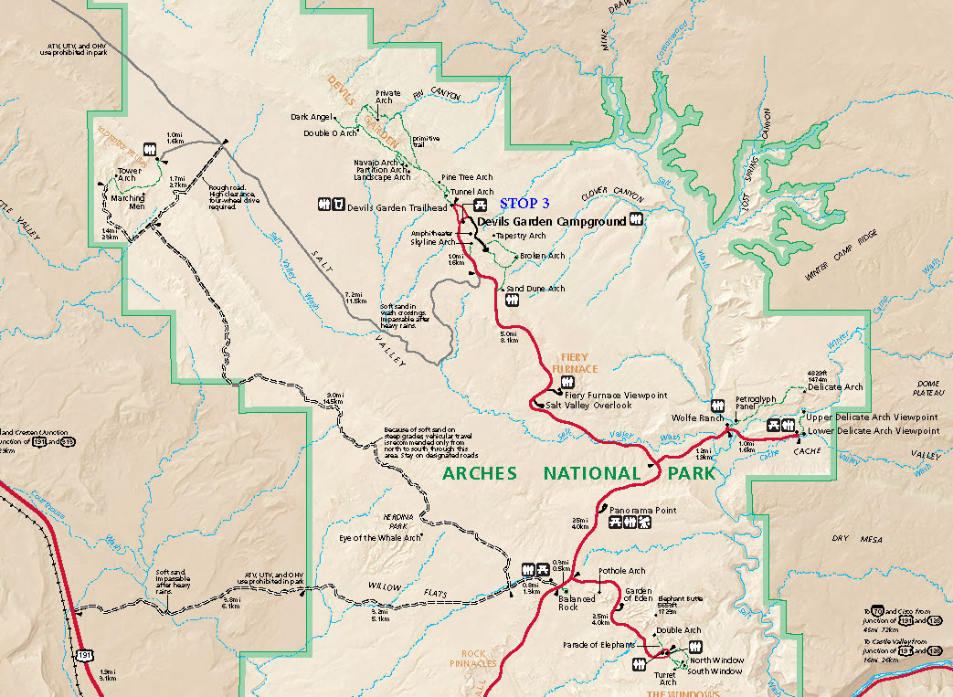
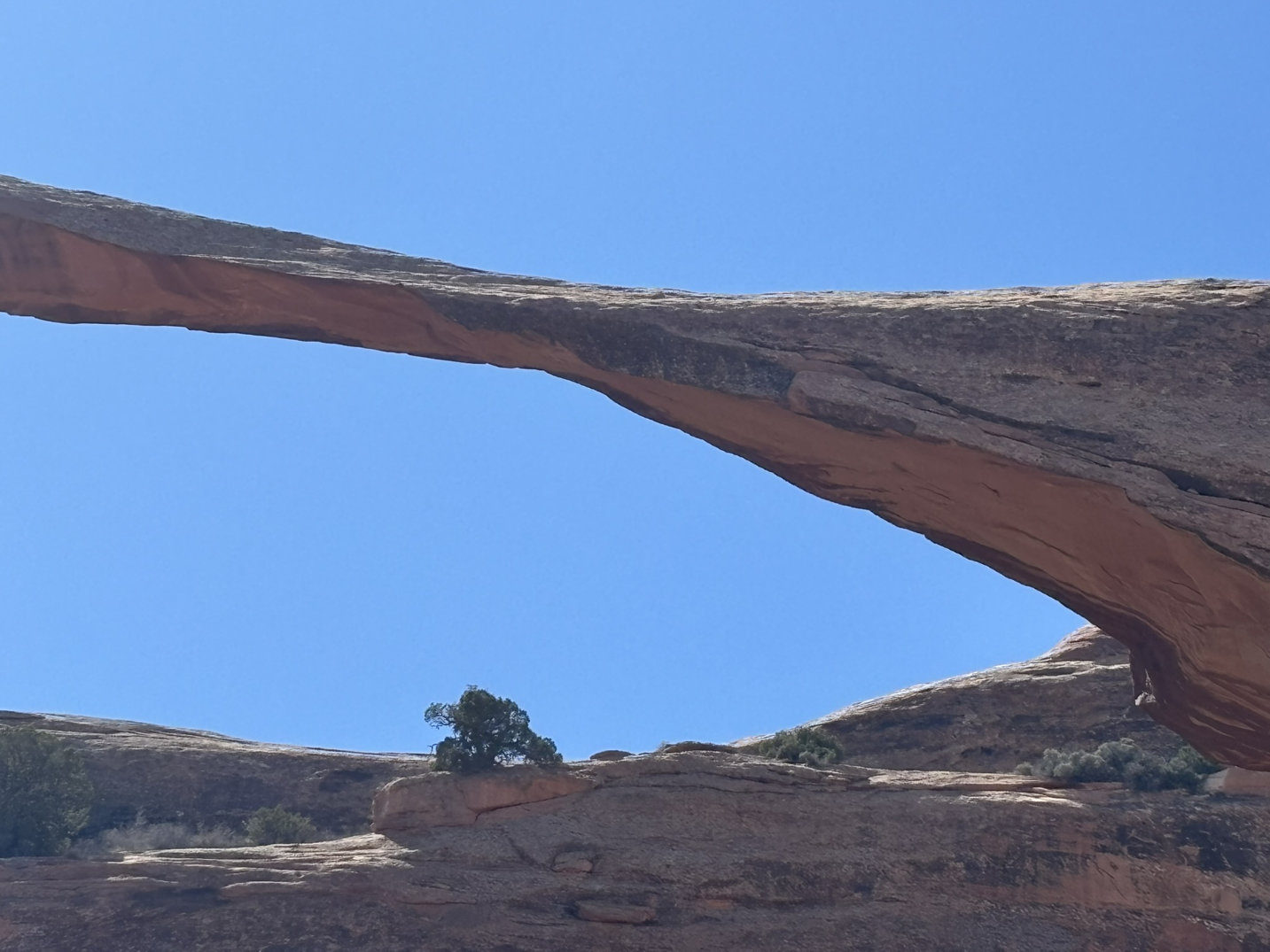
We hit the road bright and early and headed out so that we could get some hiking/walking in and see some arches with a less crowded situation. First stop was the Double Arch area shown on the map (north is up) below. The title photo is a shot of Double Arch.
This was a good stop as there are 4 major arches, several minor arches, several trails and walks
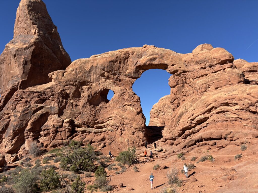
Turret Arch – looking west
North (right) and South (left) Arches from the back looking west.
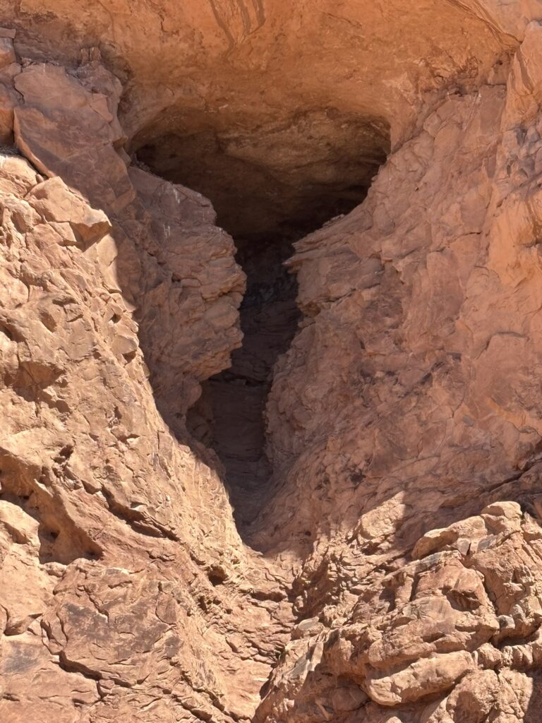
Arch-In-Progress
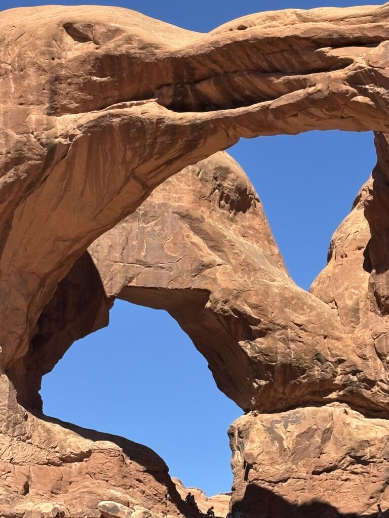
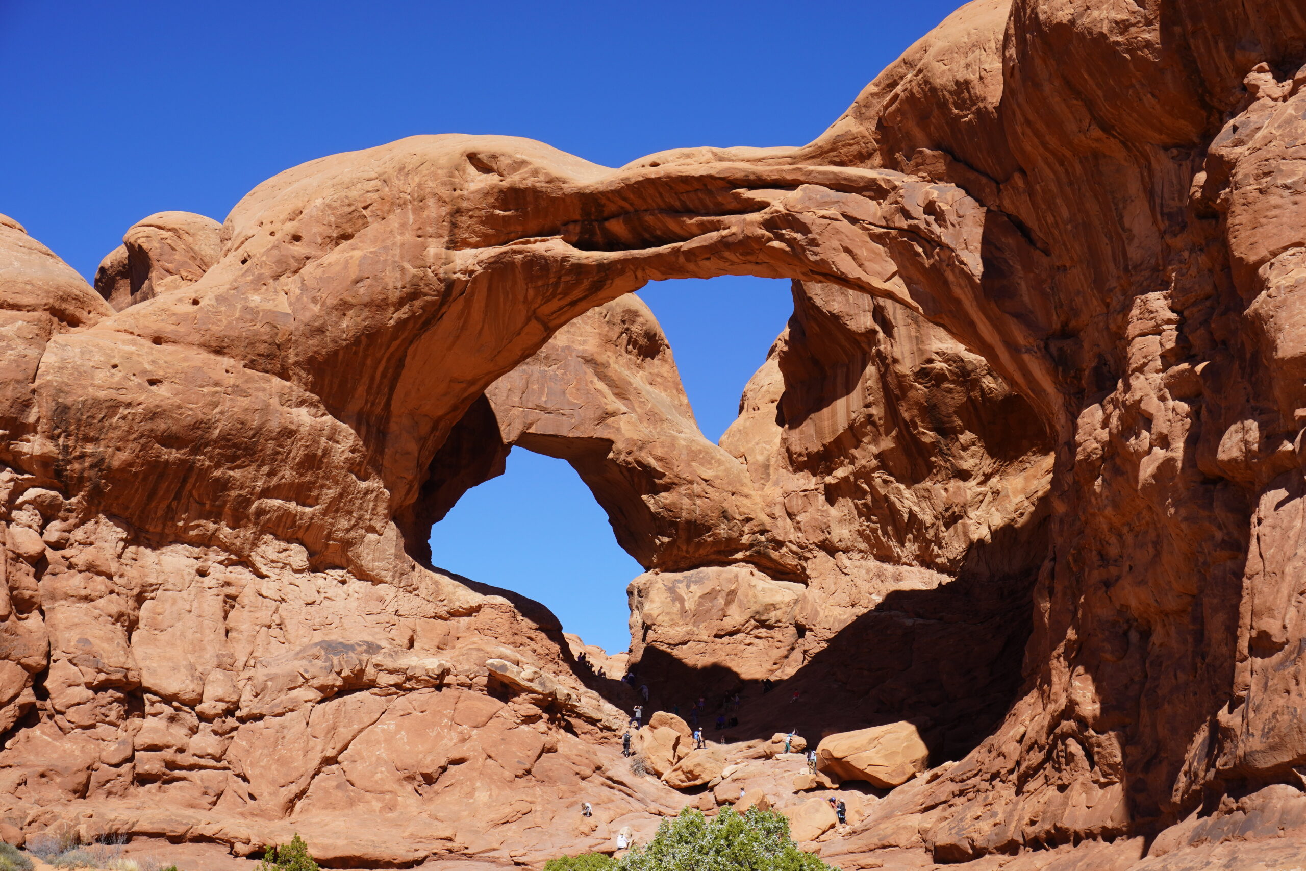
Close up of Double Arch
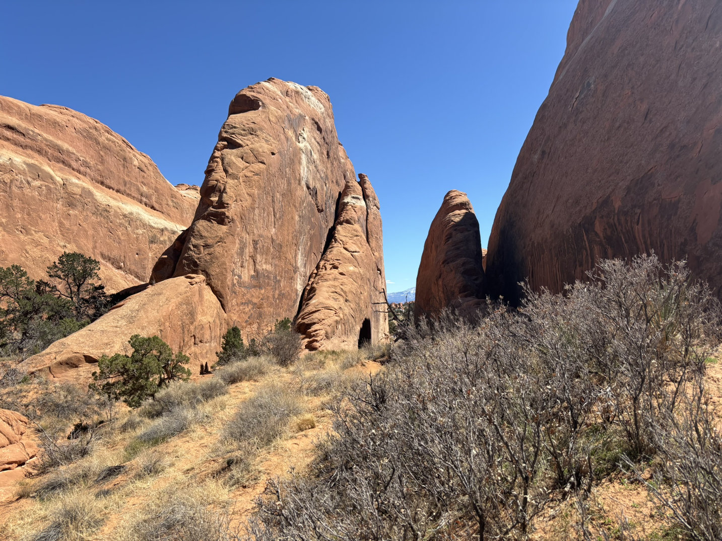
Moving on, we headed up the road to the Sand Dune Arch and Broken Arch area.
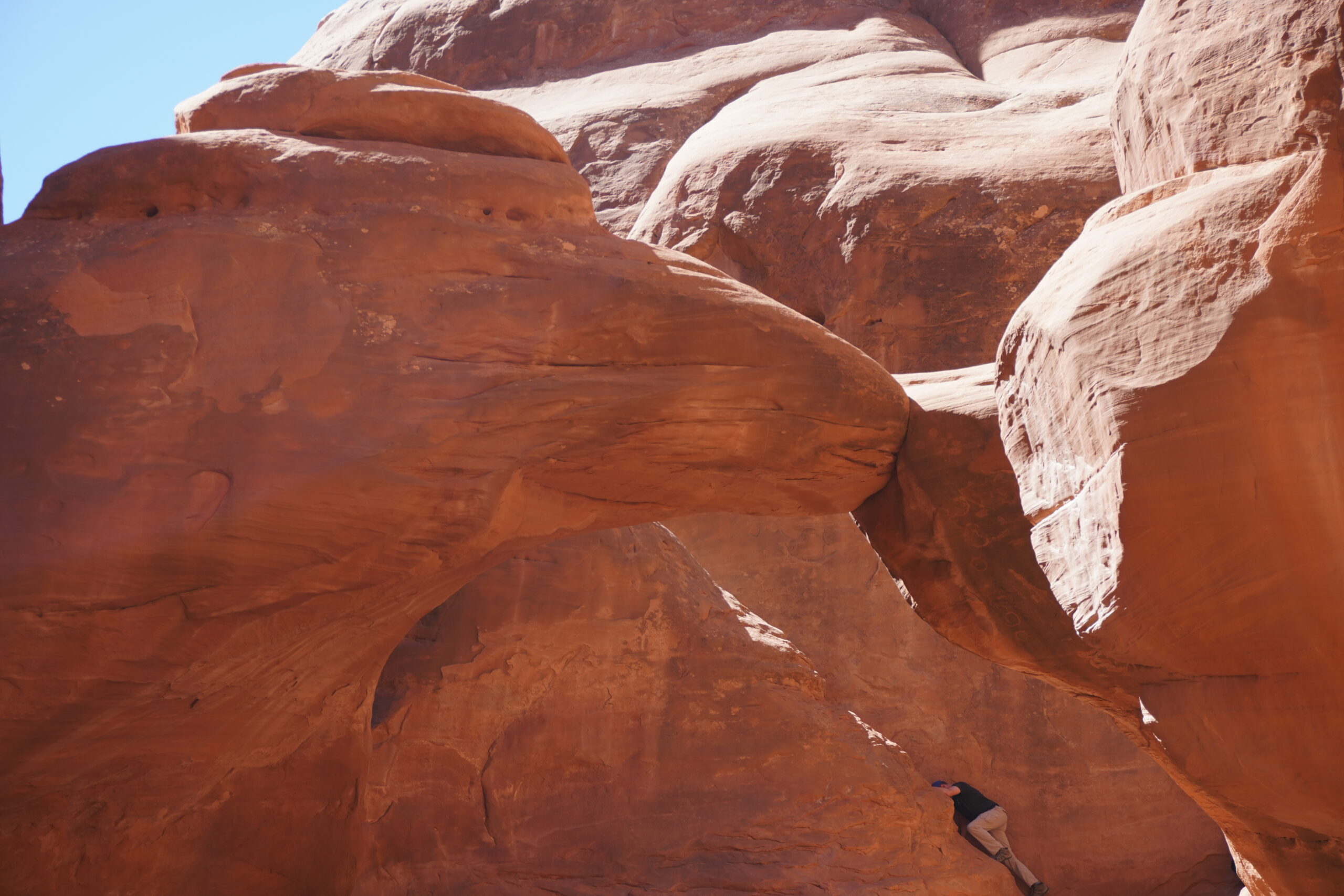
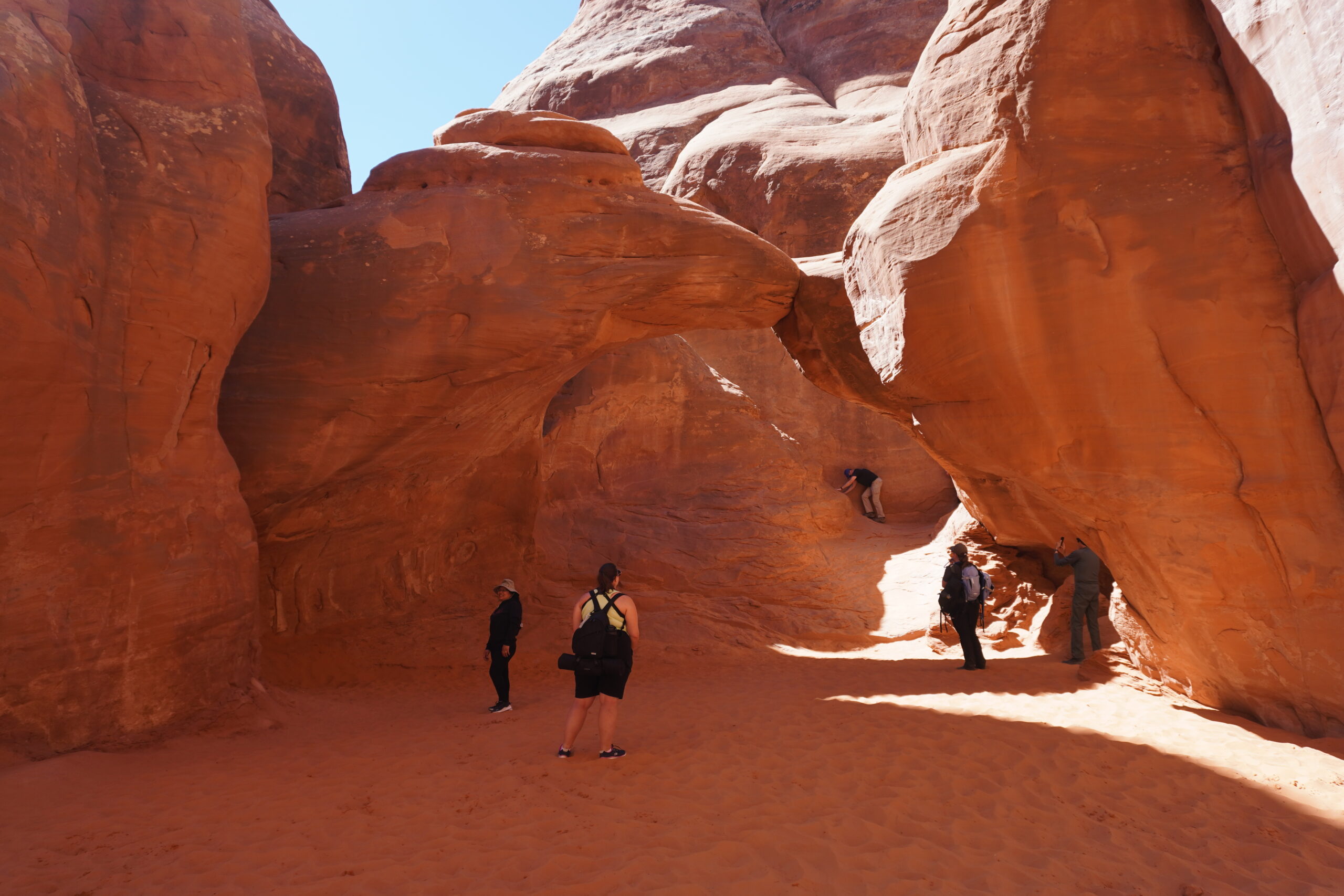
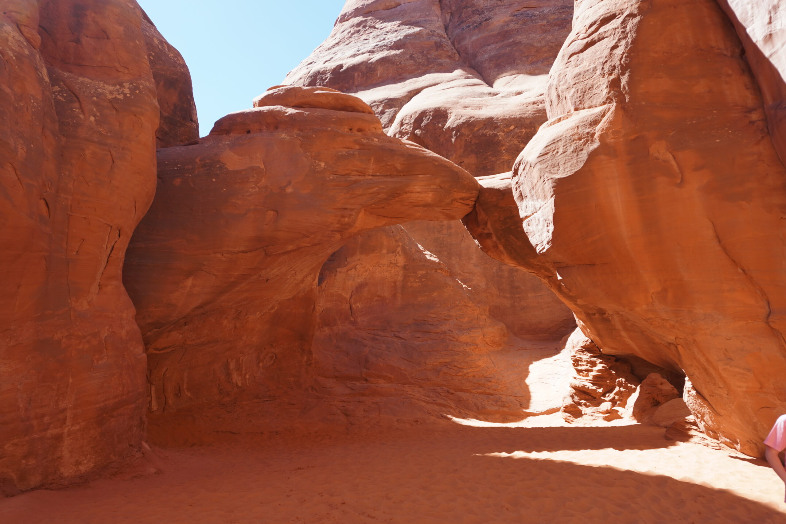
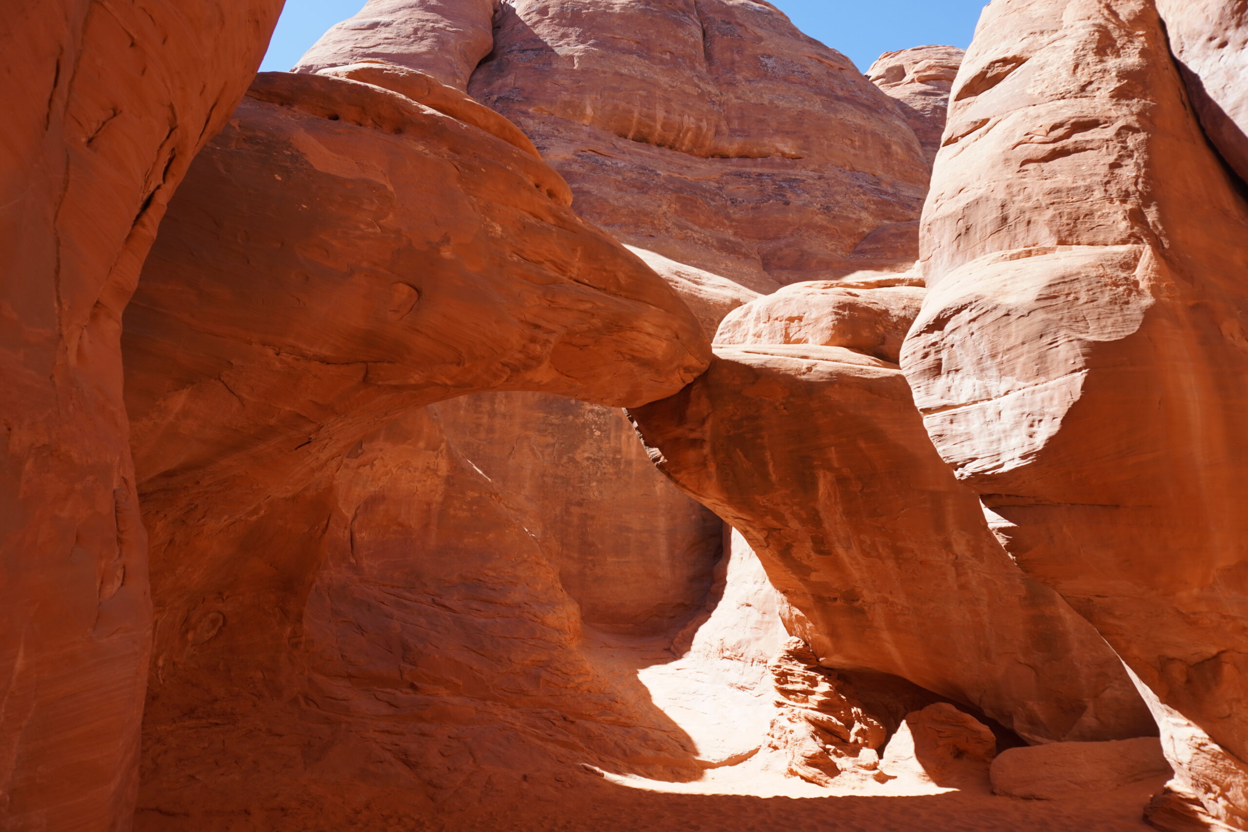
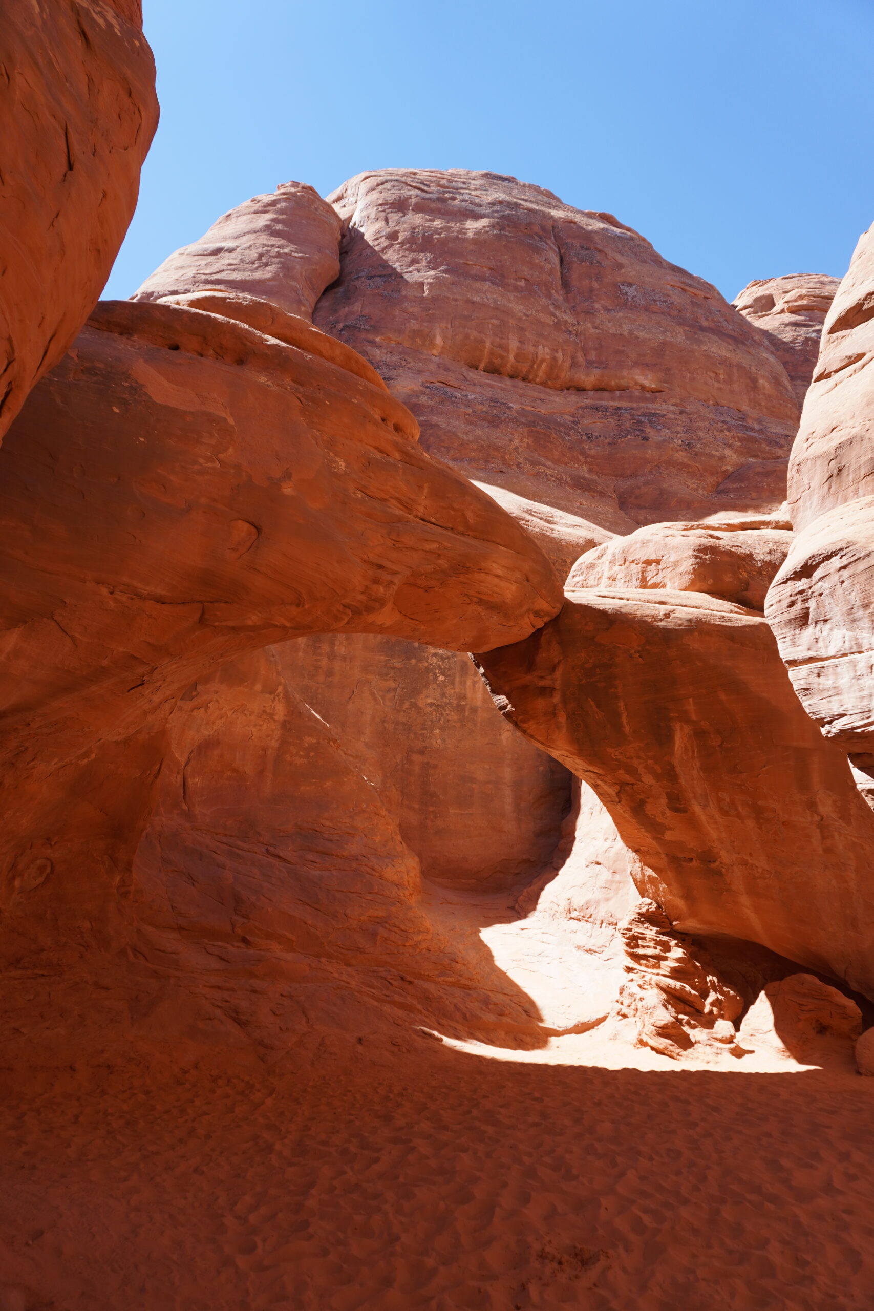
Sand Dune Arch is hidden in a large outcrop not far off of the road. The walk is very short, only 0.3 mile out and back so great for little kids and older folks!
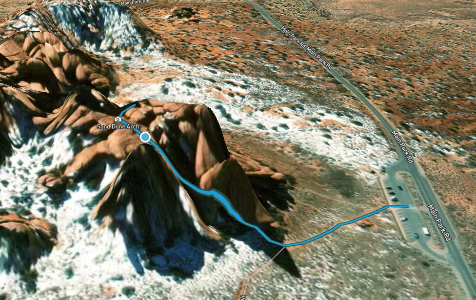
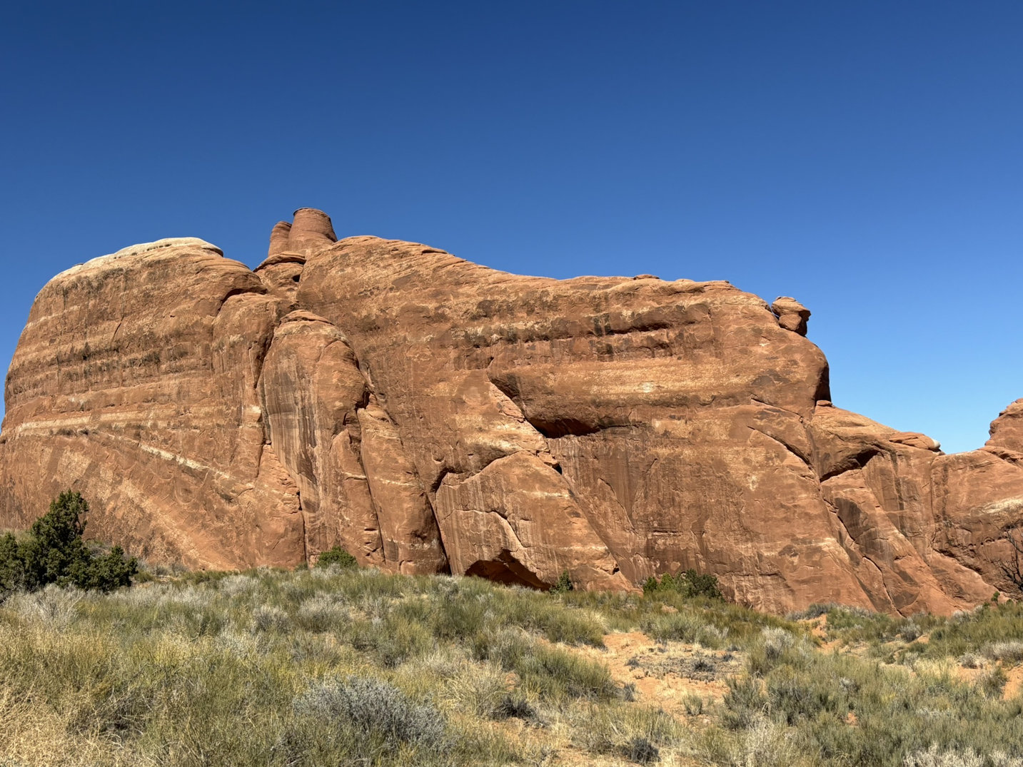
From just outside the outcrop, you can see Broken Arch. We opted to skip the walk to see that location.
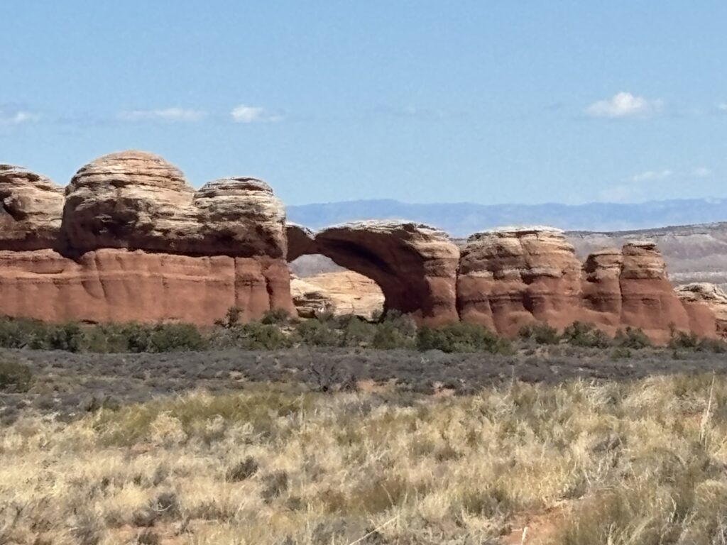
Broken Arch – from a distance.
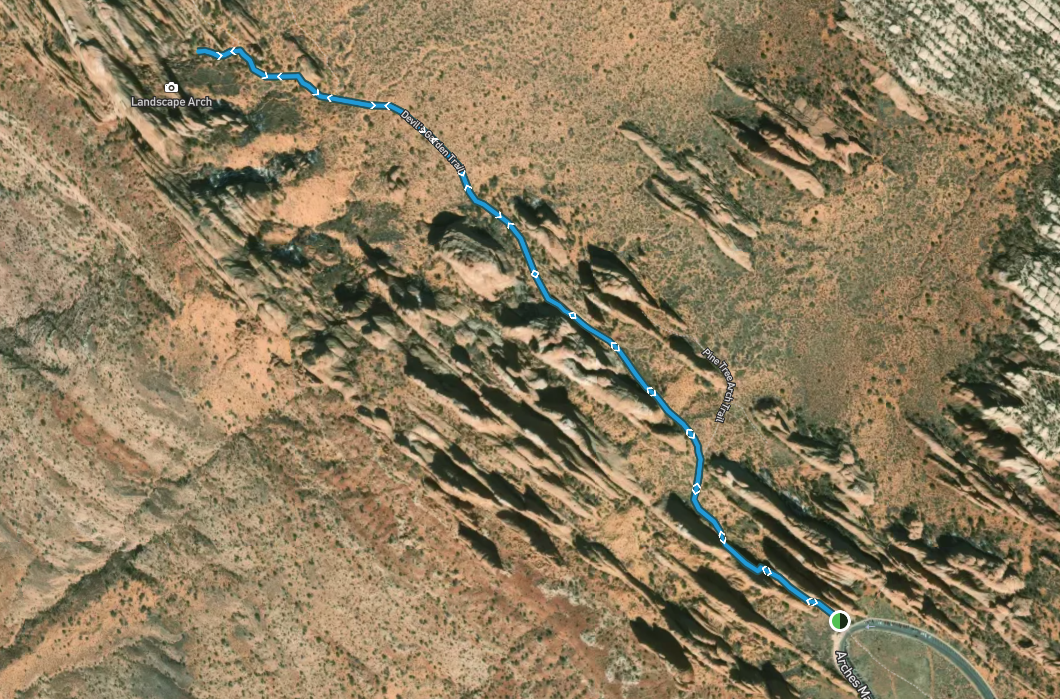
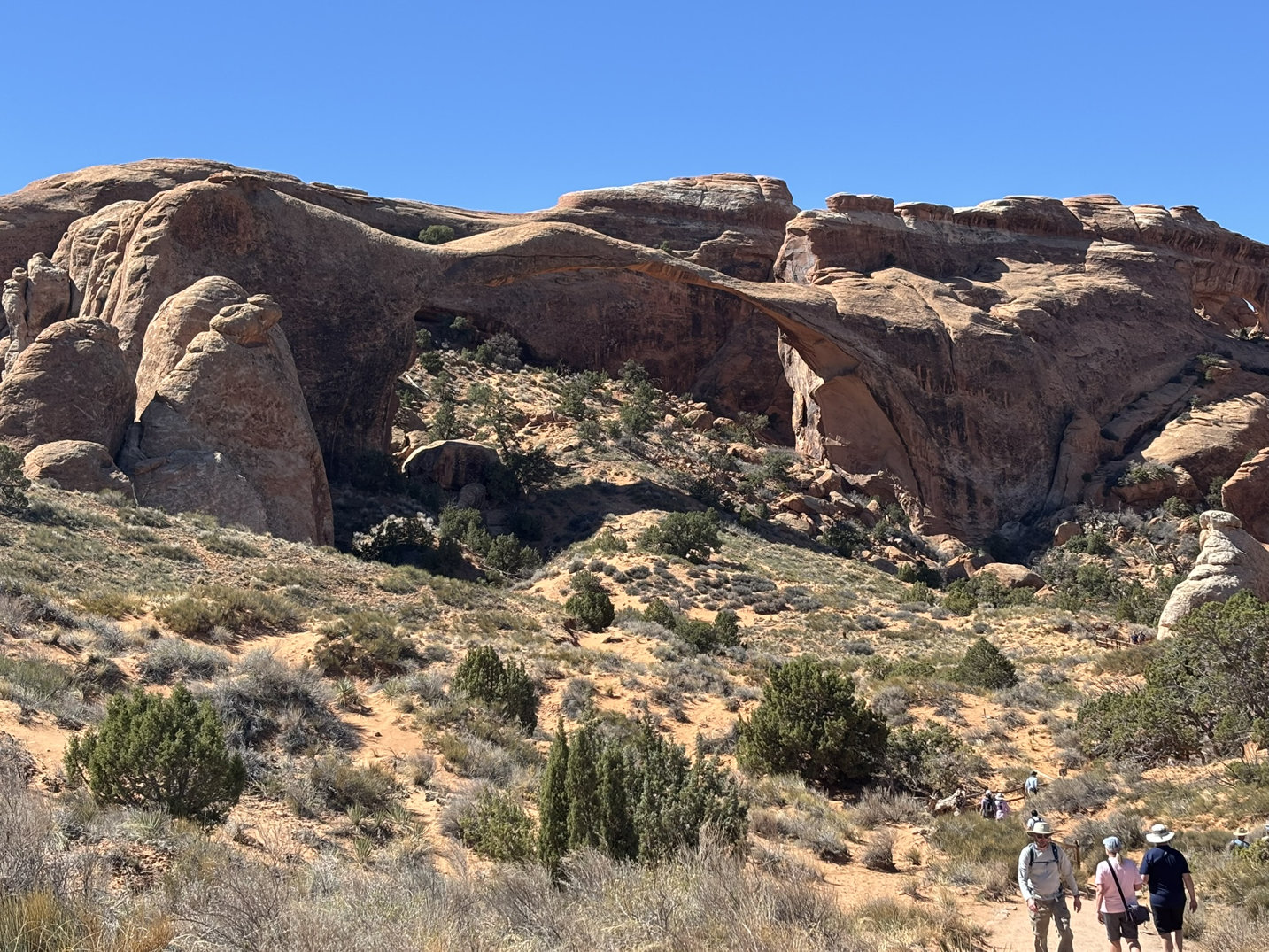
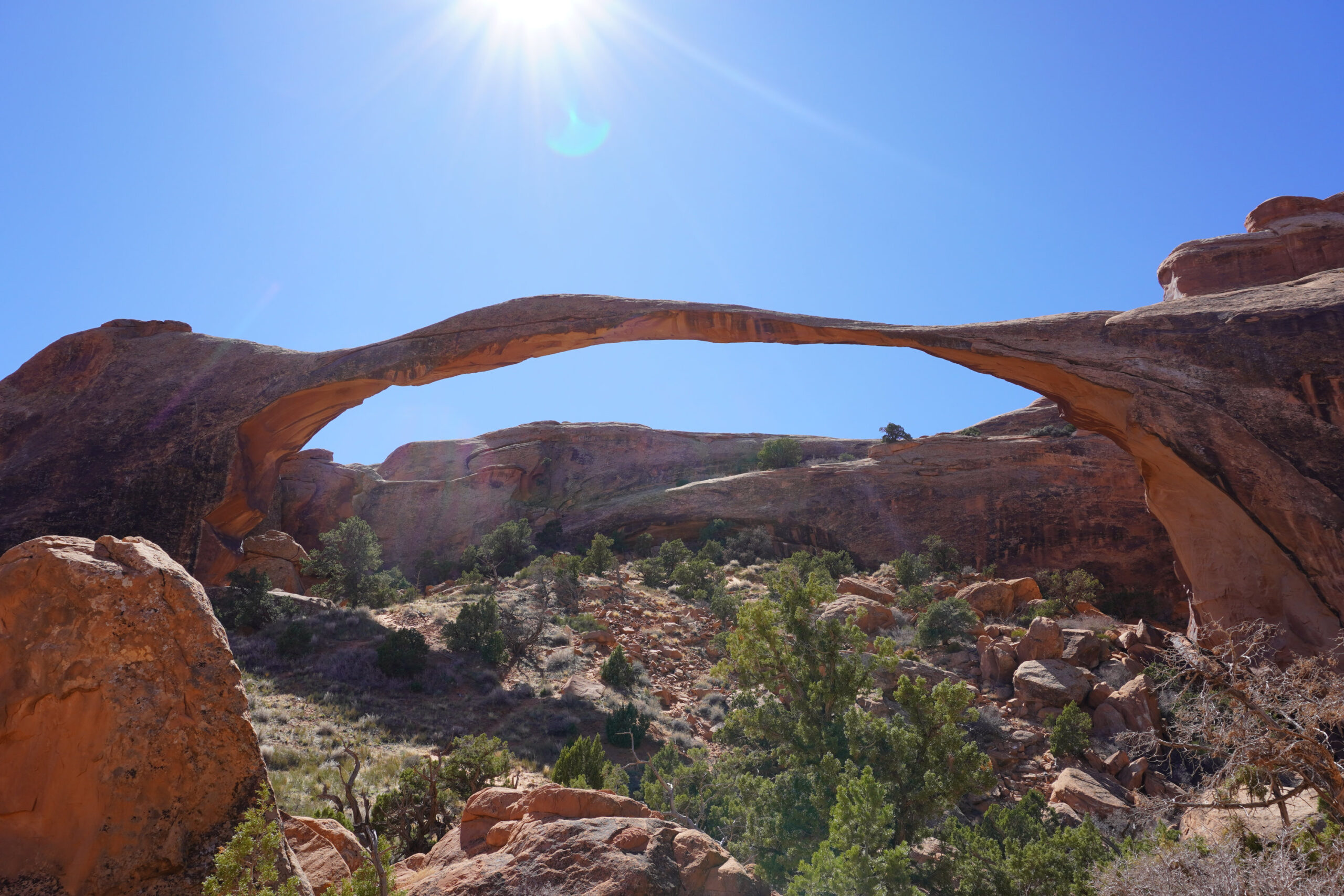
The next stop was at the north end of the road for a hike out to Landscape Arch. On the way, we passed Tunnel and Pine Tree Arches.
This is about a 2-mile out and back trail (North is up) with only a 252 ft elevation gain so a nice late day stroll.


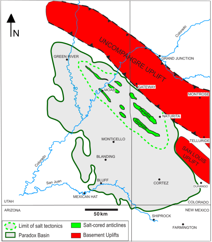
I’ve sort of dropped back into my creative malaise with the constant attacks on our political and I guess more disturbingly on our judicial system. So, I’ll retreat back into my happy place and talk geology a bit. You may have seen in the previous blog post a sort of passing reference to the Paradox Basin. I kept it at the 75,000 foot-level because the Paradox Basin is one of the rarest geological phenomena on earth. As such it is also one of the most studied areas on earth. I suspect the scenery was a draw. But in the end, the economics were more of the driving force behind the characterization of the subsurface. The resources of the Paradox Basin generated bundles of dough for the petroleum industry, the uranium and copper mining industries and more mundane minerals like potash(fertilizer) and gypsum (wallboard etc.). The figure below is the approximate boundary of the Paradox Basin. In this post we are going to look quickly at the formation of the Paradox Basin but more focused on the area in the green dashed line and the northwest-southeast trending valleys on the figure below.
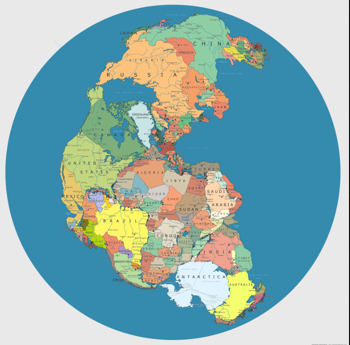
The Paradox Basin began life about 300+ million years ago which is right around the time that the Atlantic Ocean had disappeared with most of the land masses forming up into Pangea. Canada and the United States and Greenland (and every other landmass were all one big happy family (sigh…). You can see in the figure below that if you were in Greenland 300 mya you could easily have seen Russia “out your back door”. Almost every map that you look at of Pangea is a little different. This one is more of an overlay of current day geographic boundaries on a more or less general outline of Pangea. The current geographic boundaries 300 mya were somewhat smaller than what you see here (i.e. the west coast of North America was back somewhere around Idaho).
These two creatures were in charge of everything. Same degree of intelligence as current large and in-charge arseholes.

Nice hair!
Look — little bumps on the head, orange complexion and very short fingers and arms. I wonder if it had a comb-over.
SO that sort of sets up the start of our story. Around 300 mya, the Paradox formation, a geologic unit primarily composed of evaporites (salts and gypsum) and limestone, and shales (particularly on the seaway margins), was deposited in a large restricted marine basin where the seas repeatedly came in (transgression) and went out (regression). The formation is best known for its thick salt (halite) layers, which have played a dominant role in shaping the region’s tectonics and stratigraphy. Because the seas were predominately shallow and tectonics and climate conspired to keep them that way, occasionally creating enclosed inland seas and large lakes similar to the Salton Sea in SoCal, there was significant evaporation and deposition. Moreover, the periodic closures of the seaway resulted in super saturation of the water with salts. The salts reached thicknesses of up to 4,500 feet.
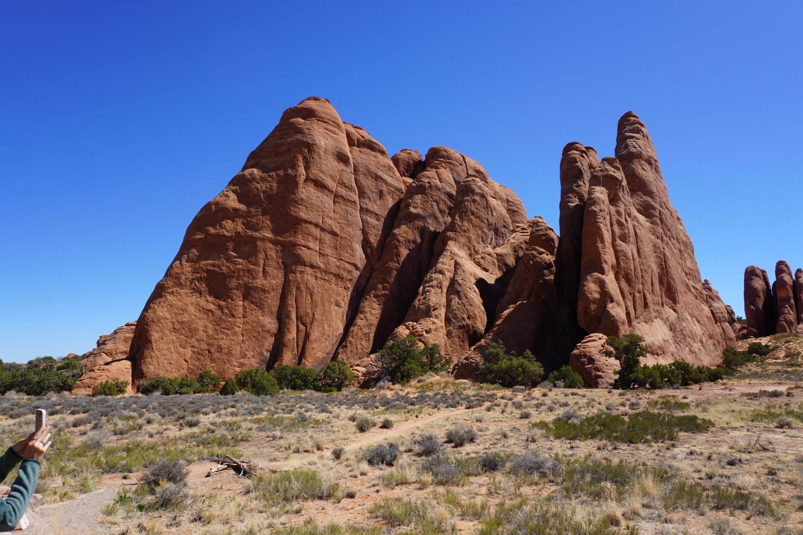
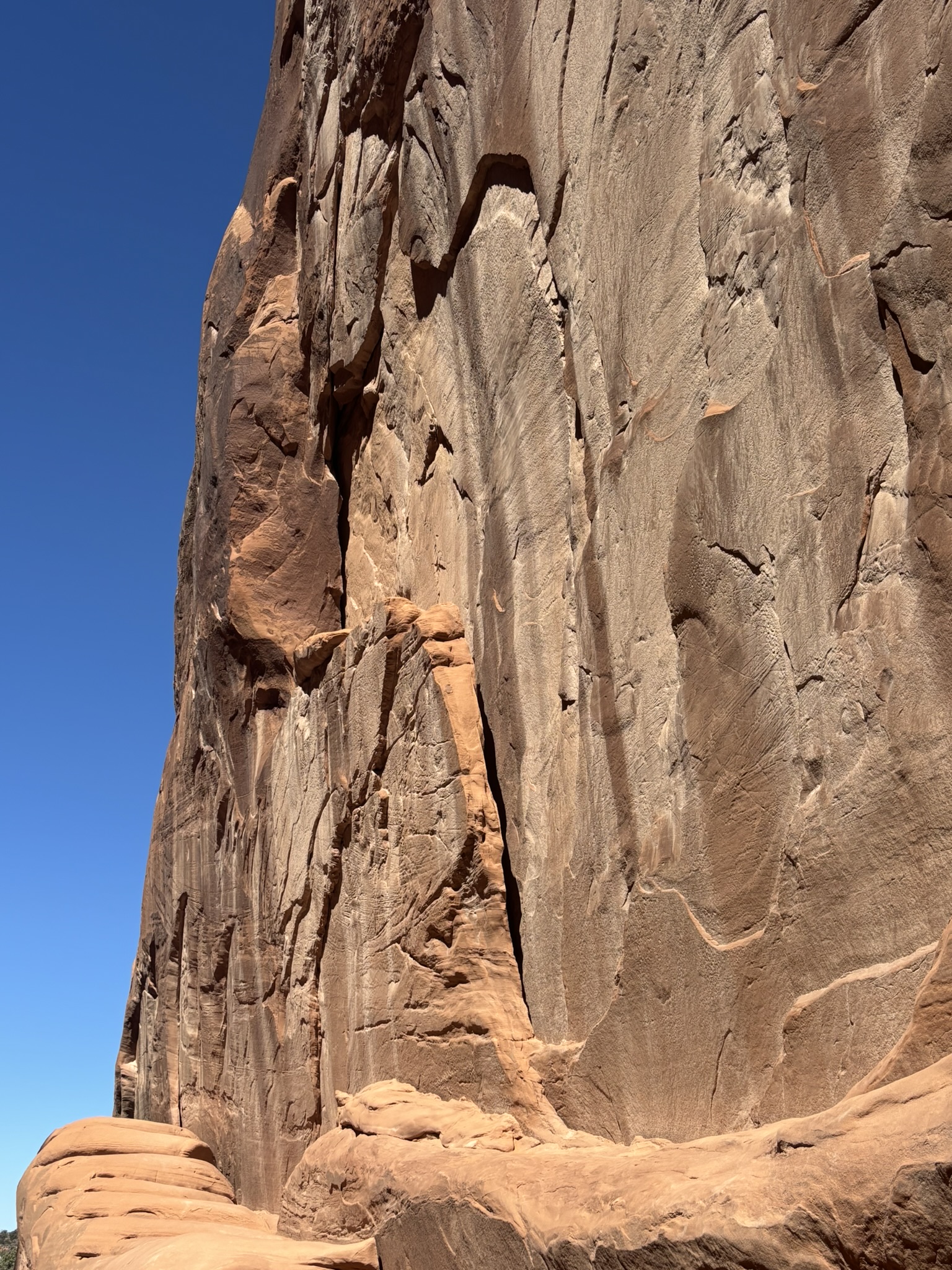
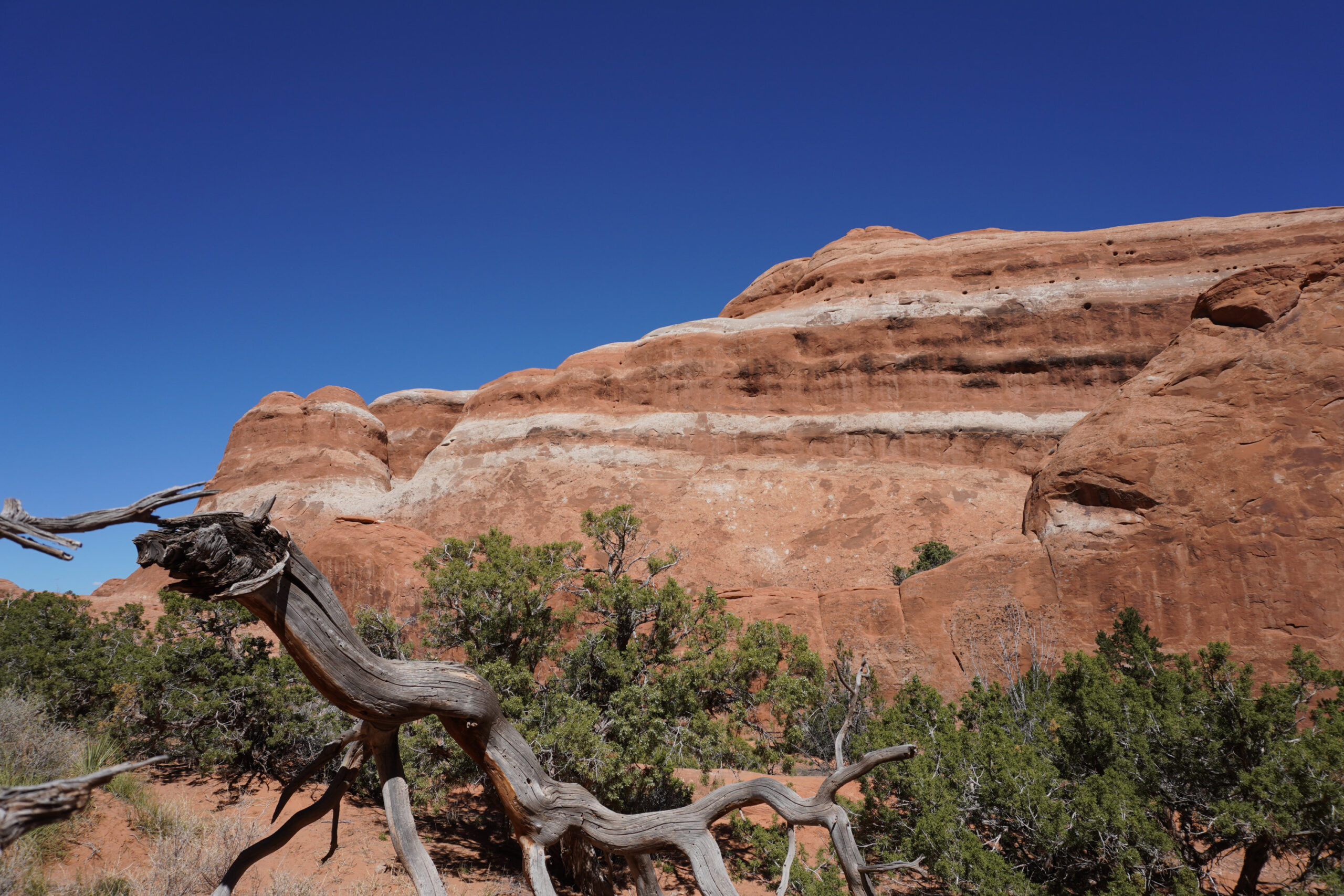
In order to shorten this up and let you get to sleep; here is a summary of how the salt in the Paradox formation eventually ended up 4,000 feet above sea level creating much of the magnificent scenery in eastern Utah. Geologists aren’t happy unless there is a label on a process and this process has taken on salt tectonics as its claim to fame. Salt is explanatory, tectonics is the processes that form the structures of the earth’s crust. In this situation, Salt tectonics refers to the movement and deformation of salt layers (usually halite) in the Paradox formation due to the low density and ductile nature of salt. When overburden pressure increases (i.e. more and more geologic formations are deposited on top of the Paradox – my favorite due to name only, being the Honaker Trail formation), salt can flow, creating distinct geological structures. These structures end up deforming the overlying formations. In those deformations, as well as later regional tectonic excitement (The Colorado Plateau), joints and faults form in the overlying units contributing to the formation of fins and arches. Fins being the elongated thin banding shown on the photo above of the Devils Garden Trail.
Key resulting features:
- Salt domes/diapirs – upward-moving columns of salt that pierce overlying rock.
- Salt walls and ridges – elongated intrusions of salt between tilted rock layers.
- Mini-basins – depressions that form adjacent to rising salt due to sediment loading.
- Salt canopies – extensive, near-surface sheets formed when salt spreads laterally.
- Faulting and folding – induced in surrounding strata by the flow or withdrawal of salt.
Eventually, with the uplift of the Colorado Plateau which includes the Paradox Basin it all ended up in the erosion mill at the surface.
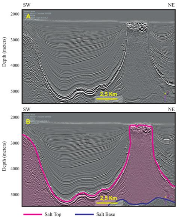
Seismic section of a salt diapir (magenta line)
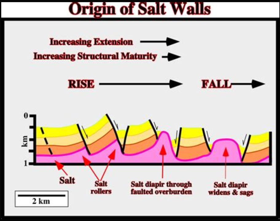
This one is a little less clear. Salt walls are long walls along most of the valley walls shown on the Paradox Basin map above. The pink is the salt. It pushes up the overlying formations and then gypsum (yellow) forms on the surface. In the desert environment gypsum is fairly recalcitrant to erosion.