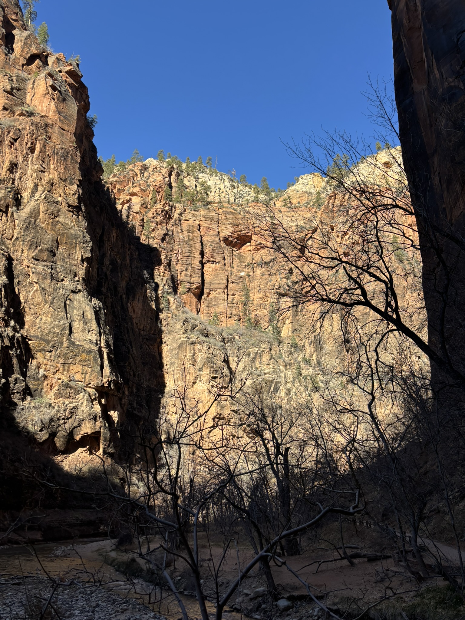
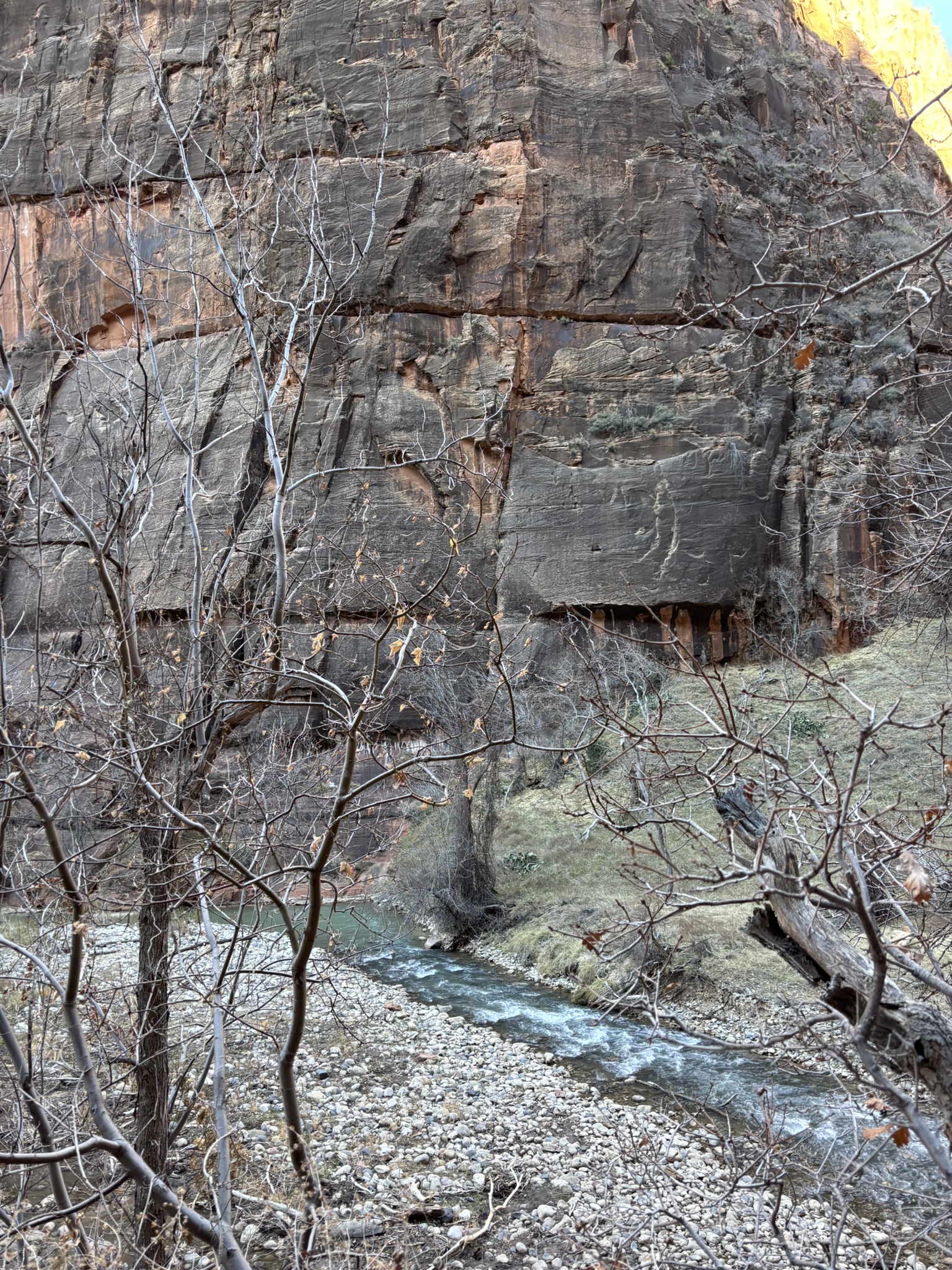
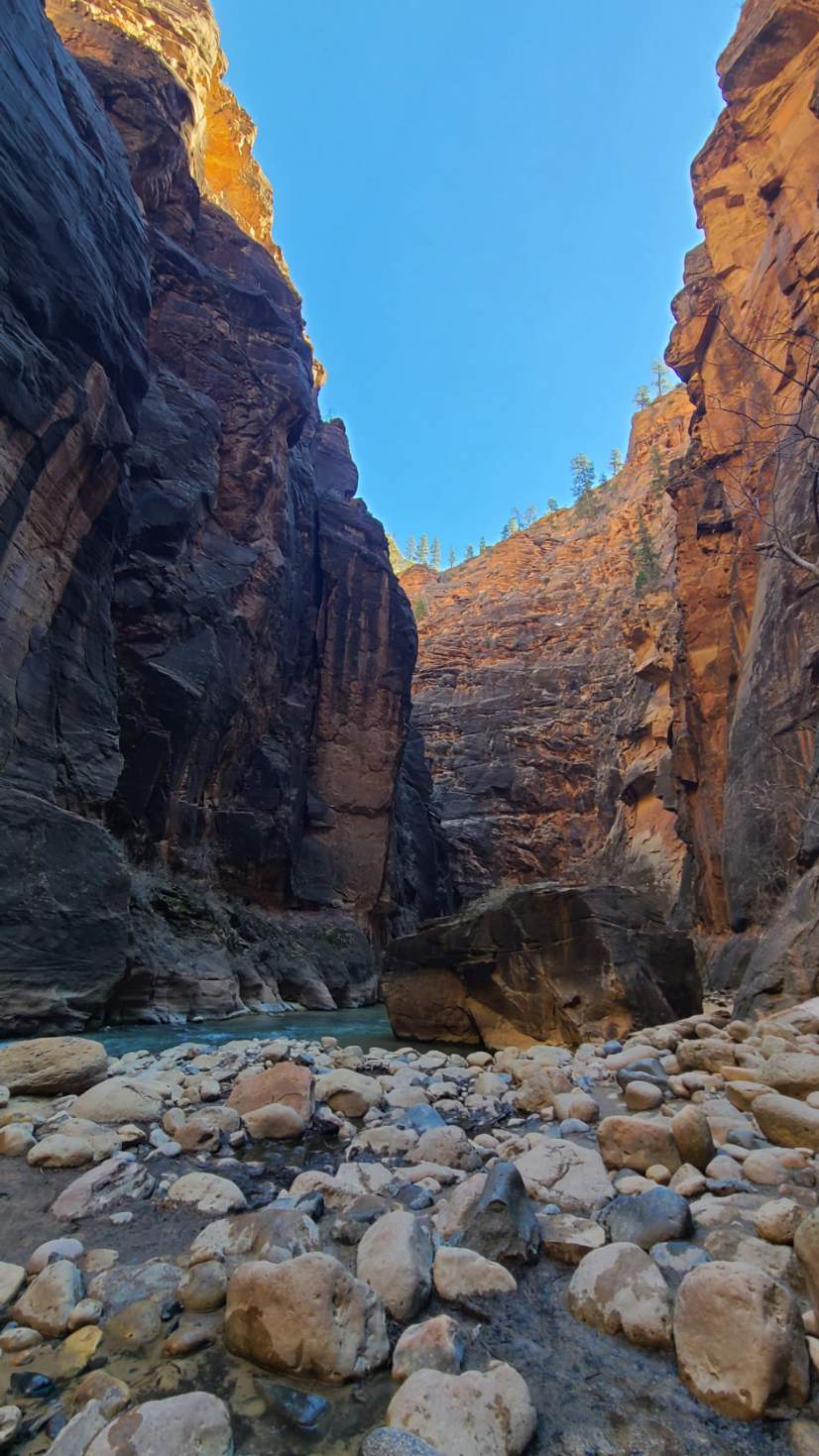
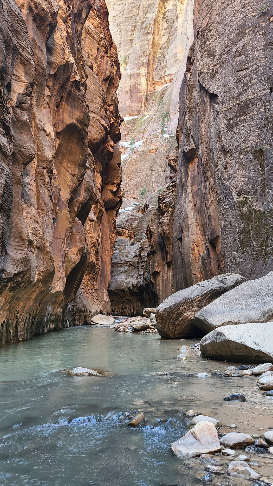
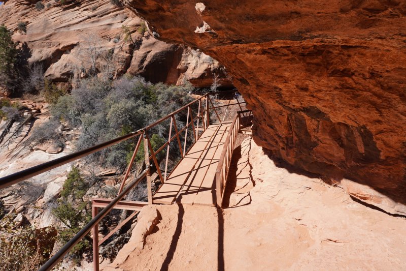
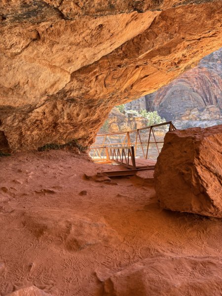
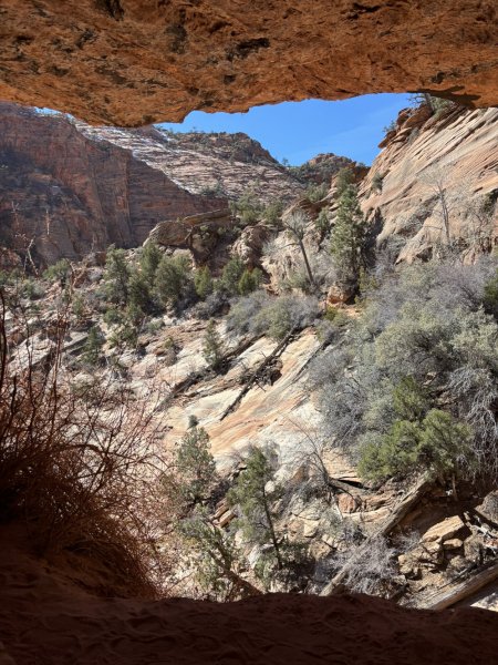
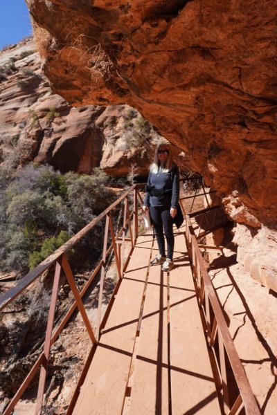
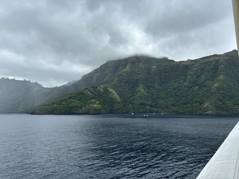
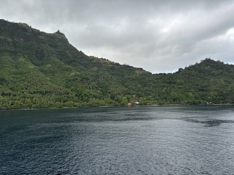
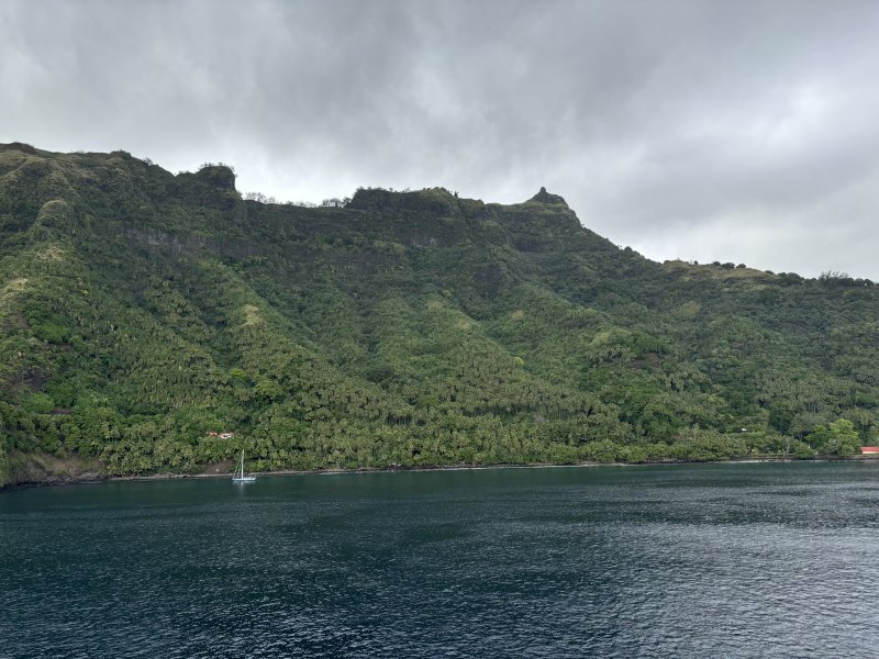
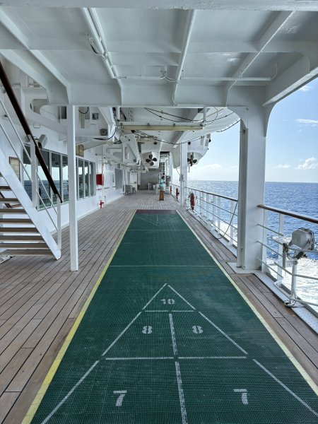
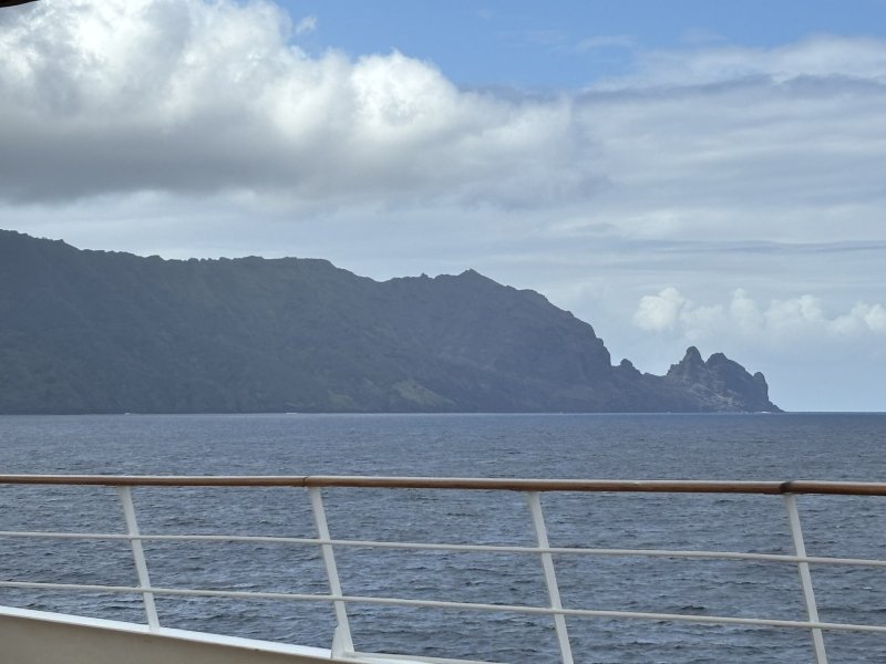
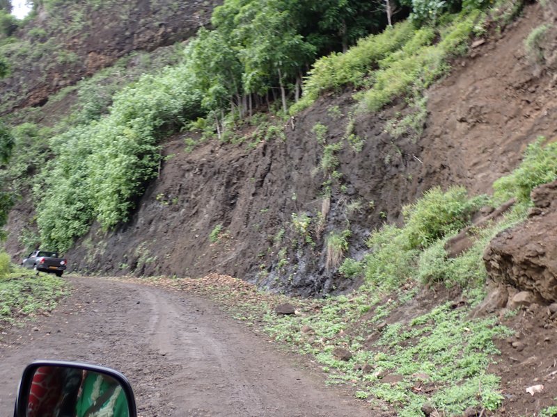
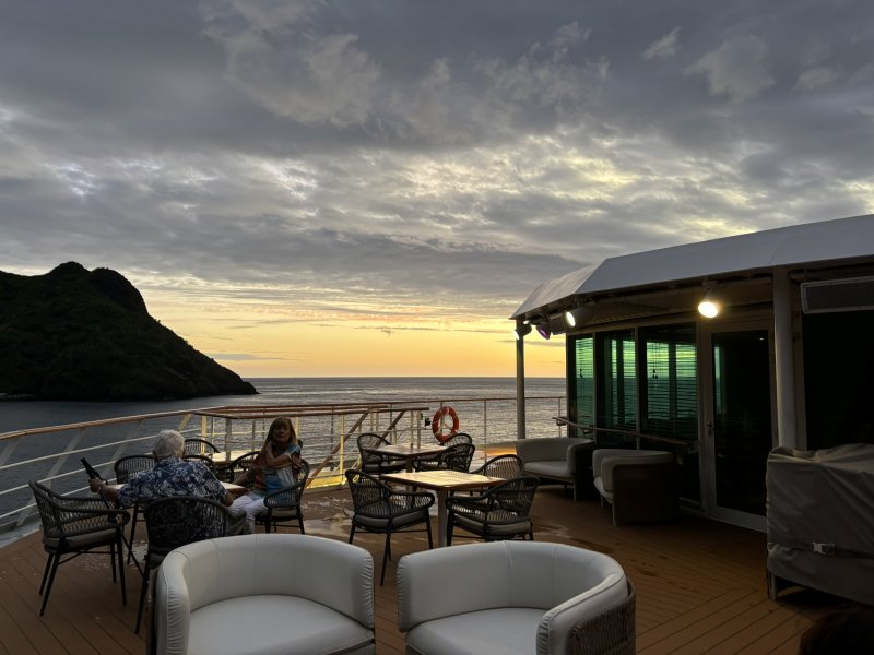
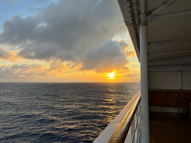
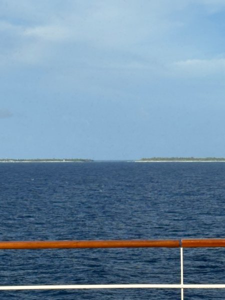
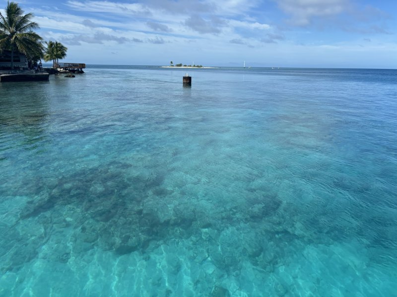
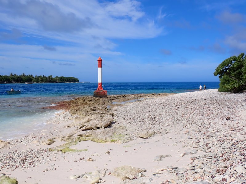
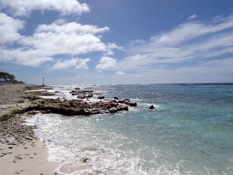
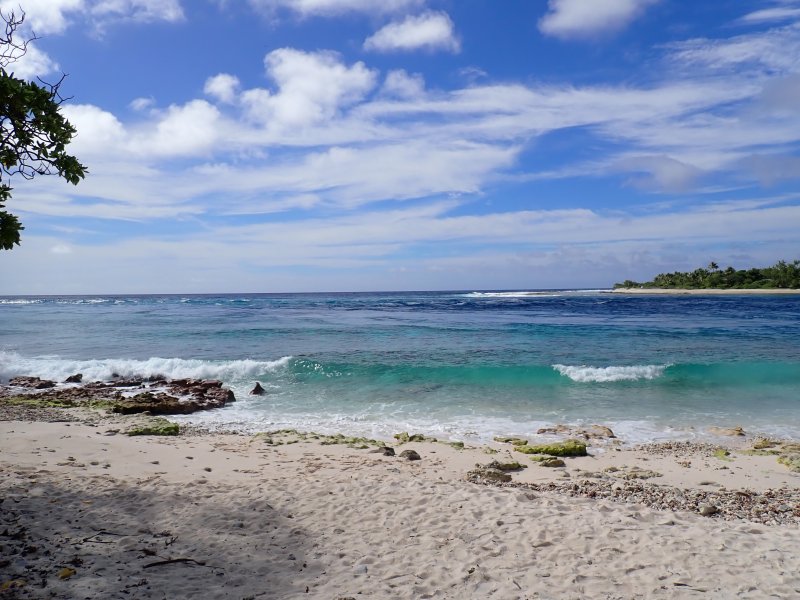
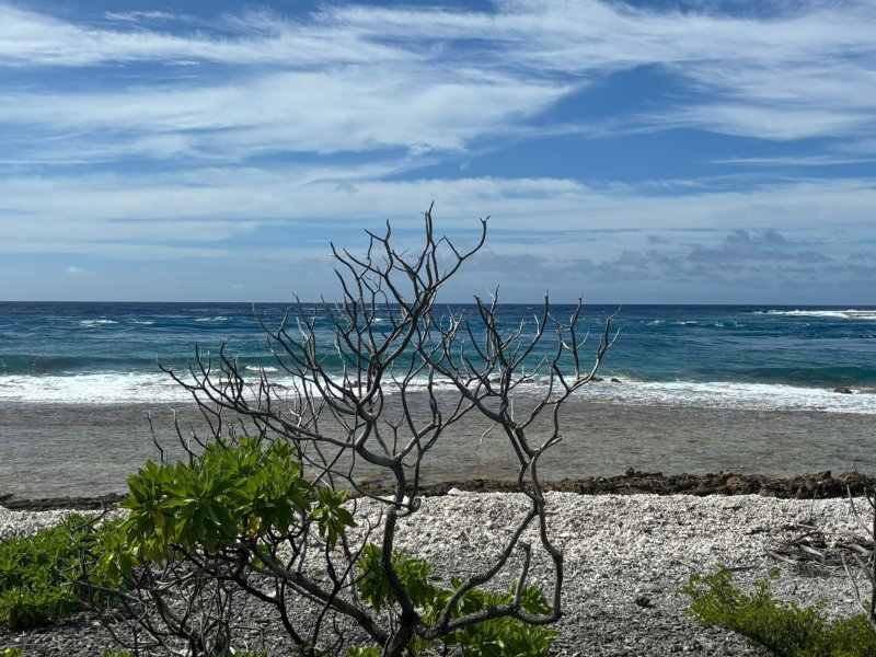
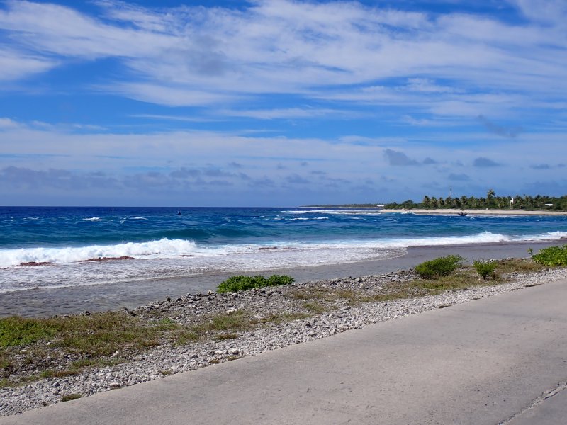
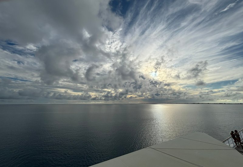
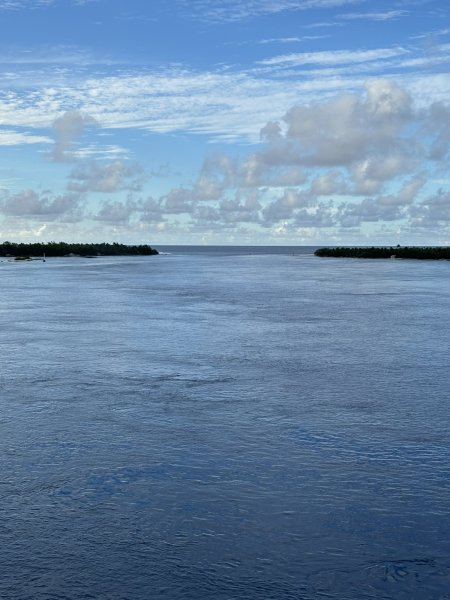
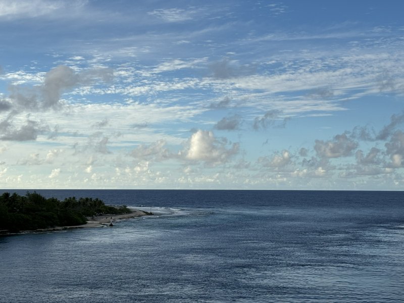
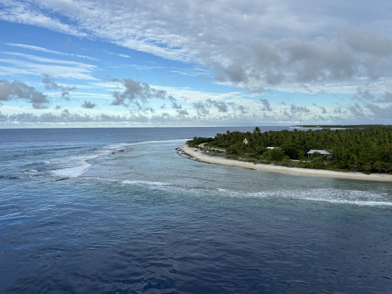
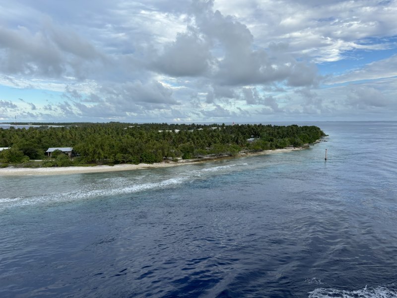
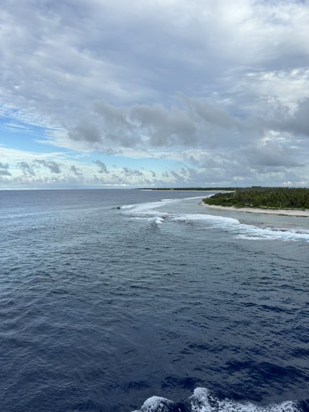
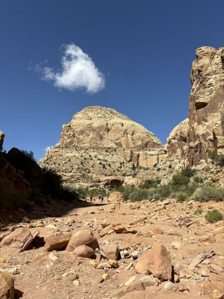
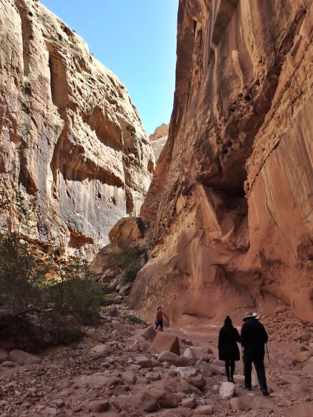
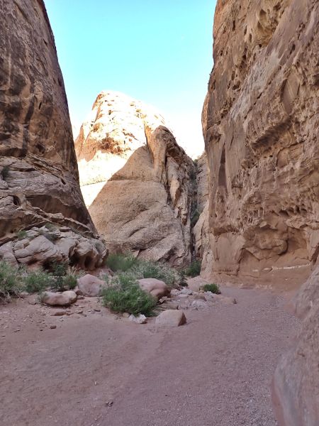
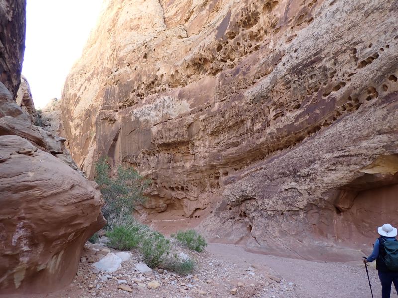
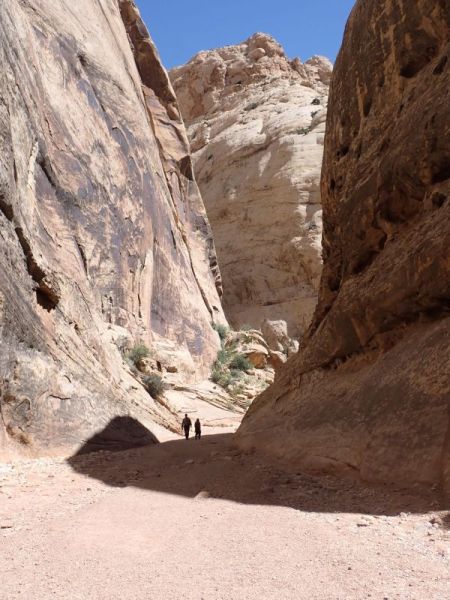
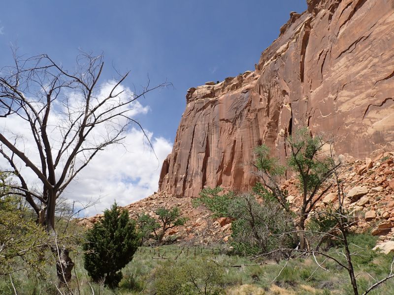
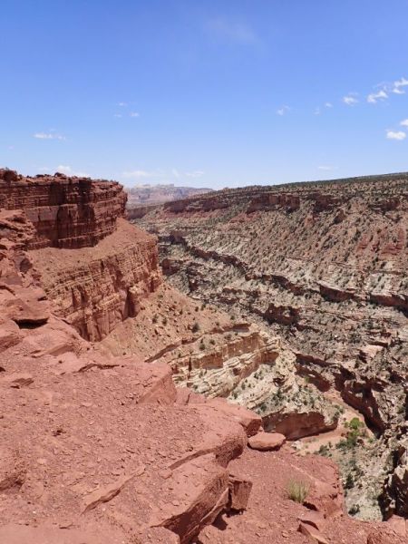
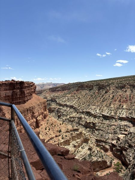
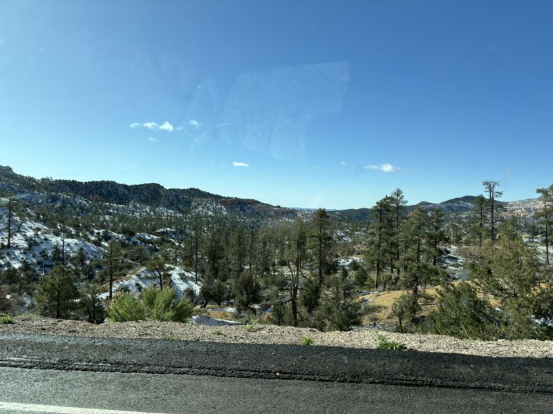
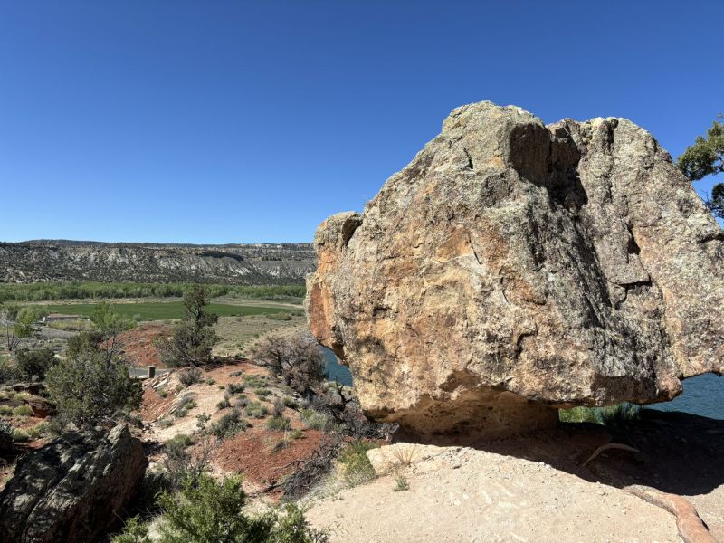
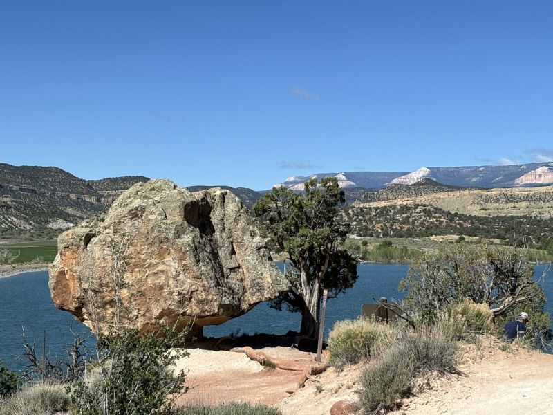
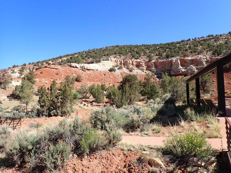
While reviewing trails on Sunday evening, we found the Zion Narrows Riverside Walk which is at the far north end of the main park scenic drive. The trail (without the wading in the snow fed river extension) is an approximately 2-mile round trip on a very well-maintained trail that has only about a 200-foot elevation gain over the trail. We got up a bit early so that we would be able to get a parking place in the parking area at the trailhead. Once again parking lot karma was on our side, and it all worked out great. Only downside was that the main restrooms were closed for repair and while they had porta potties, I’m pretty sure the inside bathrooms were warmer.
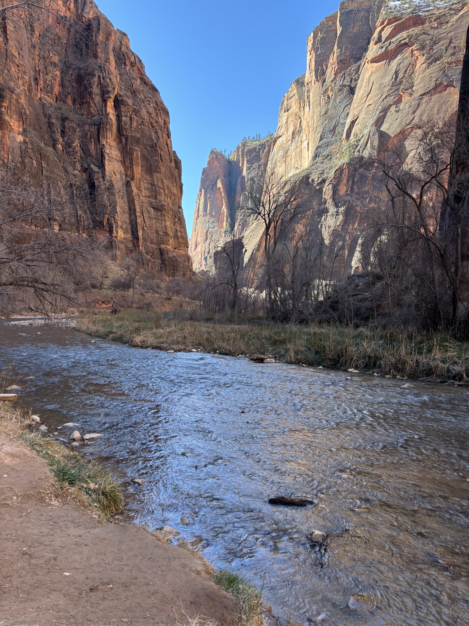
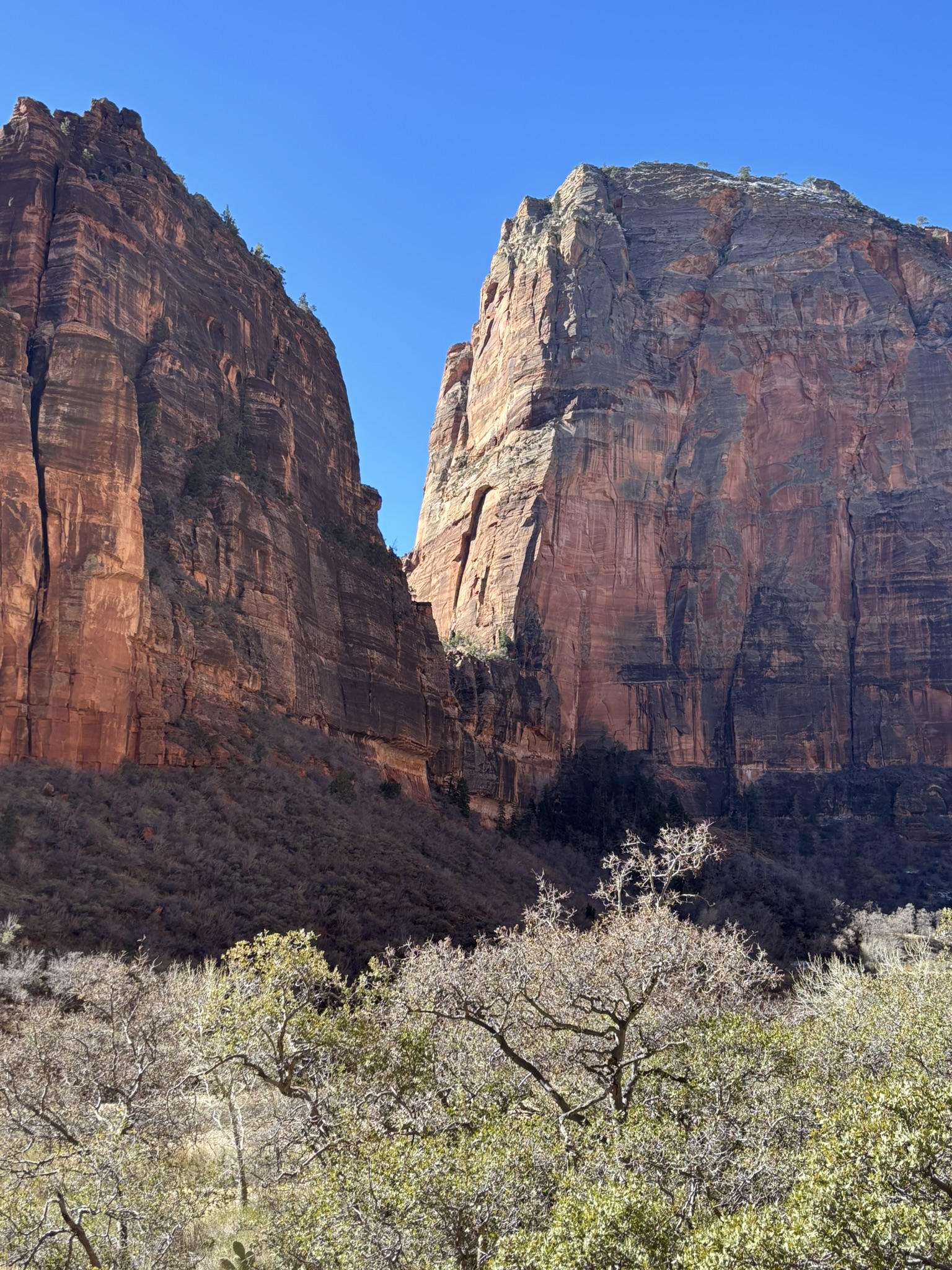
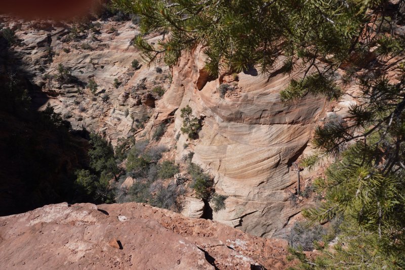
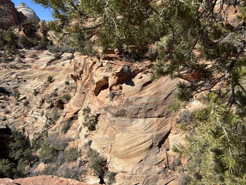
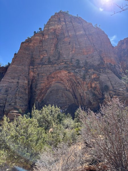
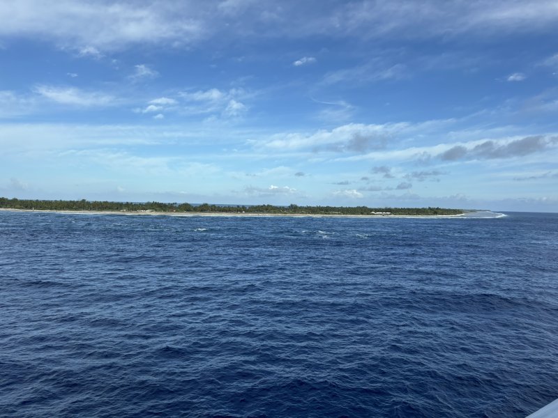
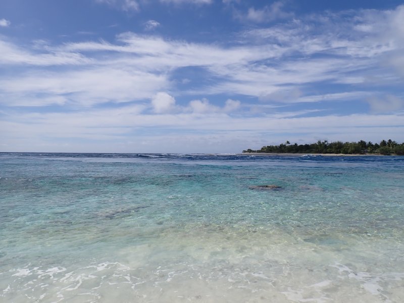
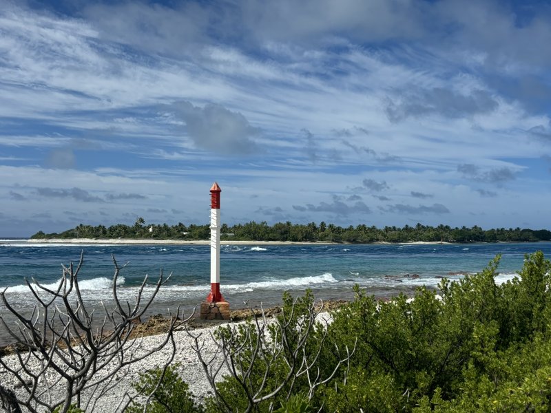
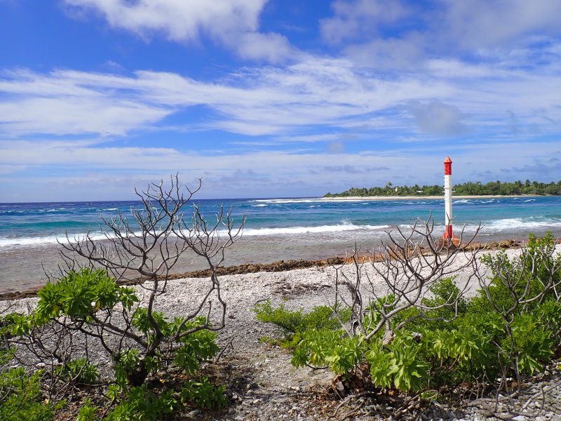
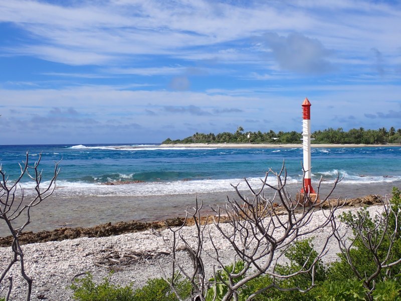
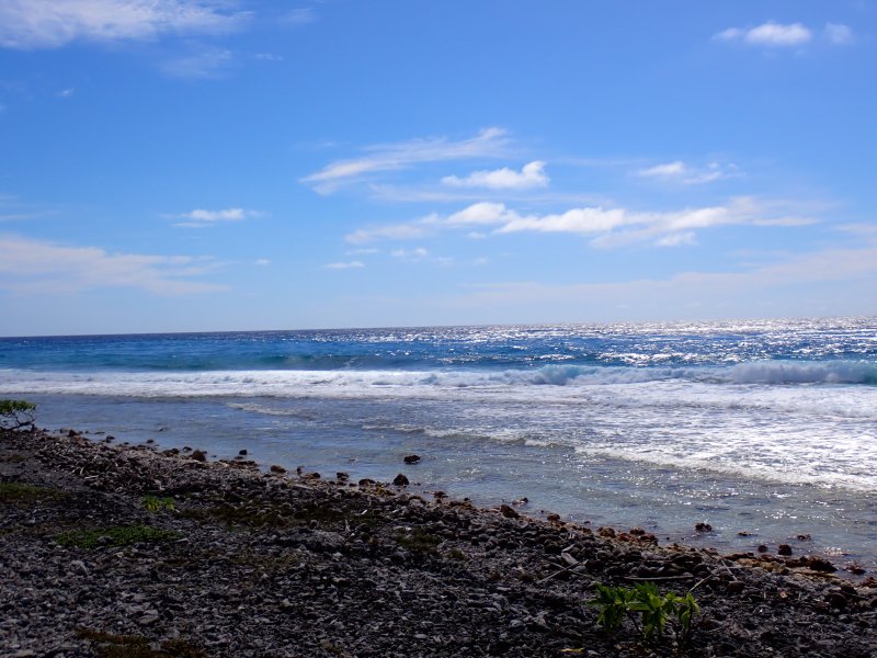
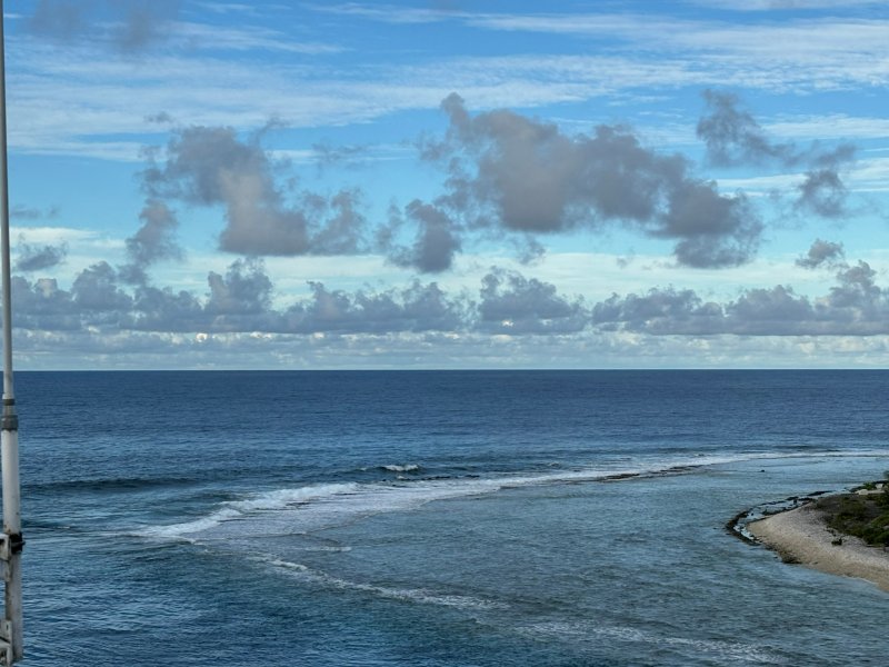
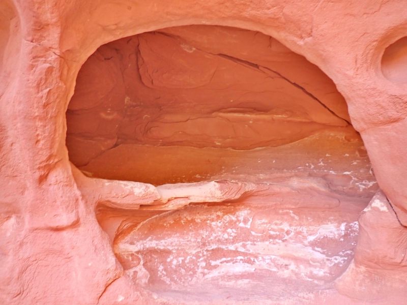
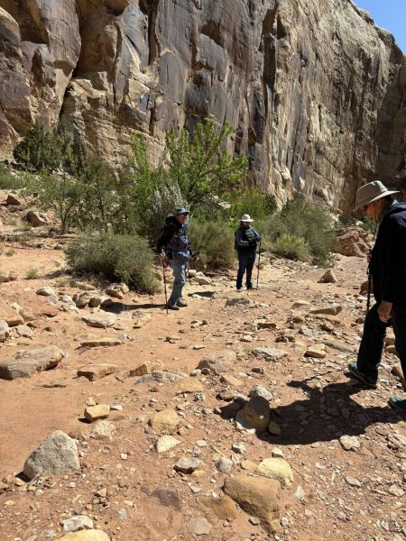
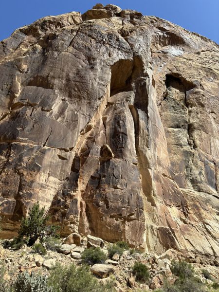
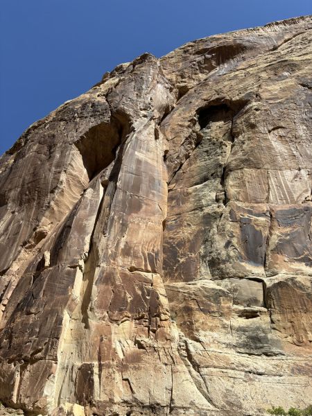
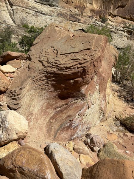
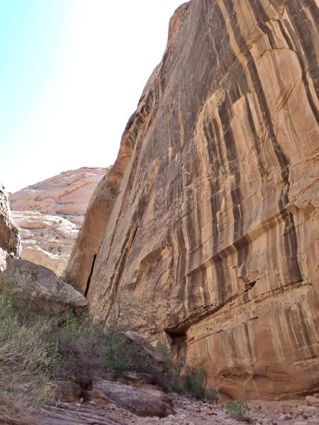
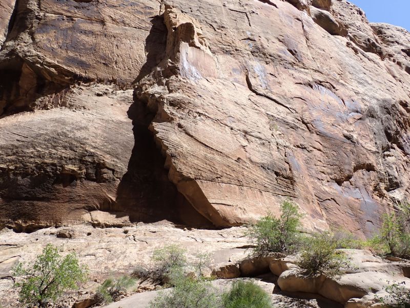
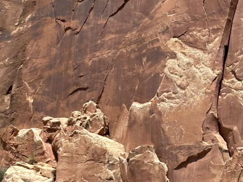
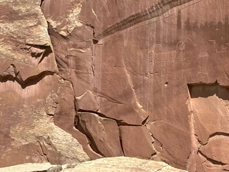
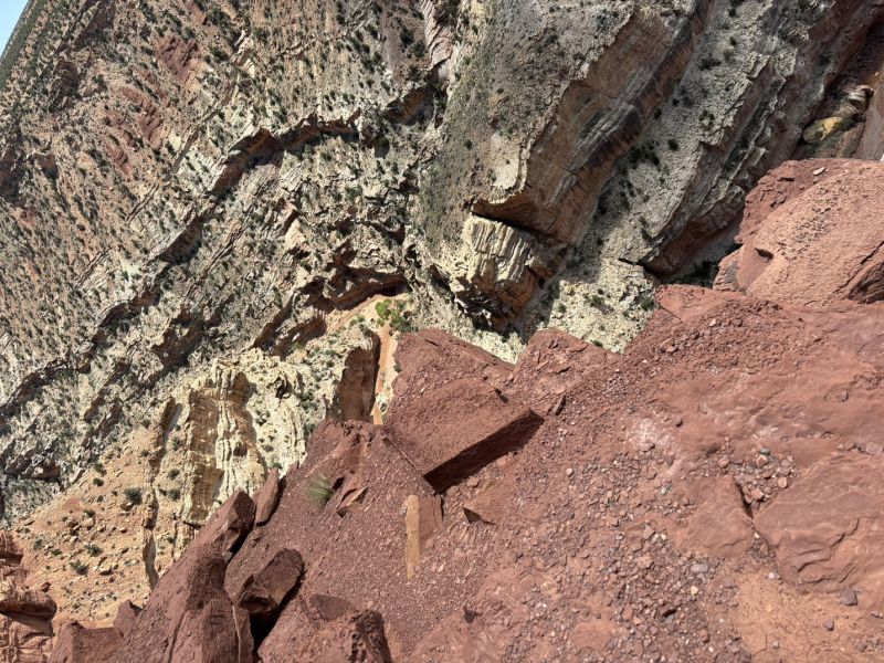
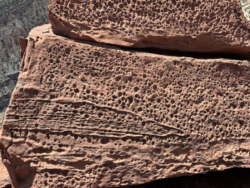
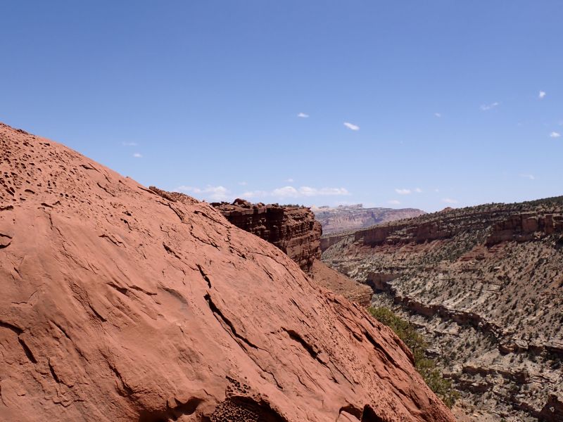
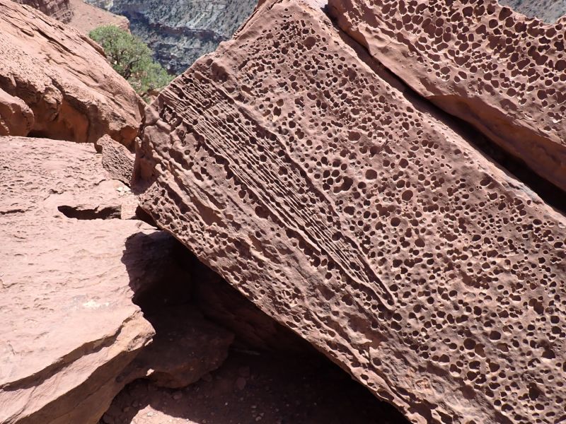
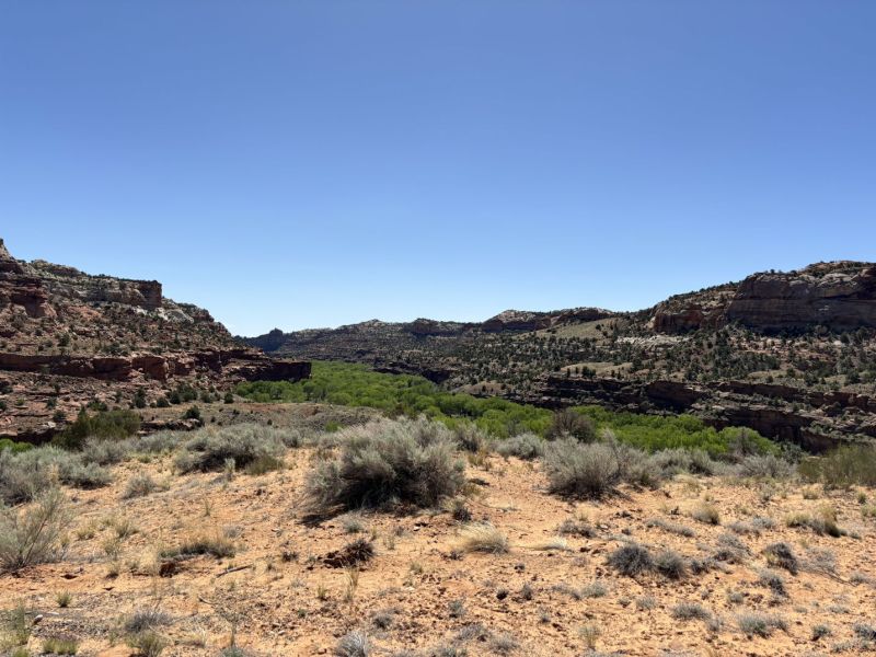
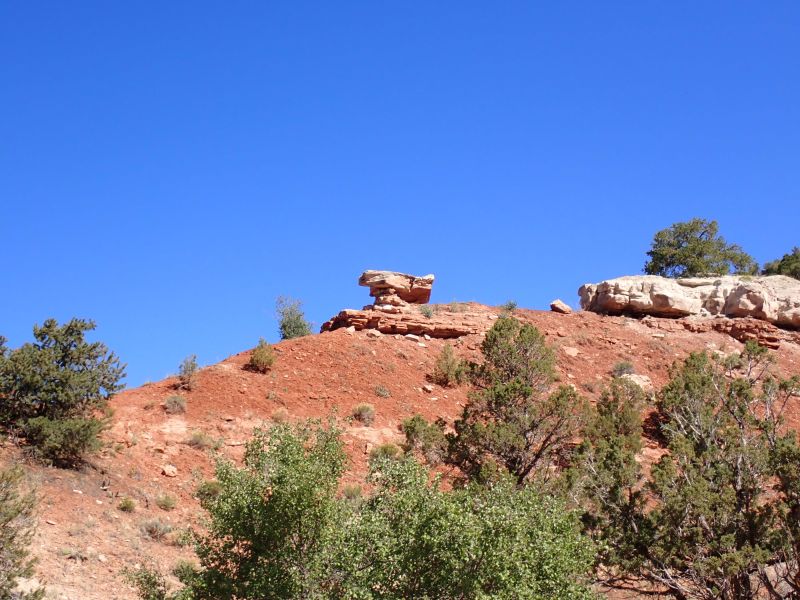
We arrived around 8:30 in the morning and because the North Fork of the Virgin River Canyon is mostly in the shade this time of year until mid to late afternoon, it was cold (45 deg F). The wind was also blowing adding to the chill factor. We had prepared well so we were not particularly uncomfortable, but the chill was noticeable. The walls of the canyon were near vertical and were still primarily the Navajo Sandstone, with a bit of snow for accent.
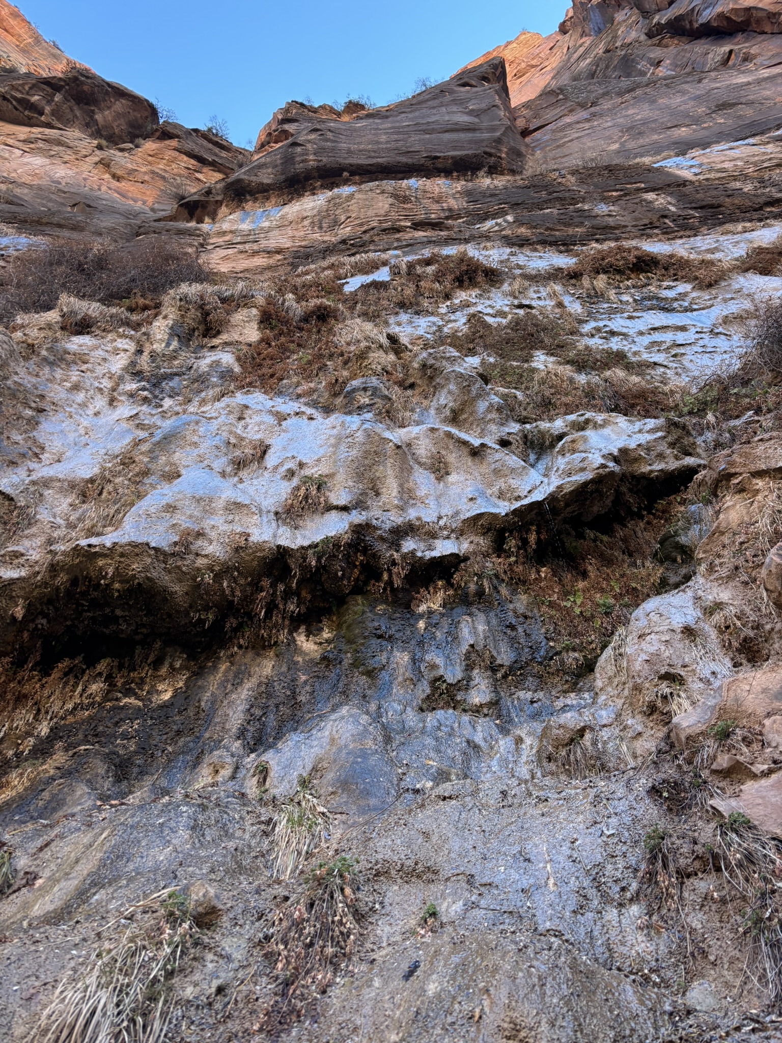
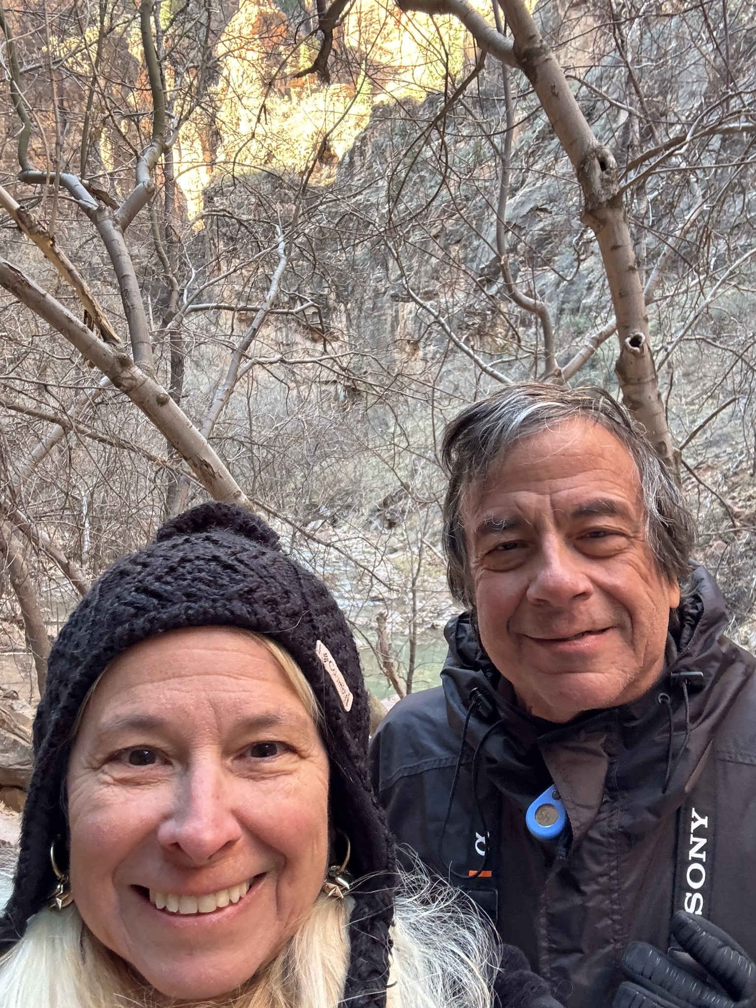
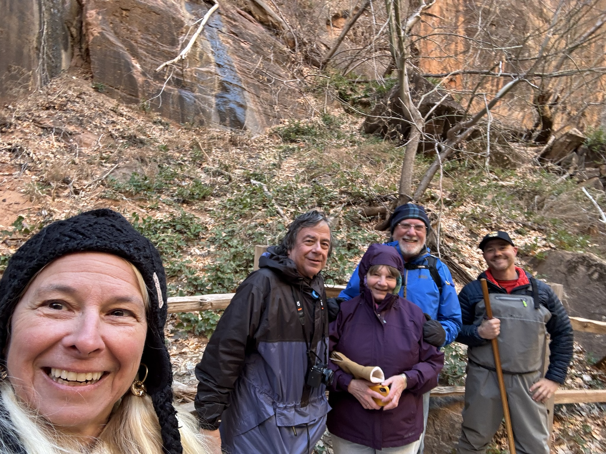
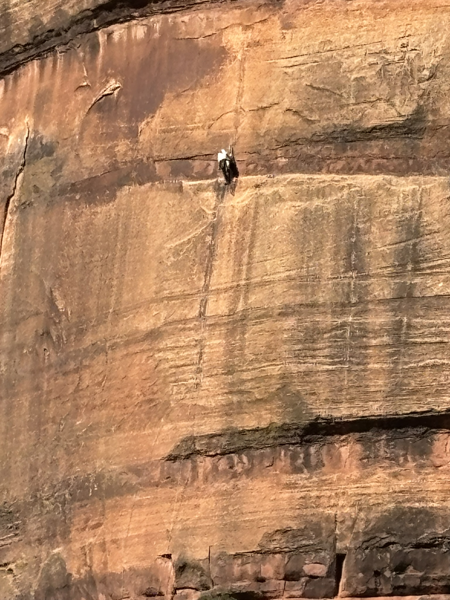
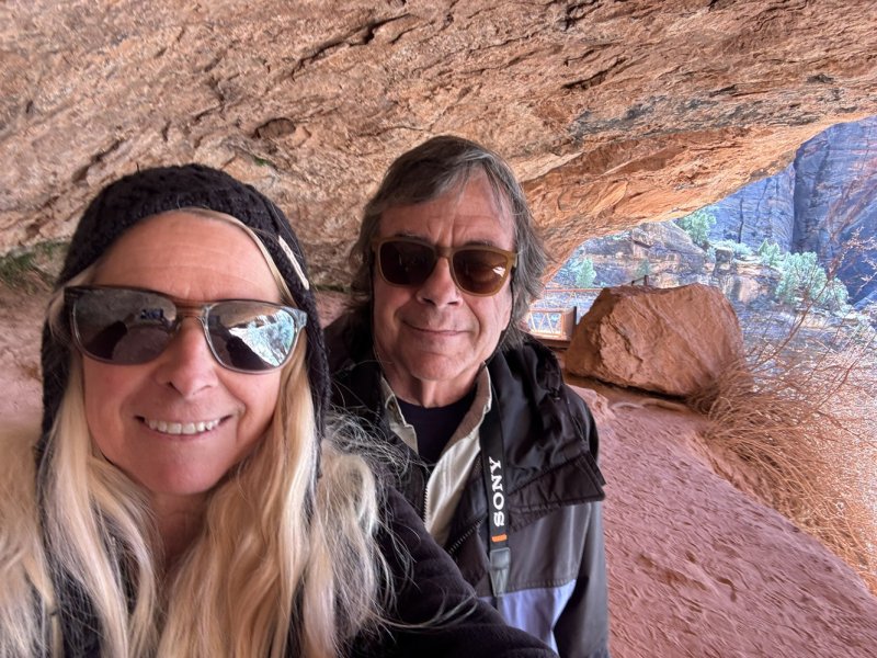
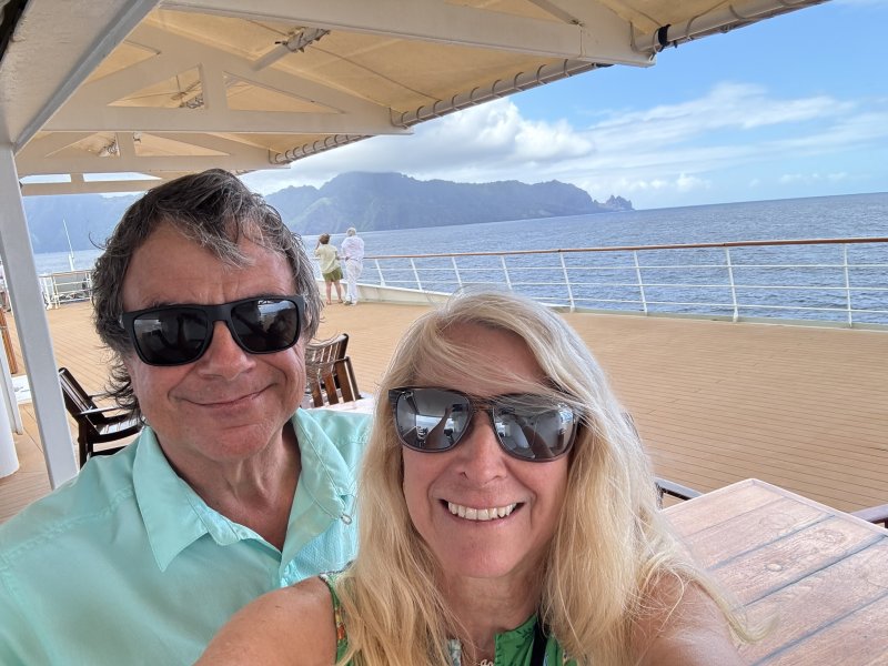
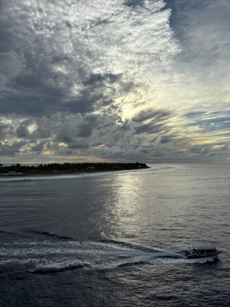
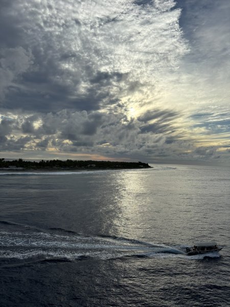
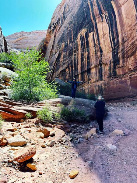
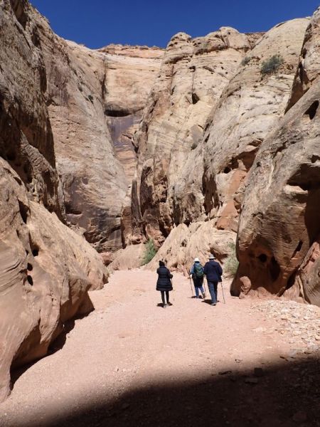
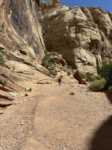
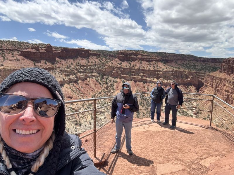
We ran into the New York couple and Phoenix guy that we had met at the geology talk the day before. Phoenix guy (John) was all decked out in insulated, waterproof waders with a pair of stout hiking sticks and continued up the trail into the river beyond the old folks’ trail ending. He sent us the two photos below of his in the river adventure.
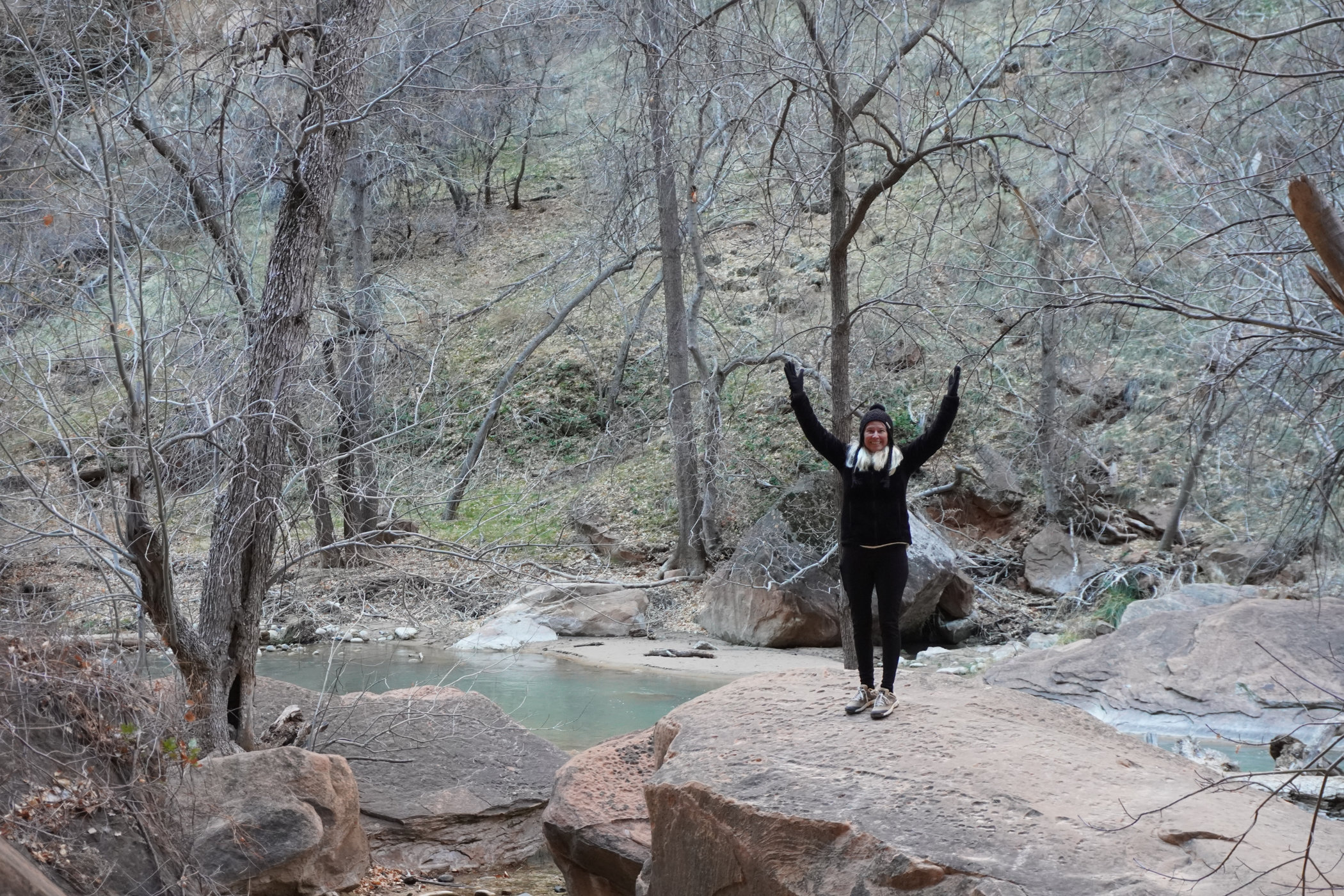
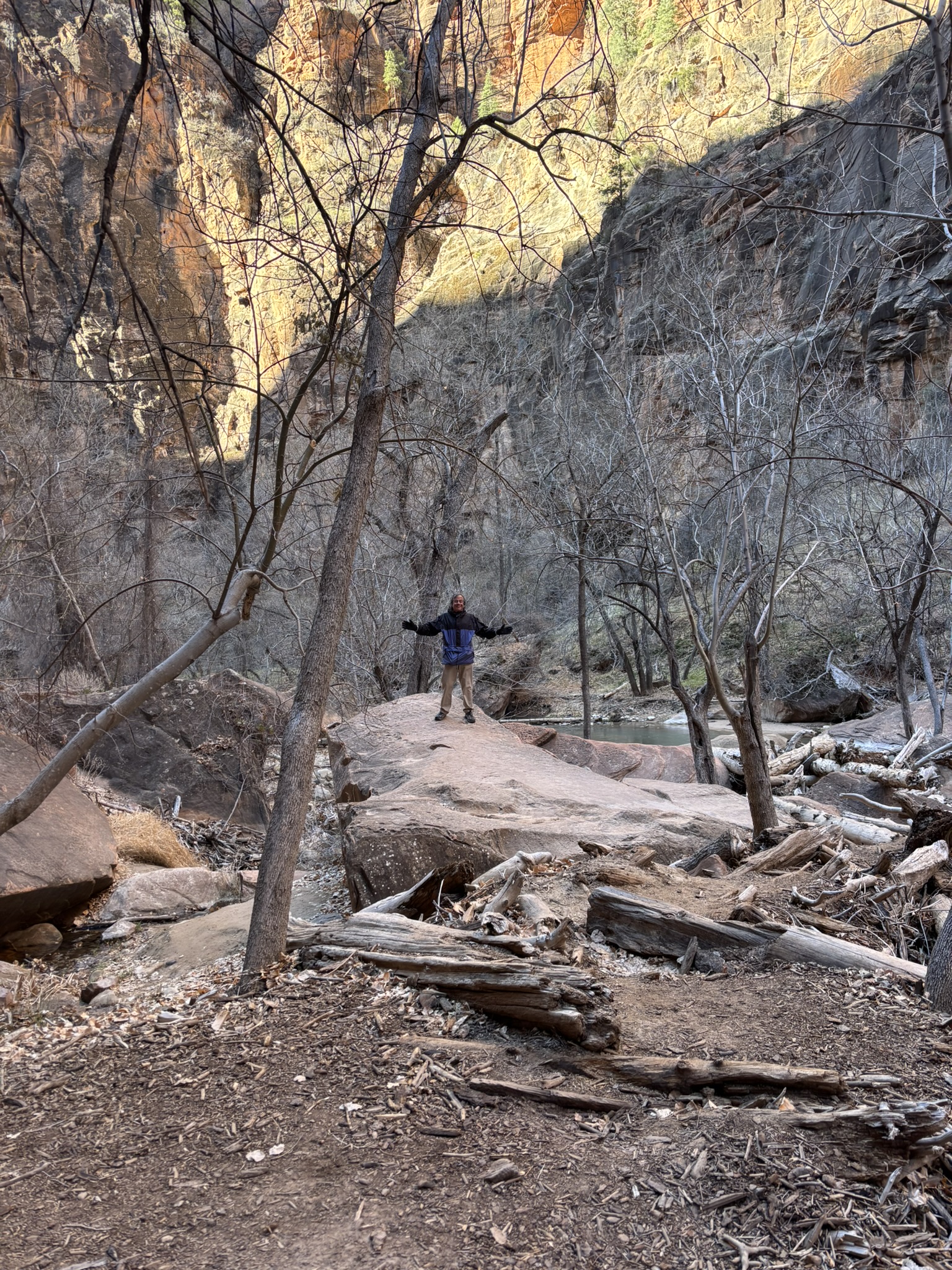
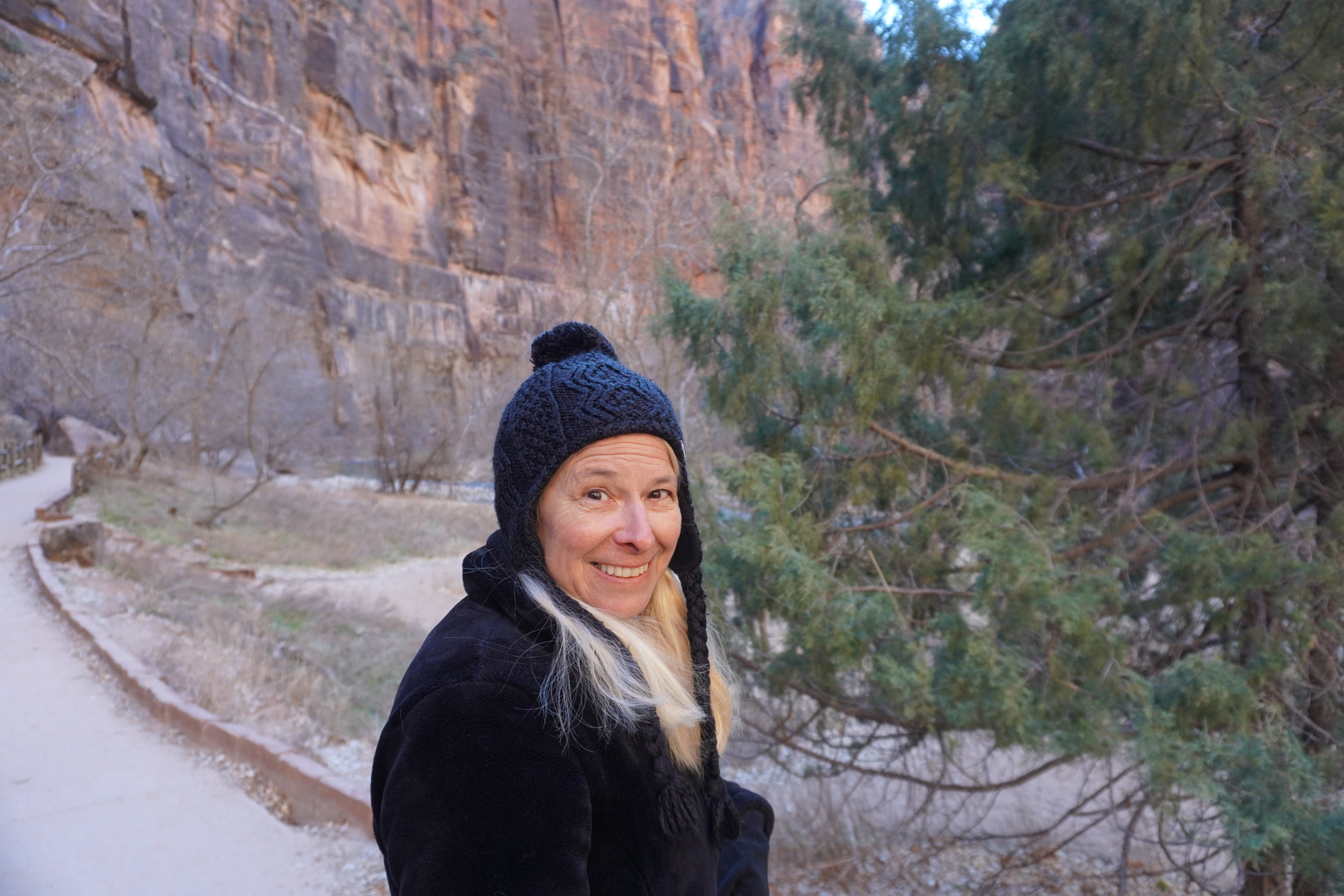
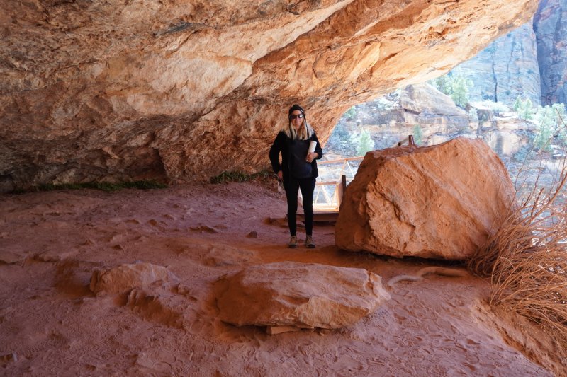
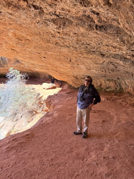
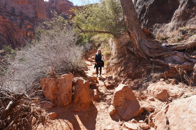
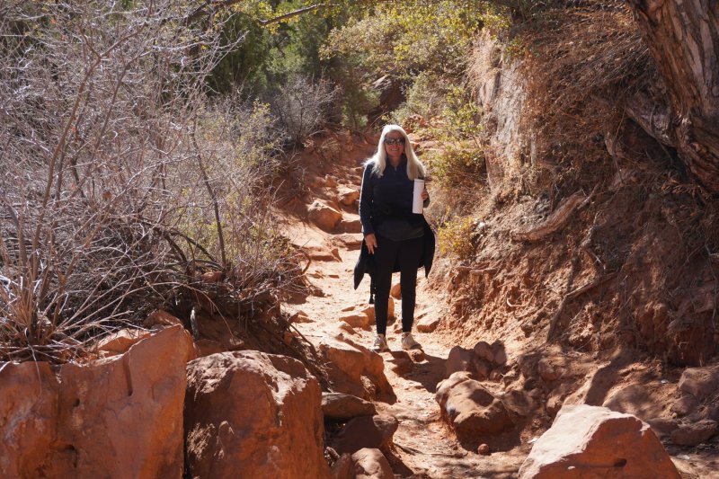
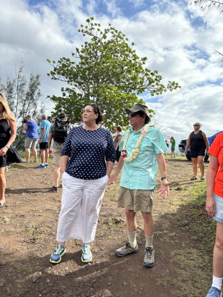
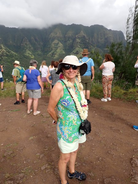
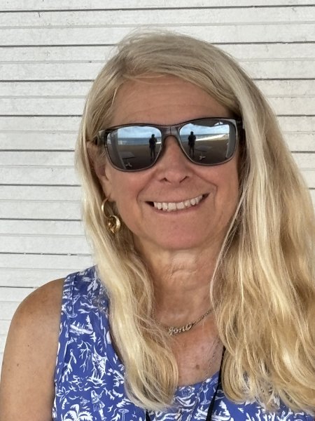
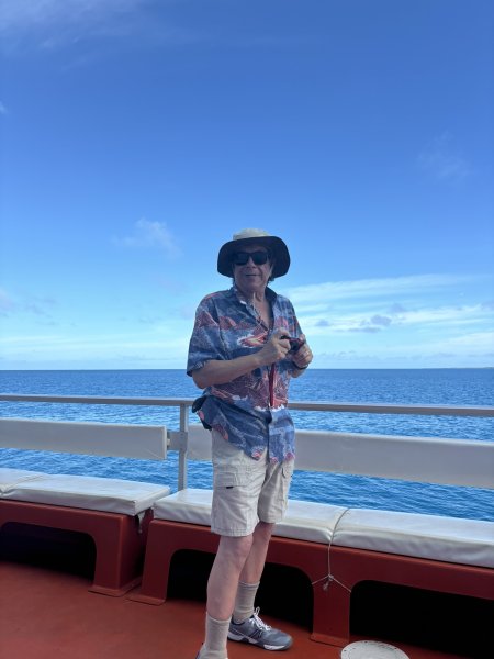
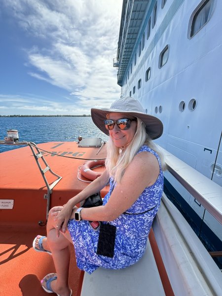
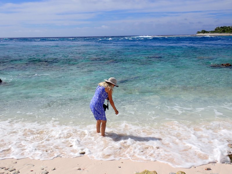
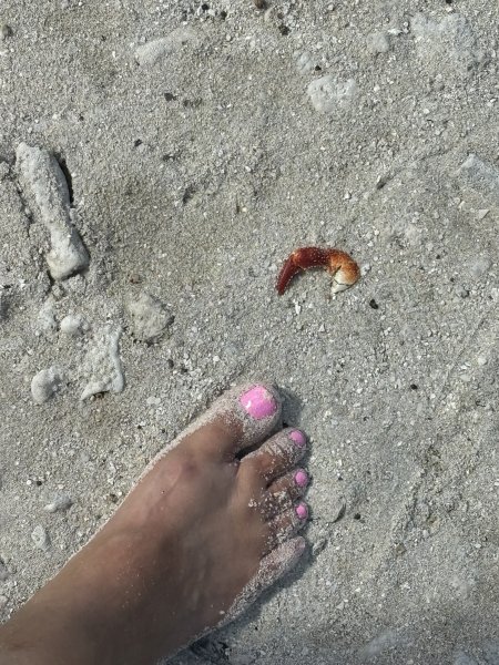
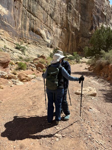
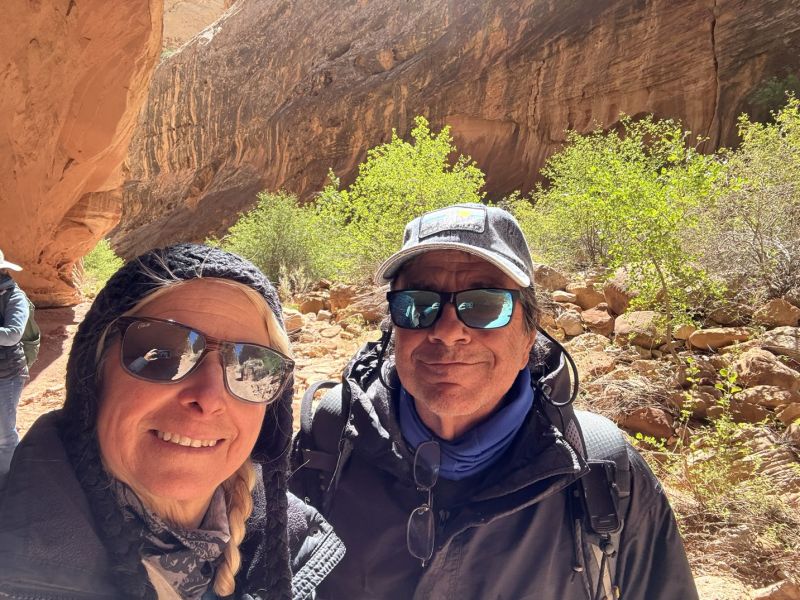
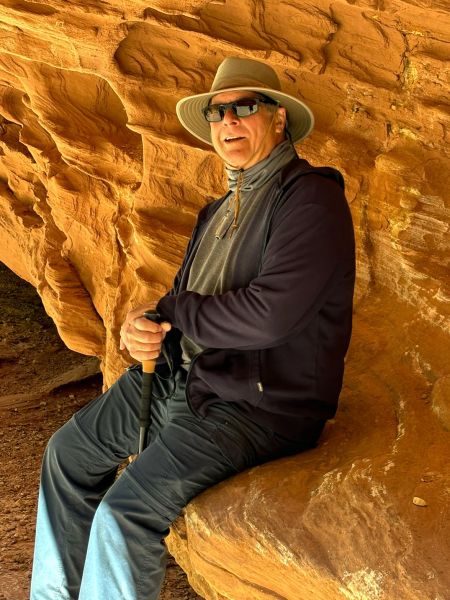
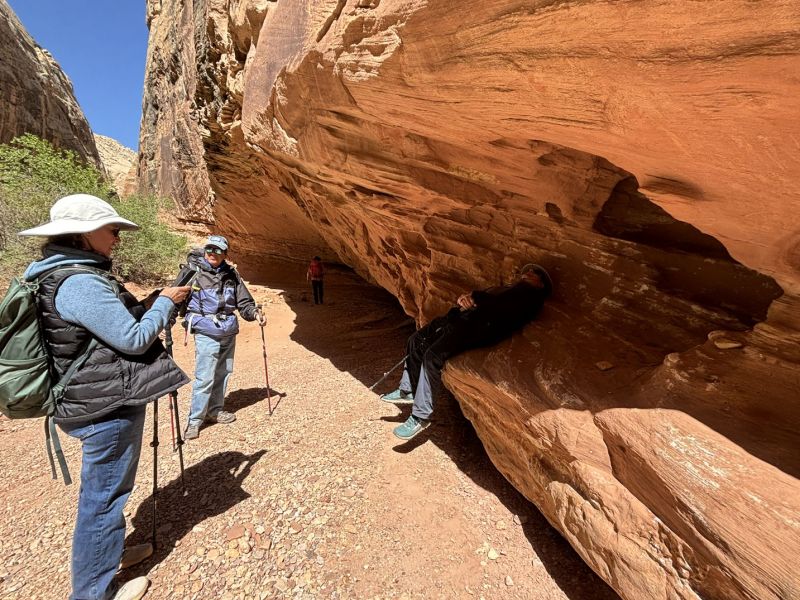
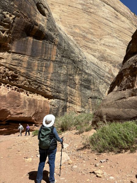
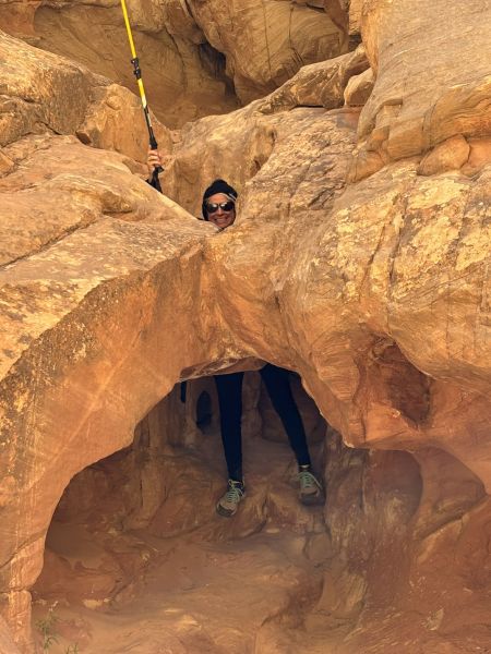
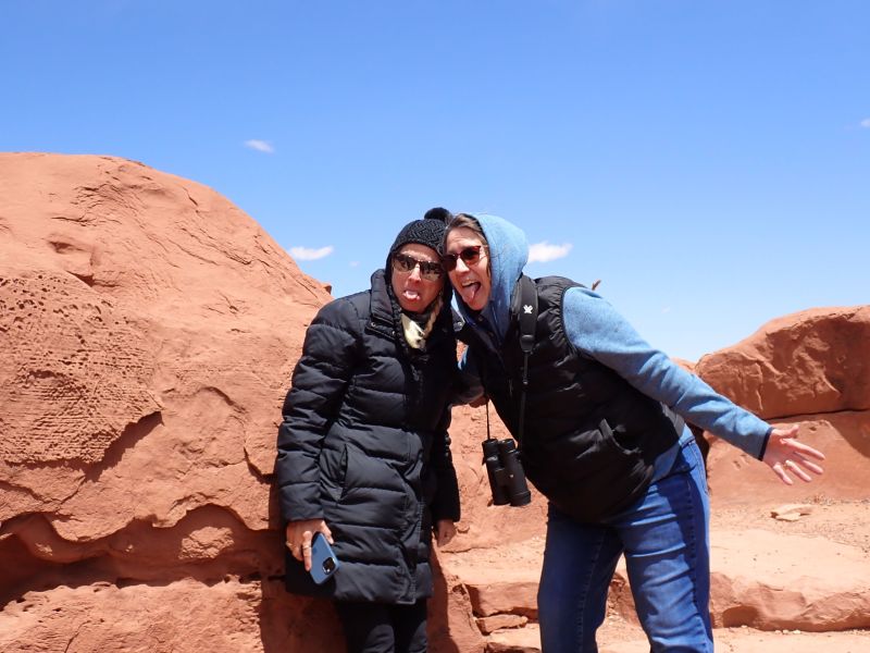
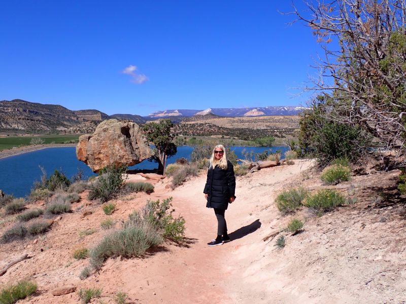
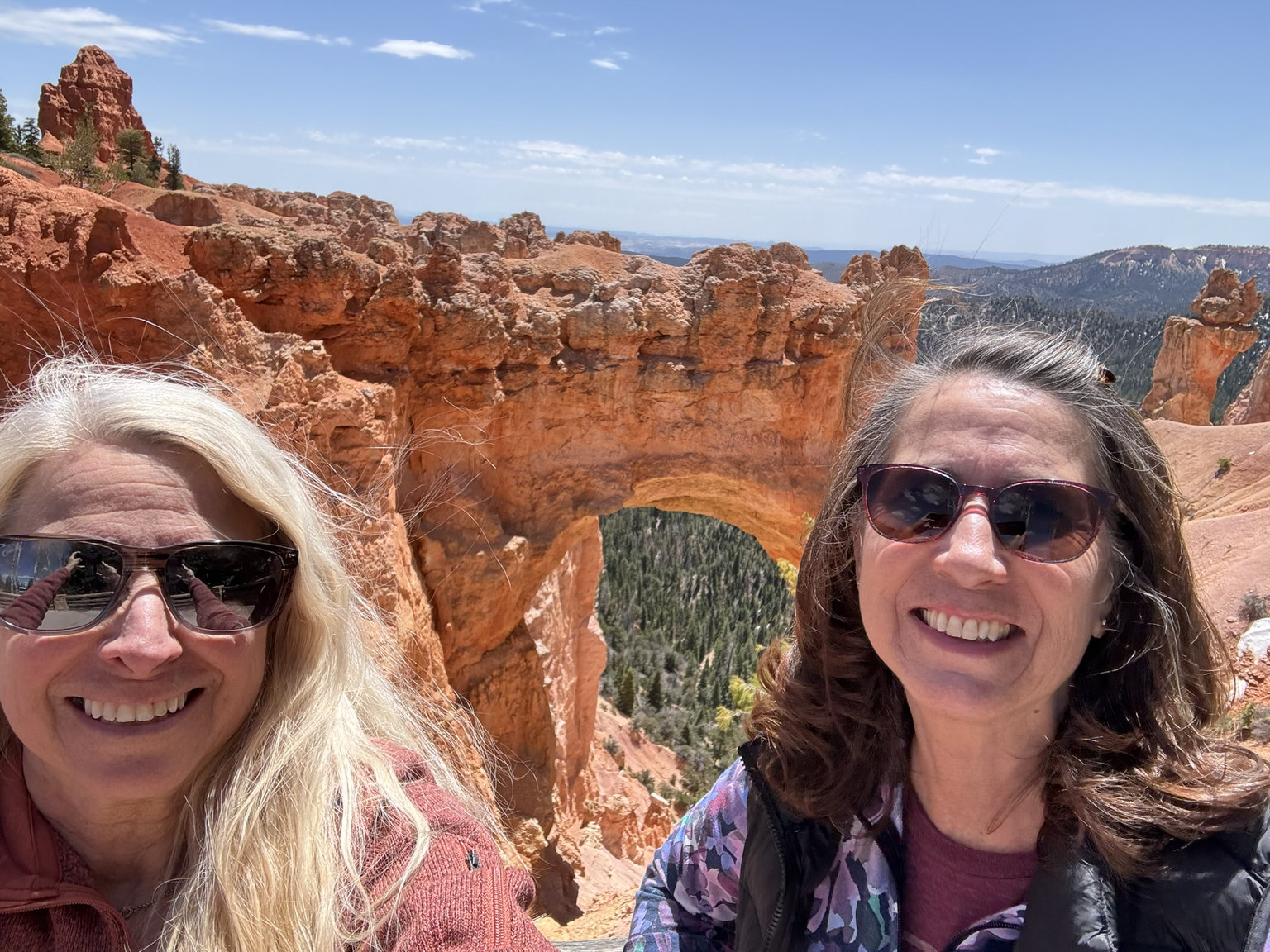
A few people pictures while enjoying the river walk and with our newfound friends.
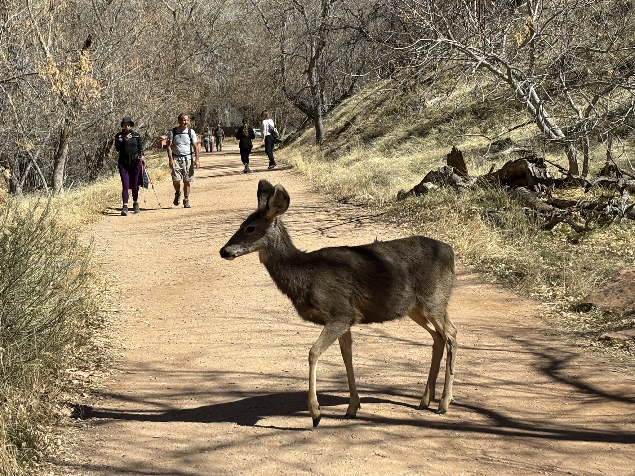
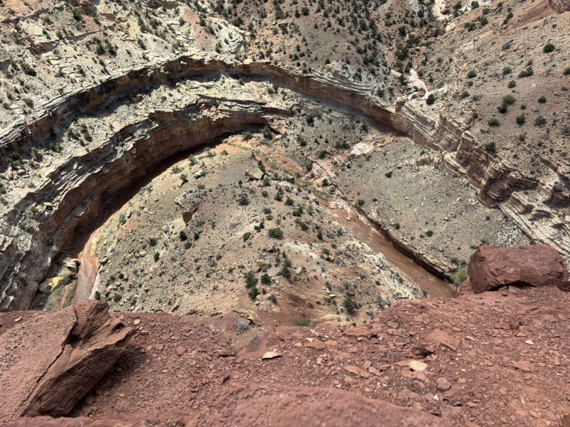
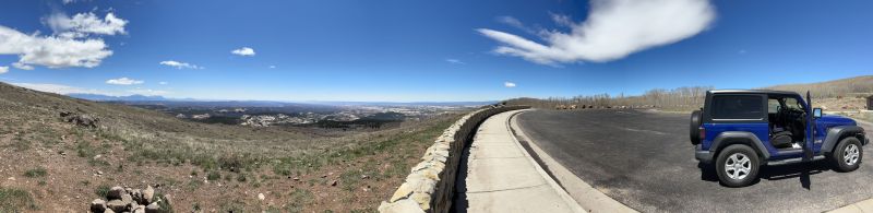
After our early morning hike, we turned back south on the scenic drive. We did make a couple of stops at pull outs heading south. At one stop that we had visited early in the morning on the way up the river, we had seen a fairly free-spirited looking fellow sitting on top of his van enjoying a cup of something. He was still there about 3 hours later but had switched his intake to something significantly more aromatic and relaxing. Just sitting there staring at the scenery yearning for the ’70s. We were planning on doing a second hike at the Emerald Pools Trail to finish out the days sightseeing. At this point, our parking lot karma expired, and we had to park a bit of a distance from the trailhead. Also, Joni’s leg, which had registered a complaint the evening before, was not being as cooperative as we needed for uphill, trail hiking. In the end we did walk up to the Emerald Pools Trailhead along the Grotto Trail which went from the Zion Lodge area to the trailhead. On the walk, several deer sort of dropped onto the trail apparently thinking that the folks walking would have some morsels for them to enjoy. Again, I think the folks that brave the cold to visit the park are more conscious of the wildlife and scenery and no one walked up to the deer to try to pet them or feed them. Everyone stayed a respectable distance from the deer. It appeared that the deer thought that the humans were being a bit stand offish, and they tentatively relocated closer to the folks on the trail.
All in all, another great scenery and sightseeing day in the park. We had a late lunch, so dinner was not a huge priority but we both thought that we should have something. We found a small place in Springdale called MeMe’s Cafe that advertised burgers, salad and crepes. Opting for a lower key meal, we tried it out and it was very good. By the way, Springdale in late February rolls up the sidewalks pretty early. Not sure where all the tourists go, but it was extraordinarily quiet in the evenings during our visit.
Posted inGeology, Travel and Scenery|Comments Off on Zion National Park – A Day at the River – February 24, 2025
We decided to leave for Zion a day early, so we ended up staying in Hurricane, Ut on Saturday night before our first day in the park. Great choice as we found a very good restaurant called Stagecoach in La Verkin just a stone’s throw from the Hurricane Fault. With enough beer even at my age I could have…. on the fault trace. Great craft beer selection and very good food at a very good price. Anytime craft beer is $6.00 a pint you have found home. I had Chicken Fried Steak recommended by our server who said it was very good, and she was right. A slab of mushroom gravied mashed potatoes with a large piece of perfectly cooked mushroom gravied meat that was well seasoned showed up. Sometimes, restaurants over season the meat with pepper but they did it right. Joni went for a Salmon Oscar. Oscar was a crab cake on top with a sinfully rich sauce (almost a Thanksgiving class feast of butter) that was also very good.
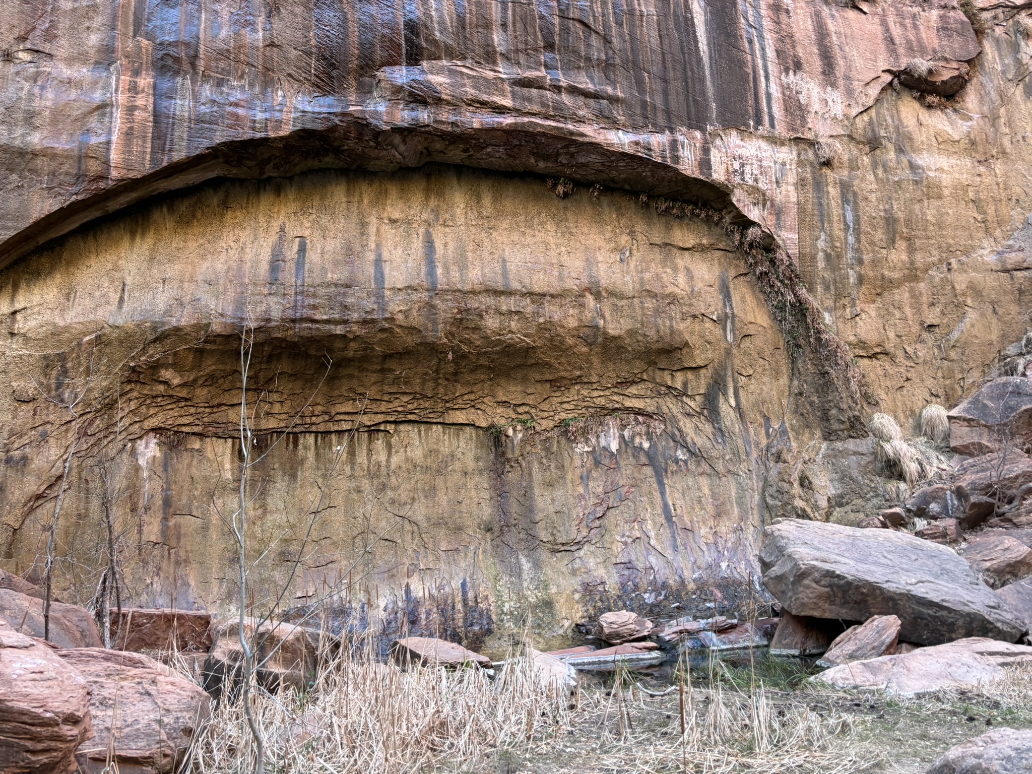
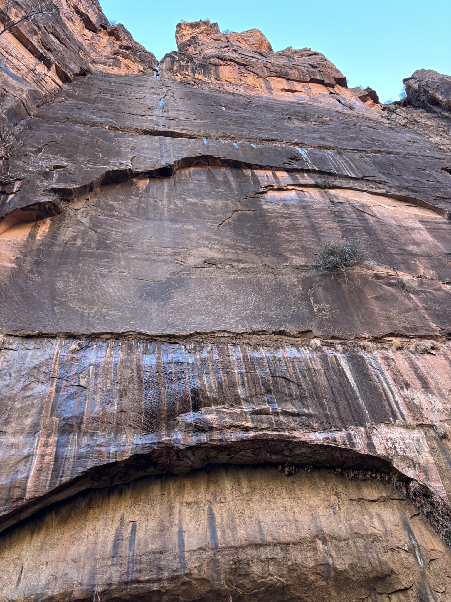
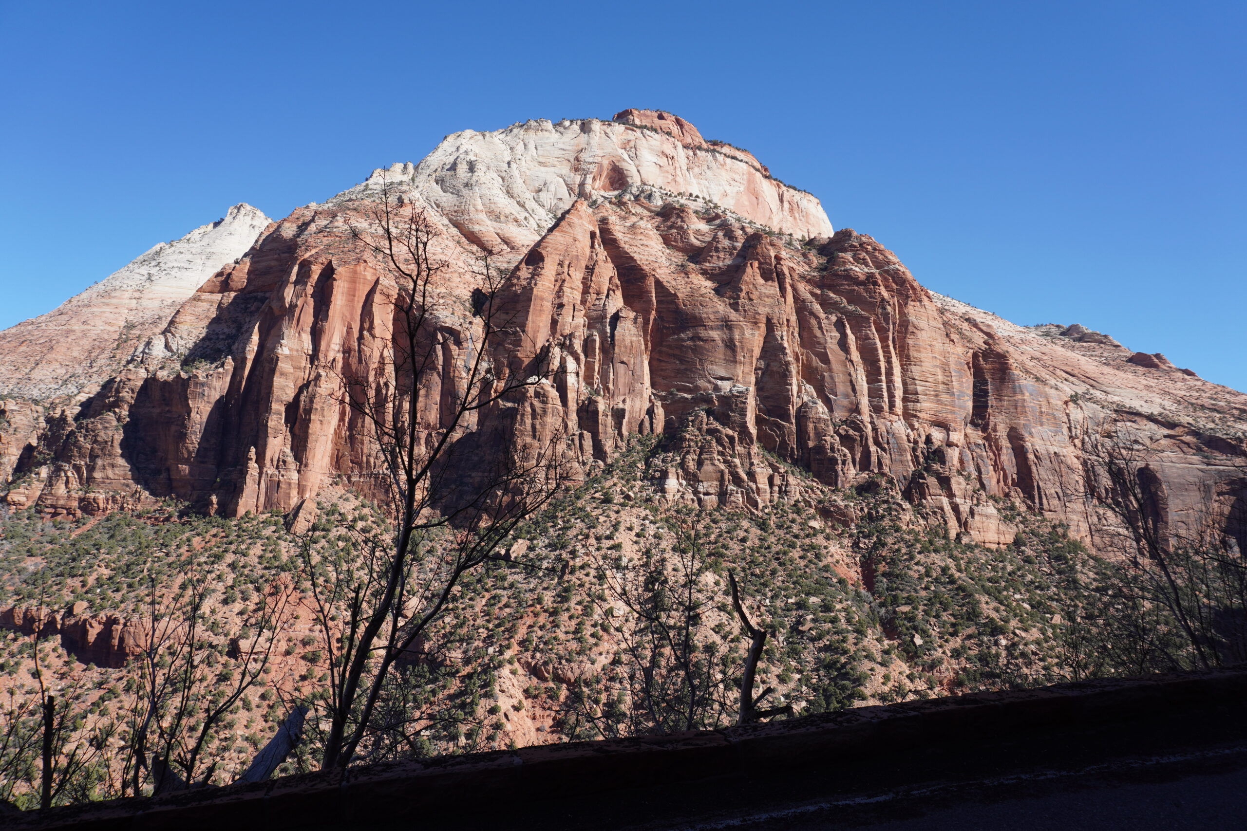
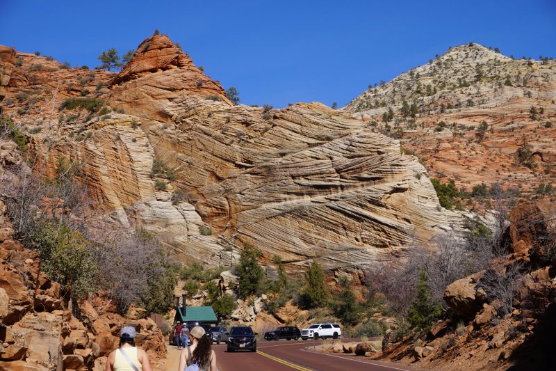
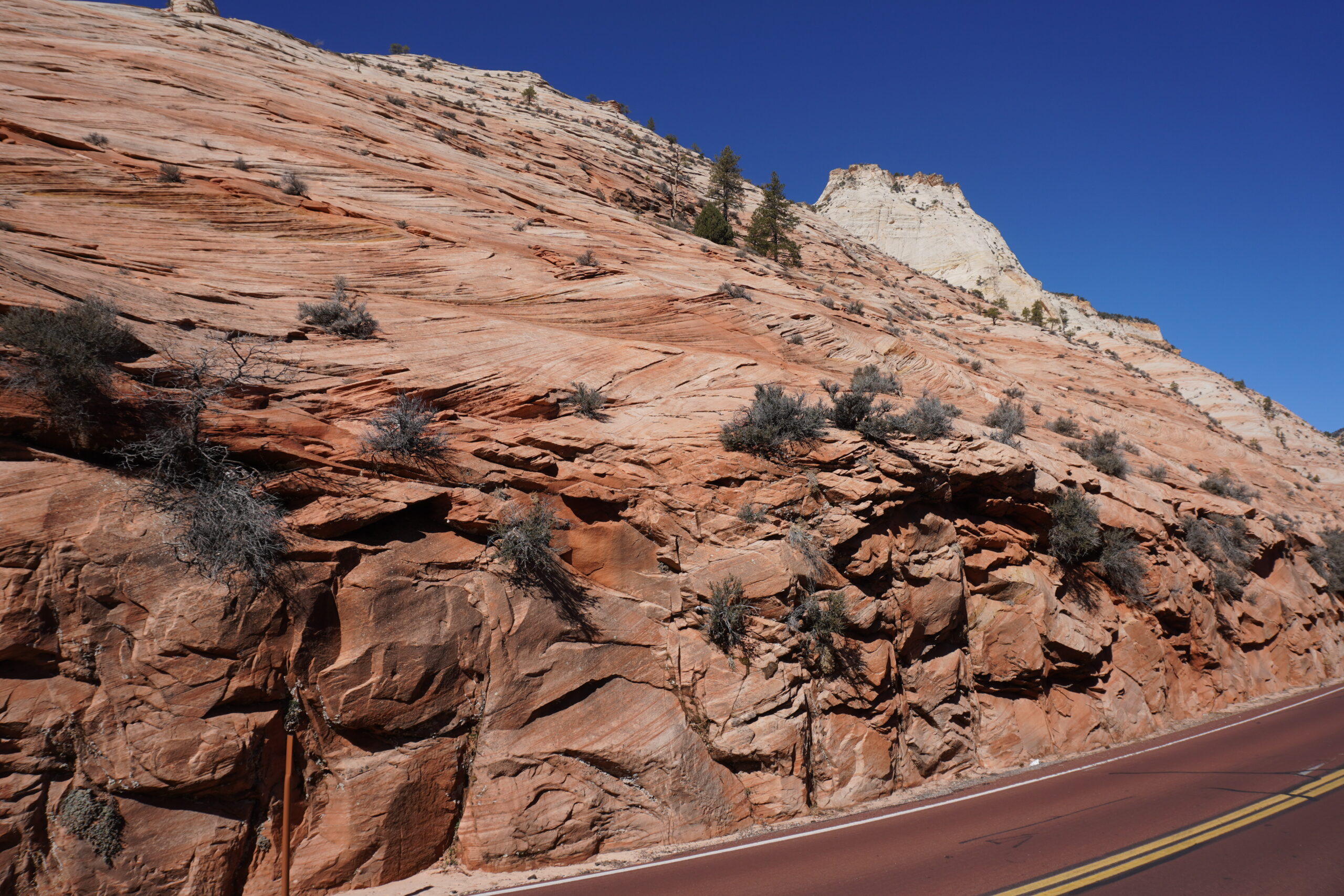
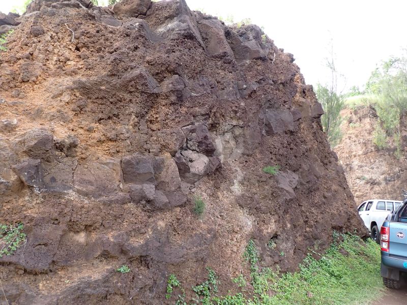
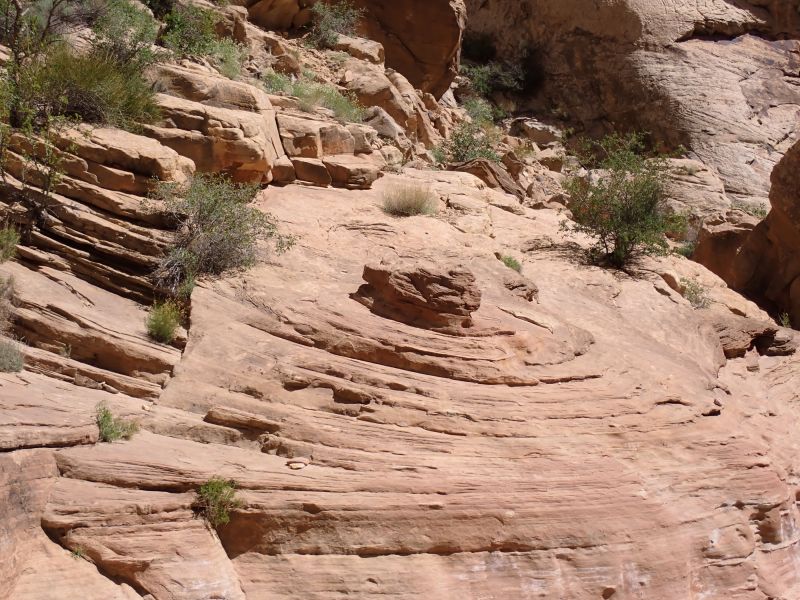
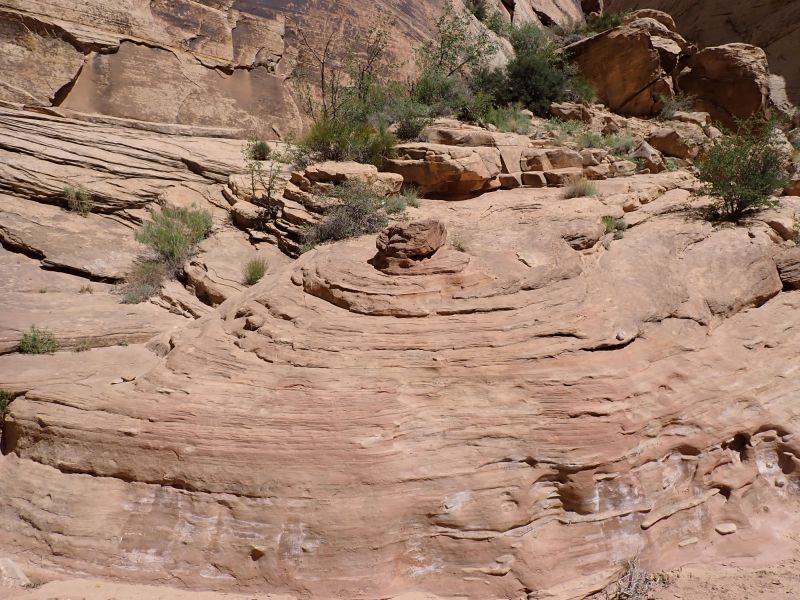
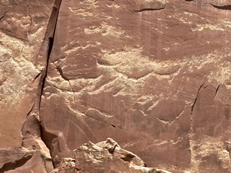
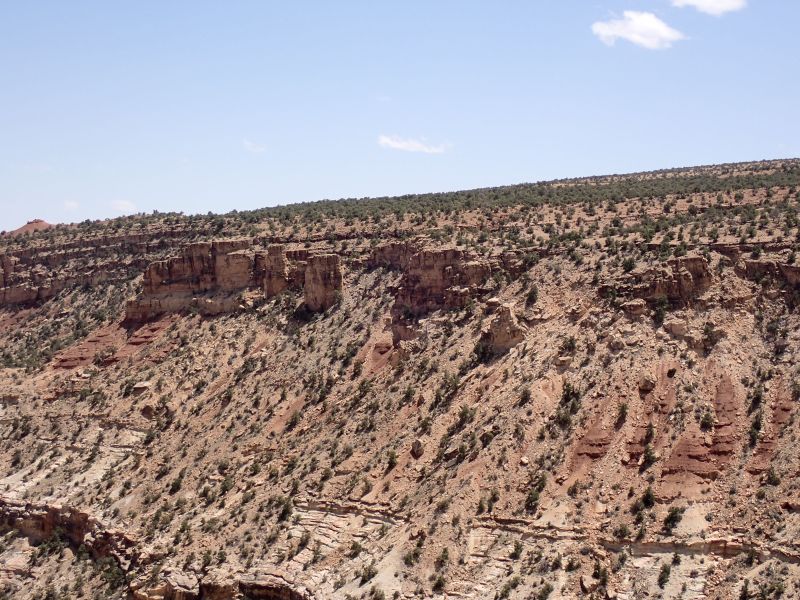
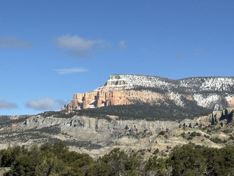
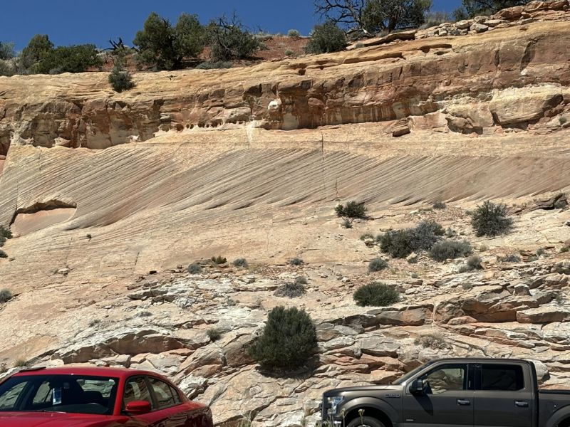
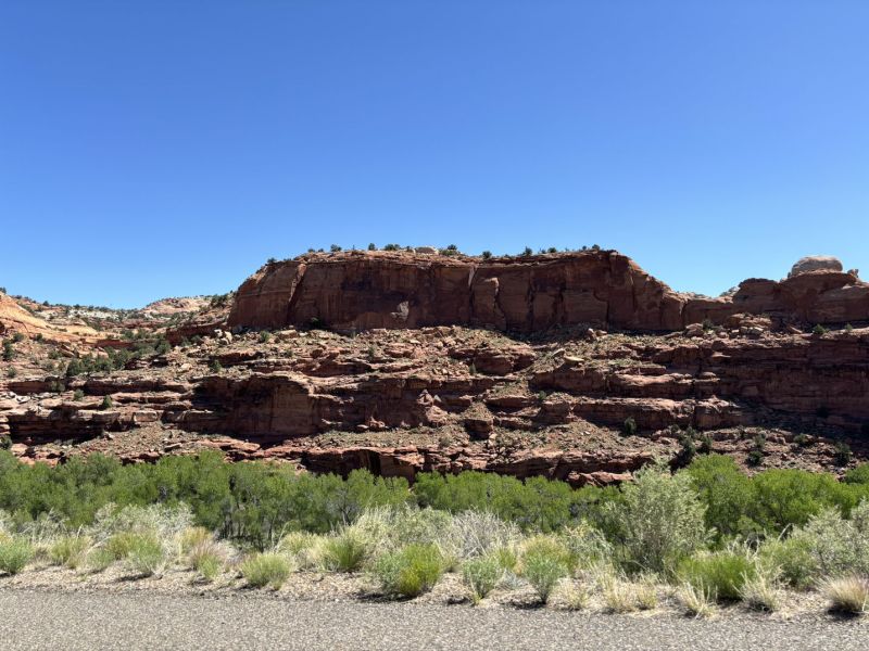
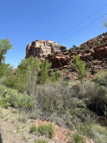
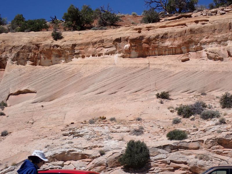
On to the park. With an early departure from Hurricane, and a stop at Lin’s grocery for water, sandwiches and snacks we climbed the Hurricane fault and headed up onto the Colorado Plateau. The geology of all of southern Utah and Northern Arizona is nothing less than spectacular due to the magic of uplift and erosion, and this drive on Utah Highway 9 just reinforced that observation. I suppose the geologic star of the show (not to ignore all of the other contributing formations and structures) as you get closer to the park is the Navajo Formation which is a 190 +/- million-year-old (Jurassic Period) sandstone that towers up to 2,000 feet above the Virgin River Canyon(s). It was deposited as wind borne sands (eolian deposit) in an extreme desert environment that covered the entire Colorado Plateau and beyond. The formation is characterized by its signature and prominent cross bedding due to winds during deposition of the dunes. I was always somewhat impressed that cross bedding in an eolian environment only happens on the lee side of the dunes. After visiting Great Sand Dunes in southern Colorado 45+ years ago it finally all made sense. Dune fields are very mobile with crests moving repositioning themselves covering and uncovering the lee sides of the dunes. As the dunes migrate the inclined layers of sand on the lee side get buried, covered with new sand, compacted and .. bang after a few million or tens of million years and you end up with a consolidated rock formation.
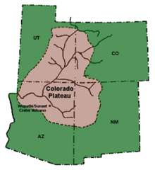
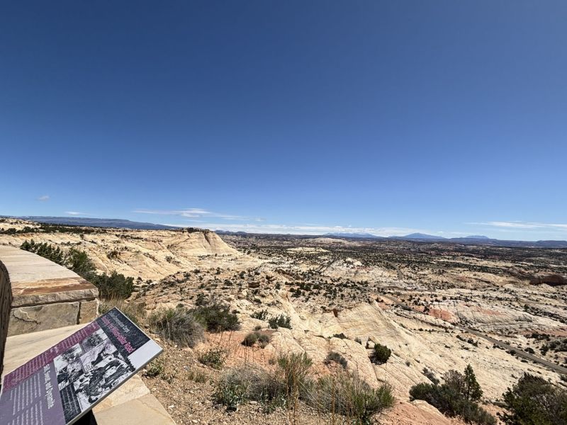
The palteau.
As we entered Springdale, we scoped out our accommodations and then entered the park. We made the requisite stop at the visitor center and dropped a few bucks on a book or two and the Deenan National Park mug. When they allow cars into the park in the off-season, the Rangers monitor key intersections and knowing the number of available parking spaces uphill of the intersection, they cut off access when all available parking spaces could be filled. Then as cars come back through the intersection, they allow new entries. Very civilized and very good at limiting how many of your fellow man you get to enjoy rubbing elbows with on the trails, at the parking stops and in the parking lots. When the shuttles are running, they can and do stuff about 2 to 3 times the parking volume of people into the areas.
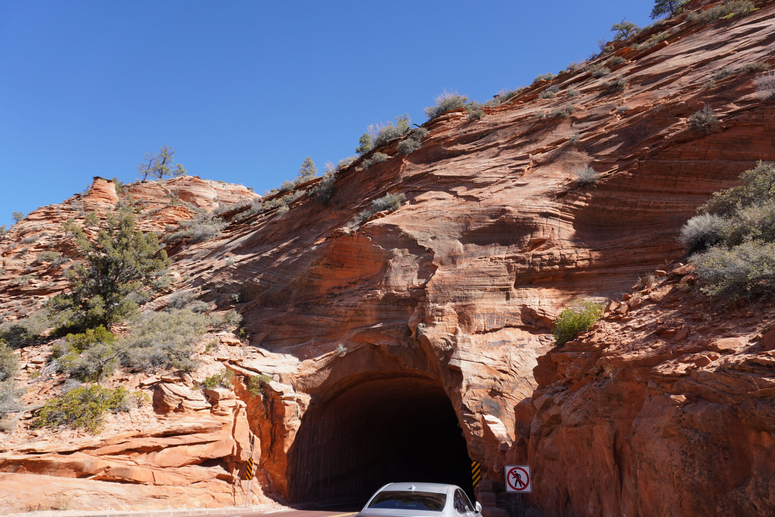
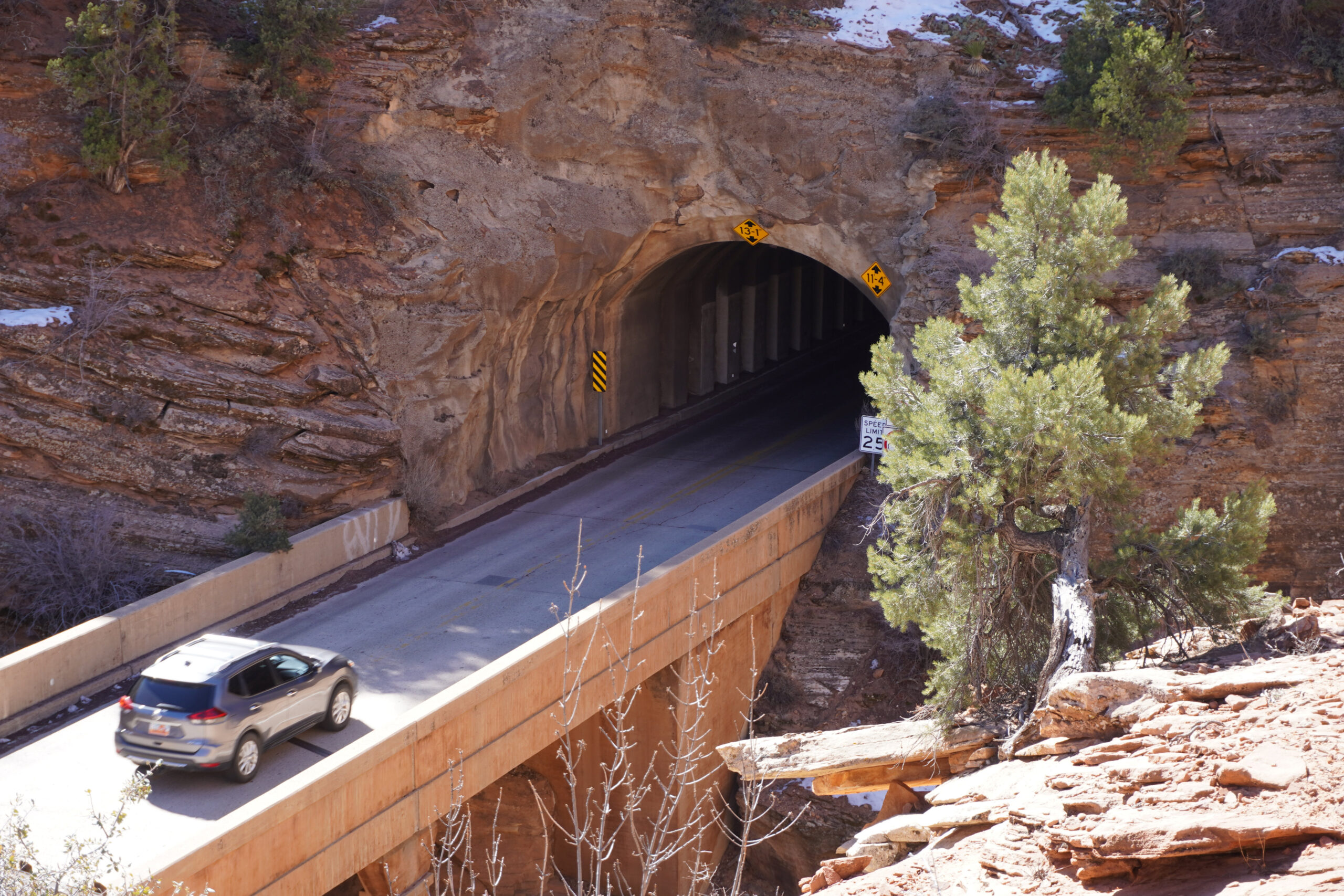
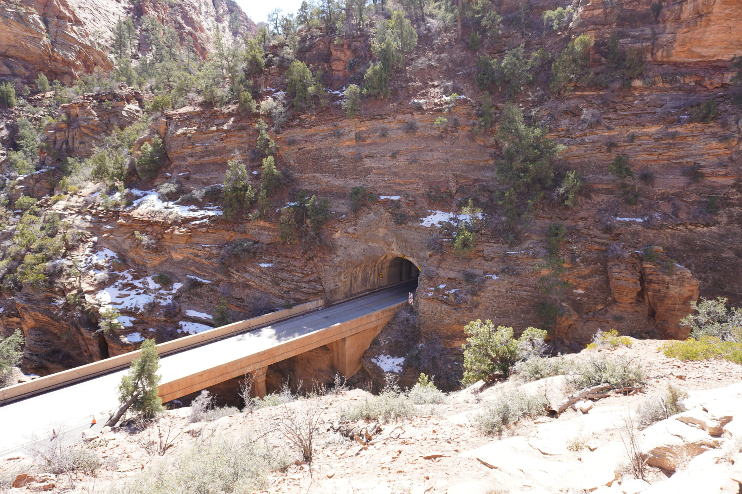
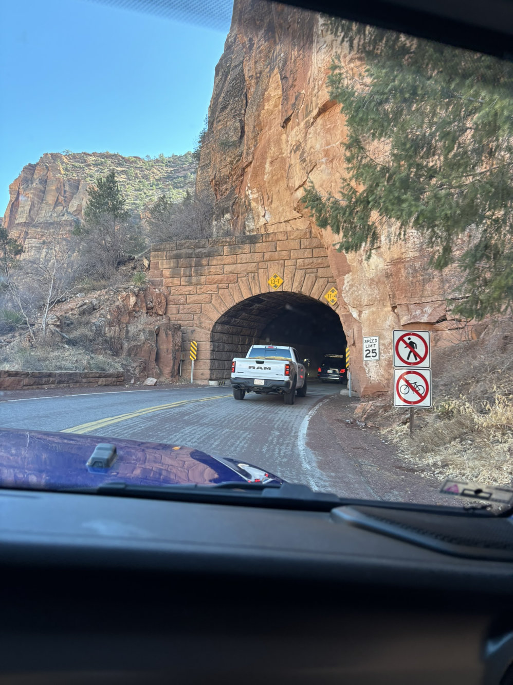
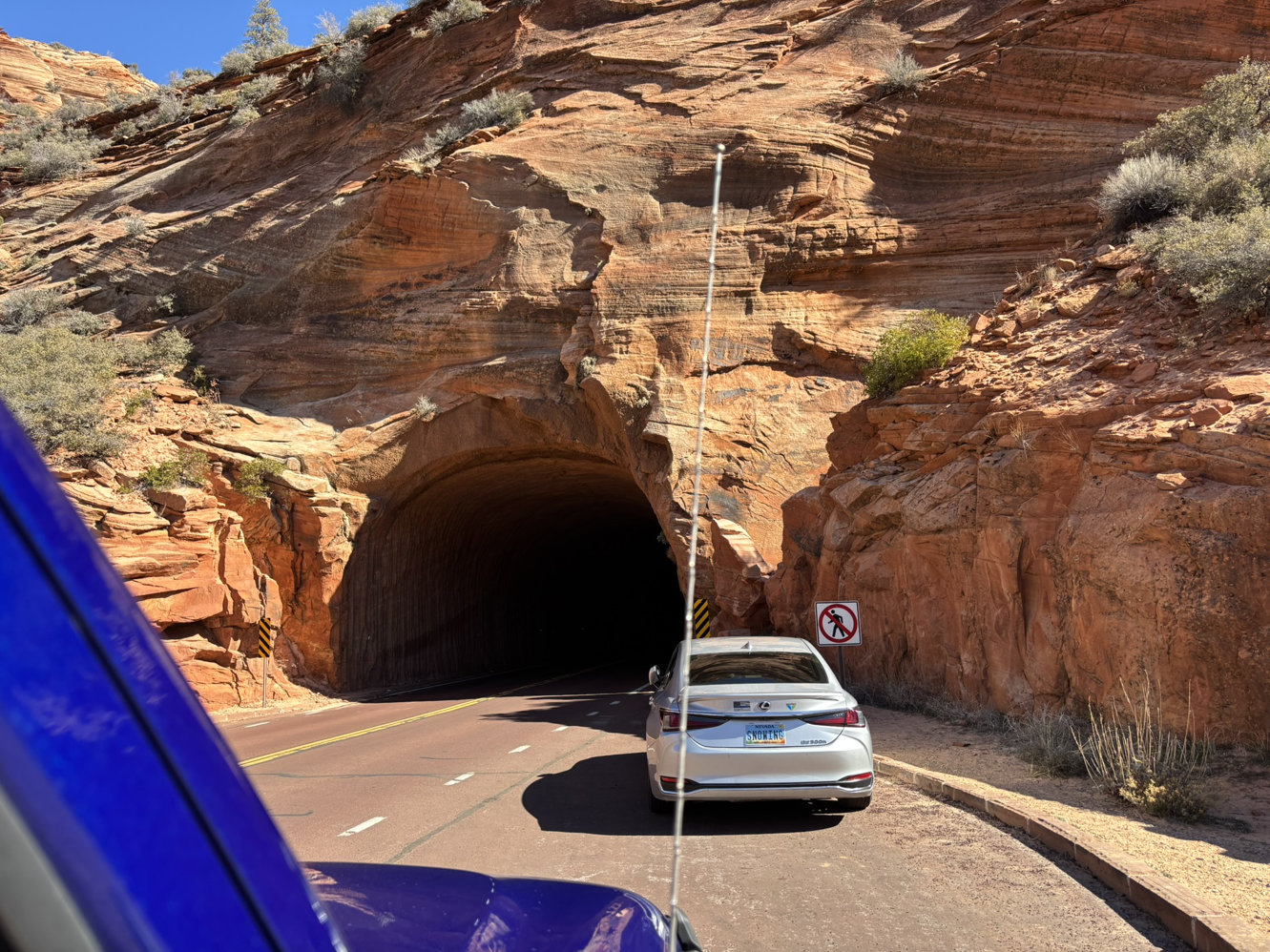
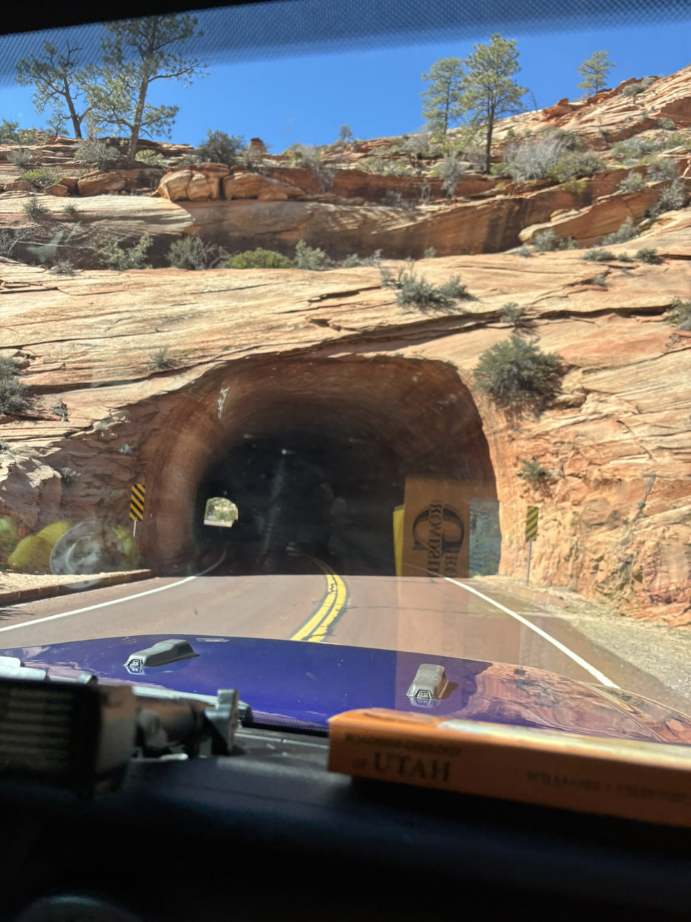
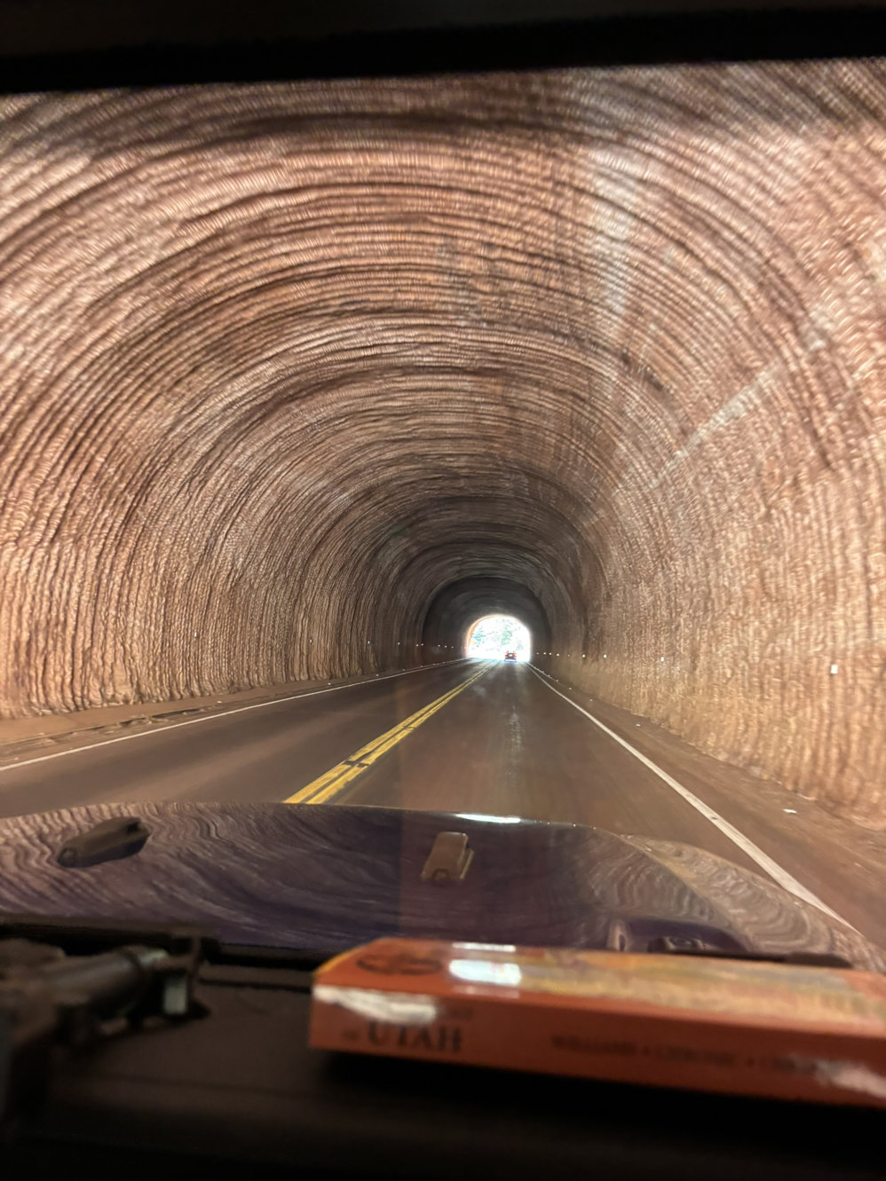
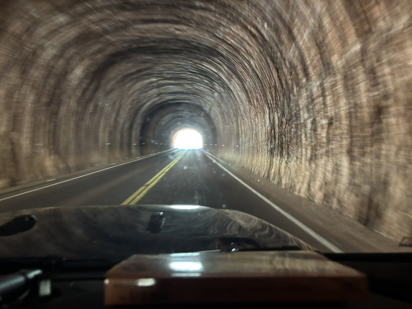
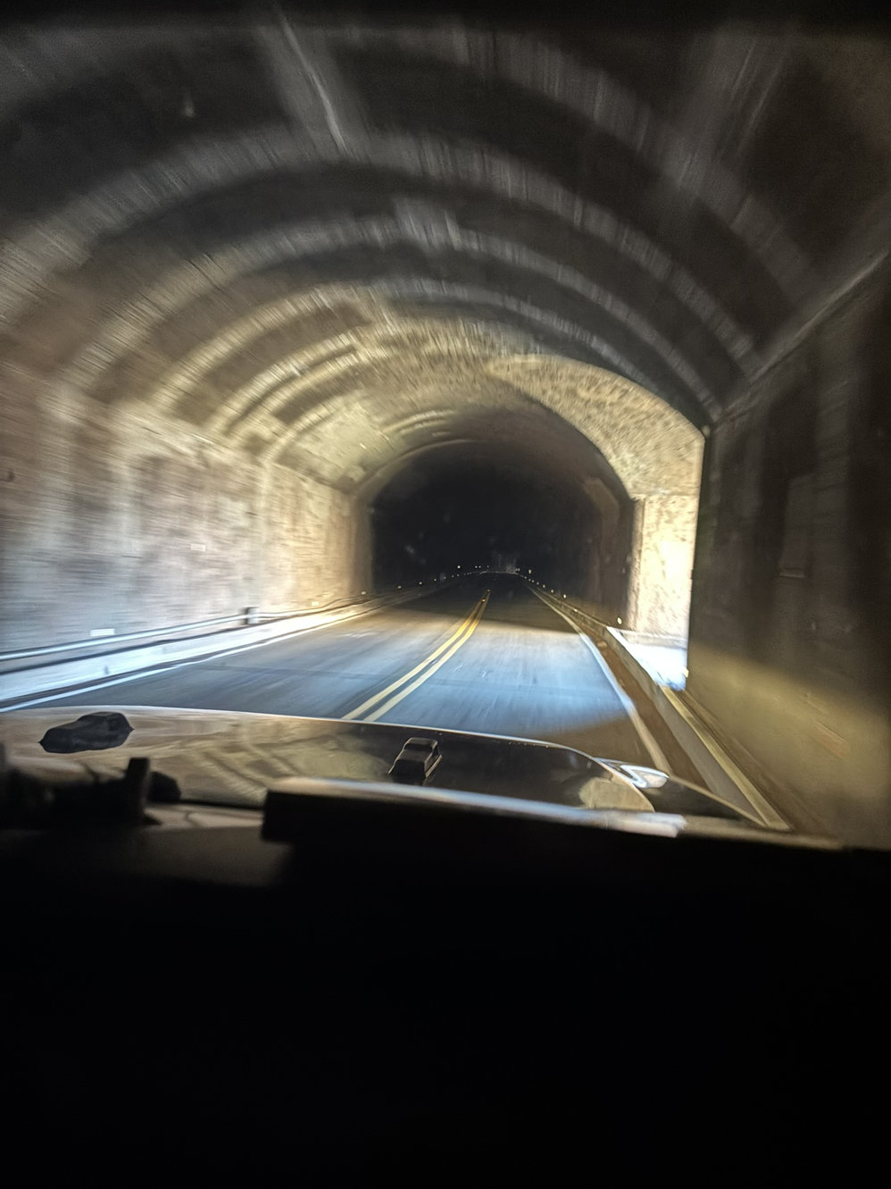
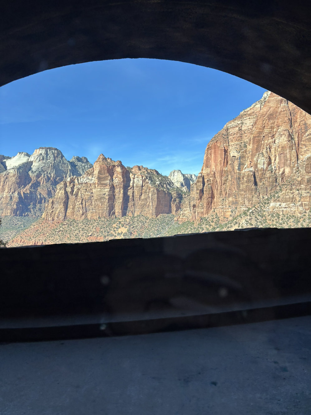
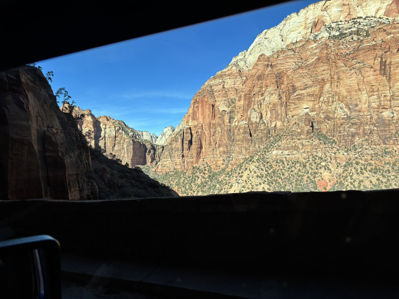
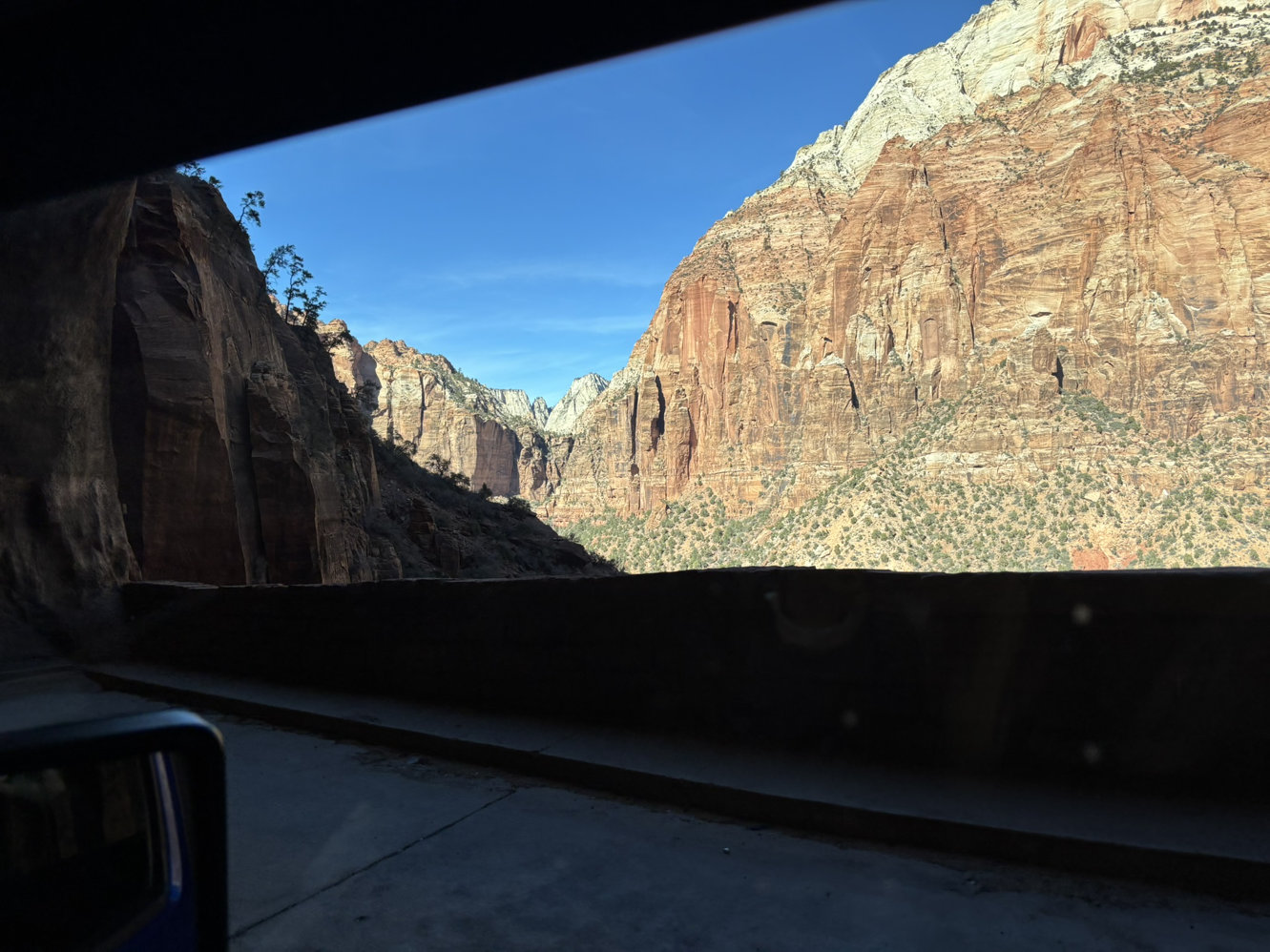
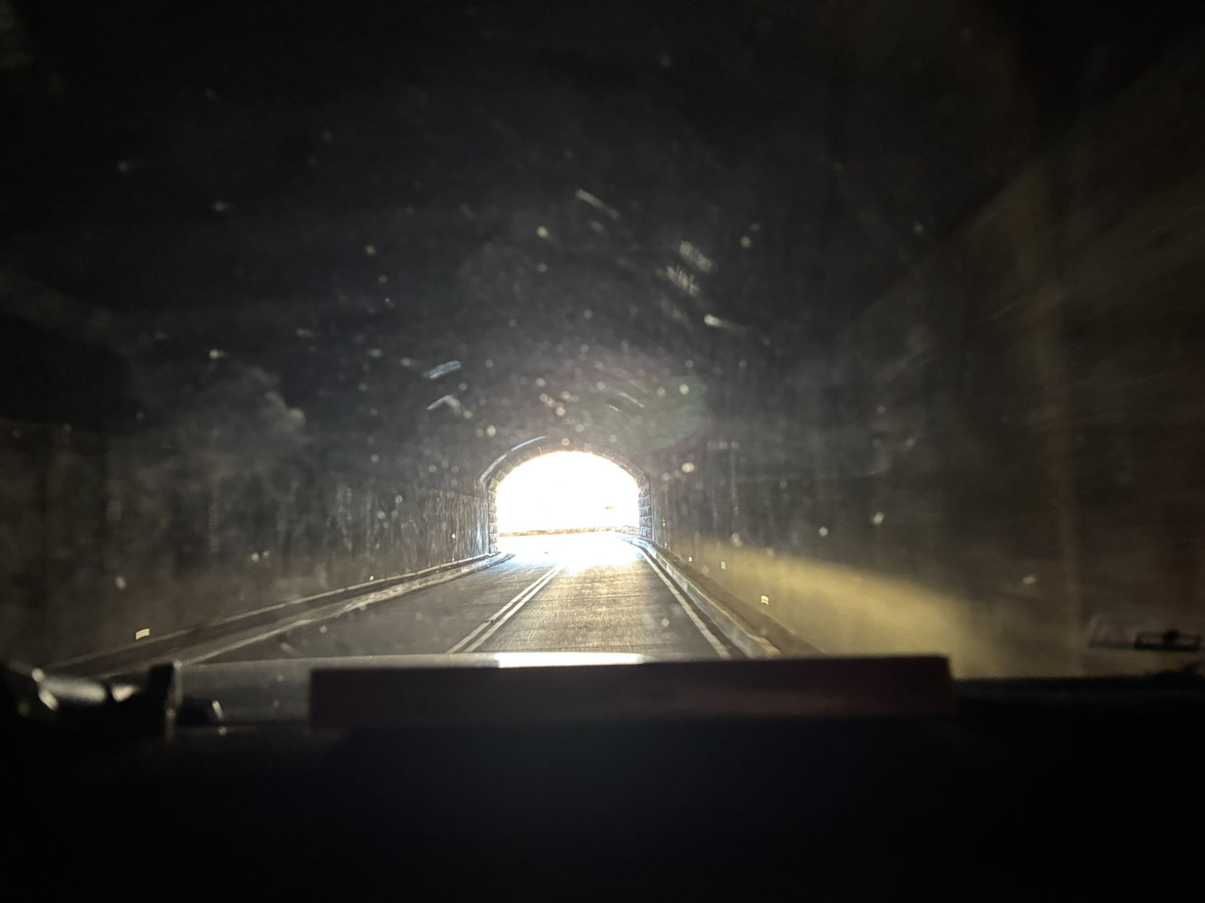
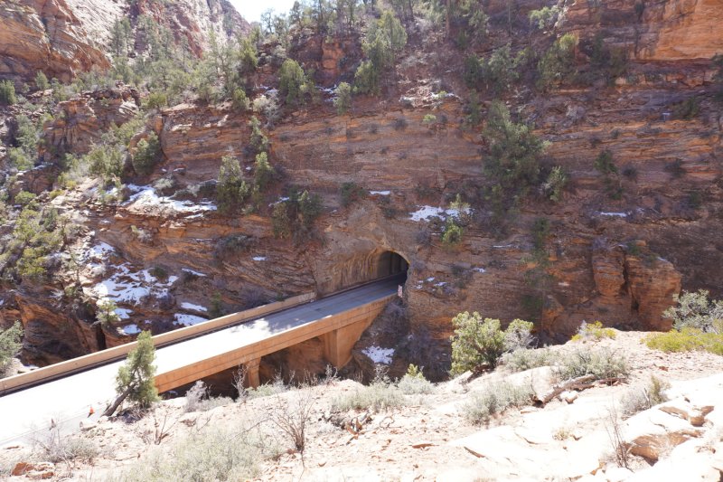
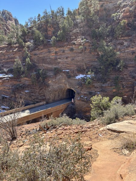
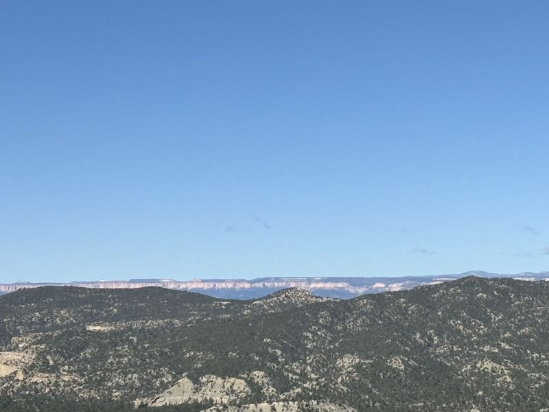
We decided for the first day to explore the Mt. Carmel highway and tunnel and vicinity. The highway is Utah State Highway 9 which if you follow it out east and make all the right turns will take you on to Bryce Canyon NP. Besides the views, the tunnel itself is quite the attraction. The tunnel, opened on July 4, 1930, is a 1.1 mile long, curving 2-lane highway that is 800 feet higher in elevation on the east end that cuts through the Navajo Sandstone. There are “windows” and “openings” in the canyon side of the tunnel creating spectacular views. Back in the day when the visitor count was more manageable, and people were more reasonable, there were two pullouts in the tunnel where you could swing the ’59 Ford sedan into the pullout and drink in the views. The pullouts are still there but blocked off.
After traversing the tunnel, we continued to the recommended turnaround before the east entrance to the park which is apparently usually crowded and slow. An aside… have you ever noticed at the entrance to national parks there are an inordinate number of people who want the ranger in the booth to give them a 20-minute verbal tour of the park so that they don’t have to look at a map or figure out anything for themselves? OK enough of that.
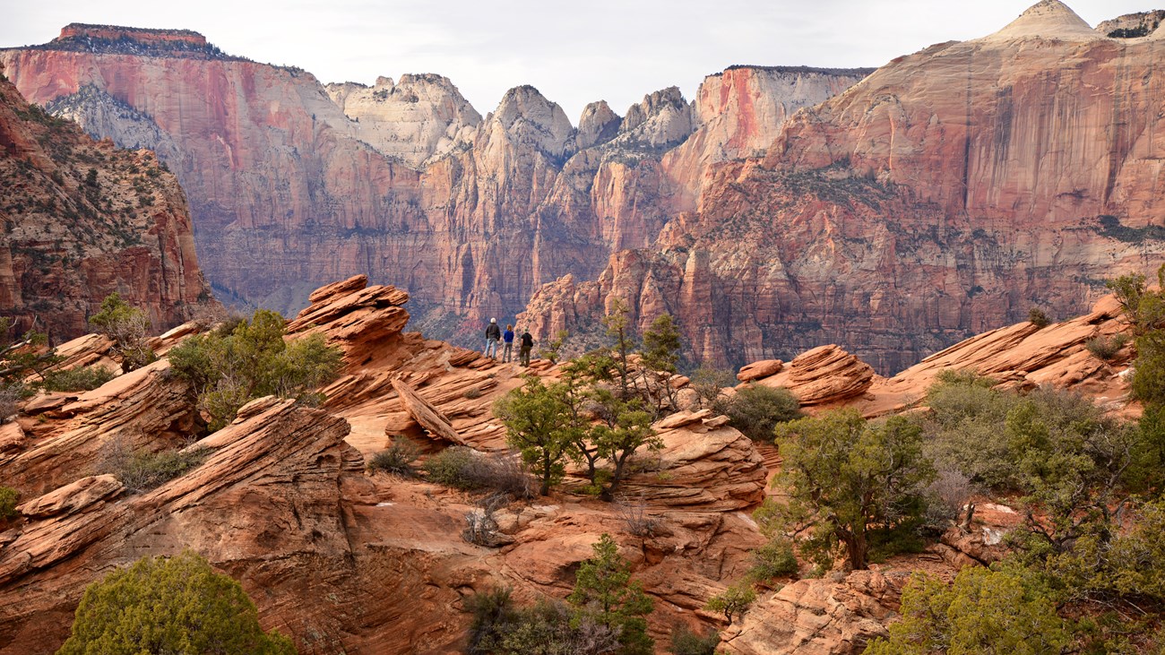
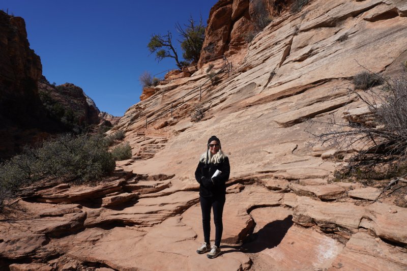
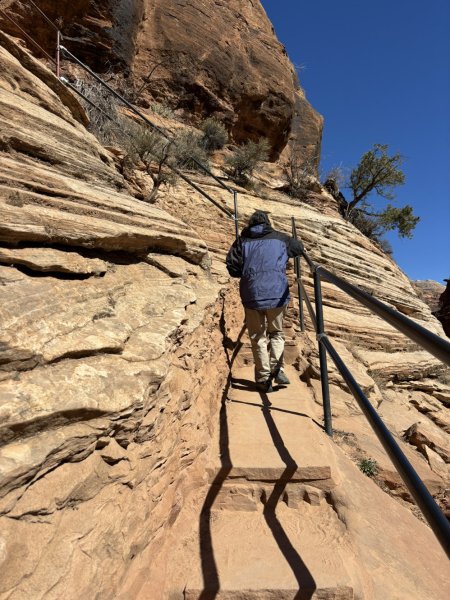
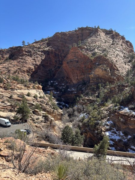
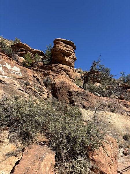
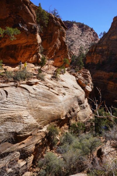
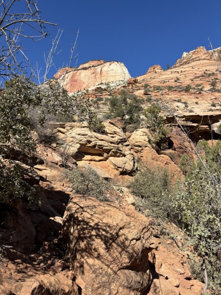
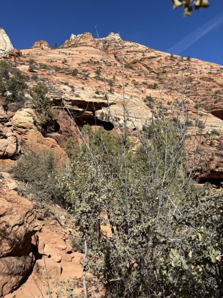
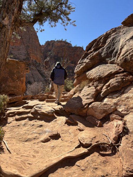
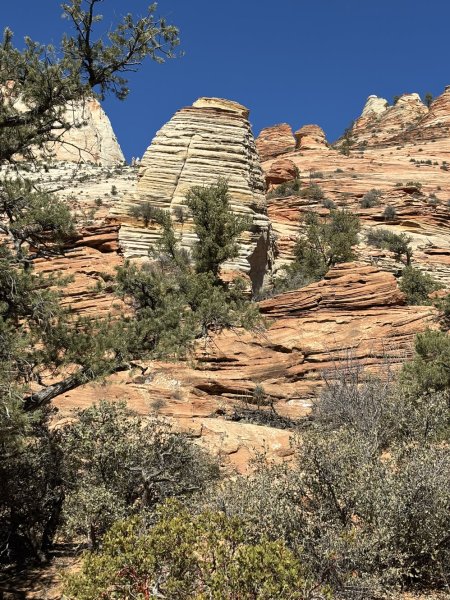
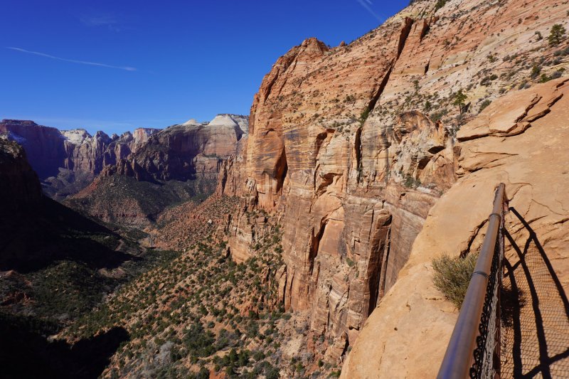
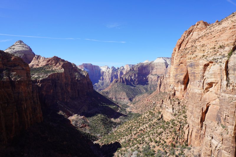
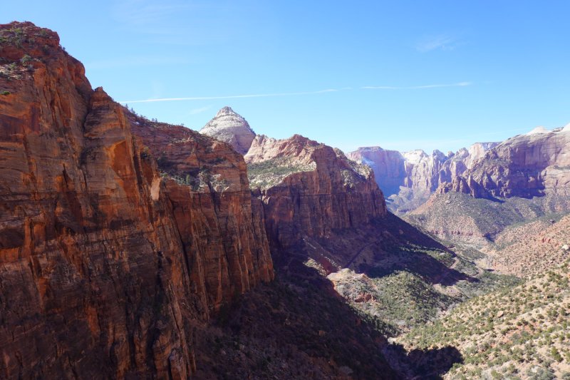
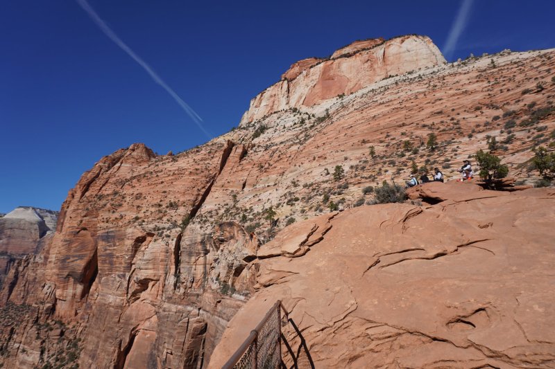
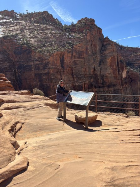
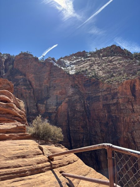
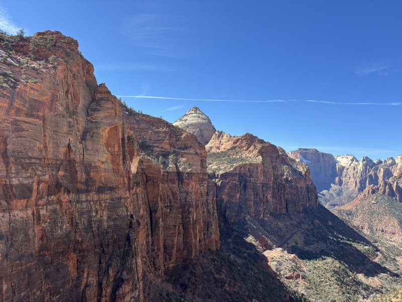
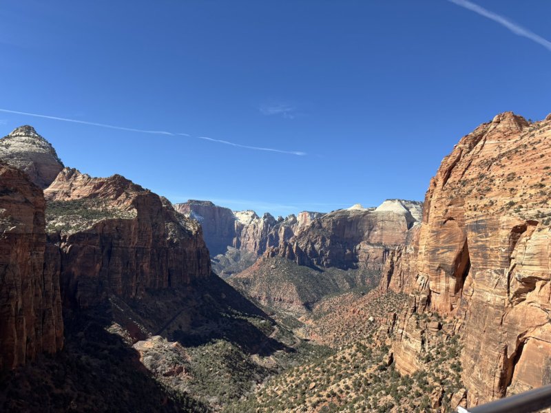
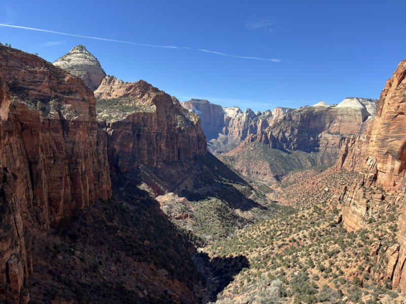
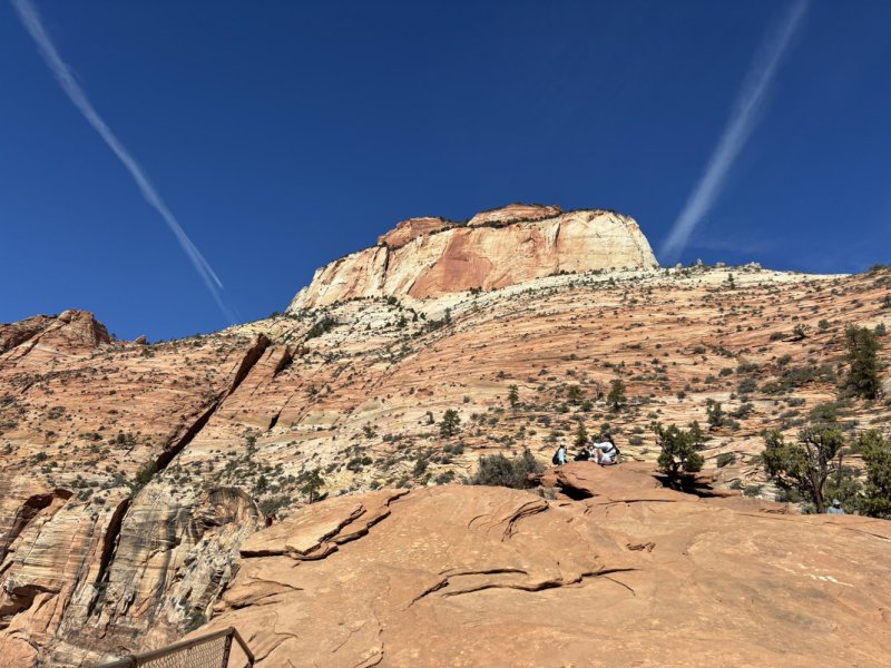
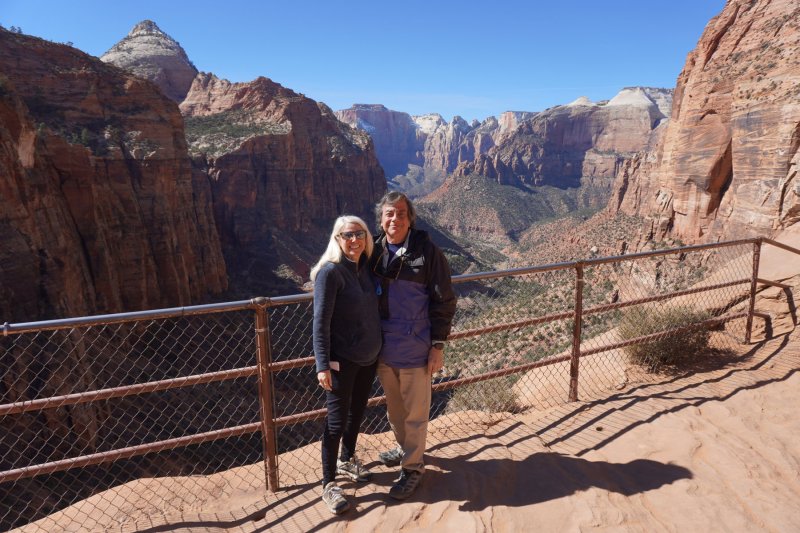
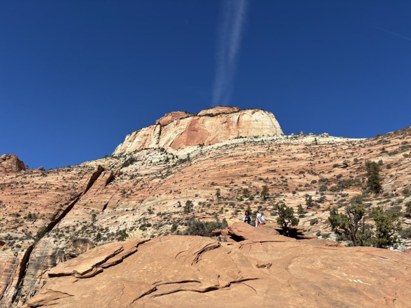
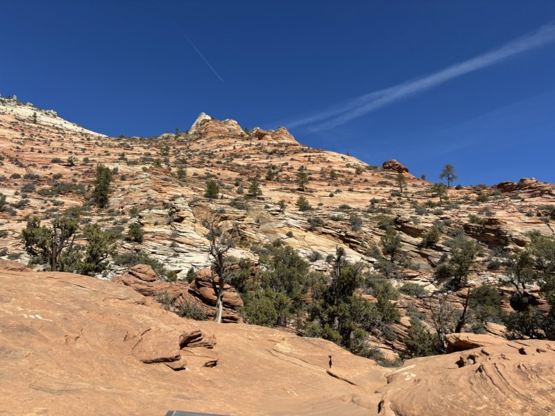
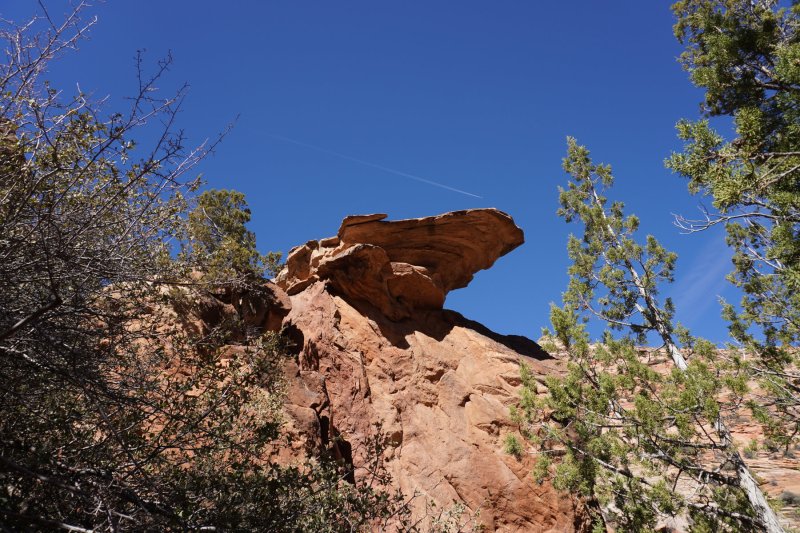
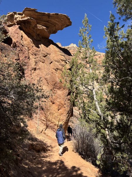
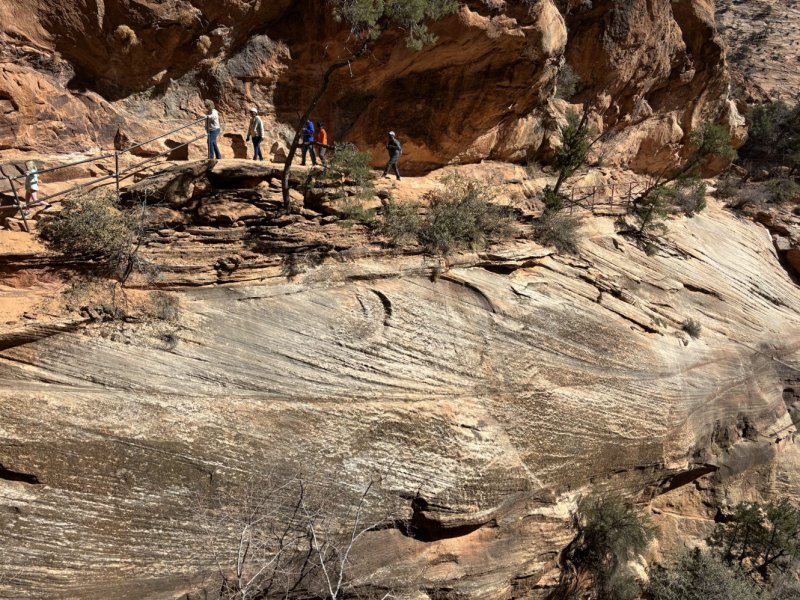
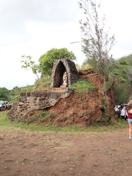
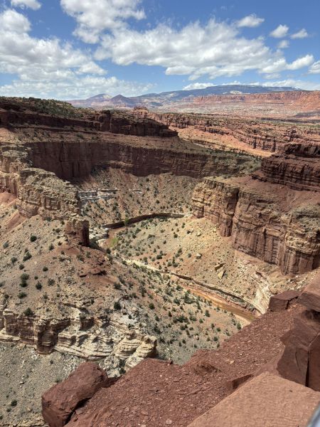
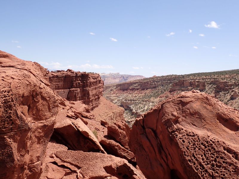
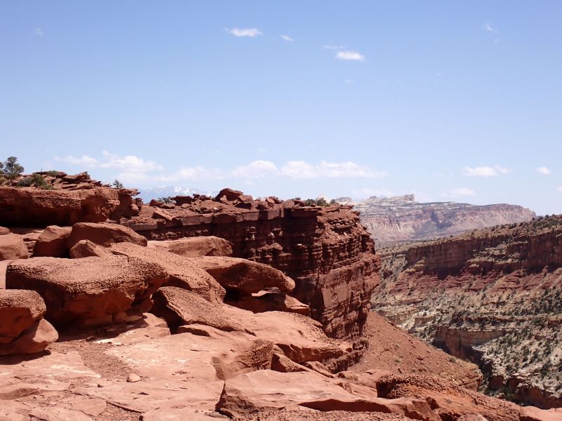
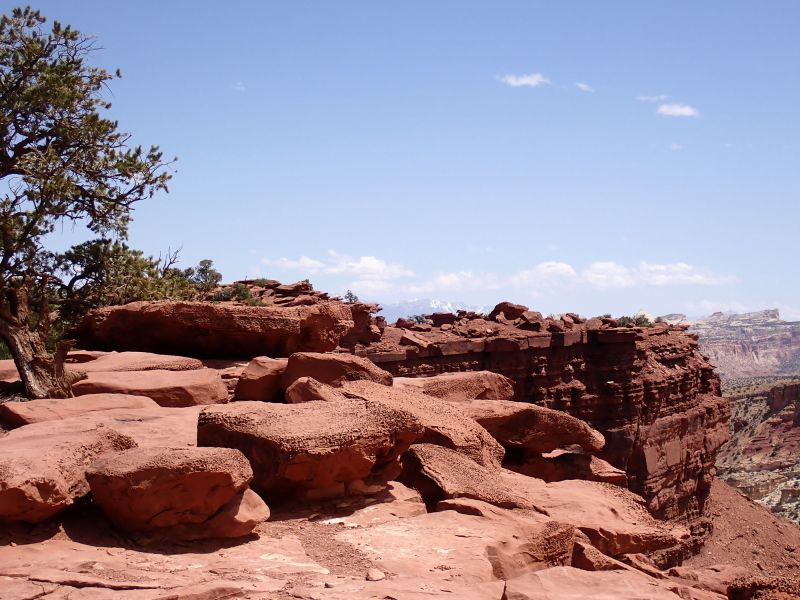
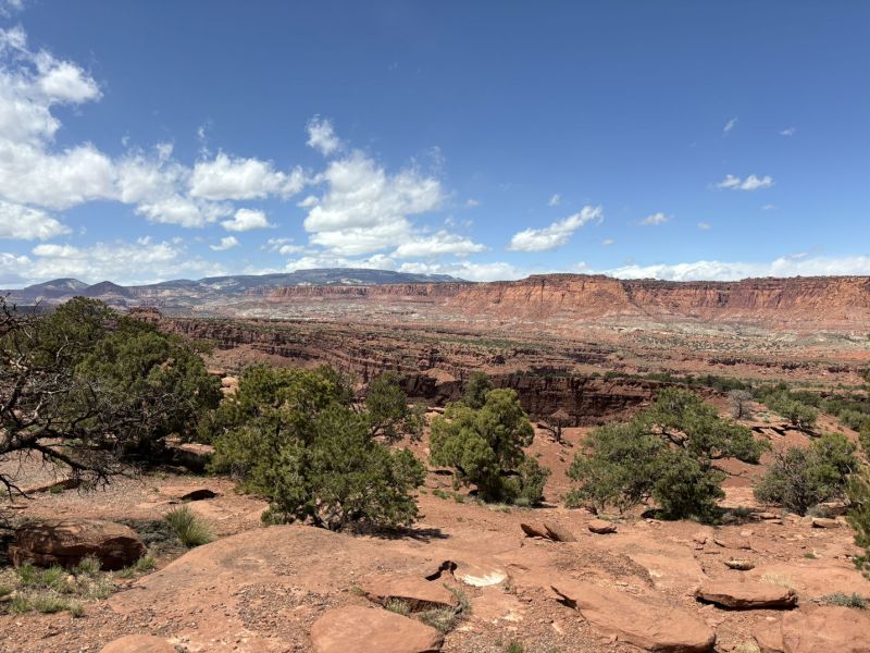
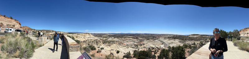
We decided to do the Canyon Overlook hike on the east side of the tunnel so headed back to the tunnel hoping that parking lot karma would strike, and we would get a spot. We lucked out!! The hike is a 1-mile +/- round trip that climbs up onto a shelf above the road and heads generally west-northwest with a couple of sporty areas on the trail until you are greeted with a spectacular view of Zion Canyon. I have to say that during this entire trip we met some truly friendly people who seemed to me to not be typical summertime tourists. They all were truly inspired by the park and had a great appreciation for the fact that at one point in time people with foresight thought to protect this area for future generations. We met a couple from Ohio who were touring the Utah parks. Talked with them for about a half an hour. He was a veteran who had served in Afghanistan. Turned out that the lady had an identical jeep as ours. We took heroic pictures of each other to commemorate the event. The hike was amazing, and the views along the trail and the intimate proximity of the trail with the cliffs was very invigorating. The picture immediately below is actually from the National Park Service, but it is a great shot of the overlook.
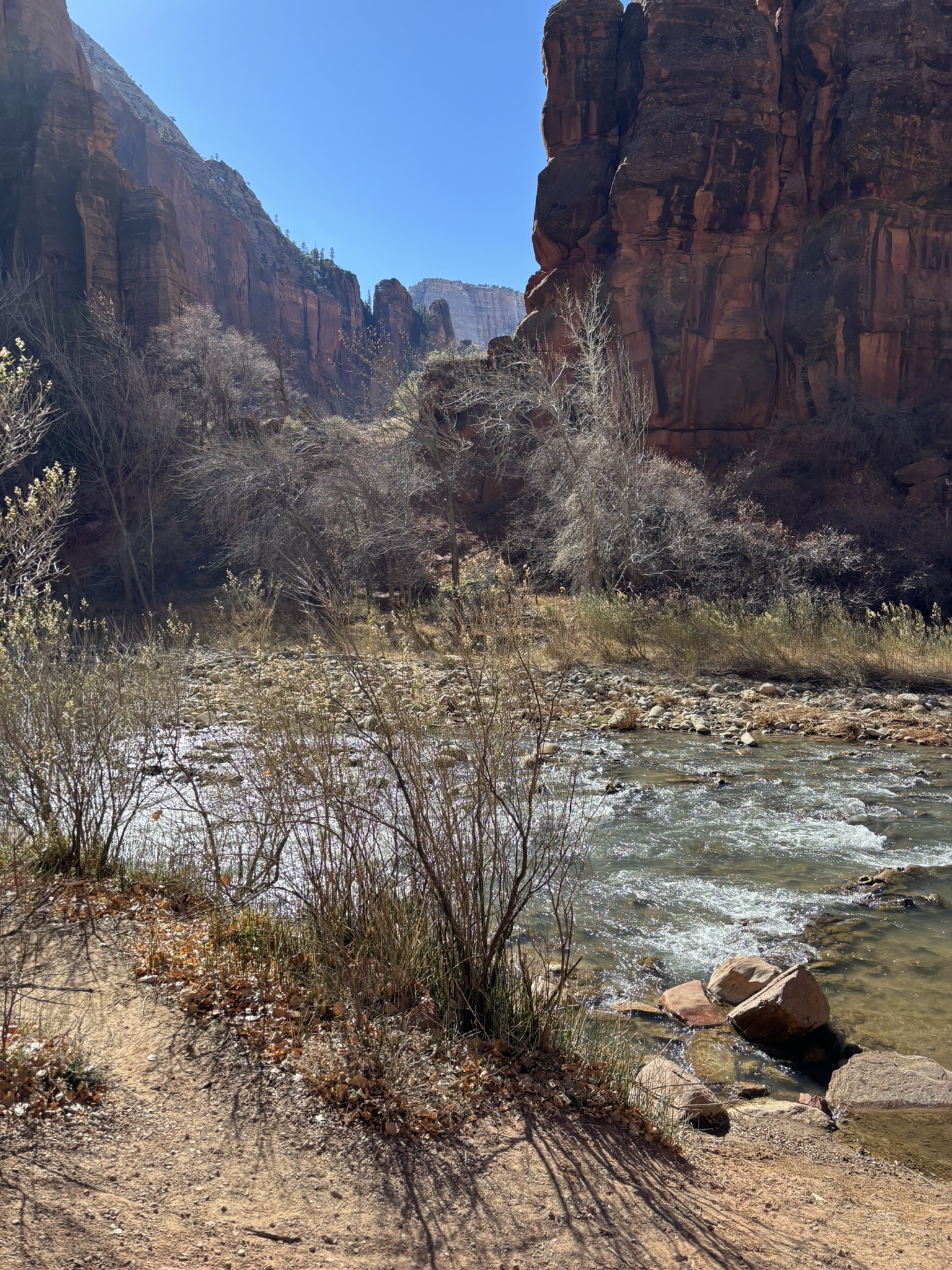
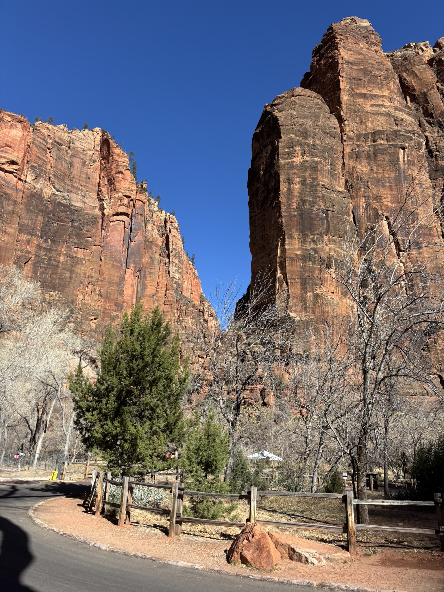
A selection of our trail pictures follows here.
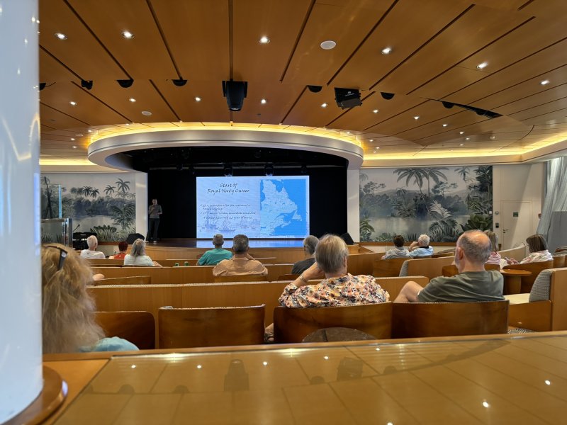
After the hike, we had lunch sitting on a rock next to the Jeep on the side of the road. Then to top the day off, we stopped back at the visitor center to go to the geology lecture. A very personable, knowledgeable and very young-looking ranger gave a well-organized talk that truly caught the attention of the 10 or so people listening in. We had chatted before the talk, and she found out that we were geologists. A great group, of varied backgrounds asked really insightful questions and she really got into the swing of the talk. We met a couple more or less our age (a bit older) in the group from upstate New York and a 40-ish young guy from Phoenix who we struck up an after talk conversation with. Interestingly, we ran into the same folks the next day while doing the River Trail at the north end of the scenic drive road and chatted it up for another 30 minutes or so. More on that in next installment.
Finished the day back at our hotel which was great (especially at the discount price). A very nice dinner in the hotel restaurant. Most of the entrees were reasonably priced except the prime rib which was going for the princely sum of $110. Must have only had one serving in the fridge.
Posted inGeology, Travel and Scenery|Comments Off on Zion National Park – Hurricane, Ut Overnight and February 23, 2025
It has been almost 7 months since I posted to this blog. I have been in a creative malaise for a variety of reasons. I have decided to pull myself up out of the malaise and move forward.
In early December 2024, I spied a hotel offer for a location in Springdale, Ut for a $110 room (remember when Motel 6 really was $6.00/night??). Springdale is at the south entrance to Zion NP and we thought that with the right timing, this accommodation could be the start of a great road trip. The keys to success for this trip were to arrive at Zion before high season when admission metering would not be in effect, shuttles were not running in the park and the weather would be welcoming. It all came together and it could not have worked out better.
In another great stroke of luck or genius, Maps routed us north from Cathedral City to Twentynine Palms and then through a long stretch of relatively deserted 135 mile, two-lane road through the desert to Amboy, Ca on to Kelso, Ca and then on north on I-15 to Las Vegas, up the Virgin River Canyon into St George, Ut and into Hurricane, Ut. where we spent the night. The route took us through the Mojave National Preserve. Both Amboy and Kelso are located in this preservation area.
Another great historical and geologic road trip! Amboy, settled in 1858 is the first of a series of alphabetical railroad stations constructed across the Mojave Desert. Eventually, Route 66 was established in 1926 through Amboy and it is part of the route taken. There is not much in Amboy that is currently open; a closed post office, a closed Route 66 gift shop, a cafe that might be open now and then, what looks like a motel and a couple of houses. Then there is the railroad which at one time was the life blood of Amboy. The BNSF main line still runs through Amboy, but like a lot of small railroad towns that grew up for servicing steam locomotives, Amboy got kicked to the curb. The population is listed as 4 but it looked to us like the number was a bit higher, probably people looking to escape. Near Amboy, there are two geologic features of note. The Amboy Salt Flats which are actually part of a larger, dry lake known as Bristol Lake is actively mined for calcium chloride salts by the National Chloride Company of America. It is a simple operation, they dig canals/ponds into the dry lake bed. In some years, the groundwater is shallow enough that it flows into the excavations. Other times, they pump water from shallow wells into the ponds, allow it to evaporate, leaving the salts which are then picked up with front end loaders. A minimum of processing results in a very high grade of calcium chloride salt. We did not get any pictures of this feature because we figured we would do it on the trip home. That did not work out well and we will have to make a road trip in that vicinity again.
The second geologic feature of interest is the Amboy Crater about 2-3 miles west of Amboy. It is an ash and cinder cone that sits in a 20-30 sq mile pahoehoe lava field. The crater is about 80,000 years old and was last active about 10,000 years ago. Again, we did not get any pictures as we were going to potentially stop there on the trip home. However, the BNSF had other plans that caused our photography stop to be canceled.
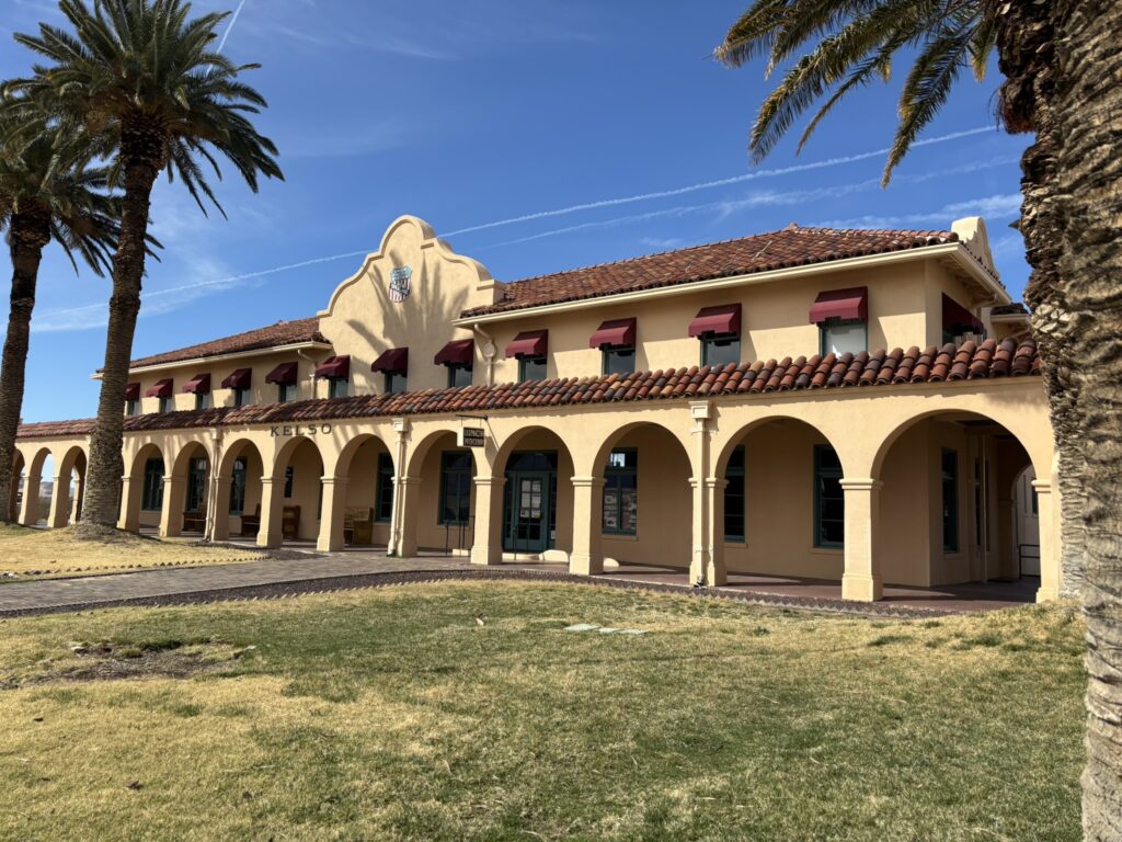
From Amboy, there is a jog east on Route 66 and then a turn north toward Kelso, a railroad town that was the base for the San Pedro, Los Angeles and Salt Lake Railroad which had track rights with Union Pacific which eventually took over operation of the line. Kelso itself is more or less a ghost town, although there are some newer looking structures which may or may not be occupied. It was a boom town during the World War 2 era when troops were traveling to and from deployments by train and also there were numerous mining operations to the southeast of the town for raw construction materials that were shipped out via the Kelso Station. There is a historical site of interest in Kelso; the Kelso Depot, and a geologic point of interest, the Kelso Dune Field located just southwest of town.
The Kelso depot was constructed in 1923 and was actively undergoing restoration when we drove through. It was built as a hotel and restaurant for railroad travelers as trains had to stop in Kelso for water and to have a helper engine attached to pull the steam locomotives up the Cima Hill. The depot was designed to directly compete with the Harvey Houses built along the Santa Fe Line.
Kelso Depot undergoing active remedial construction.
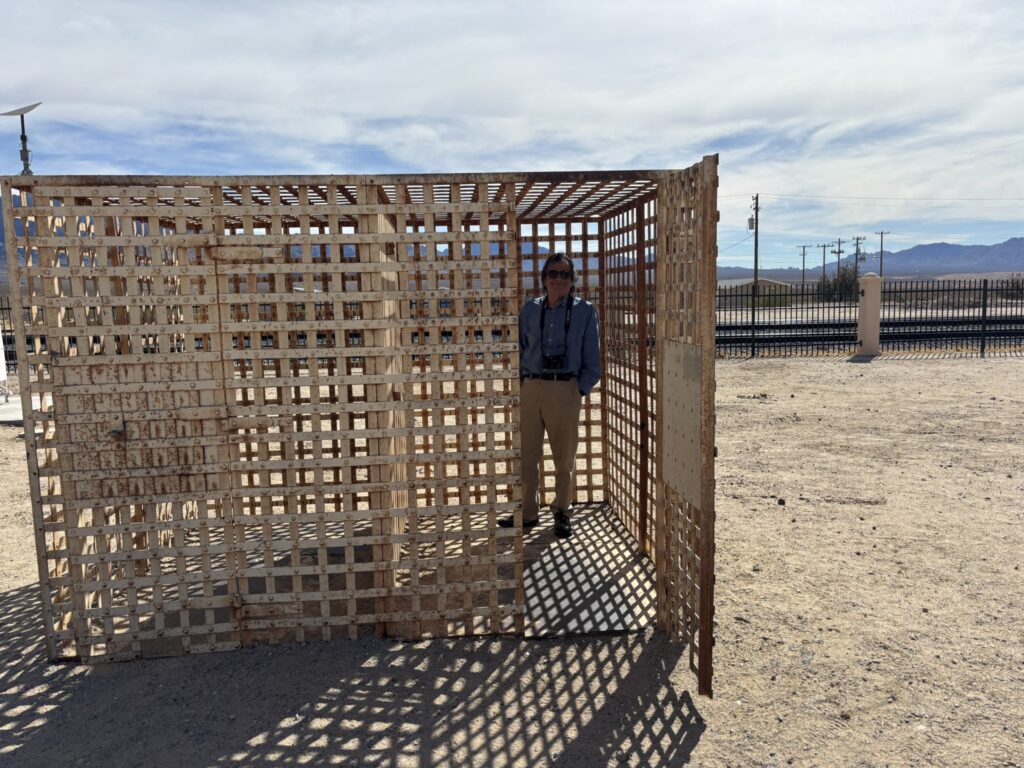
The Kelso Jail and detox center.
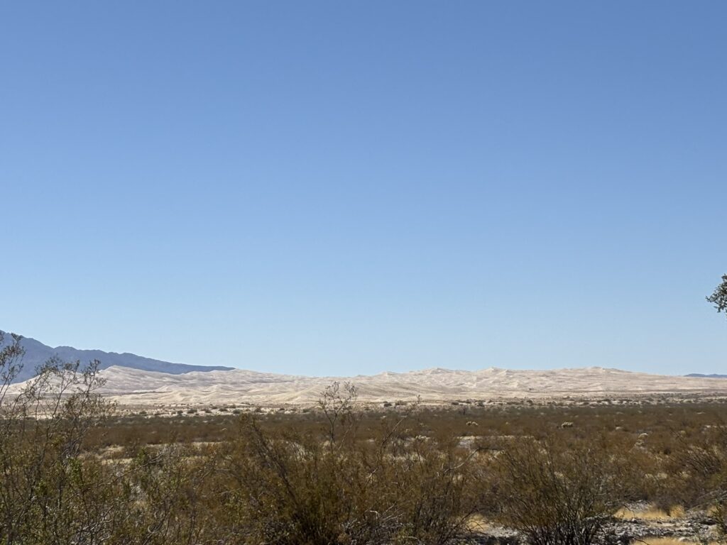
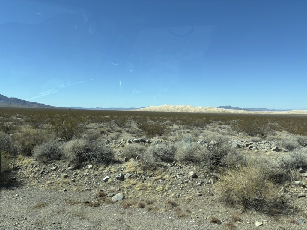
The Kelso Dune Field covers about 45 sq. mi. of the Mojave Desert and is the third largest dune field in the US. The dunes are stacked in that they were deposited over five different periods over the last 25,000 years during periods of climate changes. During dry periods, vegetation would decrease and sand would be contributed from the existing dunes and also from the original sand sources, the Soda Lake and Silver Lake dry lake beds. As dry periods subsided, vegetation would take hold in the dunes and would more or less stabilize them until the next climate cataclysm (what a great word!). One of the advertised features of the dunes is that they “sing” when the sand moves. Some reports are that it is more of a booming sand than a singing sound. We will have to visit them and hike up the dunes to make our own decision– or at least Joni can hear what they sound like.
Kelso Dunes looking west.
Kelso Dunes looking northwest
The active dunes sort of put is in the right frame of mind to visit Zion which is dominated by the Navajo Sandstone which is one of the prime example of wind born sediment deposition.
Posted inGeology, Travel and Scenery|Comments Off on Zion National Park – February 22 – February 25, 2025 – Part 1
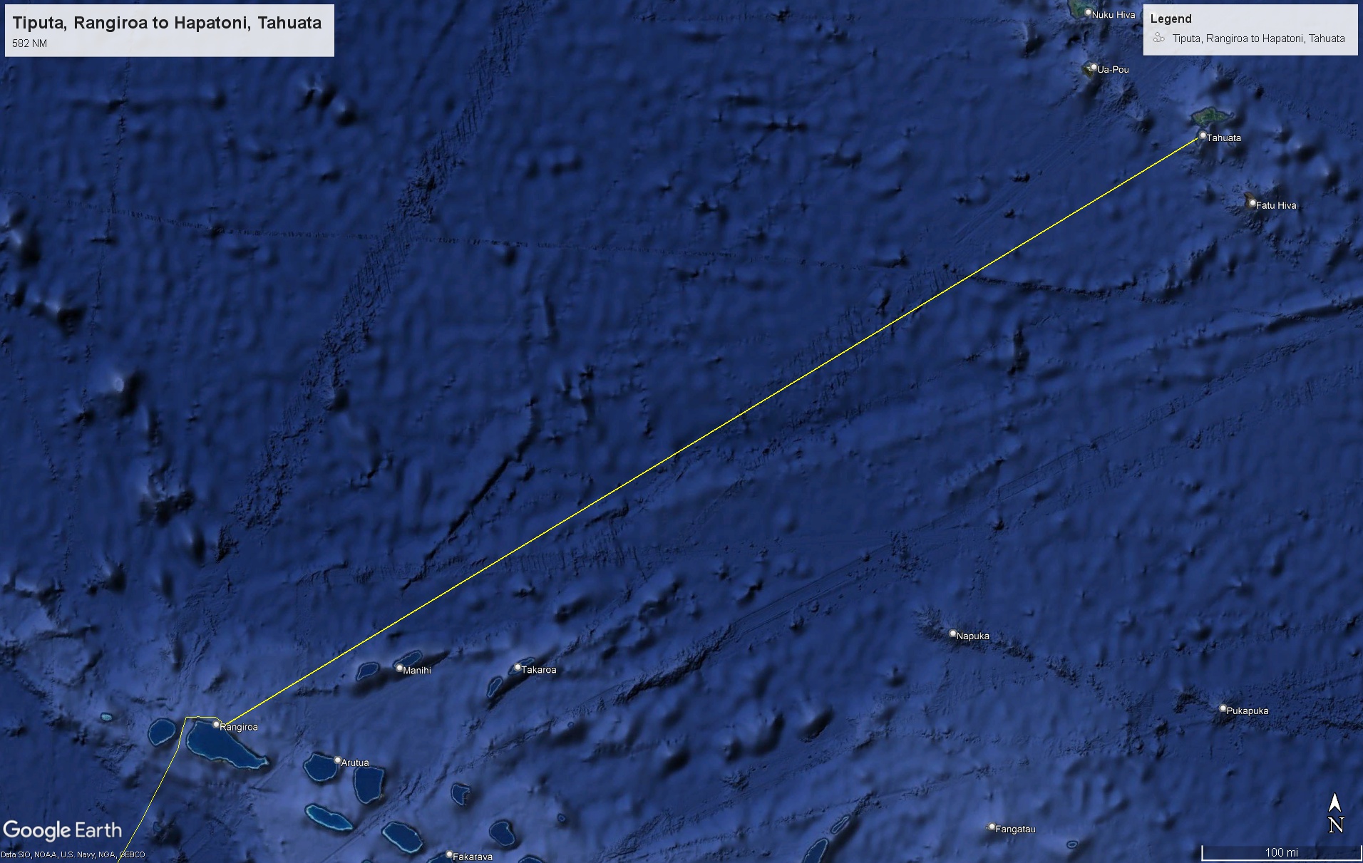
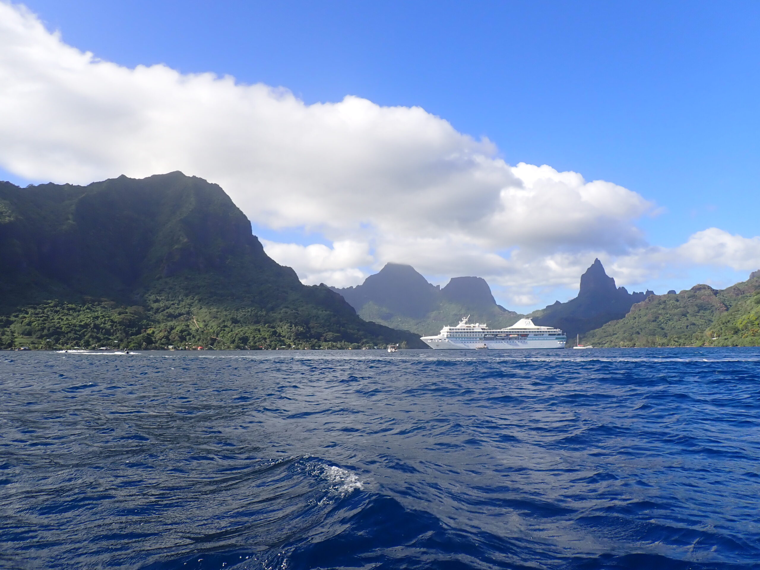
Before getting to the Marquesas, there was a sea day so that the Paul Gauguin could make the almost 600 NM journey to Hapatoni, Tahuata in the southern Marquesas.
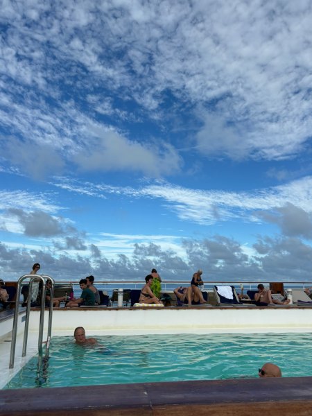
A sea day is always a great time. While nothing onboard is ever hurried, a sea day is even lower key. In addition to just enjoying the pool, the bars, the dining, a siesta and even a bit of exercise in the fitness center, on this trip, there were two experts on board providing lectures in the Grand Salon. More on those folks later because their lectures were informative, interesting and entertaining.
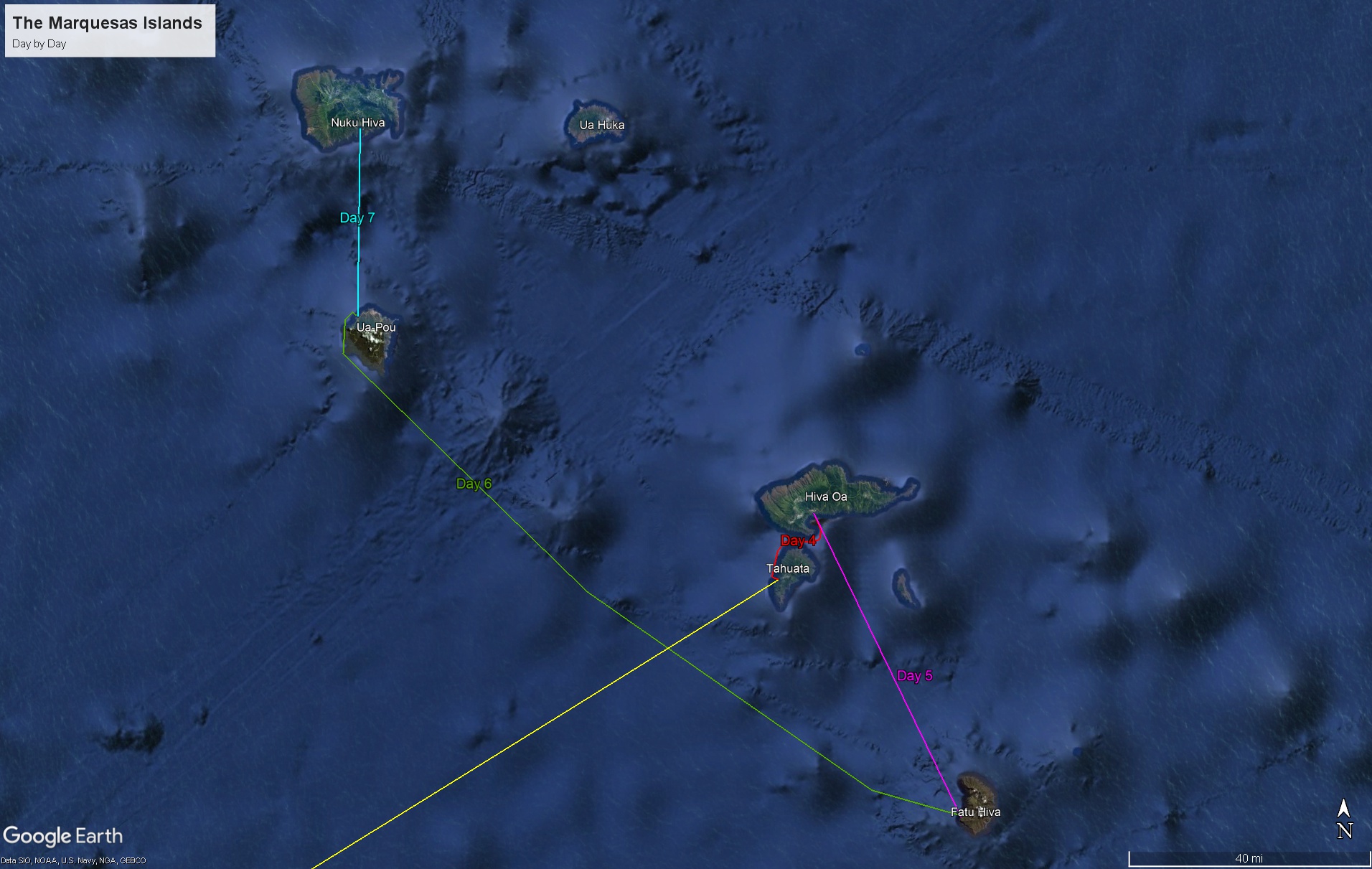
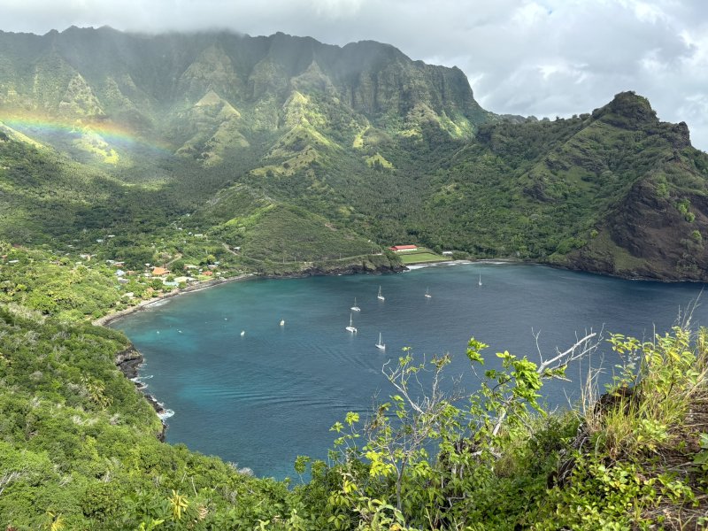
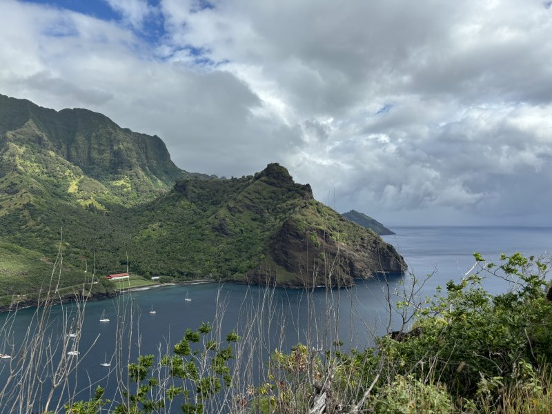
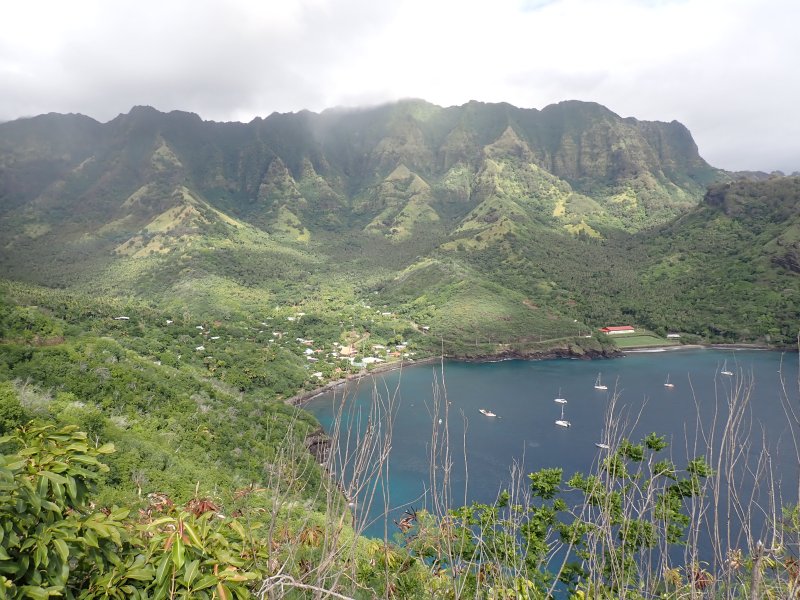
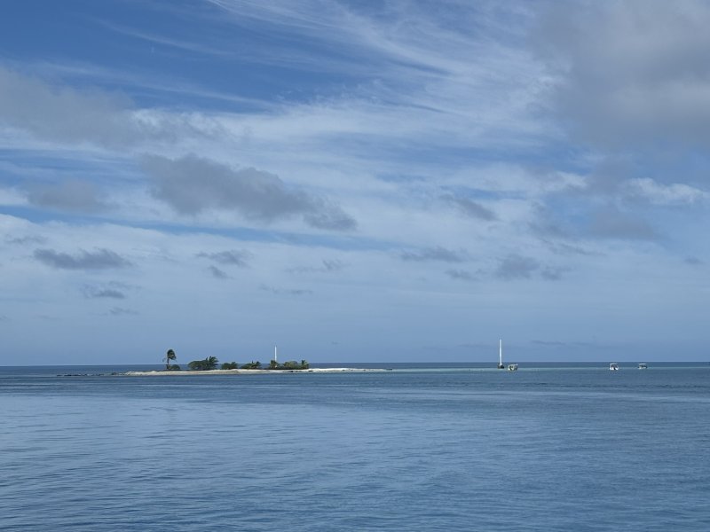
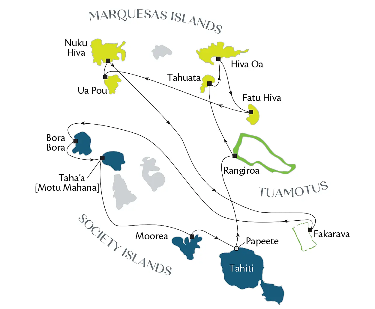
We spent 5 days in the Marquesas visiting the islands of Tahuata, Hiva Oa, Fatu Hiva, Ua Pou and Nuka Hiva (click to enlarge the image… maybe). In the Marquesan language, the archipelago is called Te Henua Enata, which means “The Land of Men”. The name Marquesas was provided by a pompous Spanish explorer in 1595 as he sailed by.
Due in no small part to the efforts of one of our on-board lecturers, Pascal Erhel, who created a dream and a team, the Marquesas were named a UNESCO World Heritage site in July 2024 for its cultural heritage and value and its abundance and preservation of rare and diverse flora and fauna.
The Marquesas are very different than the Society Islands and the Tuamotu Islands. For one thing they are extremely remote with the average number of tourists visiting each year is rarely above 10,000-15,000 people which is a daily load to Tahiti. Second, the number of inhabitants is significantly less; there are 15 islands, 12 inhabited. Of course, the geology and landforms of all three island groups visited differ significantly.
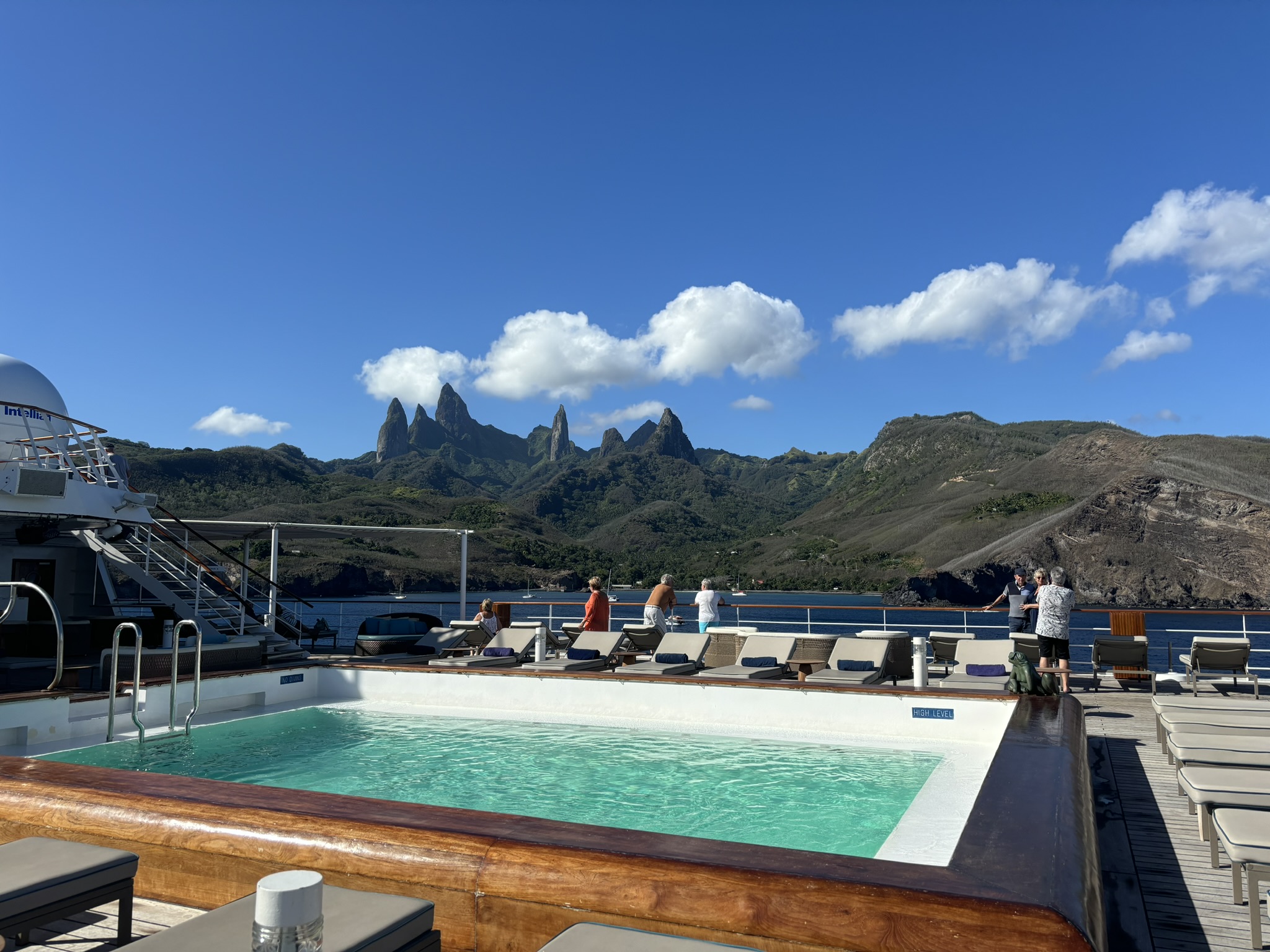
Geologically all of the Marquesas Islands are volcanic in origin with what one geologist described as “monotonous series of sub-aerial basalt flows…”. There are two locations in the Marquesas that are exceptions to this oversimplification. We visited one of the locations, the island of Ua Po (Marquesan for “pillars”). Ua Pou differs from the other Marquesan Islands in that there is no well-formed caldera and there are 30 or so pillars that dominate the skyline of the island. These features are the result of a difference in the chemistry/mineralogy of the basaltic magma and the temperatures that existed in the subsurface before the magma erupted on the island. For those familiar with Devil’s Tower in Wyoming, the chemistry of the lava in the Marquesas and in Wyoming is very similar and the resulting land feature(s) have similarities.
Basalt Pillars – Ua Pou, Marquesas Islands
The Marquesas Island ages decrease from northwest (5.5 Ma at Eiao [off map]) towards southeast (1.1 Ma at Fatu Hiva). The Marquesas shield volcanoes (broad, gently sloping profiles, formed by the eruption of highly fluid lava) experienced collapse of the caldera rims due to thin upper caldera walls and high rates of erosion, which led to the sinking (there is that sinking thing again…)/erosion of half or more of their initial shield volcanos. Most of the current island landforms are made up of a partial outer caldera remnant of the original shield volcano. In the now partial caldera an inner, younger and smaller post-shield volcano is found on most of the islands. There are no coral fringing reefs in the Marquesas Islands for a variety of reasons. The islands experience high winds and surf associated with the winter trade winds that inhibit coral development and are within the El Nino, La Nina zone bringing highly variable (for coral) water temperatures to the island group.
Back to our on-board lecturers. On our sea day, Pascal Ehrel presented the first of three lectures that we would attend, a lecture entitled Motu Haka: A Short History of the Marquesas Islands: Introduction to the Archipelago of Fenua Enata. Motu is a version of the Malayo-Polynesian language family. For rugby players you may recognize the word haka which loosely translated means “dance” but has taken on the meaning “war dance”. The Motu Haka Association is a group of Marquesan and others that have united to gather, safeguard and enhance what of remains of their culture. Fenua Enata as we have seen means “The Land of Men” in referencing the Marquesas Islands. A very interesting and informative lecture which IMHO was made somewhat more entertaining by Pascal’s French accent. Somehow it made the whole event a little more exotic.
The second pair of lectures that we attended were presented by Celine Manet. The first lecture was entitled James Cook – Part 1 (Youth, 1ST Expedition and Return to Tahiti). What a fascinating, intelligent and accomplished guy. Of course, being a captain of a ship back then also entailed being somewhat of a tyrannical despot willing to employ a bit of corporal punishment to keep the swabs in line. But overall, particularly in his younger days, a very interesting fellow and the father of nautical charting and mapping. After the first lecture, I downloaded an Audible biography of Cook to add to the lectures. Again, I think the lectures were somewhat enhanced and made more interesting and tropical with the addition of Ms. Manet’s French accent
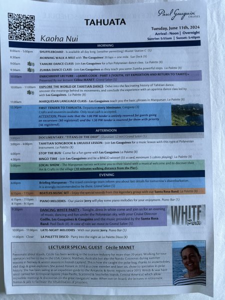
Tahuata
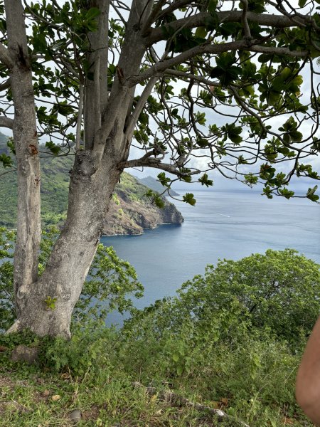
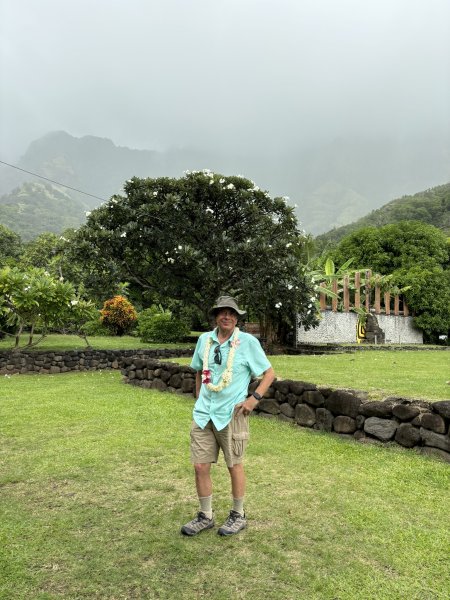
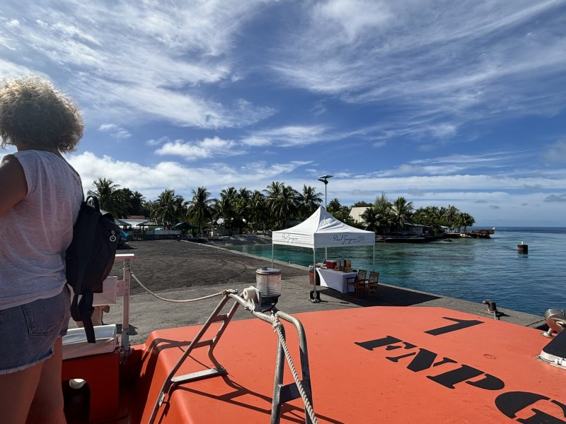
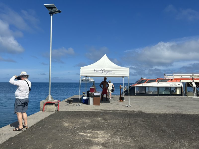
We booked an excursion in Tahuata that stopped at several important locations along the coast with ties to the Polynesian culture and with just great views. Excursions in the Marquesas were interesting from the perspective of transportation. The participants were broken into groups of four and transportation was provided by locals in fairly new four-wheel drive pickups. The tour leaders were also local folks who were well versed in the history and of course the culture and were very chatty and obviously proud of their home. Maybe somewhere in these posts, I can incorporate some cultural history as well as current political status. Might just have to go back some day so that there can be follow up blogs!
I tried to add a couple of the islands, but the photo galleries are pretty resource intensive so I will just do each island with short individual posts.
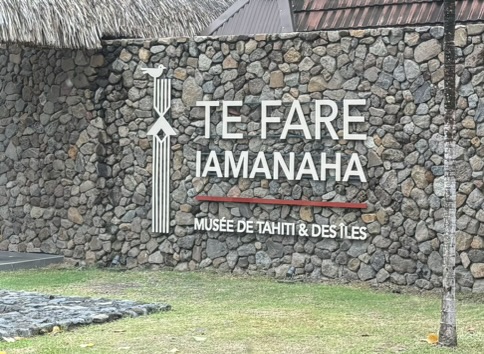
After a tour of Western Tahiti including a stop at Te Fare Iamanaha (Museum of Tahiti and her Islands) we were transported to the Paul Gauguin for boarding around 3:30 or so on Saturday afternoon. It is always a bit magical when you walk into your cabin and your baggage is sitting there, there is a bottle of chilled wine (courtesy of our travel consultant) and your cabin steward(ess) greets you and chats you up for five minutes. We ended up four doors down from our 2018 cabin, starboard side, cabin 425.
Back to the museum. This is an amazing, must see stop if you are in Tahiti. It is a very modern, well-appointed museum with incredible exhibits describing Polynesian flora, fauna, geology, history and culture. While the very attractive and accurate geology, plate tectonics and “hot spot” depictions initially attracted us, the cultural exhibits really grabbed our attention. There were several exhibits that chronicled and for those of us with unpredictable attention spans, showed with very detailed and attractive mapping, videos of the history of the Polynesian migration through the South Pacific. The migration is one of the things that has been in the back of my sometimes-cluttered mind since seeing Kon Tiki. I had this vision of a bunch of heavily tatted Polynesians sitting on the beach after a successful day fishing shooting the breeze. In my mind, I saw one of them sipping a coconut milk (maybe a bit fermented) turning to his buddies and saying “Hey, let’s get in the canoe and sail east until we find more land”. The other guys I’m sure scoffed at the idea and then the guy with the crazy idea sealed all of their fate when he asked, “what’s the matter, are you scared?” We may never actually know what their specific motivations were. Nor will we ever know how many of those canoes left and never found land and never returned home. However, Polynesian stories and lore supported with numerous archeological studies have provided a few ideas that are described in detail in this museum. Don’t miss it!!!
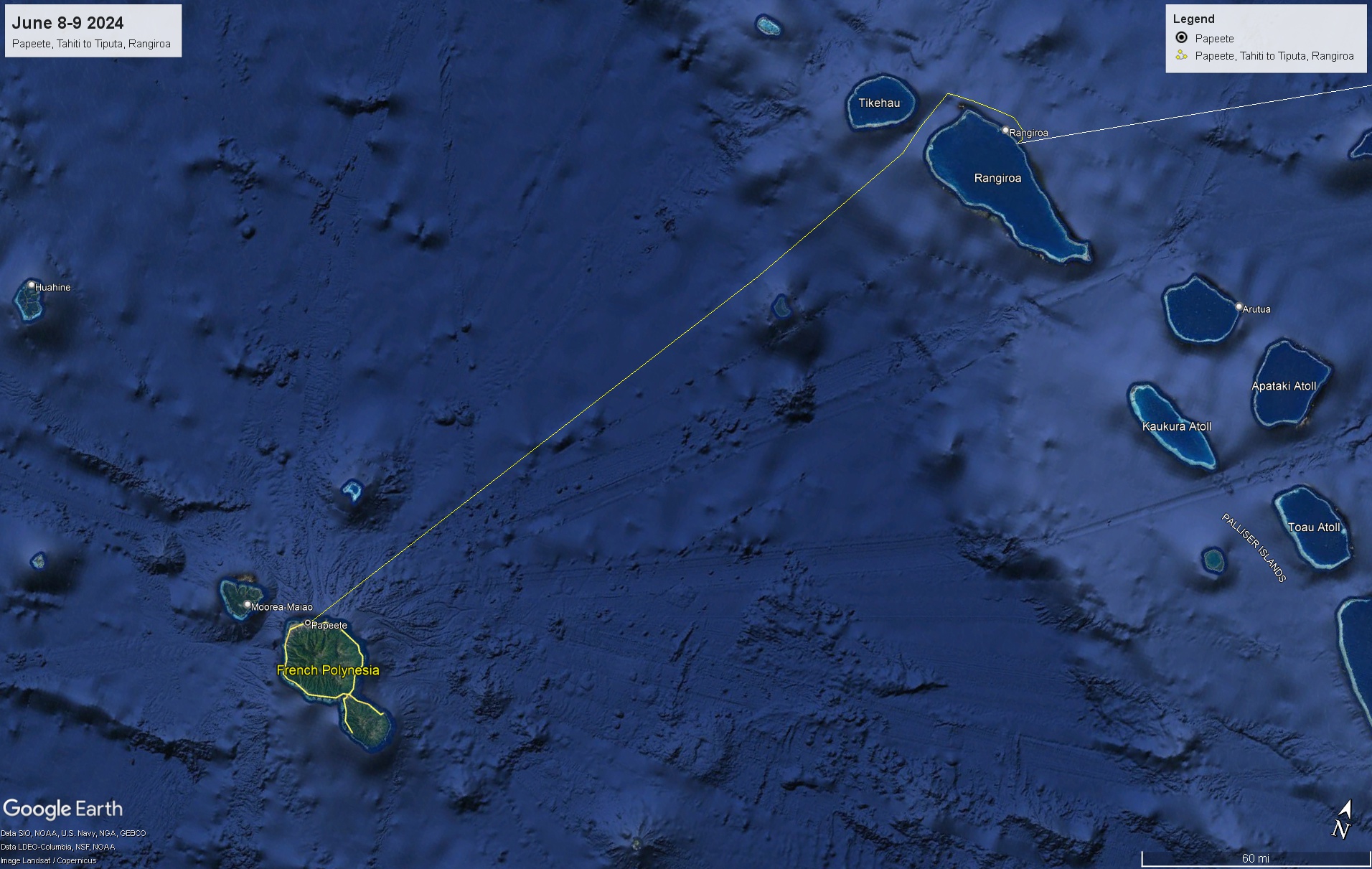
After the requisite lifeboat drill and a stop at the La Veranda restaurant (deck 6 aft) to set up dinner reservations for the trip, we enjoyed our first night dinner at the L’Etoile restaurant (deck 5 aft) as the Gauguin left the dock to begin the 210 NM or so overnight voyage heading northeast to Rangiroa in the Tuamotu Islands.
The Tuamotu archipelago (def: a group of islands closely scattered in a body of water) consists of about 80 islands and atolls, Rangiroa being the largest atoll in the Tuamotu Islands. An atoll is a ring-shaped island that includes a coral rim that encircles or creates a lagoon. However, the coral ring is generally not contiguously above sea level. There are about 100 or so shallow and narrow passes that open into the Rangiroa lagoon.
A short diversion here for geology. The Tuamotu Islands sit on a large underwater plateau oriented from the northwest to the southeast. While volcanic in origin, the Tuamotu Islands are now predominately composed of coral. Geologists continue to study the underlying tectonic forces that created not only the Tuamotu Islands, but the Society Islands, the Marquesas, the Pitcairn-Gambier, Hawaii and several other island chains in Polynesia. Until recently, the formation of these islands was more or less universally attributed by geologists to mantle hot spots which are (relatively stationary) sources of upwelling of hotter magma from the mantle which then either directly or indirectly finds its way through the crust sometimes along crustal fractures that have formed in the tectonic plate. While I am not one to strongly question long held geologic beliefs, I would point out that it was not until the 1970’s when geologists accepted the whole concept of plate tectonics and wandering continents. For the sake of brevity, because it is absolutely clear that all of these islands have a volcanic origin composed of basalt from subsea magma and they all pretty much are oriented in similar directions, let’s go with the hot spot theory.
Then we have to answer the question how did the atolls of the Tuamotu Islands form? An atoll is the result of several geologic and biologic processes.
A volcanic island forms beginning as a subsurface volcanic vent which eventually rises above the ocean surface. The size of the Rangiroa lagoon suggests that there were several volcanic vents and cones within this area.
Corals begin to build a fringing reef around the volcanic island.
Over time, the volcanic material that created the island erodes and sinks (really???) below the ocean surface. What remains of the volcanos are now subsurface features within the lagoon. The maximum depth of the lagoon is currently about 115 feet.
The coral reef continues to grow upward and outward, eventually forming a ring-shaped structure with a central lagoon.
As an interesting aside, the last glacial maximum occurred about 20,000 years ago. During this period because significant water was tied up as ice, sea levels worldwide were about 400 feet lower than they are now. The Tuamotu islands were probably above water as volcanic cones with ringing lagoons. Some other miscellaneous Rangiroa facts and figures. The lagoon is 50 miles long and from 2 to 20 miles wide. The population of Rangiroa is about 2,500 or so. There are two primary passes in the reef. Daily tidal fluctuations move significant volumes of water and thus nutrients and sea life in and out of the lagoon. The only source of potable water is cisterns with collected rainwater and runoff.
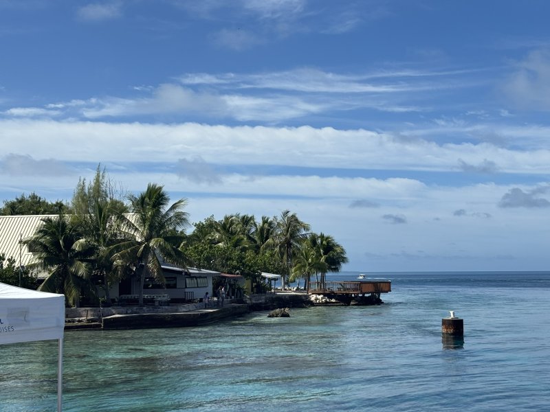
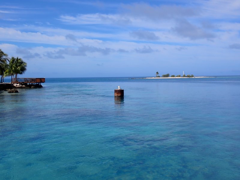
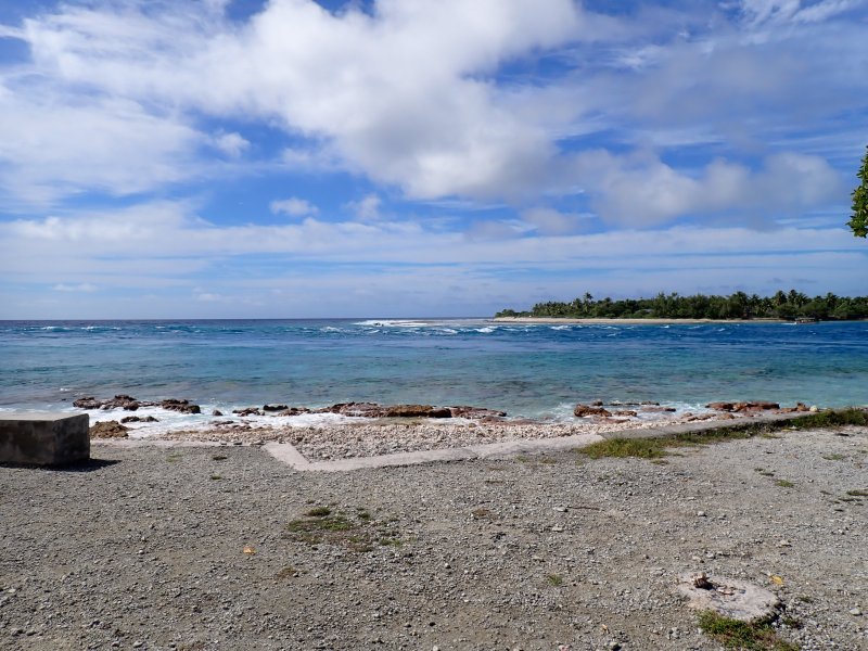
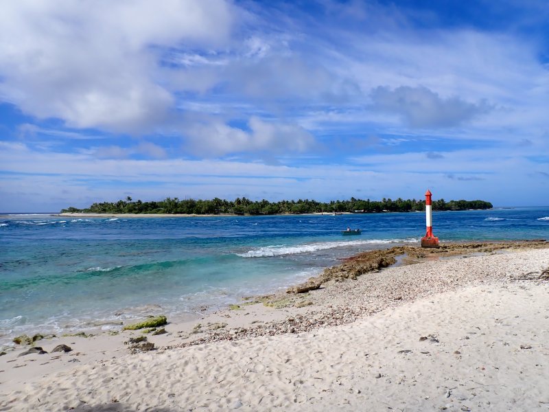
Finally – Rangiroa!! I think the Tiputa Pass entrance and the overall geography of the atoll were what impressed us the most about Rangiroa. With a close second of the scenery and the absolute potential impact on the inhabitants’ homes and way of life that a significant change in sea level would cause.
The video below (click on it — it might work) is of the Gauguin making its way through the sporty waters of the Tiputa Pass. Looks like it would be a bit of a nail biter on a 44-foot sailboat. Would have go to all of the trouble of checking tide tables, timing the entrance, hoping the motor did not die ….
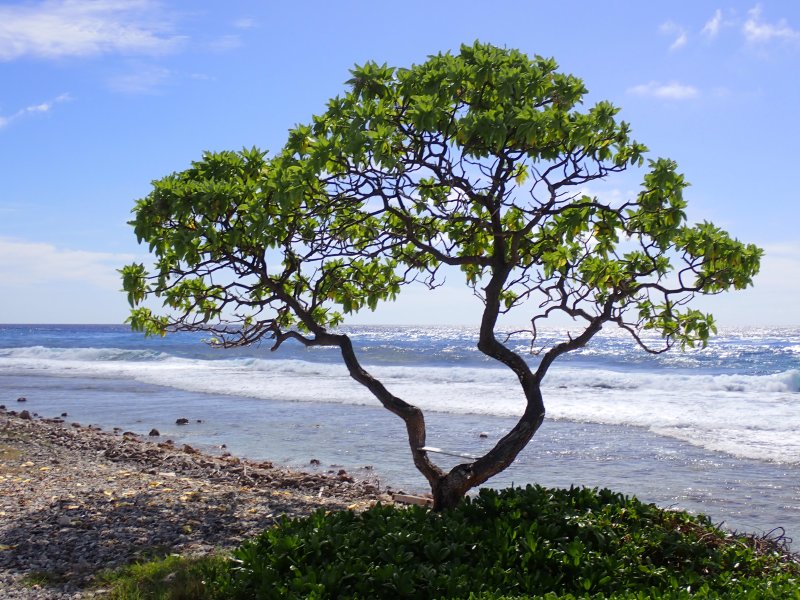
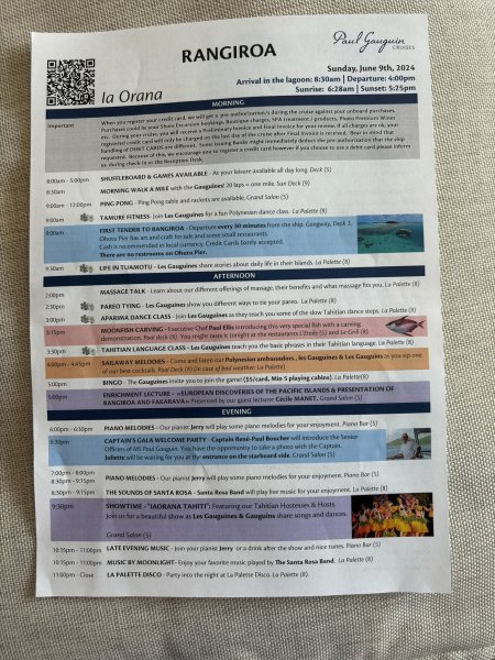
Our day in Rangiroa started with breakfast at the grill on deck 8 adjacent to the pool. Joni was very excited to find that on the Gauguin, bacon means crispy bacon! We caught an early tender to shore and walked across the atoll from the lagoon to the Pacific beach, paralleling and enjoying the views of the pass. We found an appropriate view of the shore and beach and placed a bit of Jeff in a spot that we were pretty confident he would have selected as an easy chair-boat drink spot. After dropping off Jeff, we noticed that there were a couple of the local dogs fishing. Something that we had never seen before. Did not say they were catching, but no question they were fishing.
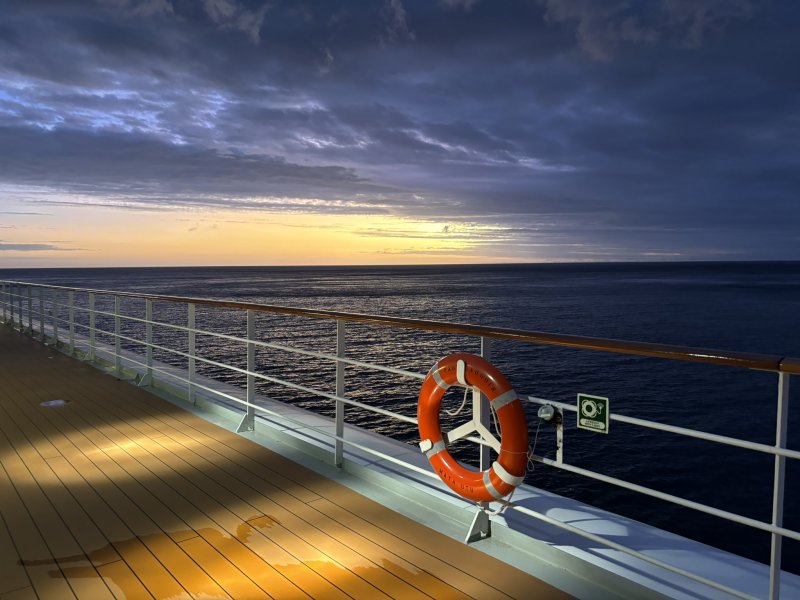
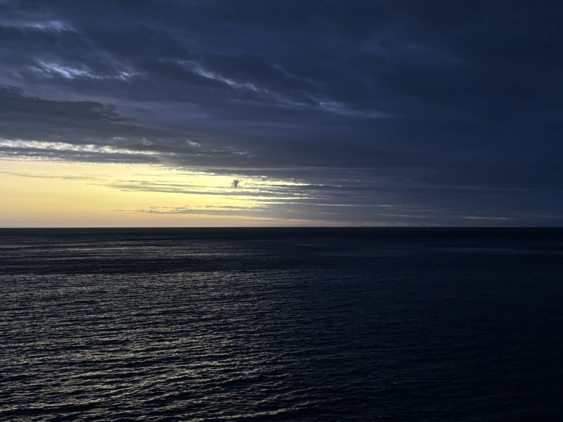
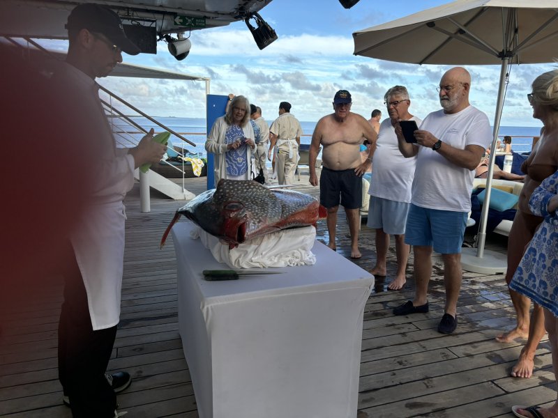
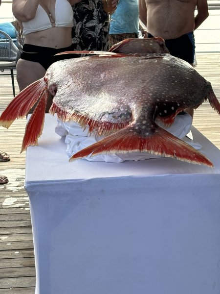
After getting back to the ship, there was a bit of time to hang out at the pool with a drink of the day and then a moon fish carving demonstration. As we left Rangiroa, again transiting a fairly sporty pass, the looming sunset and clouds caught our eye as we embarked on an almost 600 NM passage northeast to the Marquesas.
Posted inGeology, Travel and Scenery|Comments Off on Papeete, Tahiti to Tiputa, Rangiroa – Day 1 June 8-9, 2024
It has taken a bit of time to put together my thoughts for this trip and convey the essence of the experience. First a little background. In 2020, we decided to do a South Pacific vacation on the MV Paul Gauguin for a 14-day trip that highlighted the Marquesas Islands with stops along the way at two Tuamotu atolls and three Society islands. We planned this trip with our yacht club friends, Carl and Mary. Then the great covid disruption…sigh. We eventually rescheduled for June 2024.
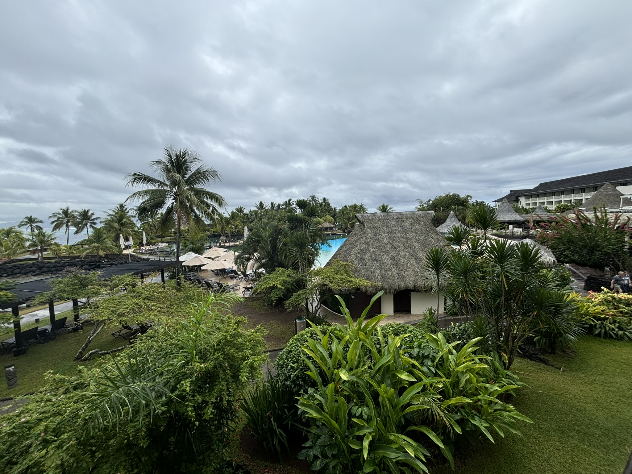
We had been on the Paul Gauguin in 2018 on a 10-day Commodores Cruise with our yacht club and had been overwhelmed by the scenery, the native population, the overall calm that the islands create, the geology, the ship, the service and the crew which all went into the 2020 decision making process. In addition, we had always wanted to take our boat to the South Pacific. However, as time passed, it seemed more enjoyable to have an 8-hour flight to Papeete, be transported in air-conditioned comfort to a dayroom at the Intercontinental hotel for lunch and boat drinks, then transported to the ship where the accommodations are incredible, have all of our beyond phenomenal food prepared and served, our clothes washed, our room cleaned, turned down and attended to at least twice a day, others taking care of ship maintenance… you get the idea on the motivation for the decision.
Intercontinental Hotel, Faa’a, Tahiti
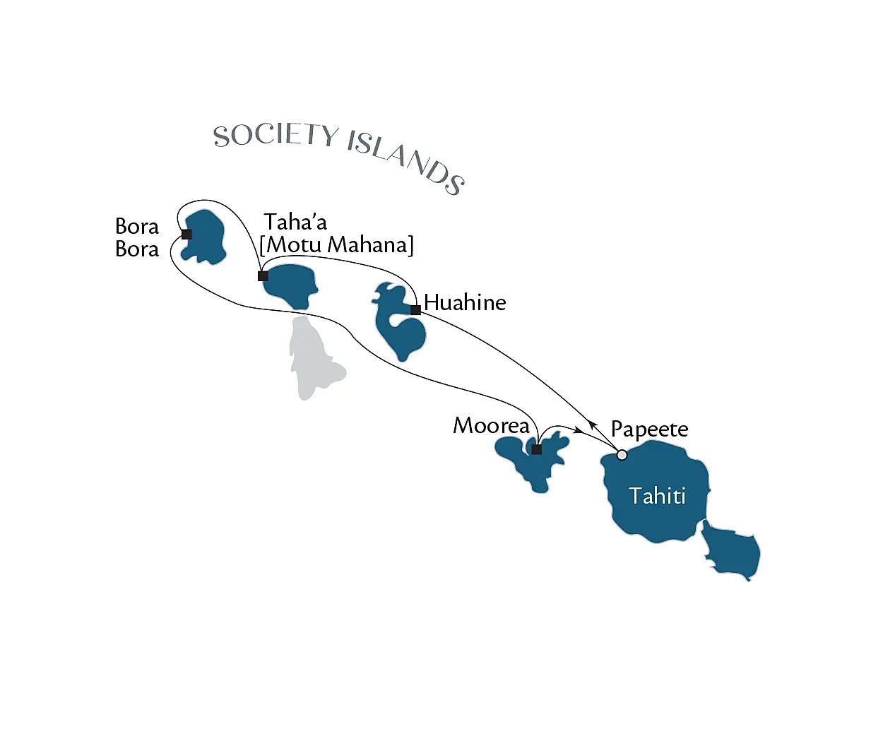
Before getting too far into this, on top of the daily/hourly adventures, there was a BIG adventure during this trip. It so happened that the Commodores Cruise for our yacht club this year was a 7-day Tahiti and Society Island trip that immediately followed our 14-day voyage. Invoking the almost always successful argument that you only have so many trips around the sun and adding that we were thoroughly enamored with the whole South Pacific experience, Joni and I asked “How can we argue that logic?” and extended our stay on the Paul Gauguin for an additional 7-days so that we could not only experience exotic locales with exotic names, but we could also do it in the company of 56 yacht club members. Joni, wrangled, bargained and cajoled and thanks to her persistence, we had seven more days on the Gauguin.
14 – Day Itinerary June 8 – June 22
7 – Day Itinerary June 22 – June 29
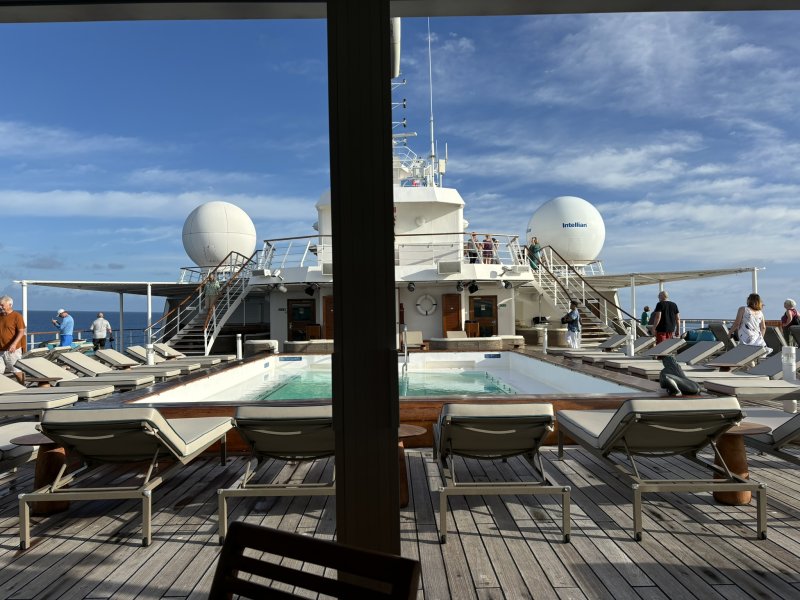
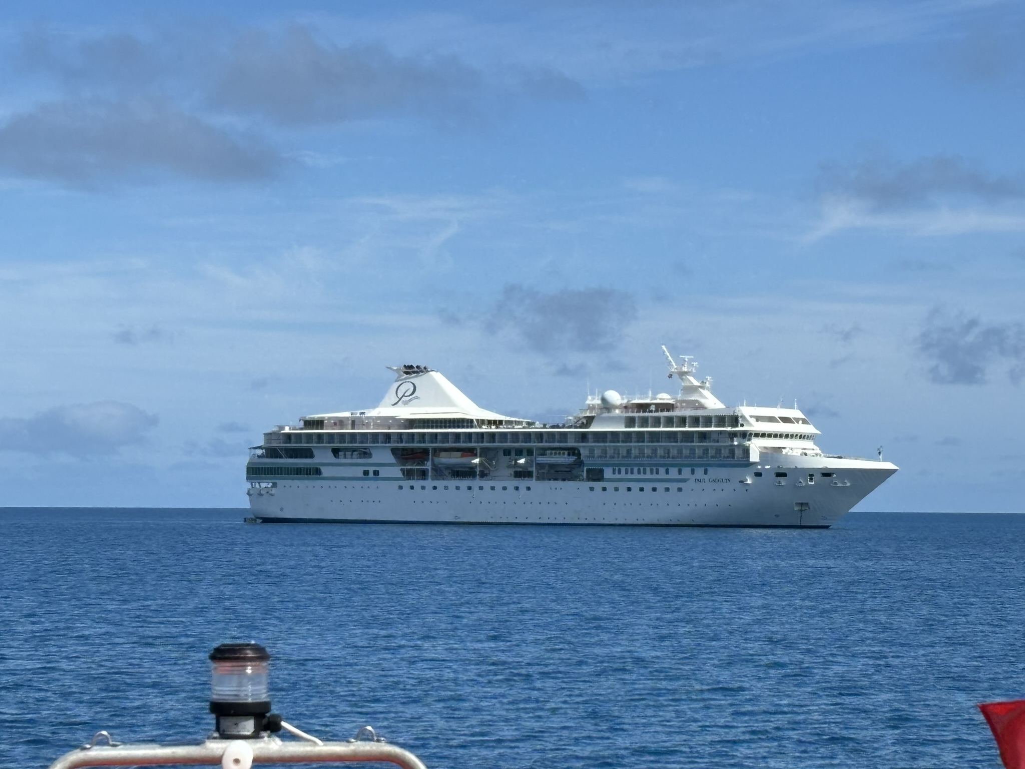
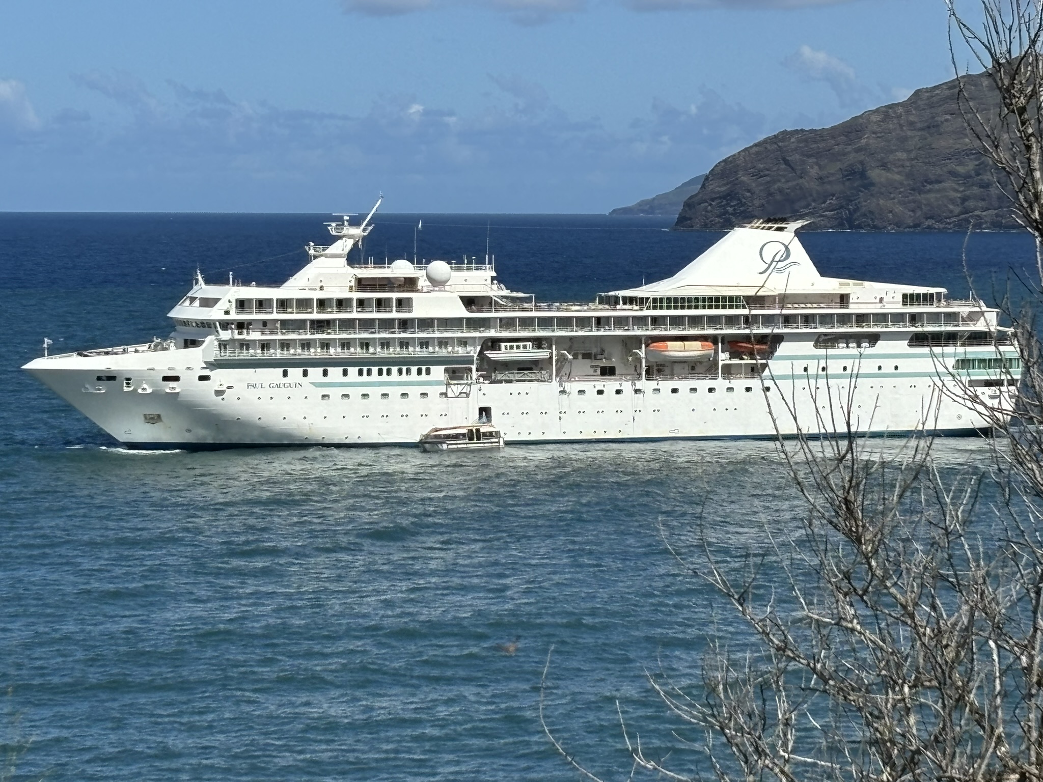
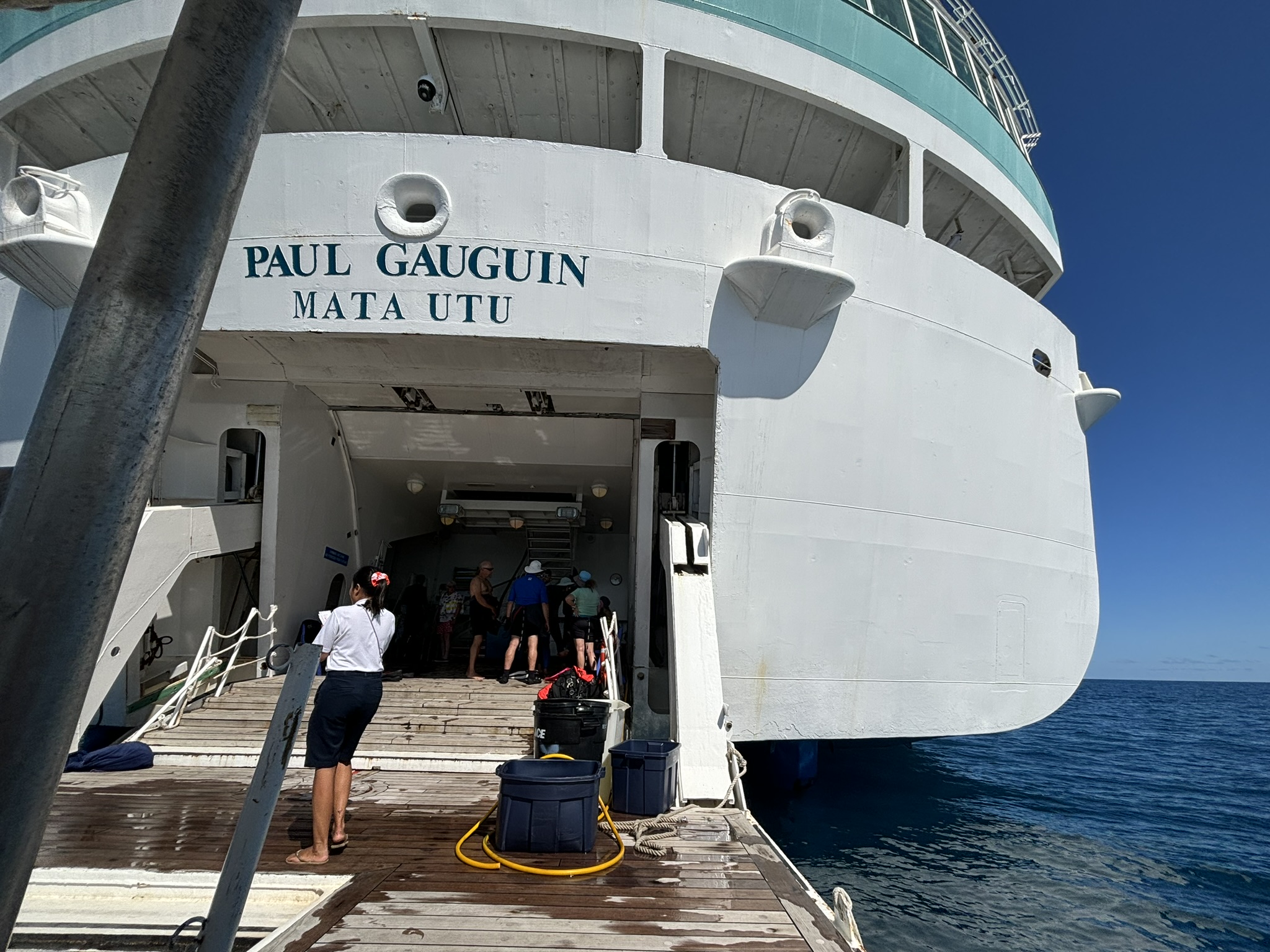
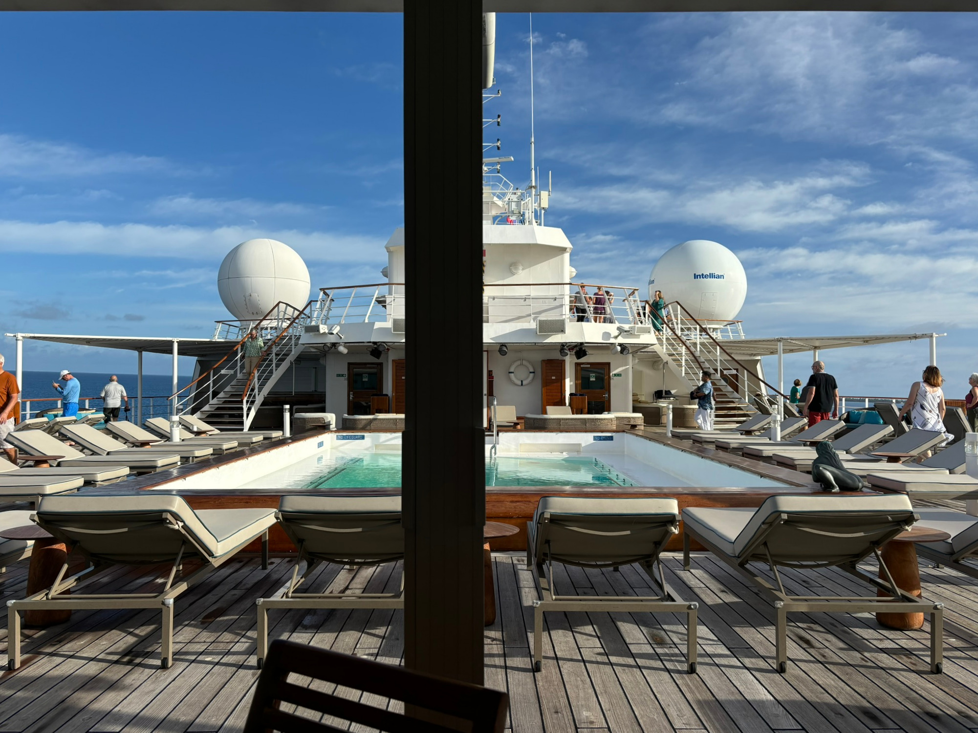
The Paul Gauguin is a smaller ship, just over 500 feet long with 9 decks and a “tailgate” marina and was designed specifically to get into anchorages in the archipelagos of the South Pacific. There are three restaurants, and four strategically located adult beverage stations staffed with very personable and friendly mixologists. The ship also includes all of the amenities you expect from a cruise ship, pool, fitness center, overpriced ships store and entertainment at several venues on-board. In all, there are 217 crew members on board. On the 14-day trip there were 256 passengers with 180 French folks … Incroyable! On the 7-day trip there were 280 passengers.
At Anchor – Rangiroa, Tuamotus
At Anchor – Opunohu Bay, Moorea, Society Islands
At Anchor-Atuona, Hiva Oa, Marquesas
The Back Porch
Looking Forward – Deck 8 From Lunch Table
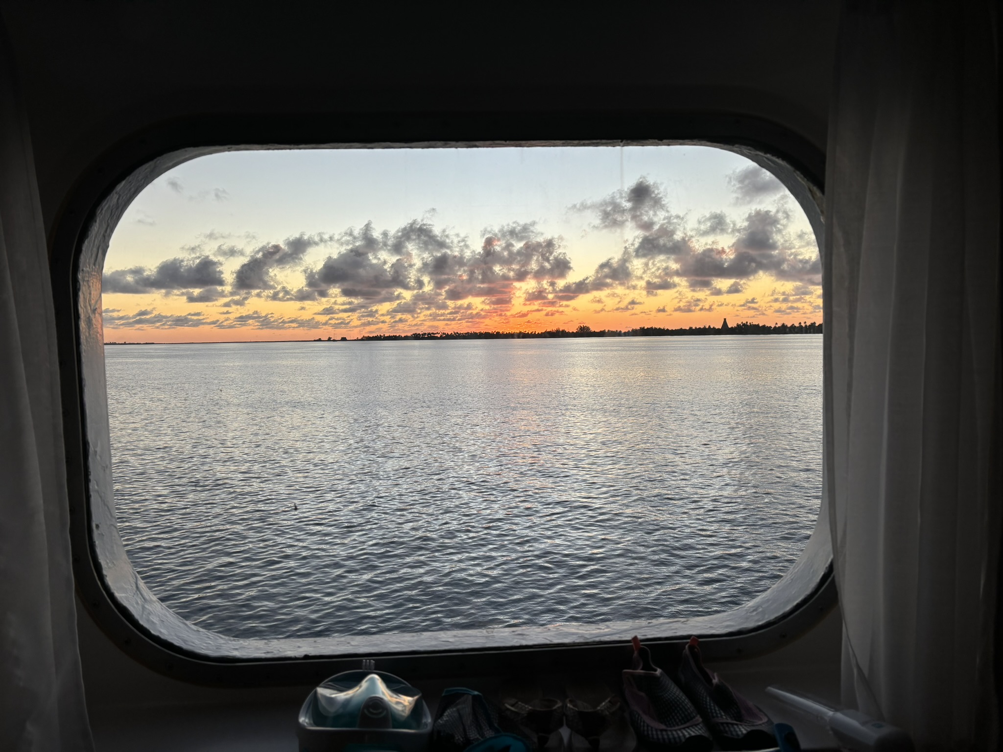
Sunset From Our Cabin Window
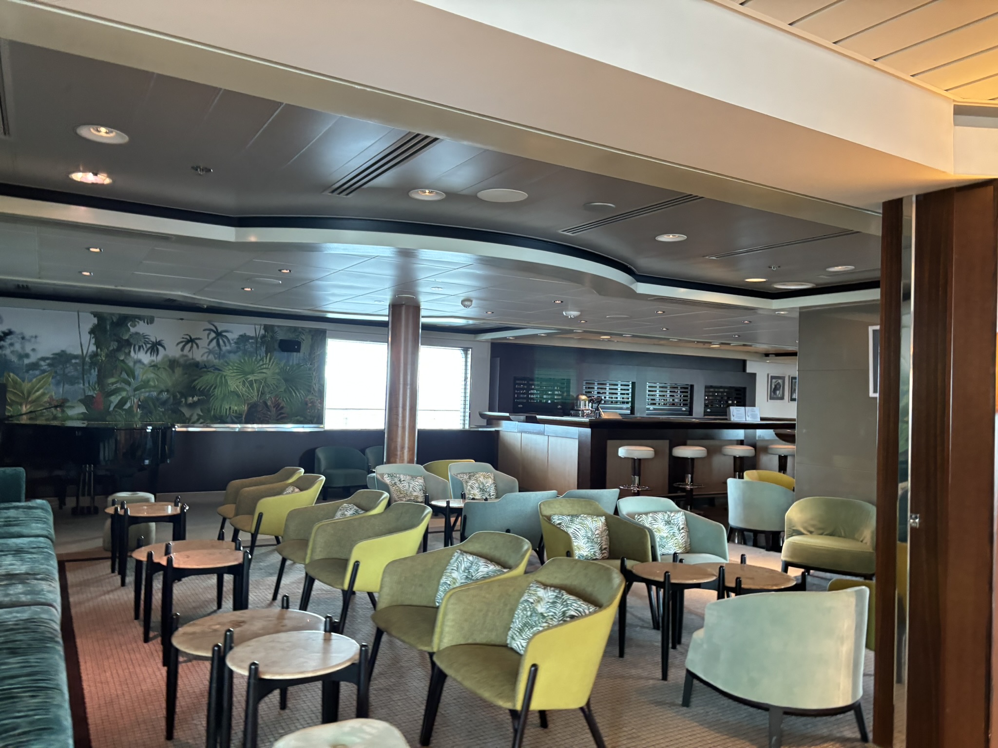
Piano Bar
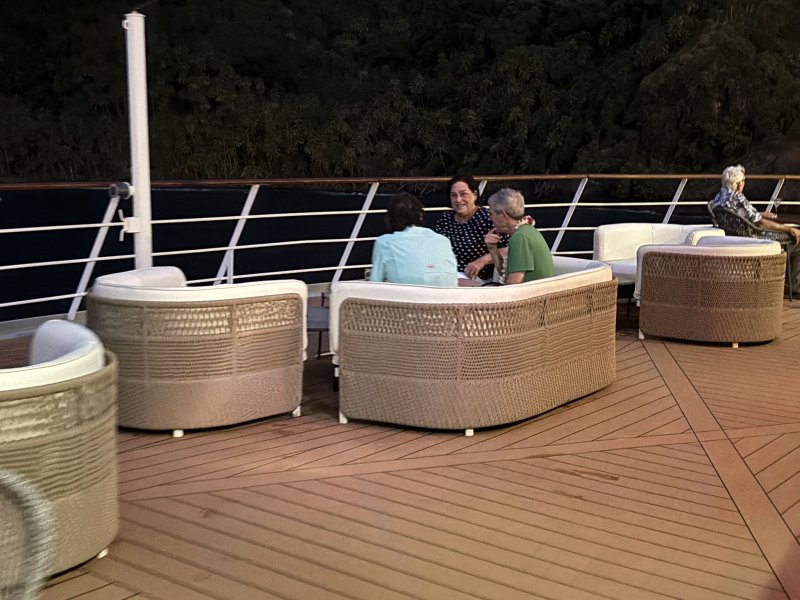
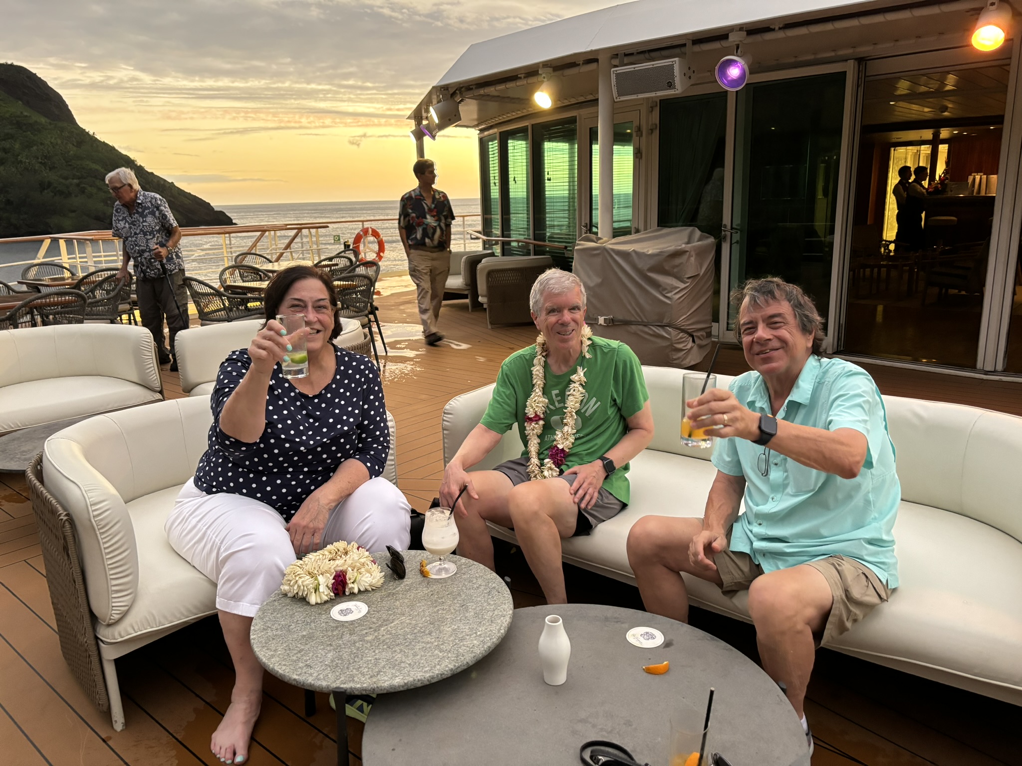
La Palette – Deck 8 Aft Bar with Carl and Mary
Pool Bar
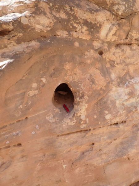
We were also on a mission on this trip. Our good friend of at least 40 years, Jeff Inshaw passed away unexpectedly last year. Jeff and Marie were avid sailors, travelers and adventurers who visited, sailed and loved Franch Polynesia. Marie asked us to place some of Jeff’s ashes in a scenic spot in the islands. We took that assignment very, very seriously and in general being over-achievers, happily made sure that we left a little of Jeff in at least one location on every island that we visited.
I am not yet sure how this series will turn out and what the format will be. Since we took a combined 1,850+ photos, I will only be posting some of those in future blogs. I’m also pretty sure I will get carried away with some geologic ramblings and an unusual addition of some cultural discussions. In the end, the short story is, get to the Tuamotus before they are inundated and while there, see the rest of French Polynesia.
Posted inTravel and Scenery|Comments Off on South Pacific – June 7 – June 30, 2024 – OVERVIEW
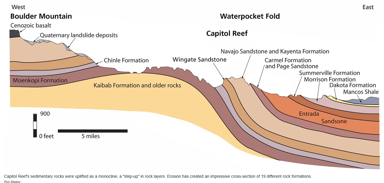
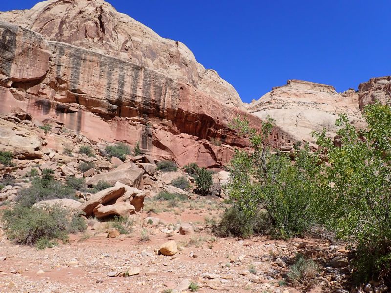
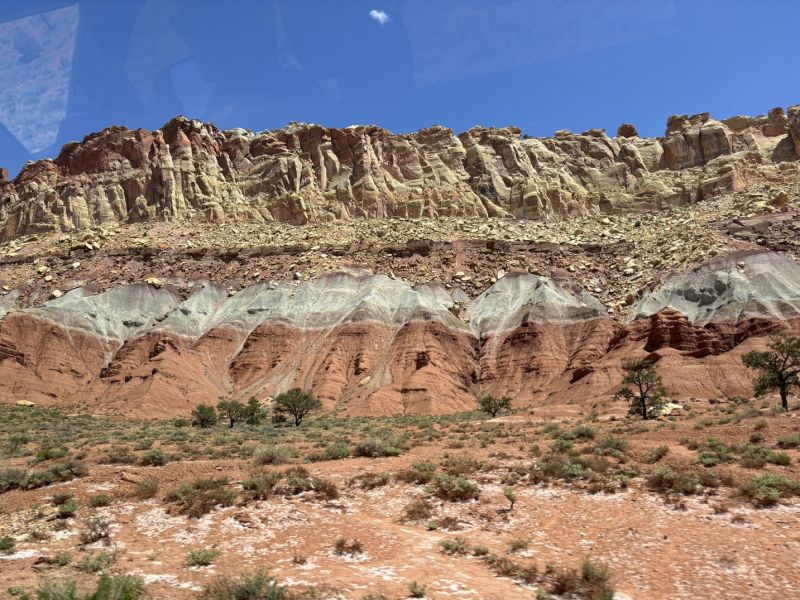
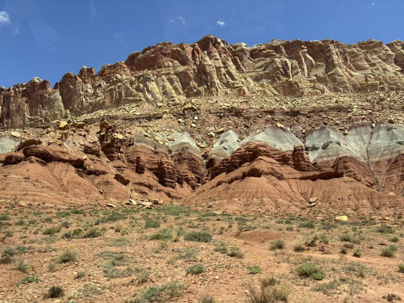
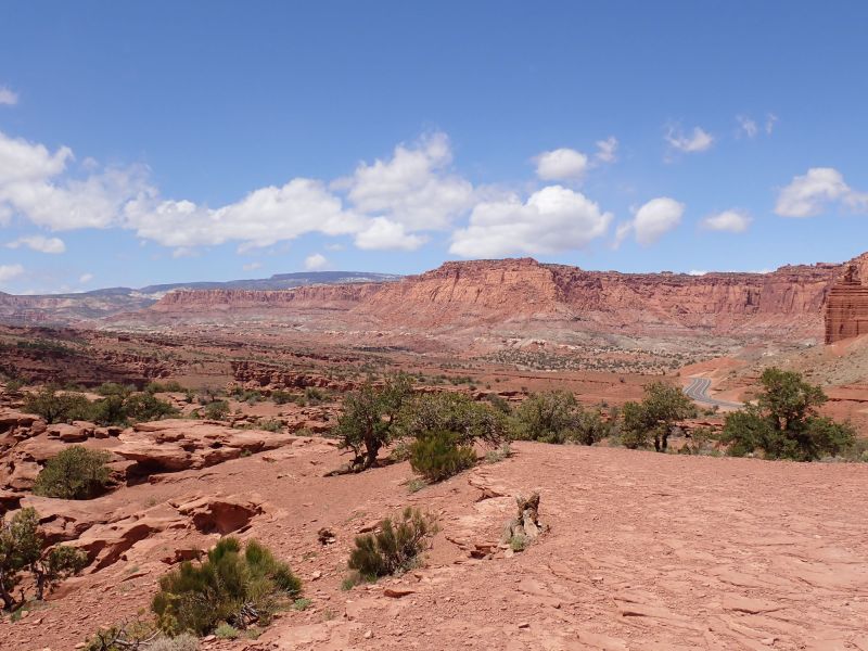
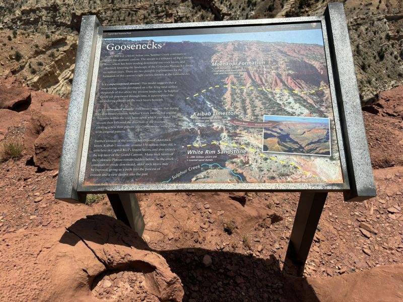
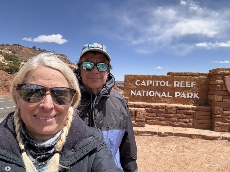
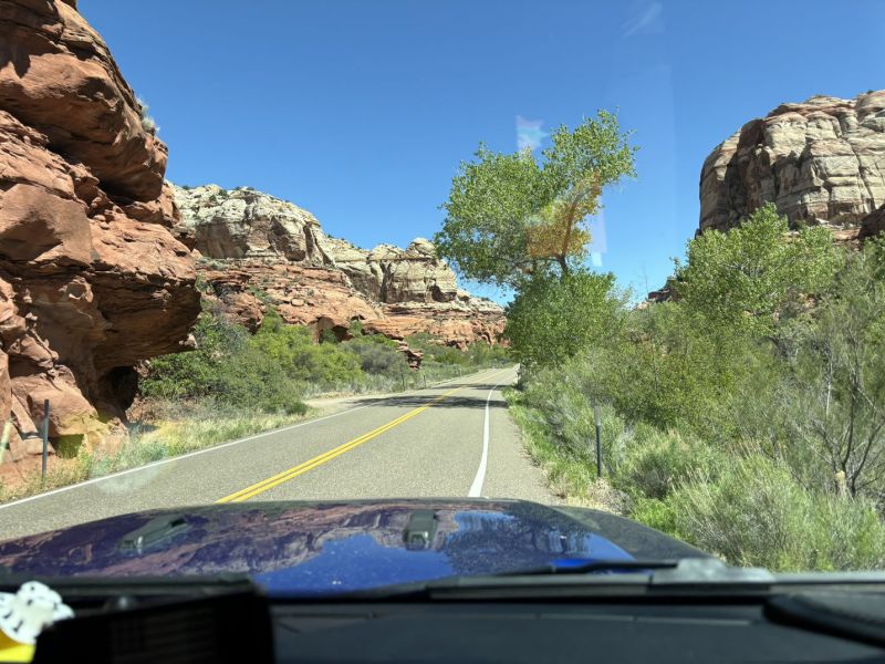
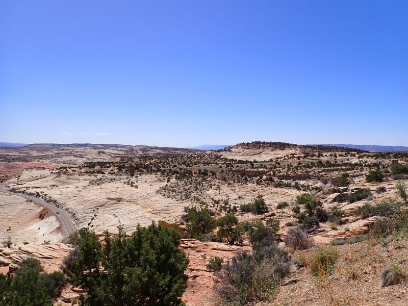
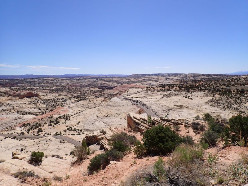
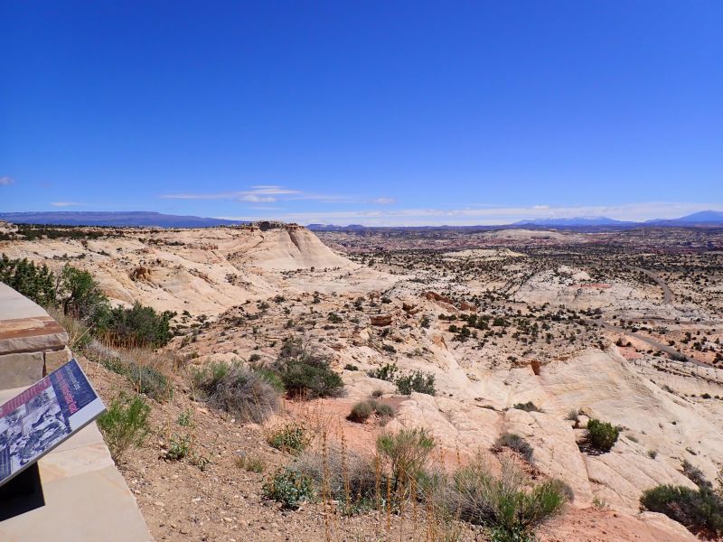
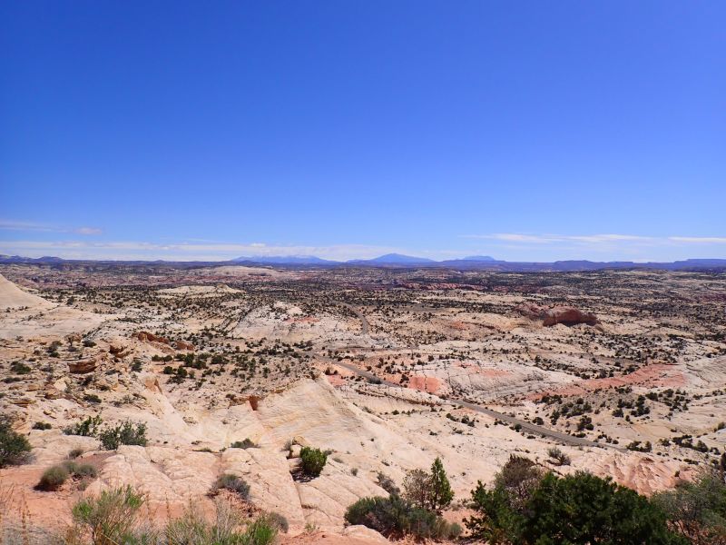
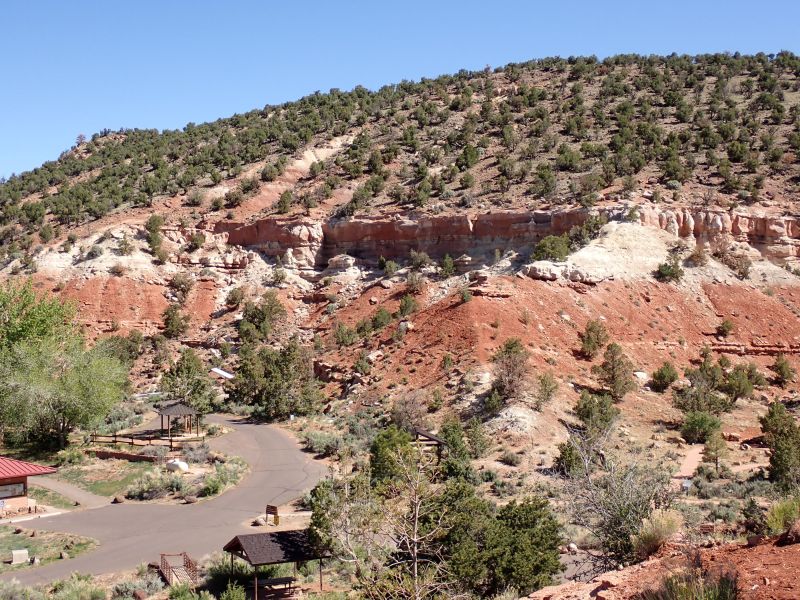
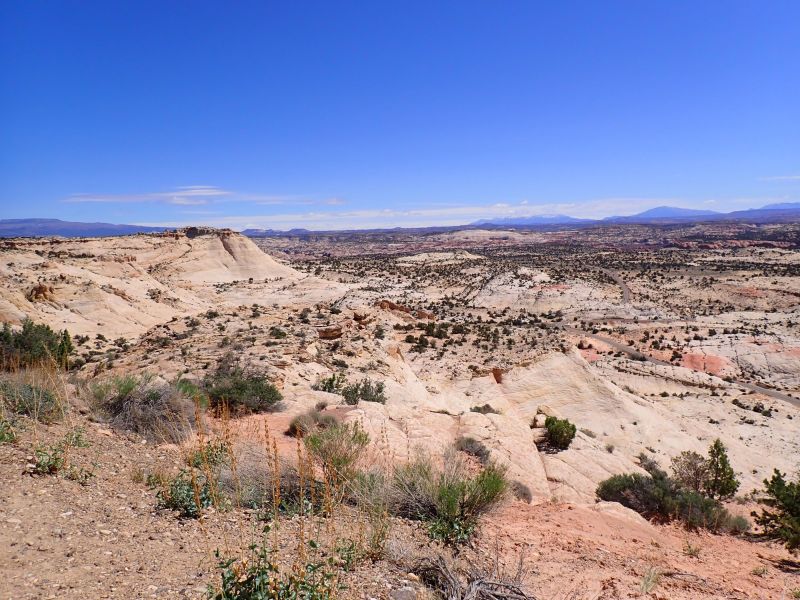
The name Capital Reef was given to this area by early settlers for a couple of reasons. The first settlers decided that the Navajo Sandstone outcrops resembled the dome of the Capitol building in Washington, DC. It is not clear which naming came first, but this one gets my vote; prospectors visiting the area (many with nautical backgrounds) referred to the Waterpocket Fold, an 87-mile-long ridge in the earth’s crust, as a reef, since it was a formidable barrier to transportation.
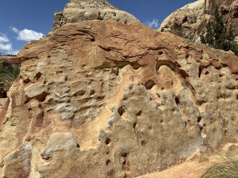
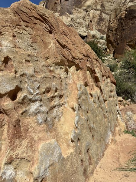
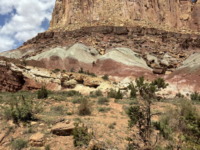
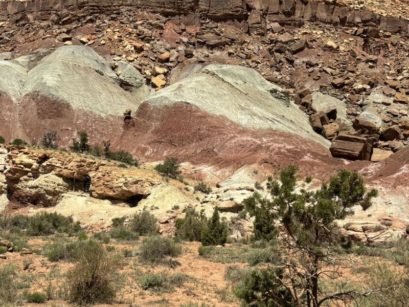
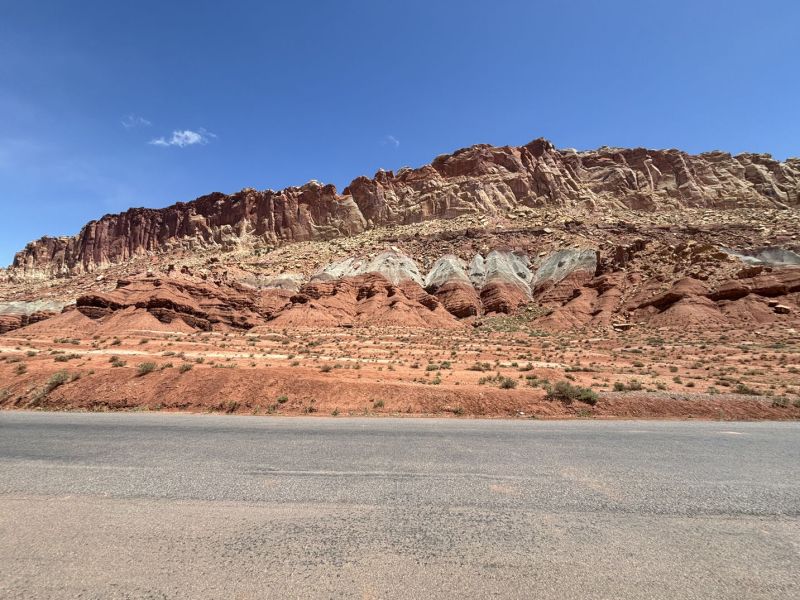
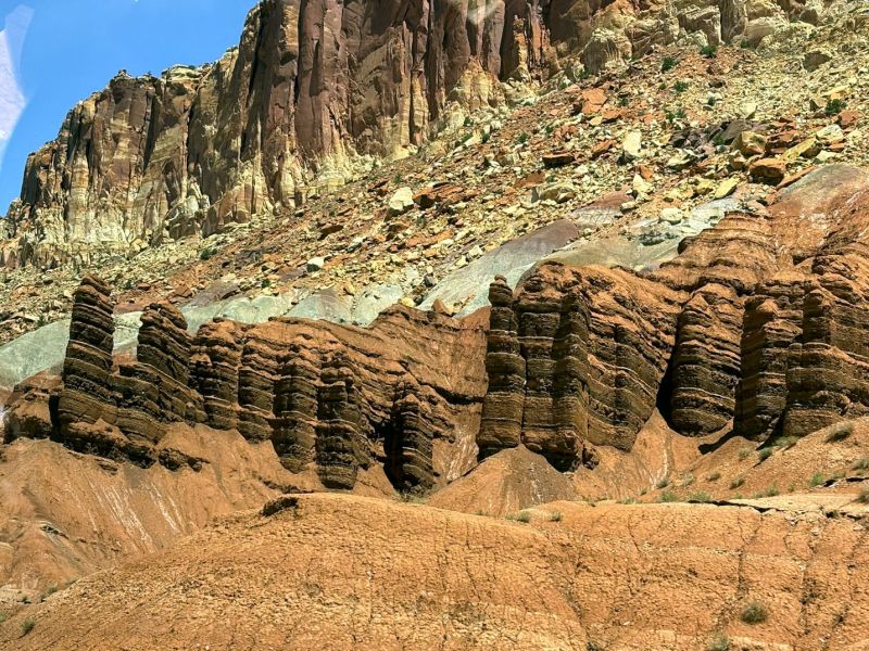
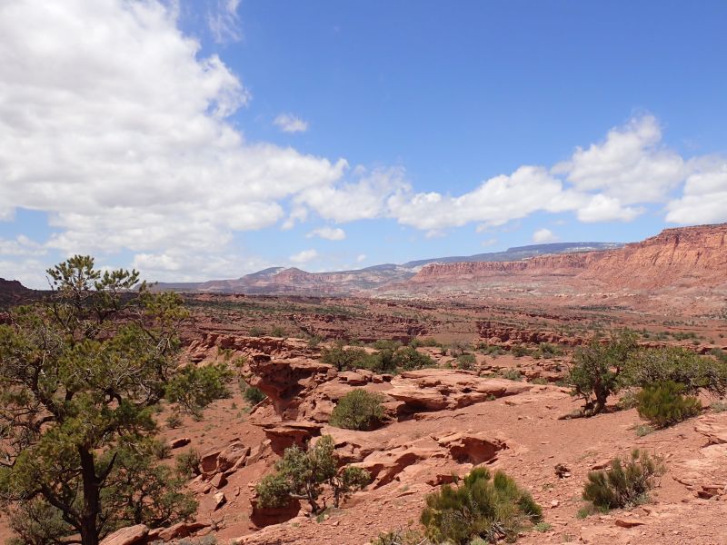
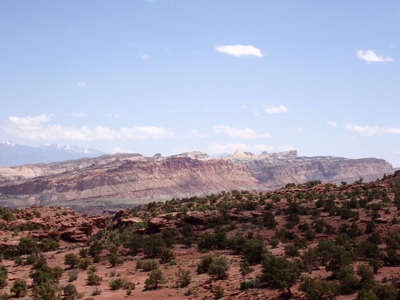
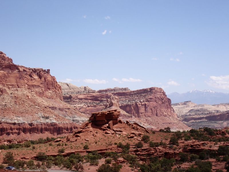
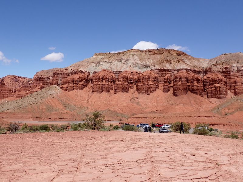
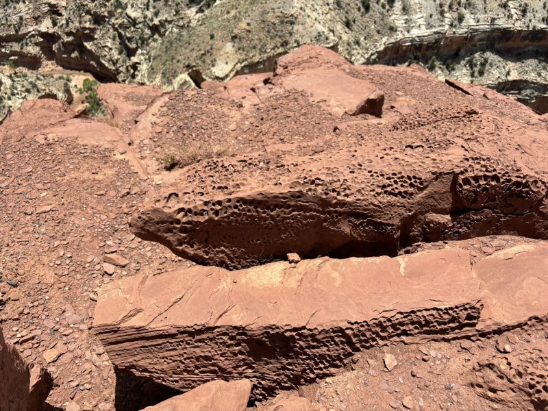
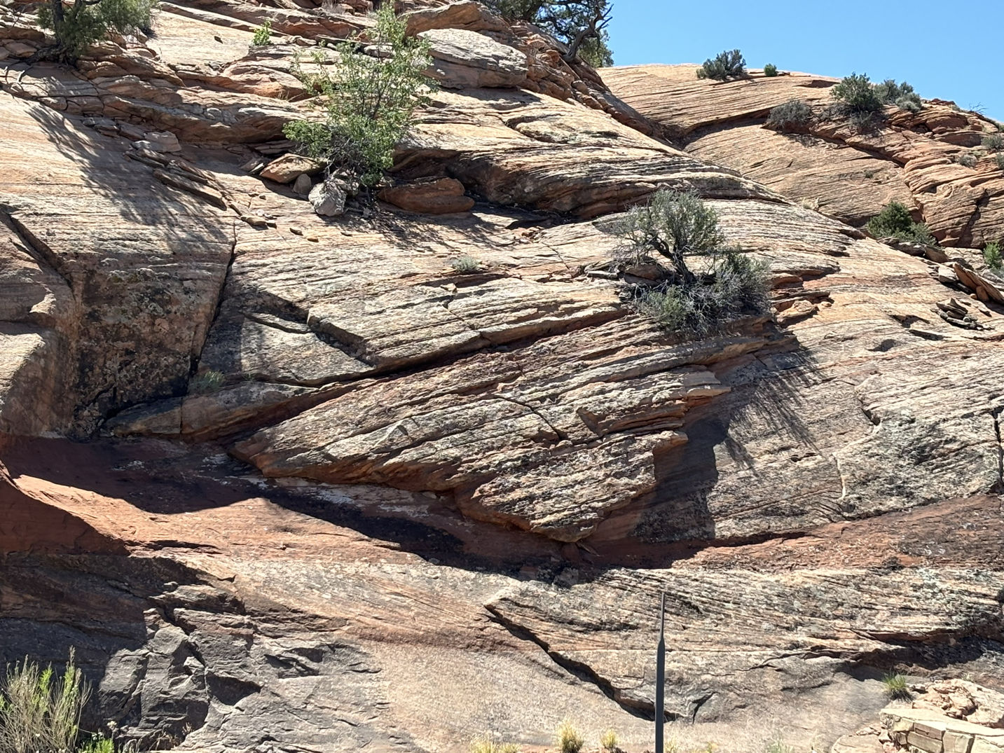
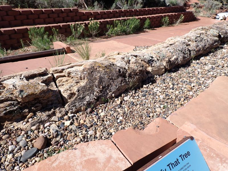
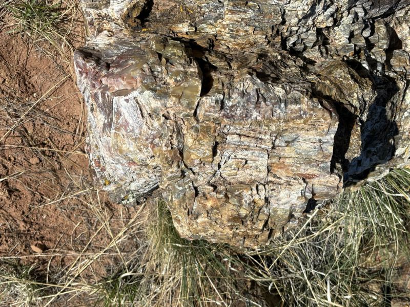
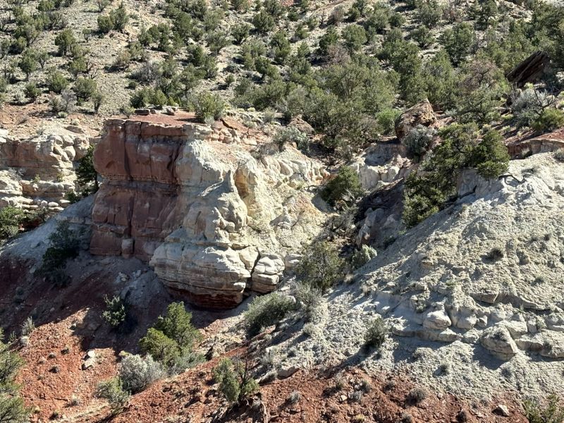
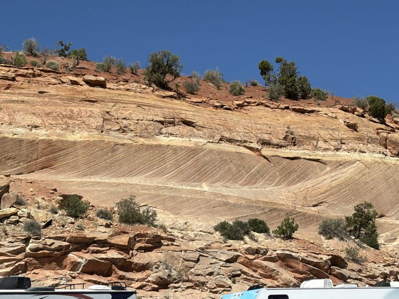
The Cliff Notes version of Capital Reef Geology supplements other blog posts. The park is still on the Colorado Plateau, so the geologic formations are comprised of many thousands of feet of sedimentary rocks deposited in a variety of environments. The readily visible formations include the Cutler Formation (White Rim Sandstone member) which is a 280-million-year-old (myo) coastal sand dune deposit; the Kaibab Limestone a 270 myo shallow sea deposit; the Moenkopi Formation a 245 myo mud and sandstone formation deposited in shallow seas and flood plains; the Chinle Formation (225 myo) which was deposited primarily in higher energy rivers and consists of petrified logs, sands, muds and windborne volcanic ash; and the Wingate sandstone, the Kayenta Formation and the Navajo Sandstone. The final three formations were deposited primarily under arid desert conditions demonstrated by extensive cross bedding (see pictures). The actual age of these final three formations is somewhat controversial allowing pompous white gentlemen geologists in their late 70’s and 80’s to sit around in big soft leather chairs smoking their pipes, sipping scotch to harumph and rail at the youngsters. In deference to both groups, let’s say the Wingate is 205 myo and the Kayenta and Navajo are younger with the Kayenta deposited between the Wingate and Navajo which was deposited from 190 to 180 mya. Due to the Waterpocket Fold/Monocline, a deep fault caused flexure in the earth’s surface, the older formations are visible on the west side of the park and the younger formations more visible on as you move east. Just to close this out, the uplift and erosion that has created the scenery and views is relatively young, having occurred in the last 45 – 20 million years.
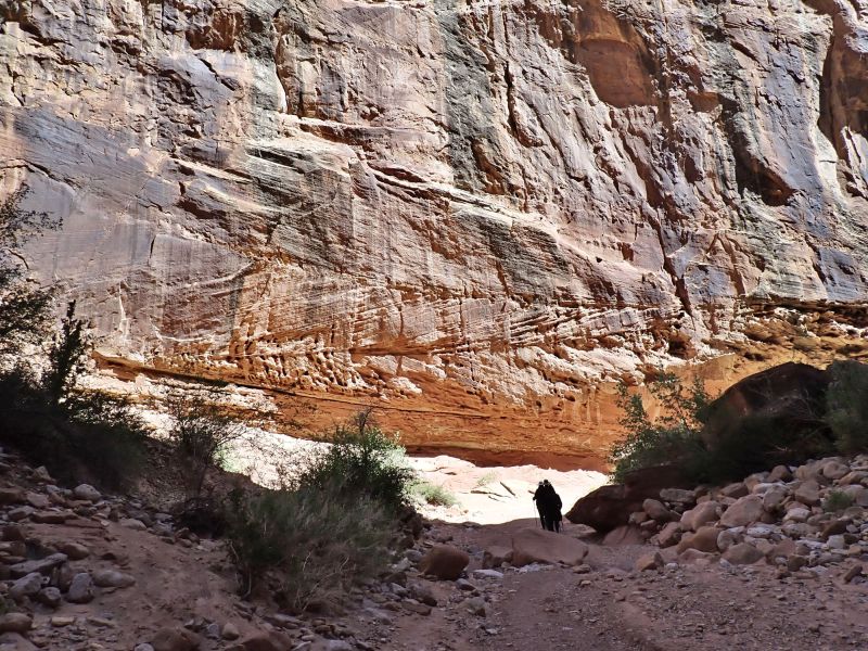
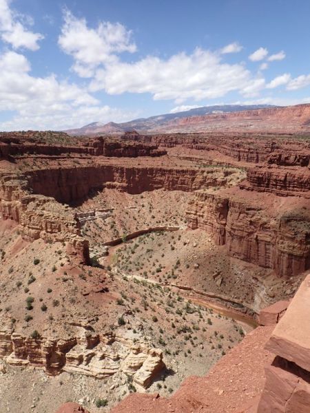
Wow, that got a little out of hand. Sometimes a fit of geologic accuracy hits and you just have to go with it. Since one picture is worth at least 5,000 of my words, here is a NP generated section of the Waterpocket monocline.
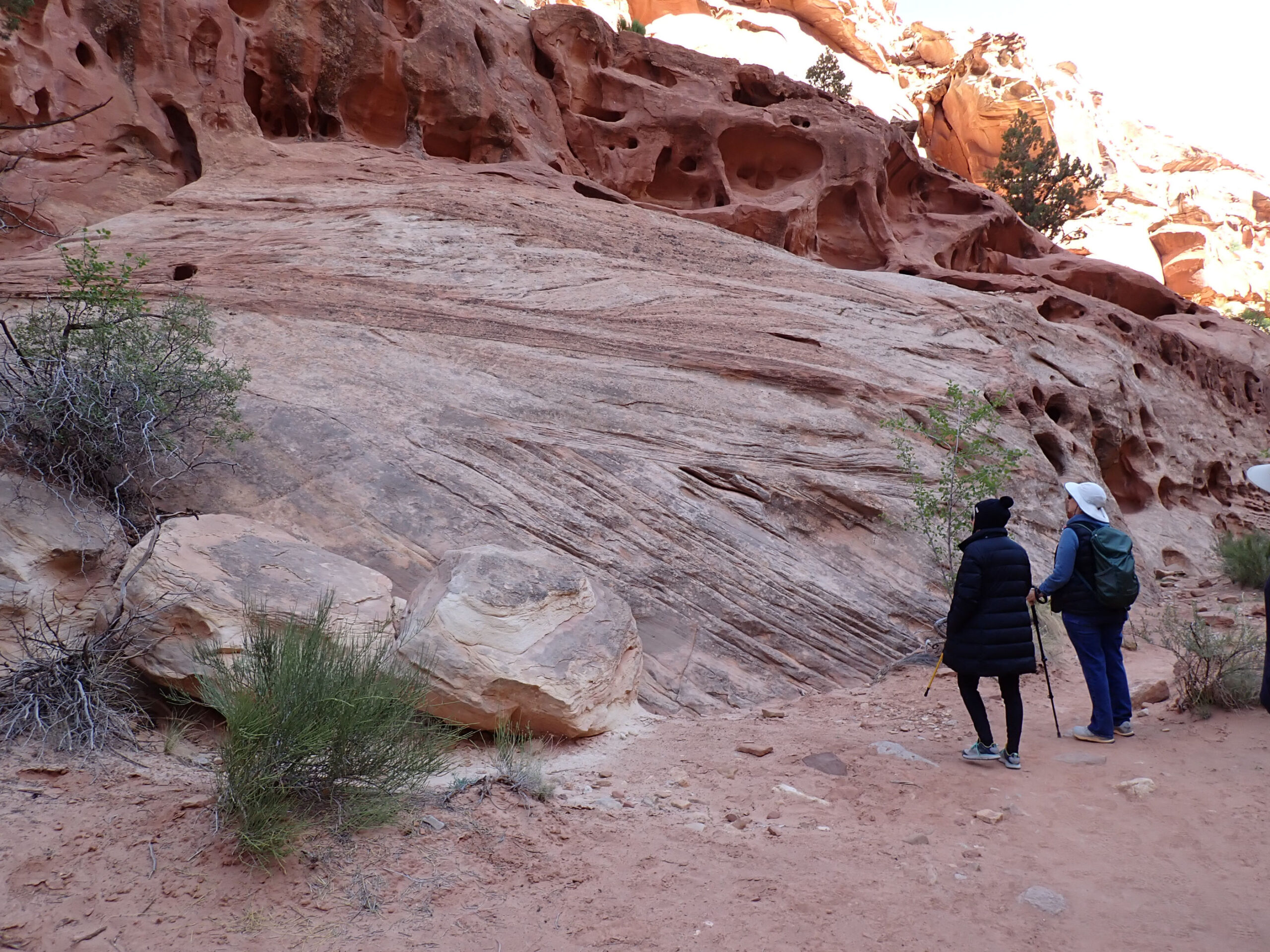
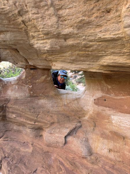
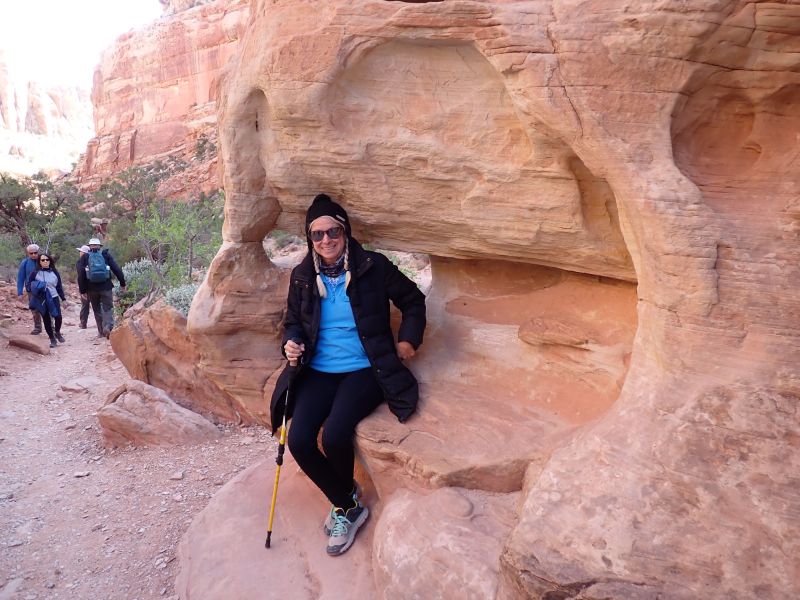
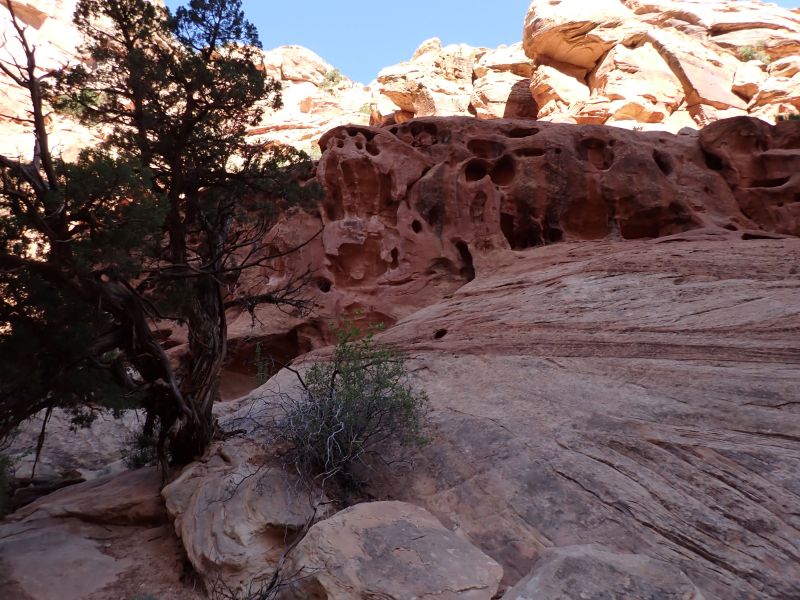
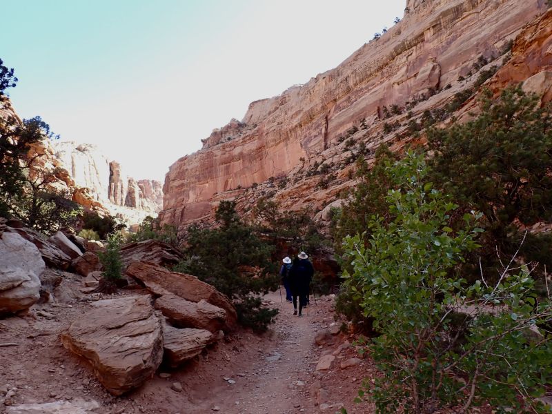
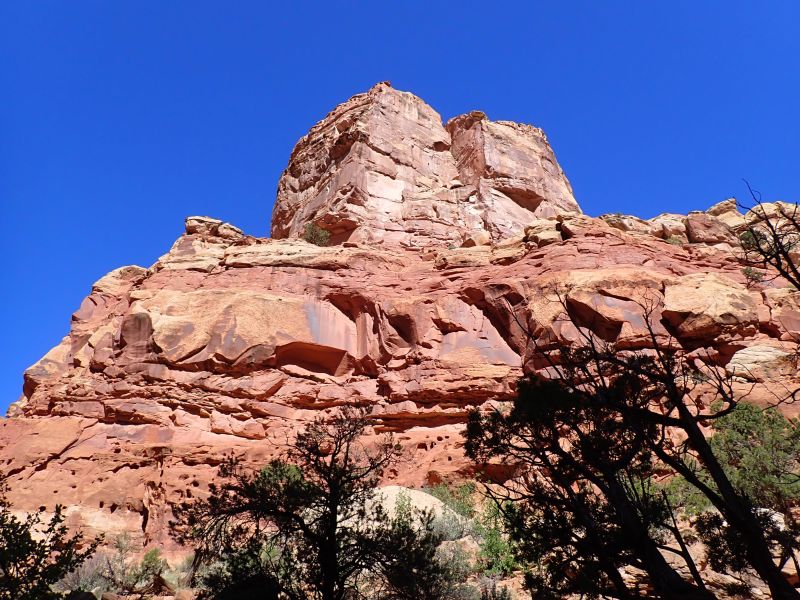
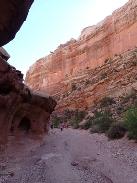
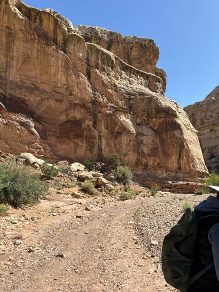
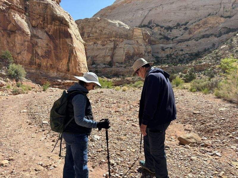
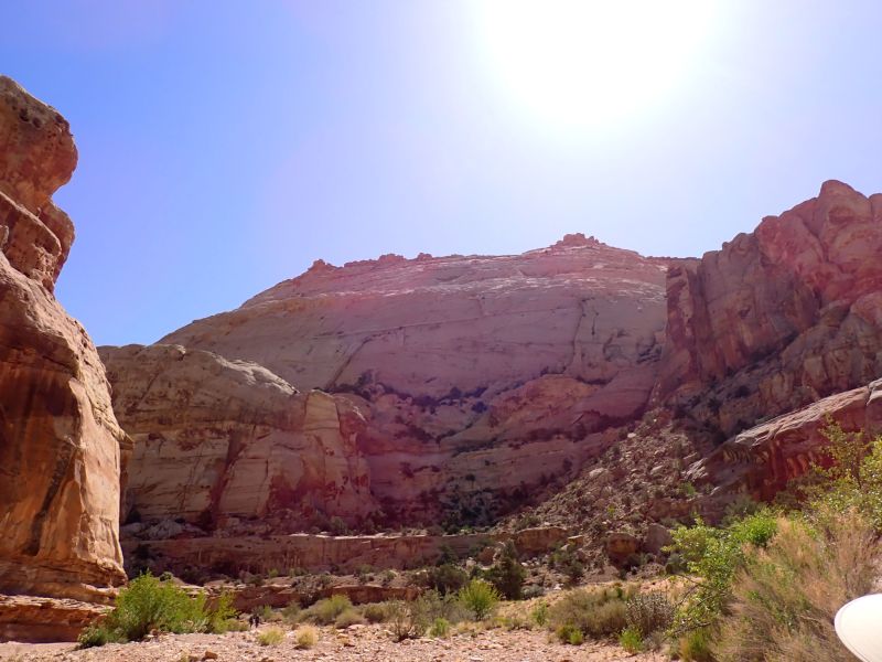
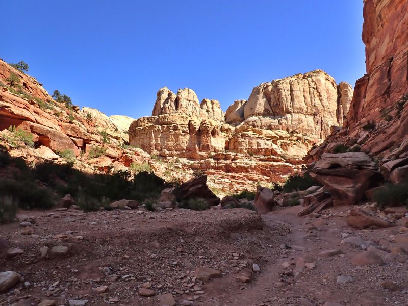
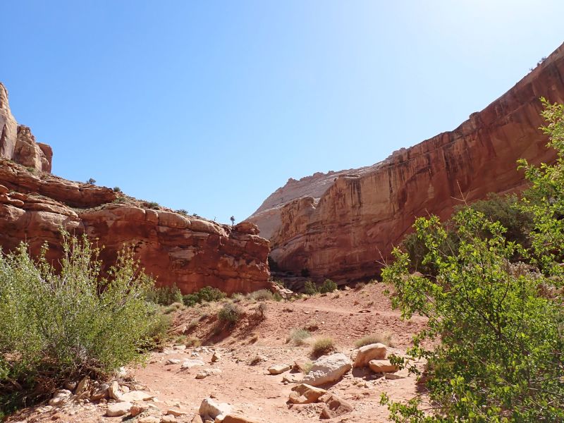
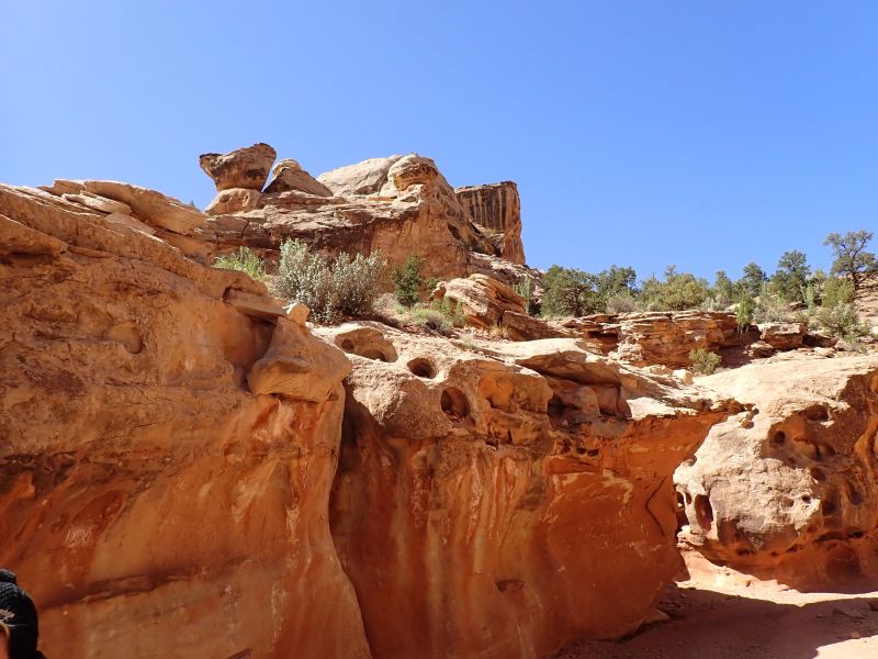
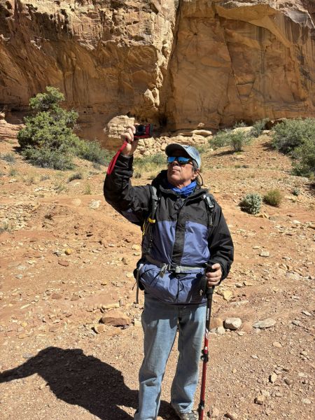
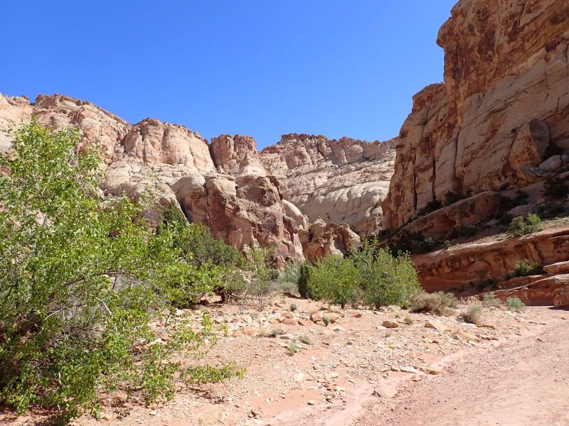
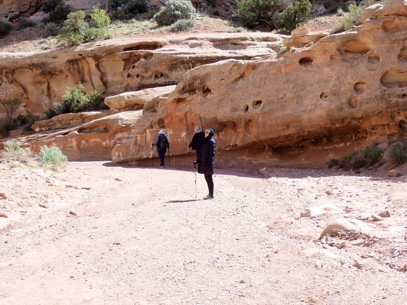
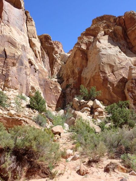
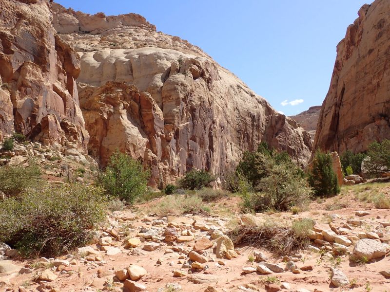
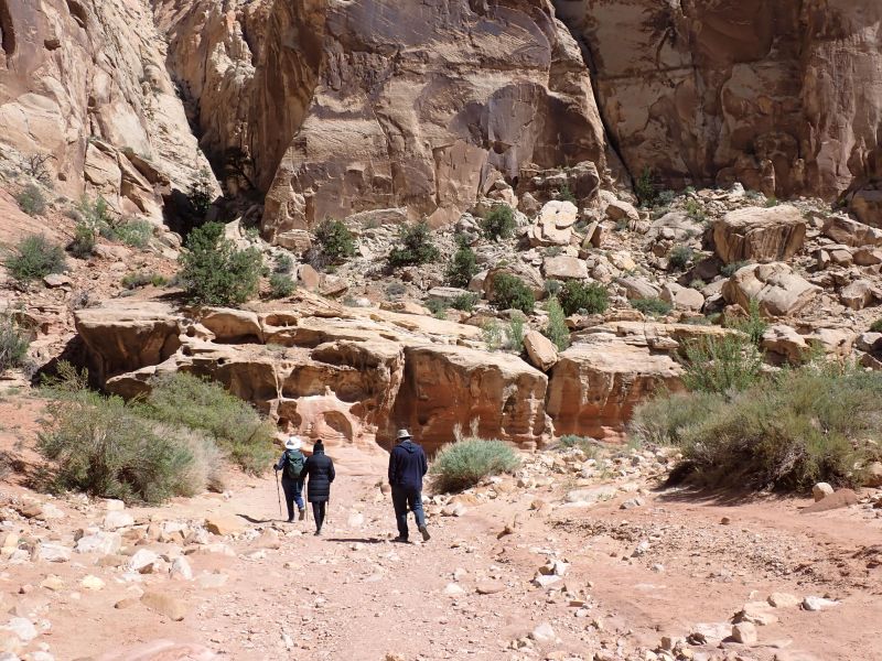
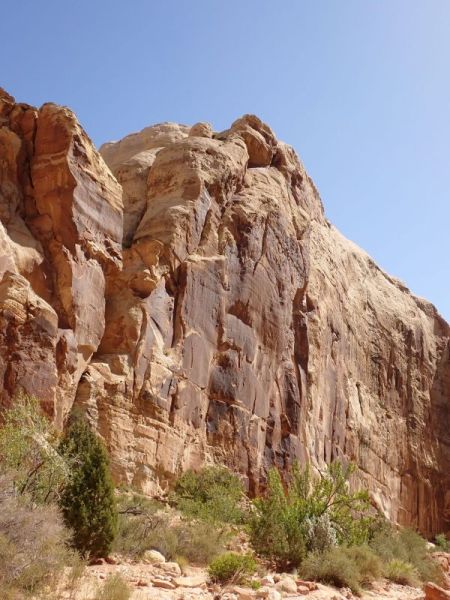
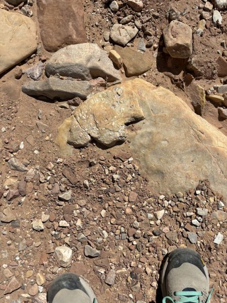
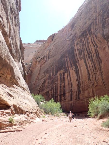
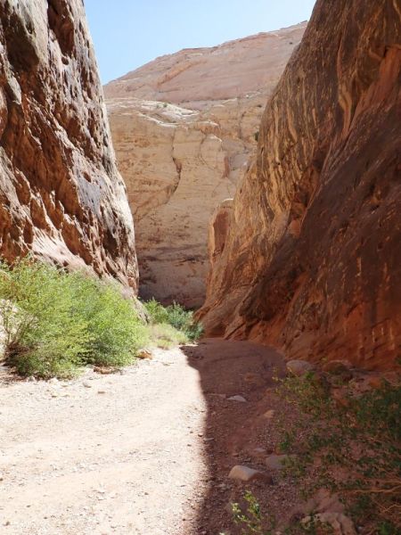
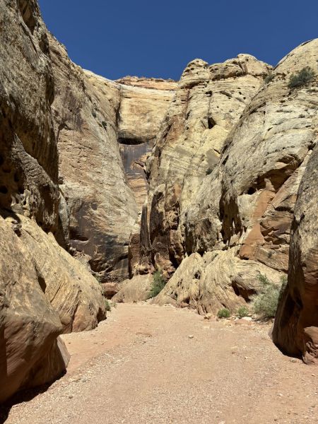
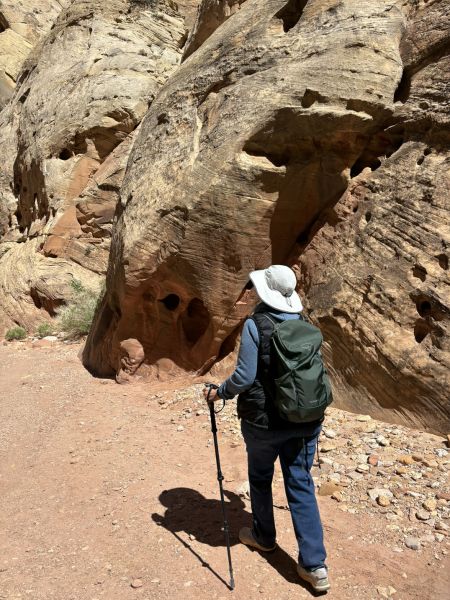
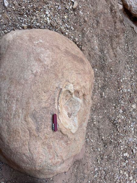
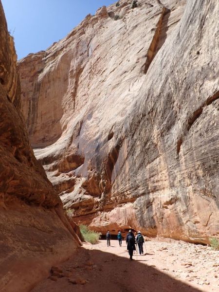
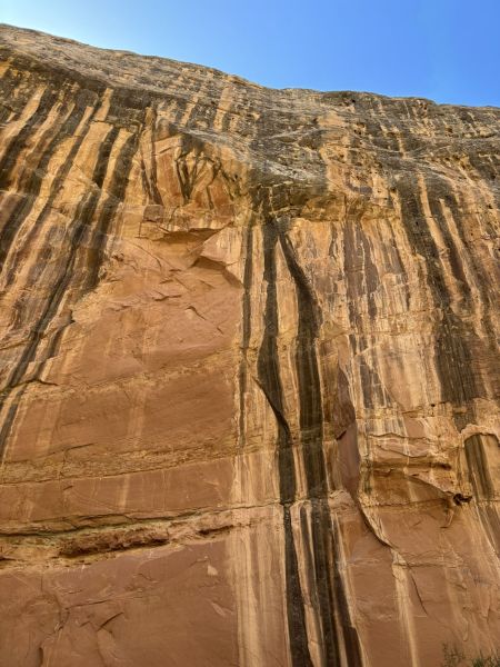
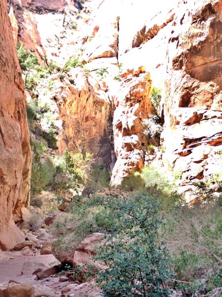
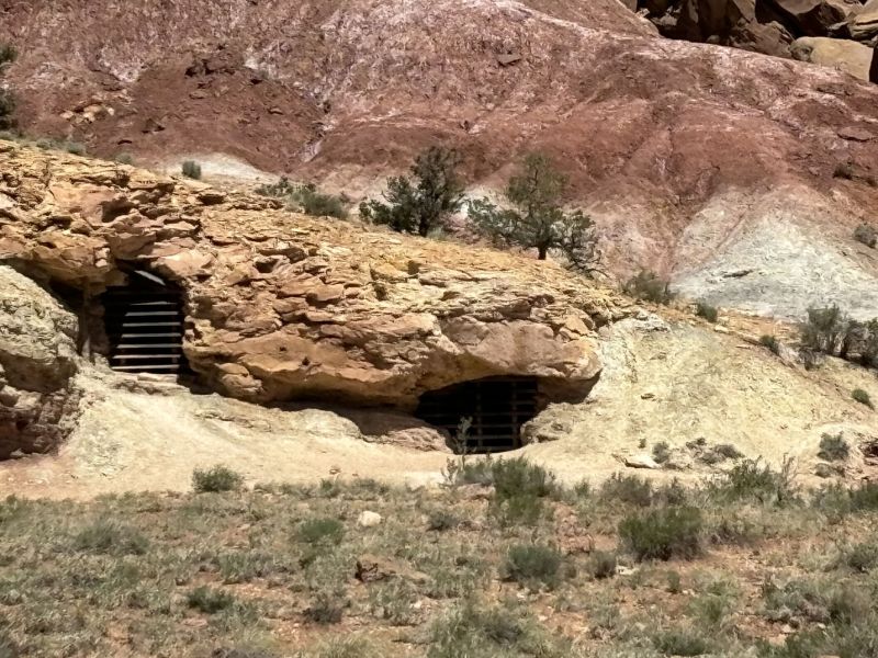
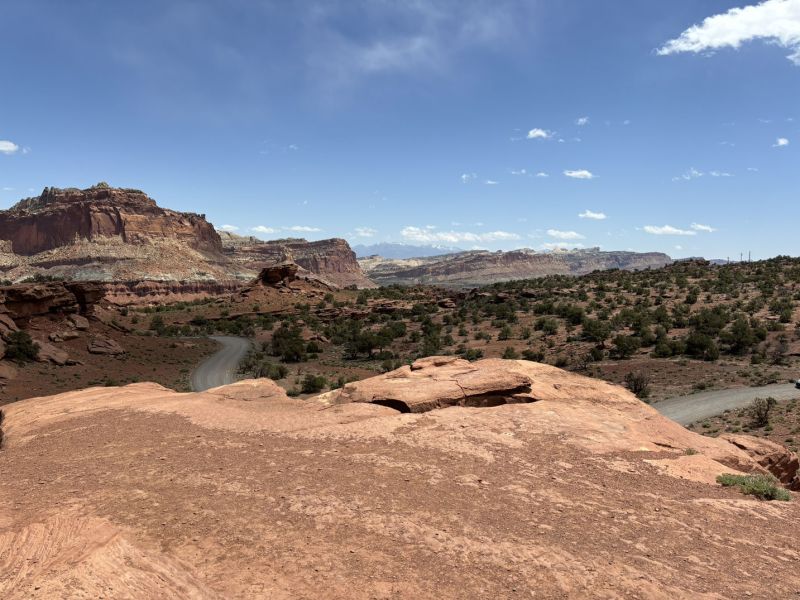
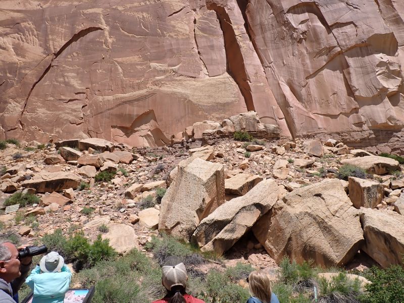
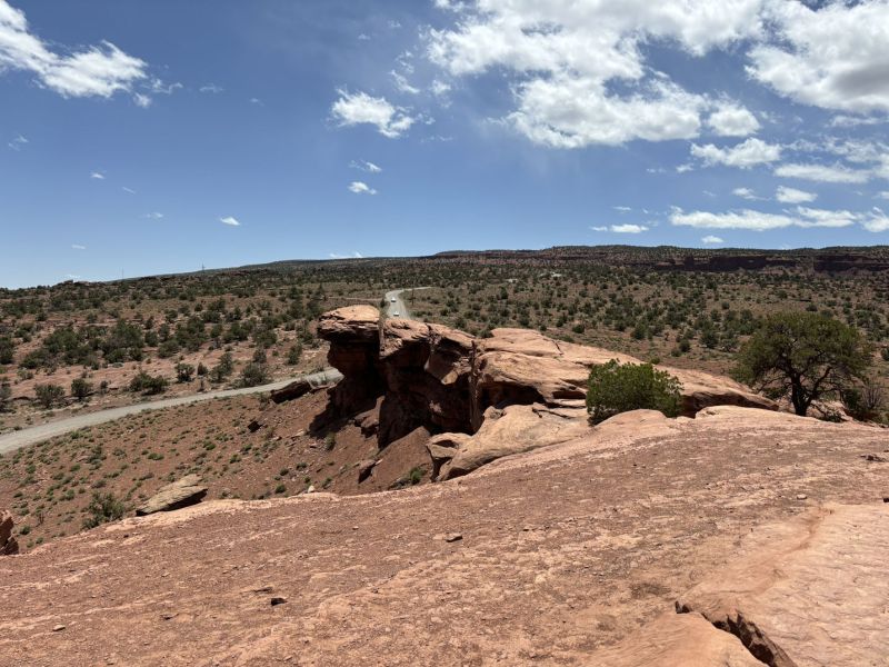
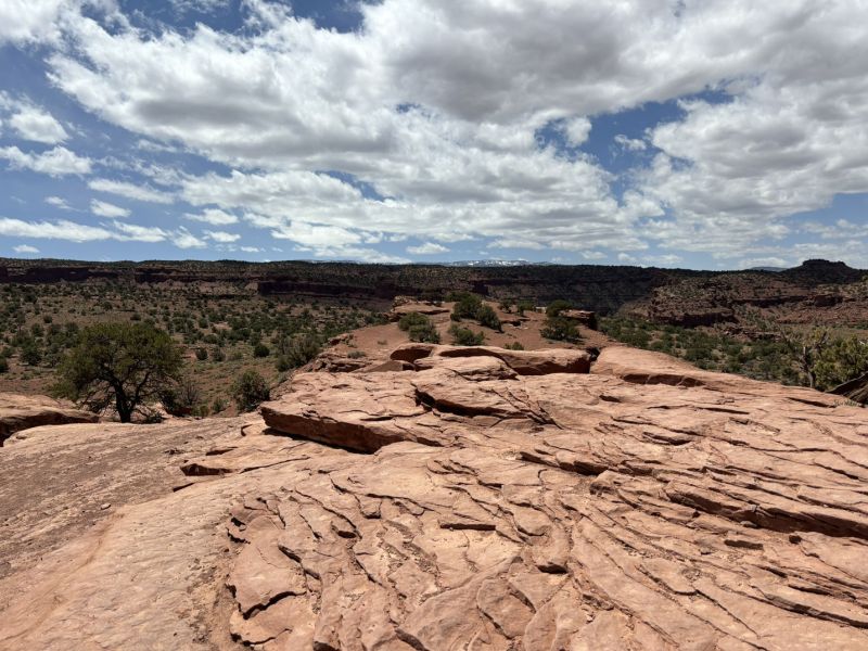
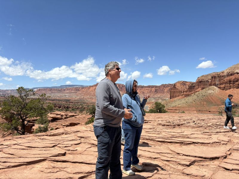
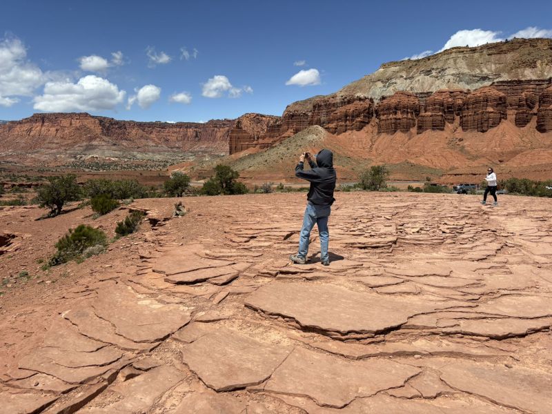
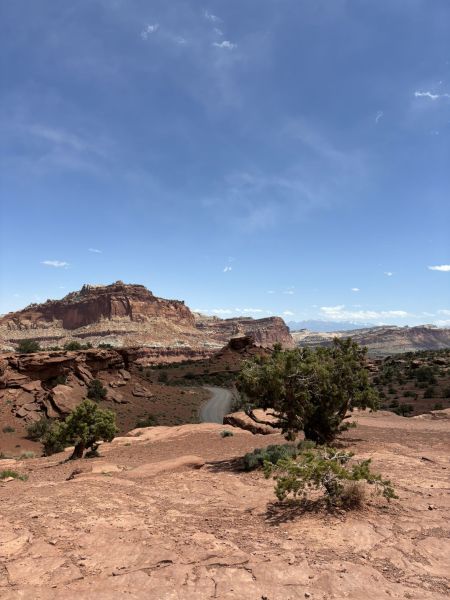
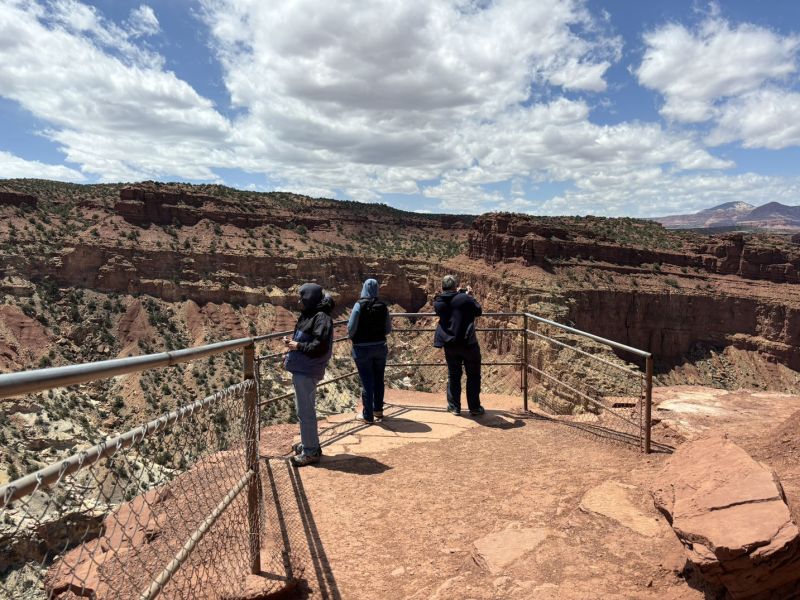
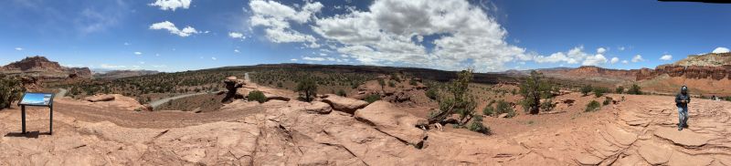
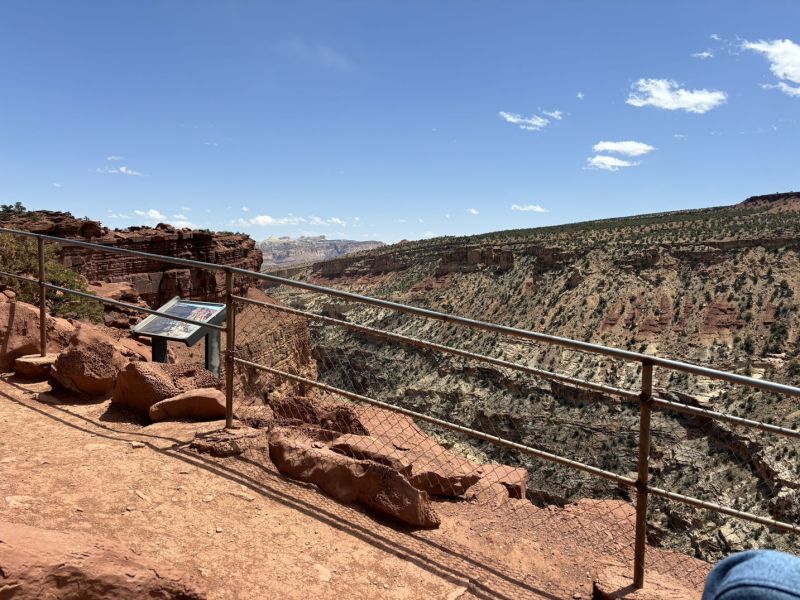
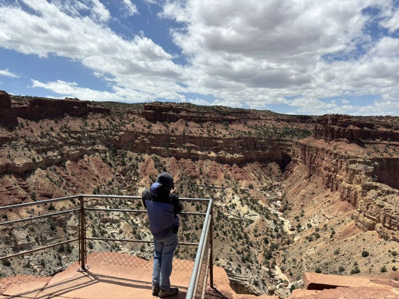
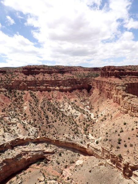
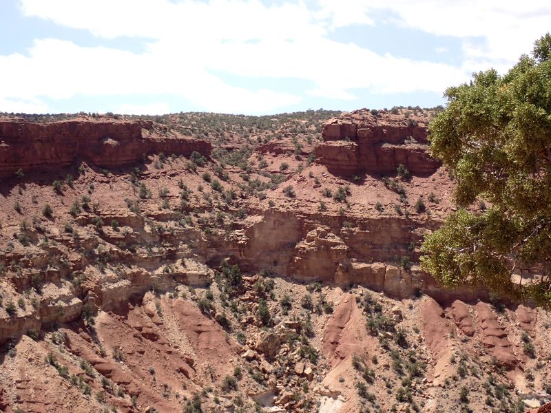
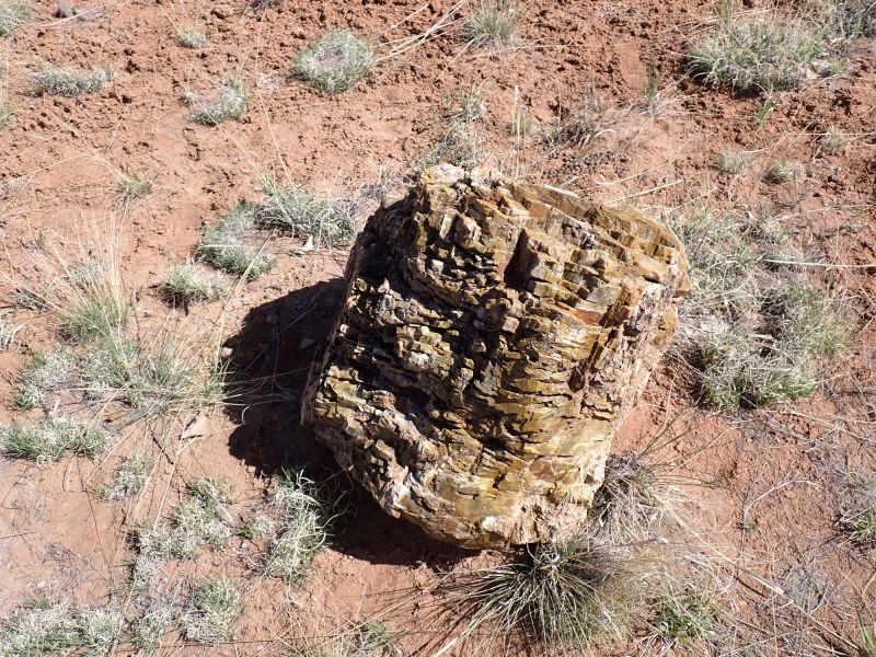
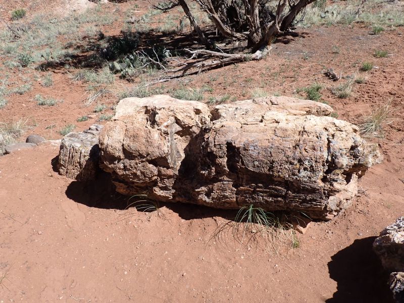
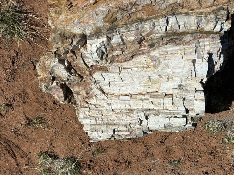
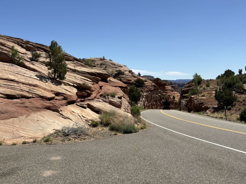
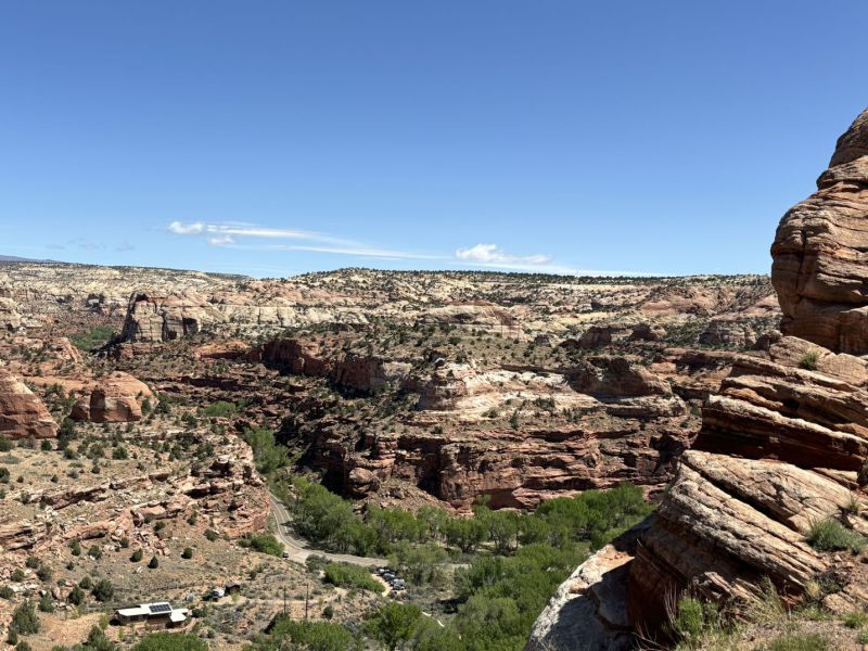
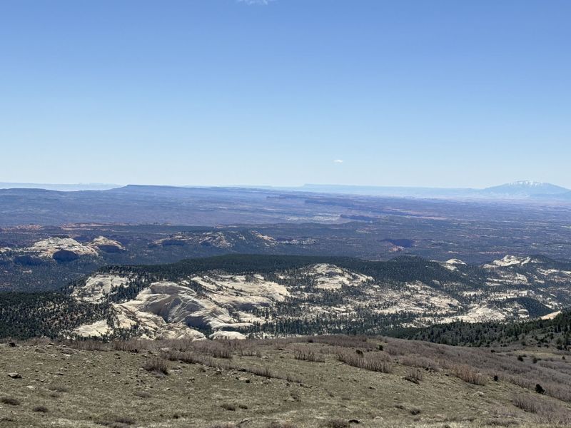
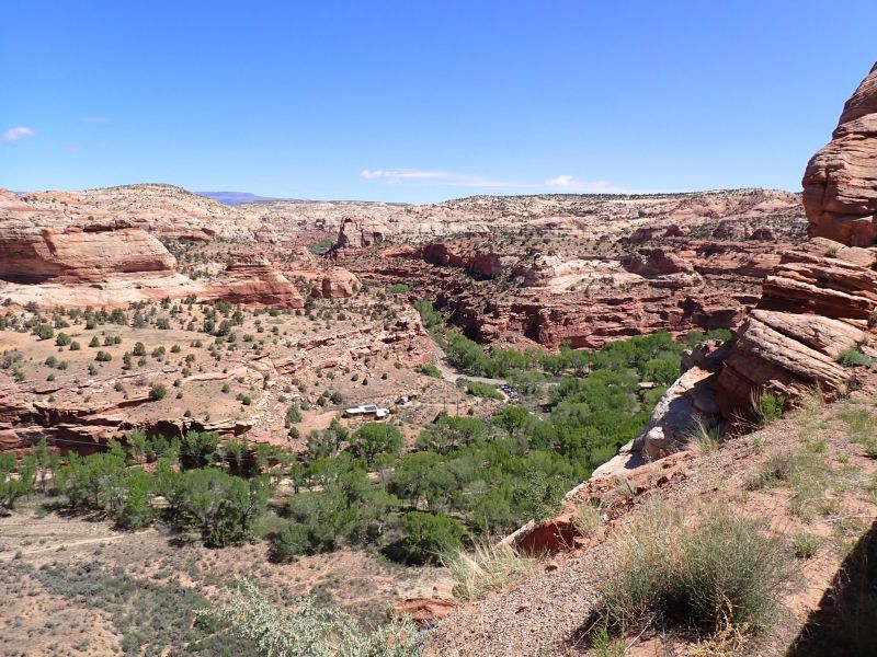
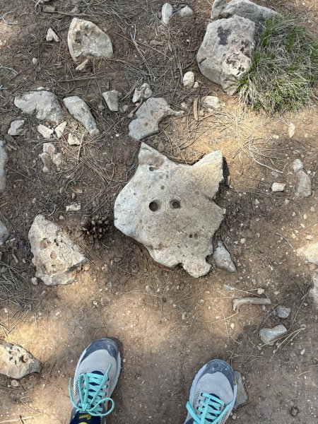
We arrived at Capital Reef on the day that they closed the majority of the scenic road for the entire summer to facilitate repairs and rejuvenation. However, we were able to get to Grand Wash along the shortened scenic road which was our long hike trail selection. While the full trail goes from the scenic road through to state highway 24, we opted to do a 3.8 mile out and back portion from the trailhead parking area through the Narrows area. The Wash is an up to 850-foot-deep canyon resplendent with geology and rocks everywhere. We had decided that the canyon walls were about 150 to 200 Joni’s high based on a visual estimate. The hike began with chilly and blustery weather. However, once in the canyon, the winds were blocked, and the sun warmed it up nicely. One of the social highlights of the hike was an encounter with a University of Alaska geology field trip class. Nice bunch of kids who seemed to be pretty focused on their task.
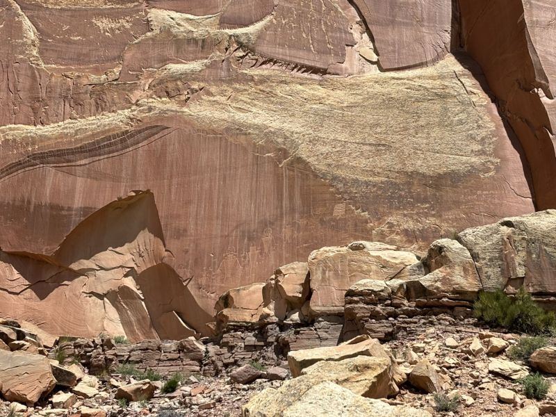
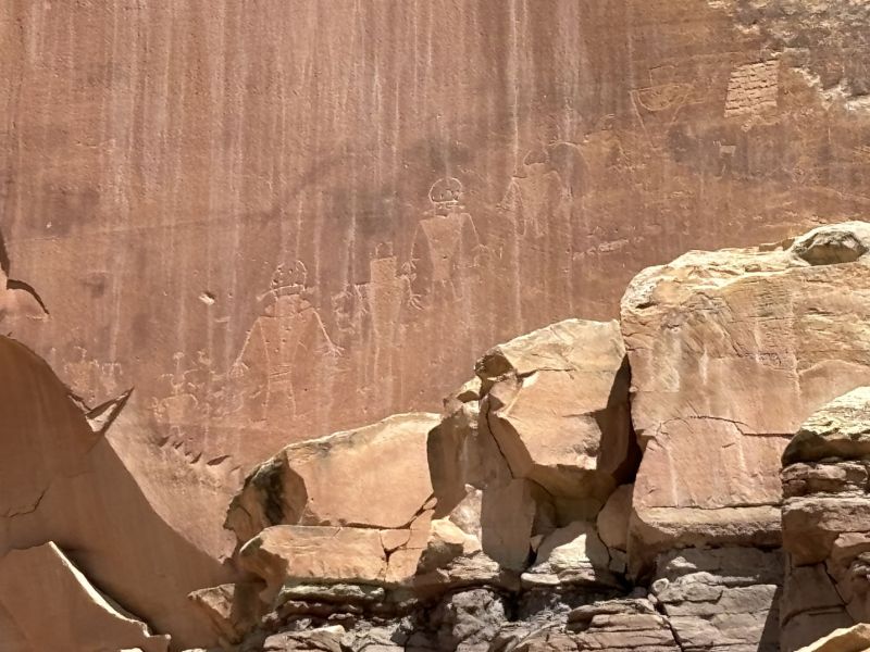
We also hit the Gifford House and bought a couple of pies, the petroglyph site along Utah Highway 24, Panorama Point and the Goosenecks before returning to a Mexican restaurant for the requisite post hike beer and feast.
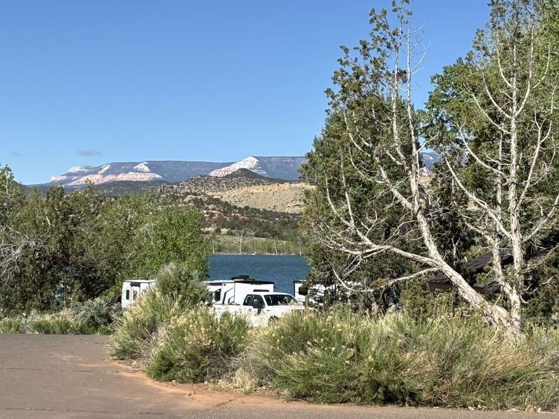
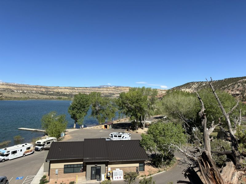
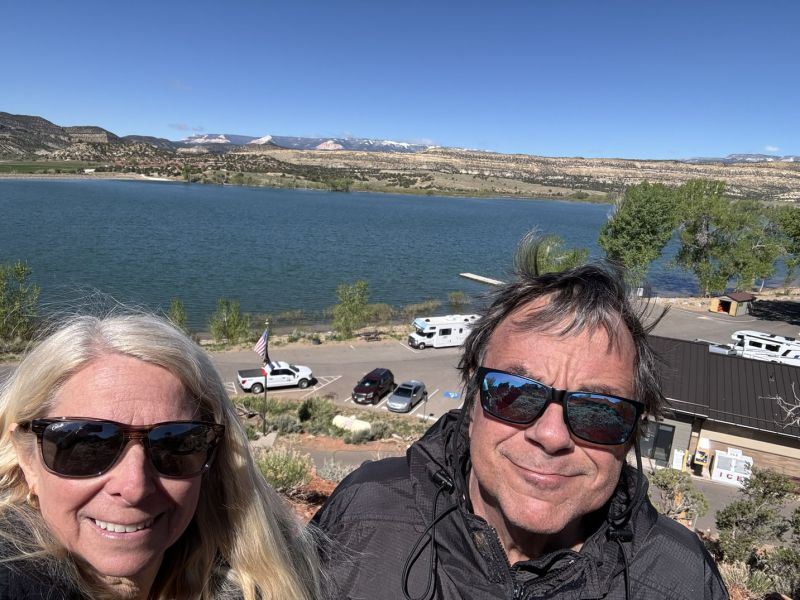
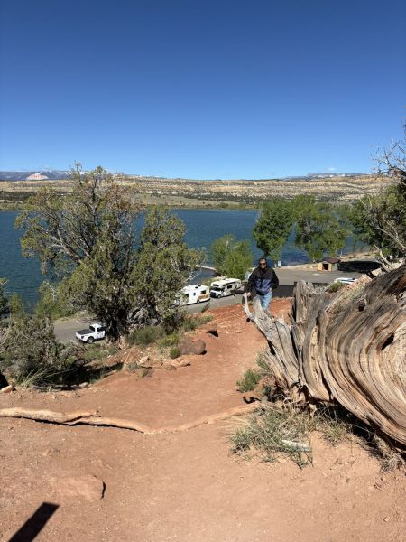
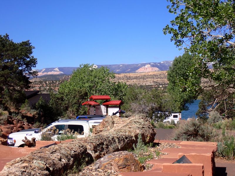
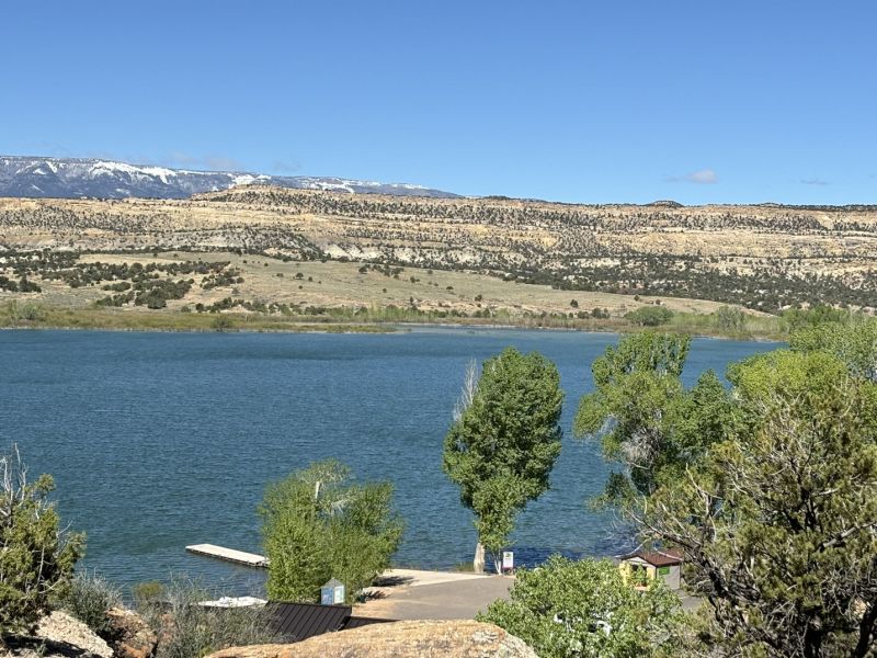
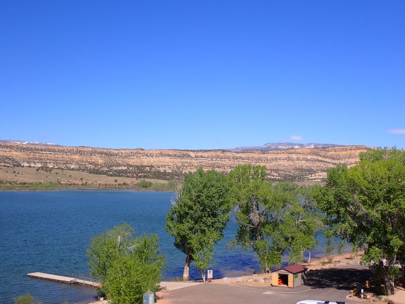
That wraps up the May Southern Utah trip. We had a great time with Joy, Larry, Cheyenne and Louie and thoroughly enjoyed their hospitality and the opulent RV accommodations. As I have aged, I appreciate the whole concept of more or less regular showers, no-fuss hot coffee in the morning, cold beer in the evening and flush toilets even while “roughing it”.
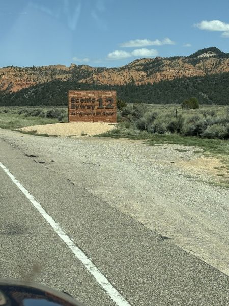
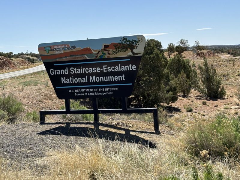
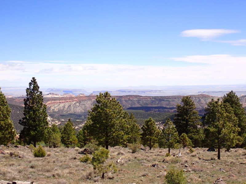
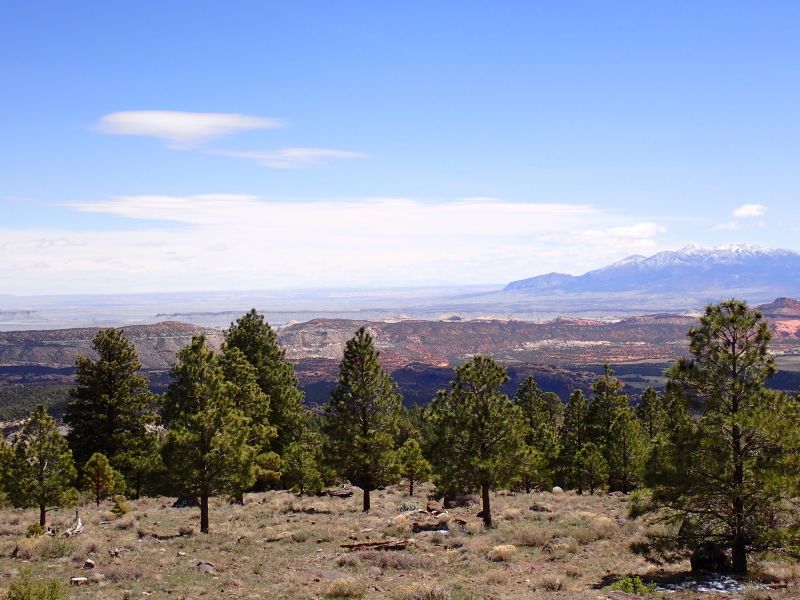
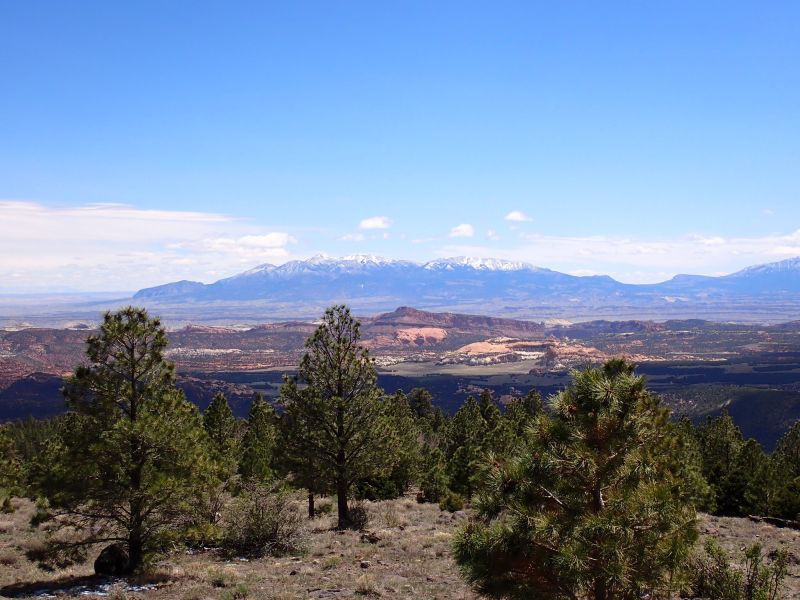
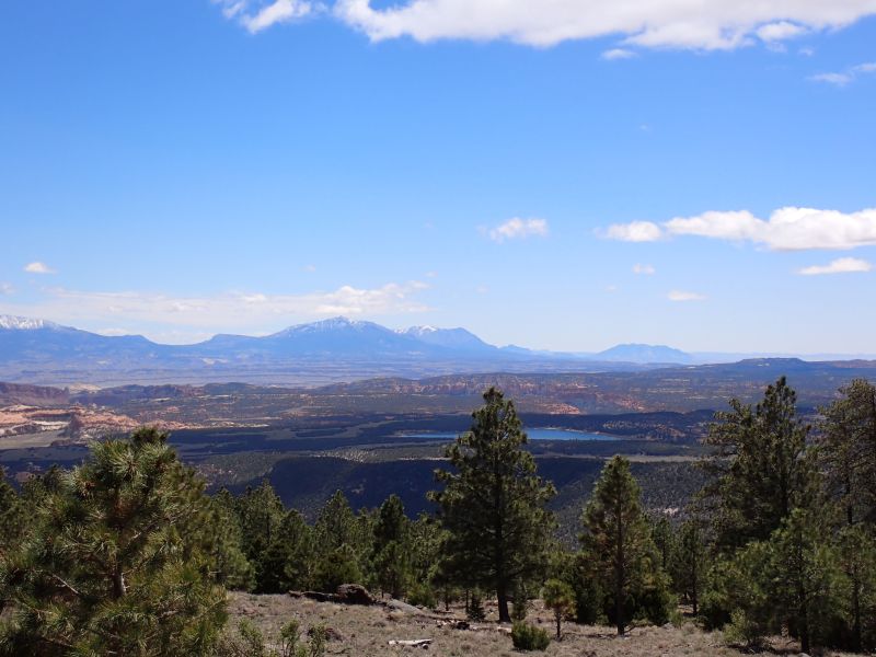
If you have not traveled Utah State Highway 12 from Bryce Canyon to Torrey, Utah, (Capital Reef NP) it is well worth the trip. Joni and I left Ruby’s as Joy and Larry were working on getting the snow cleared off of the Motorhome slides and we headed east for our adventure. Because of the numerous grades and winding road, Joy and Larry elected to head to Torrey on a more RV friendly road.
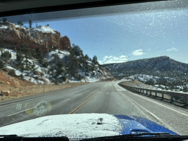
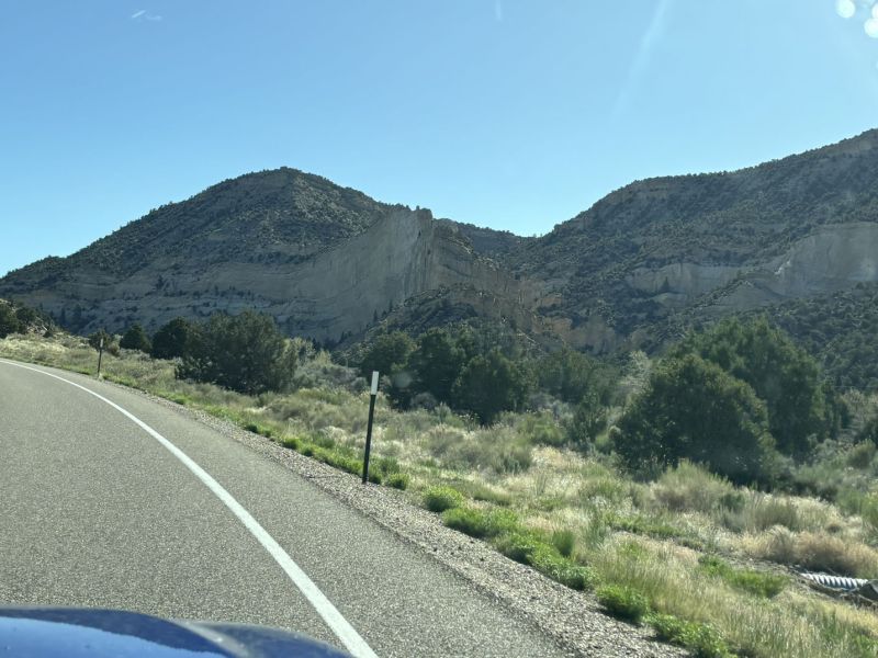
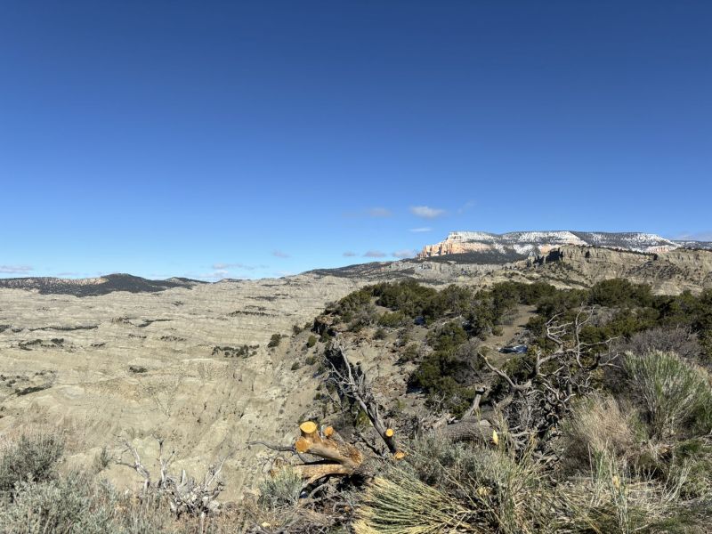
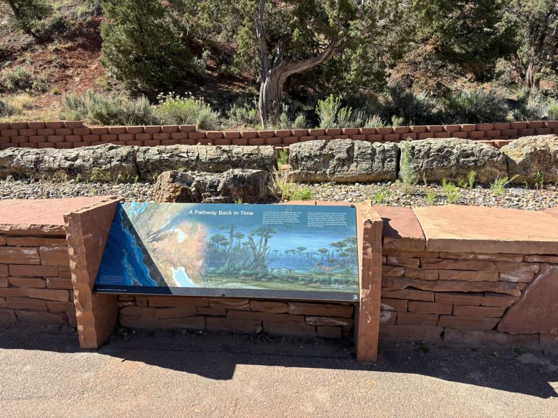
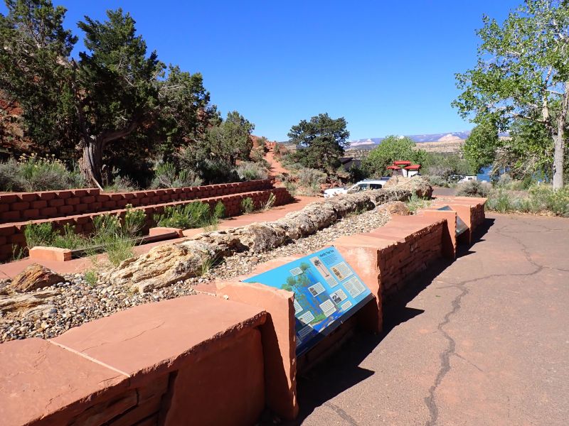
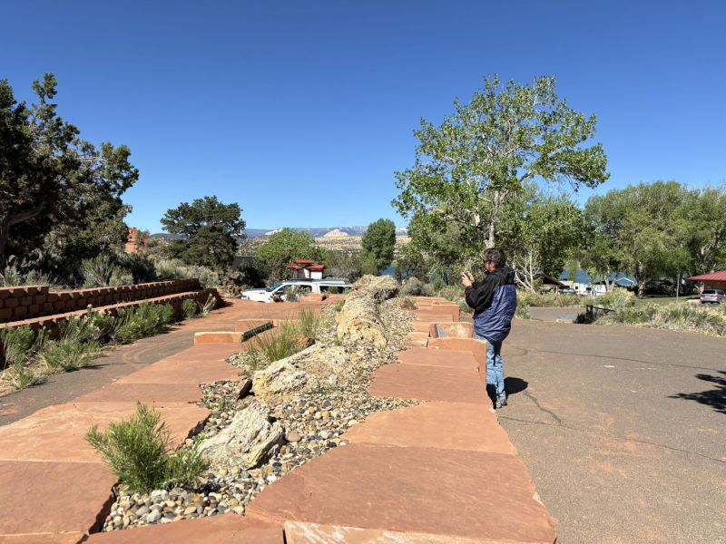
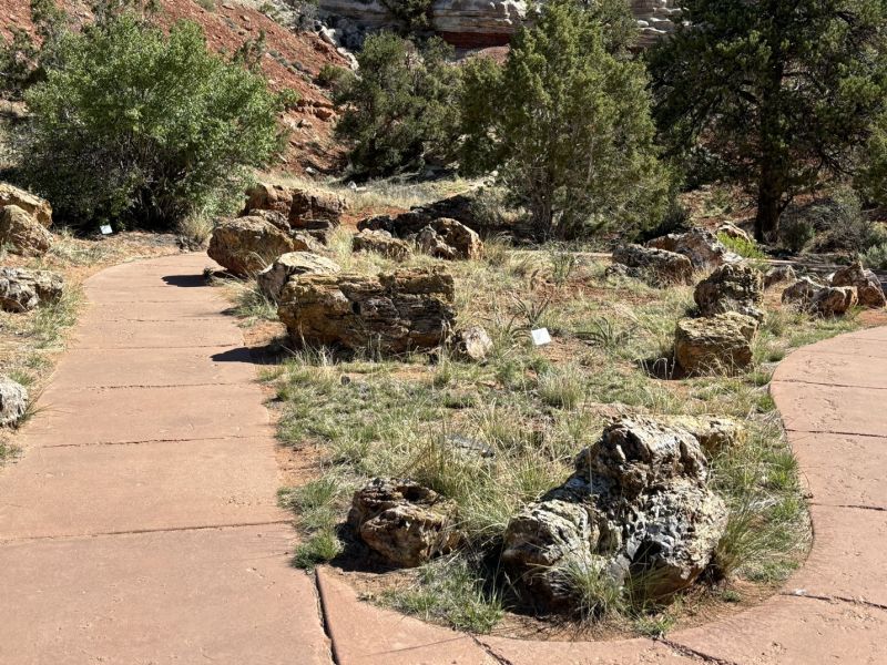
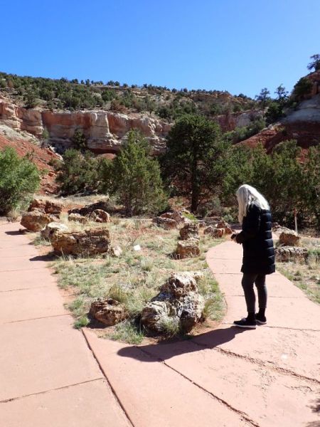
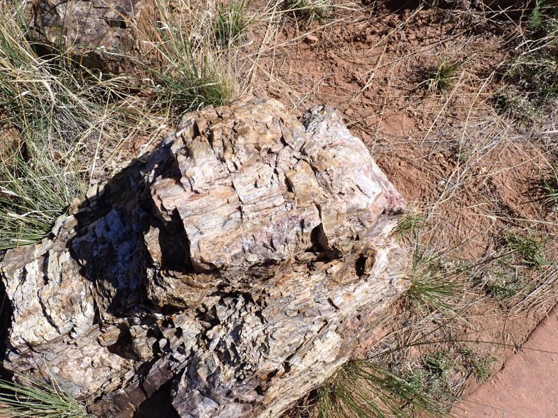
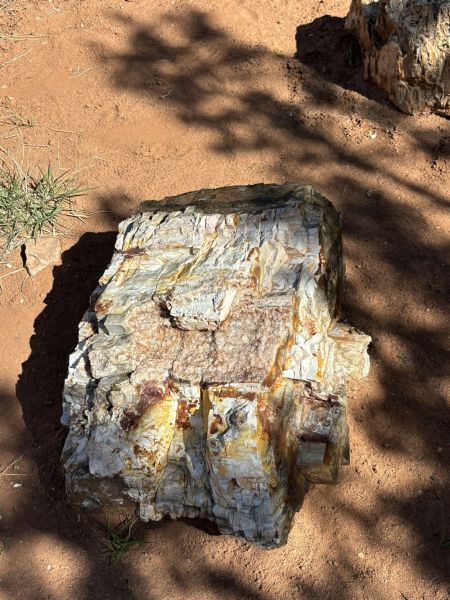
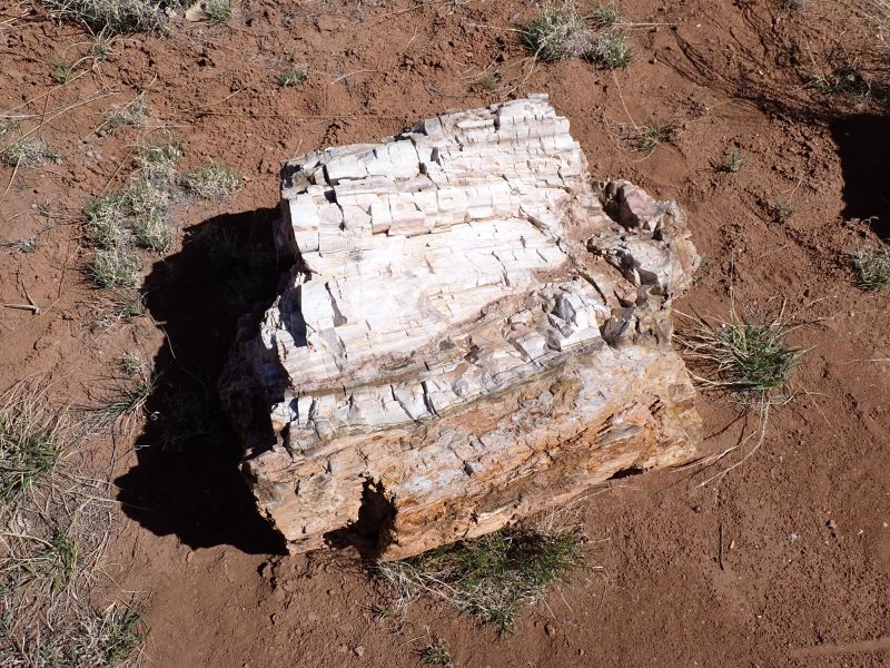
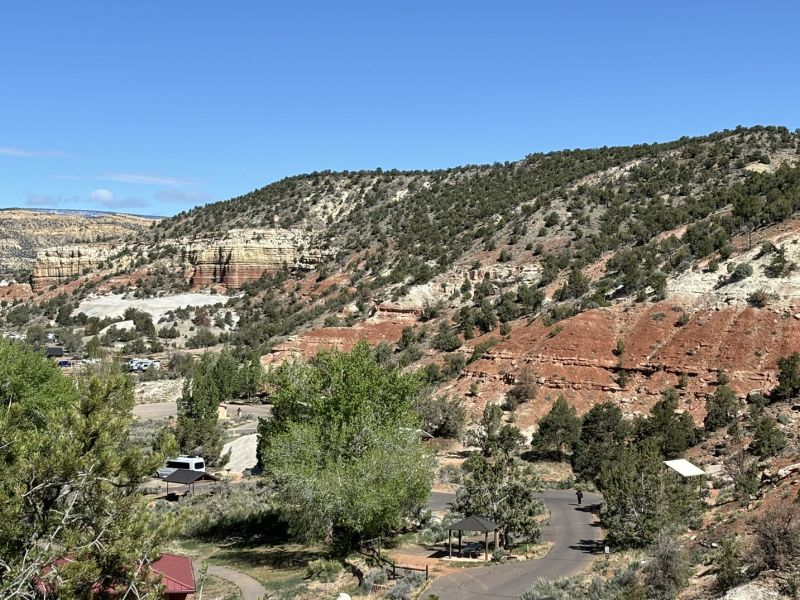
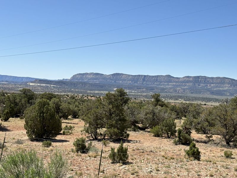
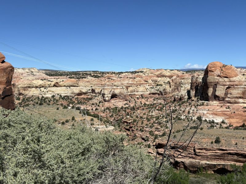
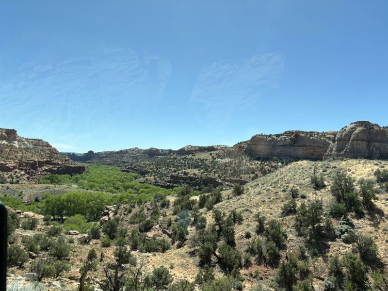
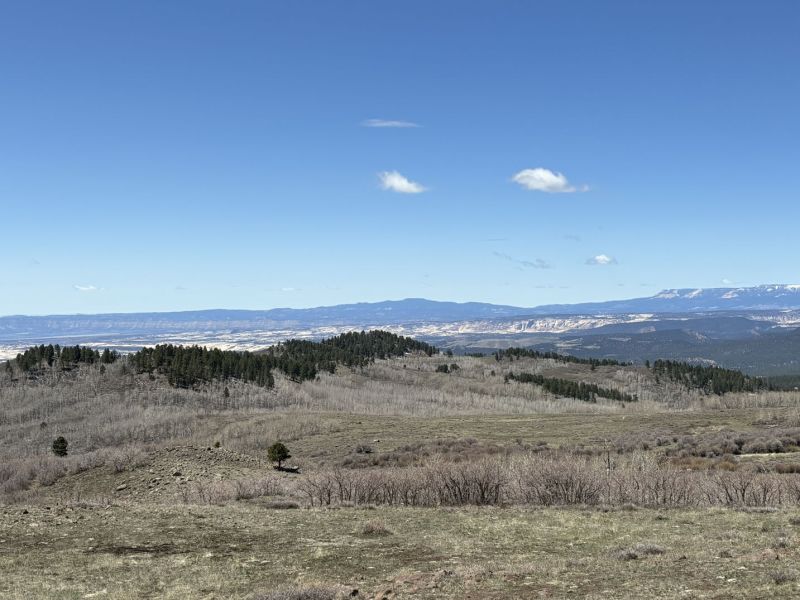
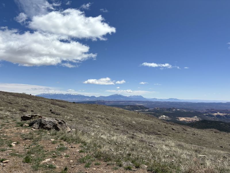
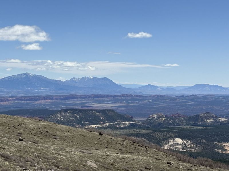
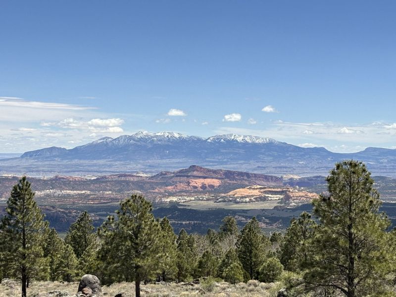
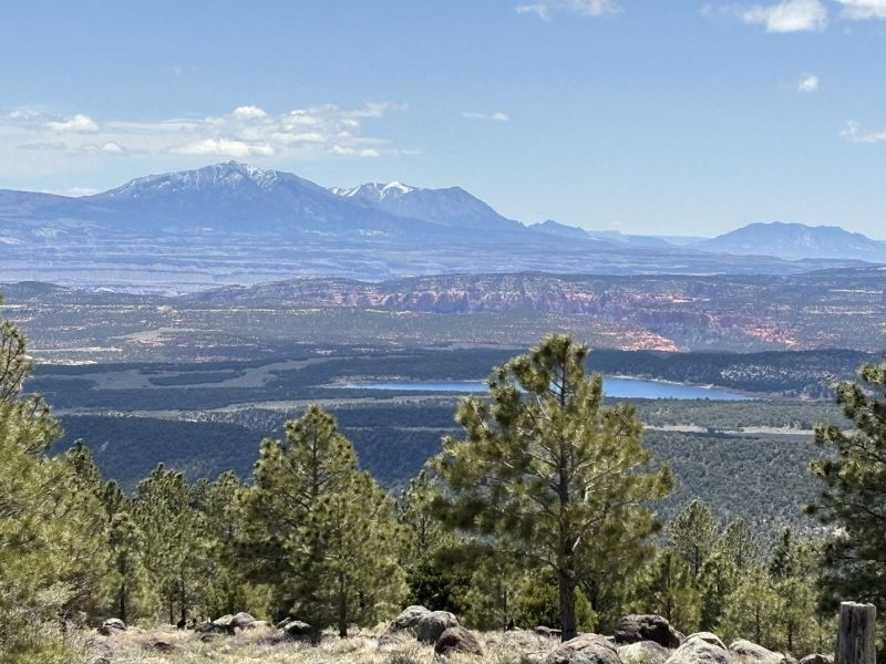
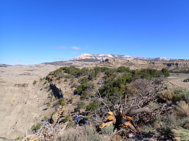
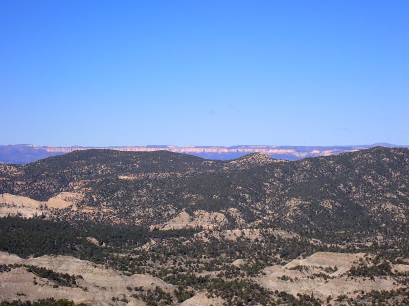
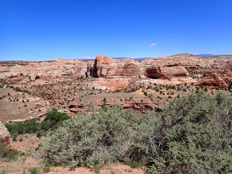
I could write about the enroute geology, but it would go on for pages. There were canyons, and passes, most with some snow from the previous days storm. There was the Escalante Petrified Forest State Park just West of Escalante, Ut with a fun little trail, large areas of surficial bedrock that the highway traversed and from a geologic perspective, cross bedding, red rock formations, sandstones, angular unconformities, faults and baby hoodoos. All coupled with huge vistas of awe-inspiring views. As we approached Torrey from the south the views were capped off with 180-degree views of the Waterpocket fold (Capital Reef) and the Henry Mountains rising behind Capital Reef.
This one is just going to have to go with pictures.
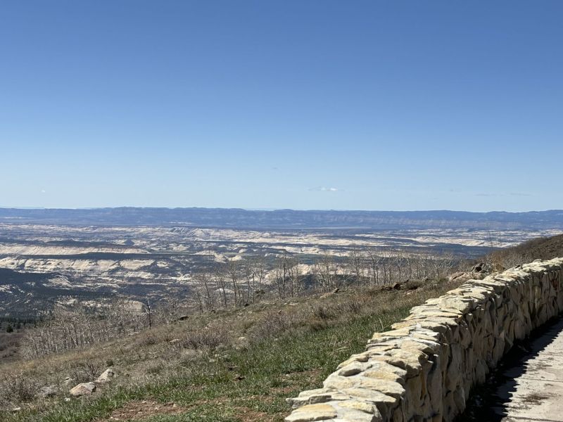
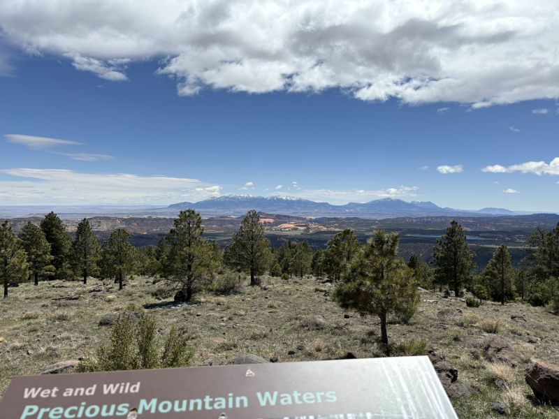
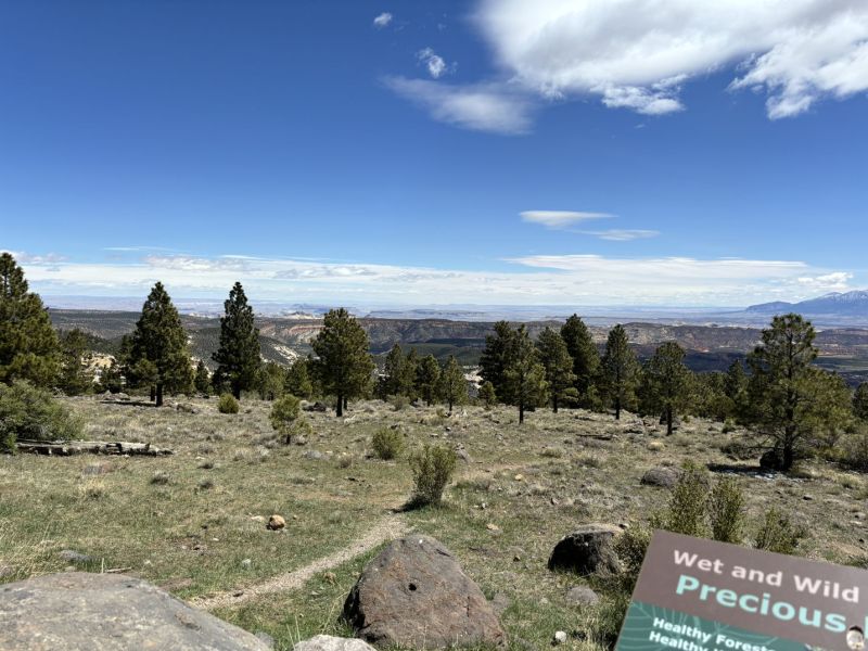
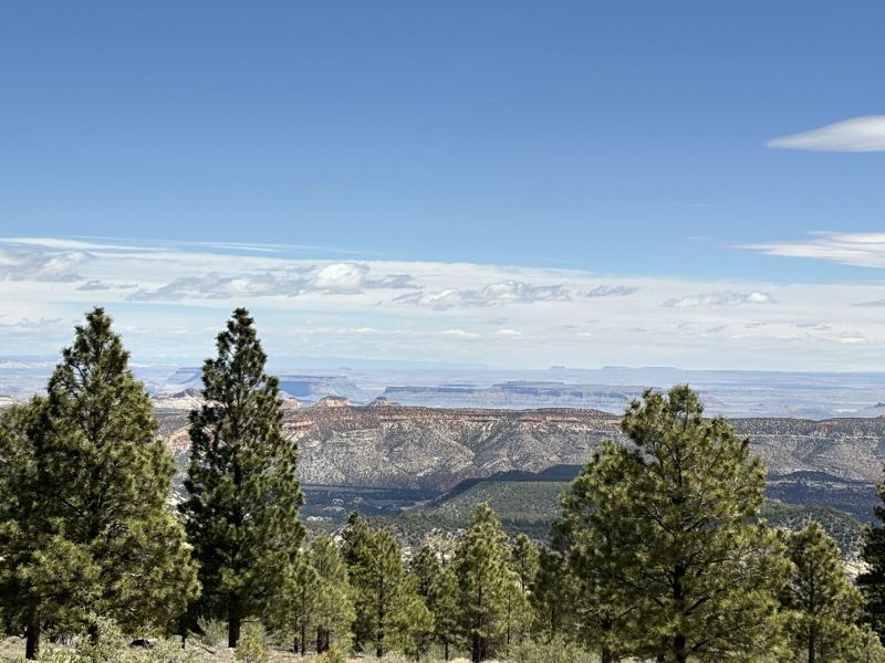
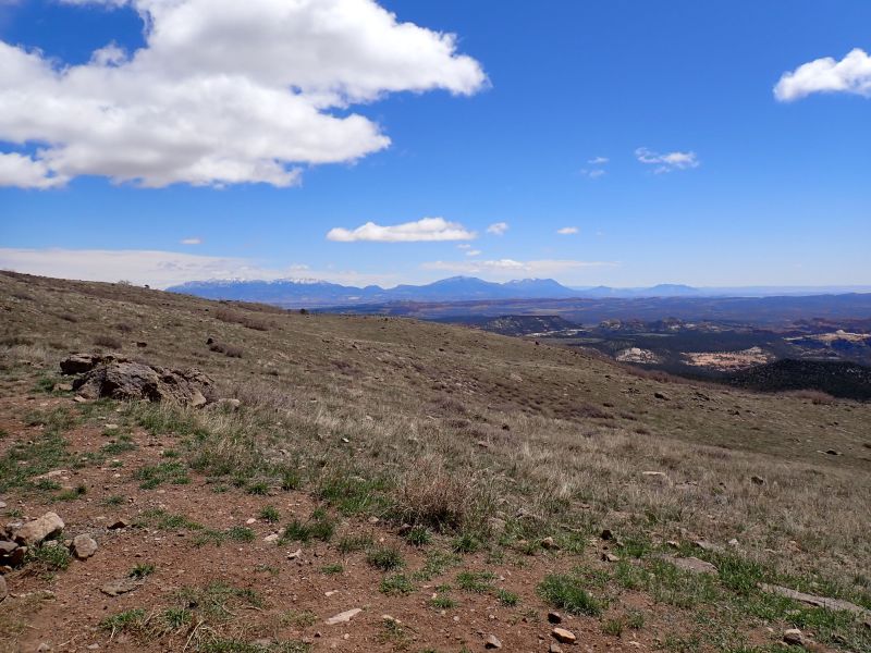
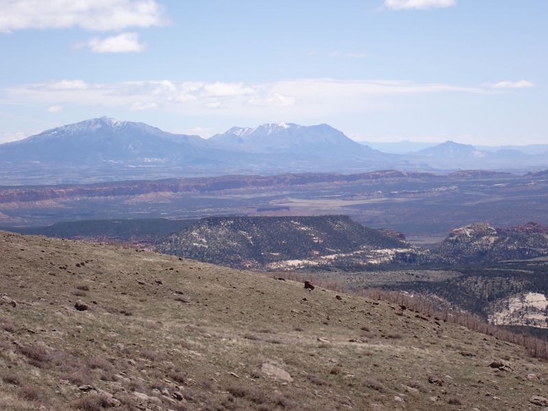
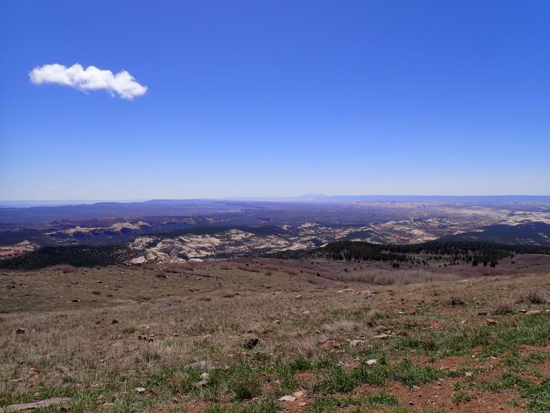
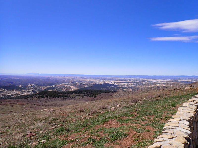
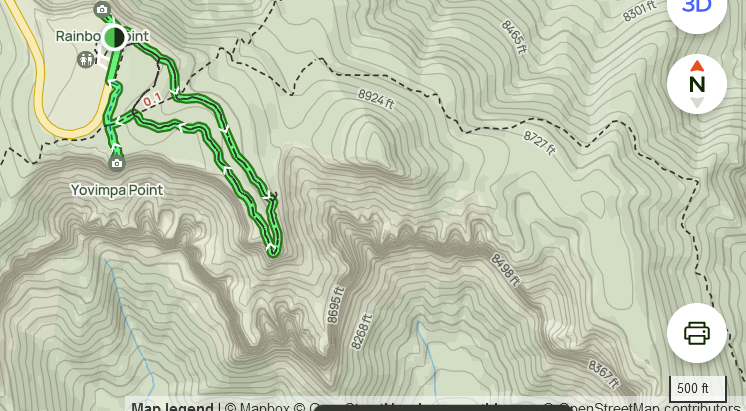
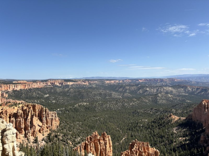
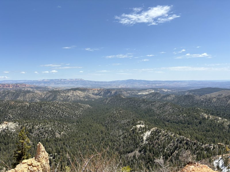
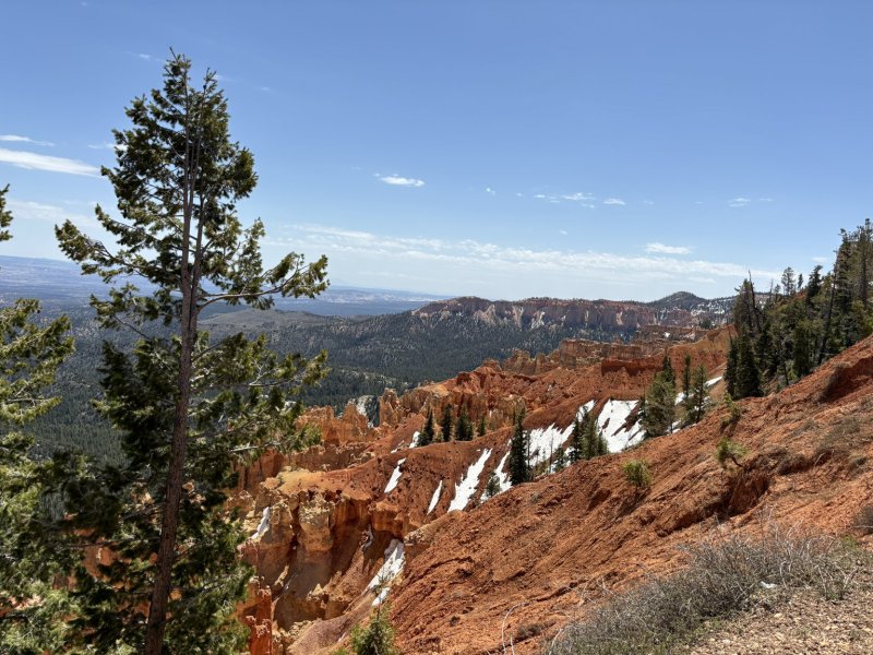
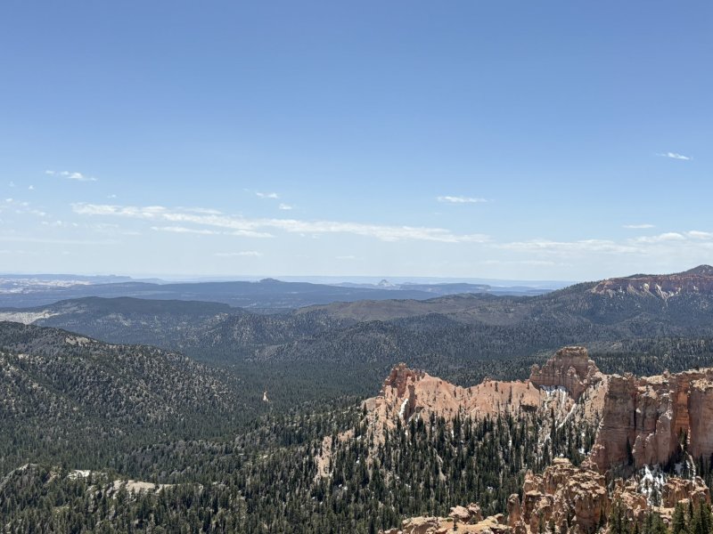
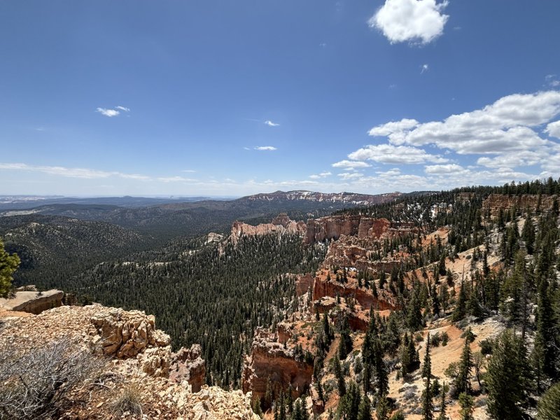
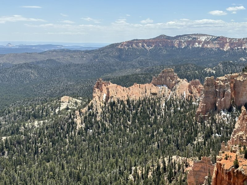
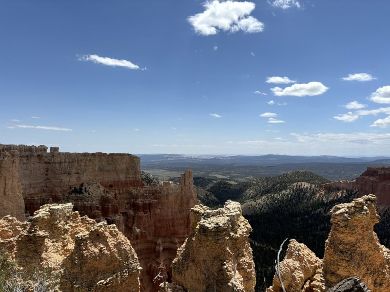
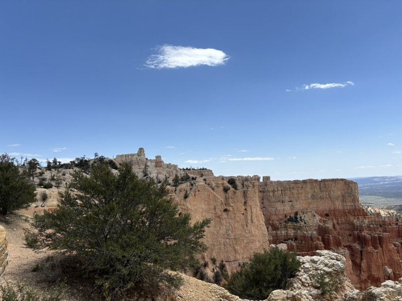
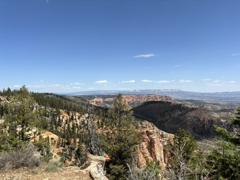
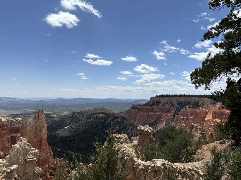
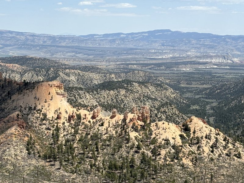
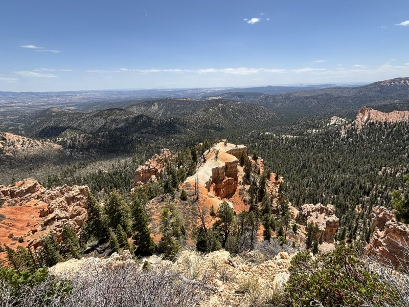
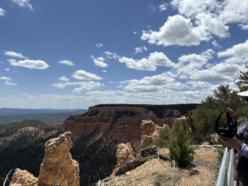
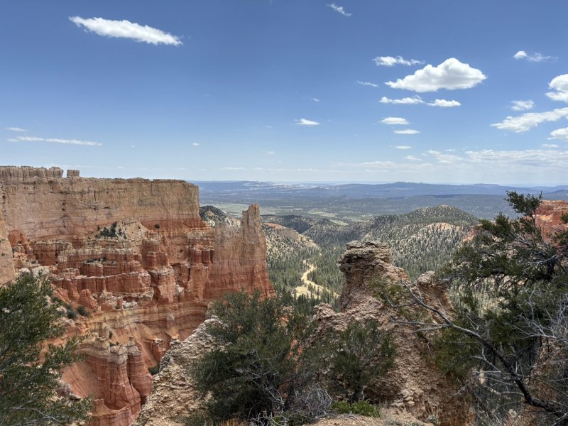
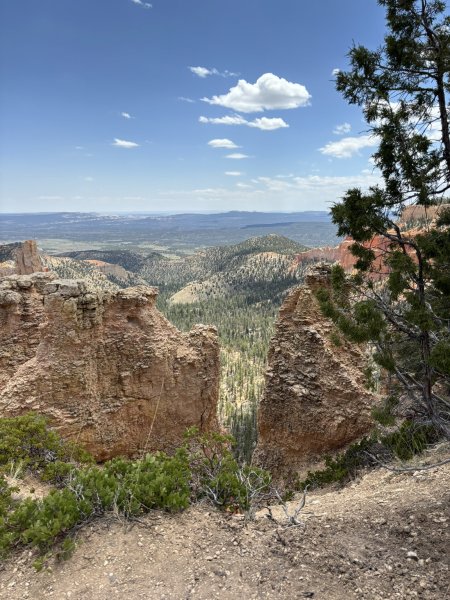
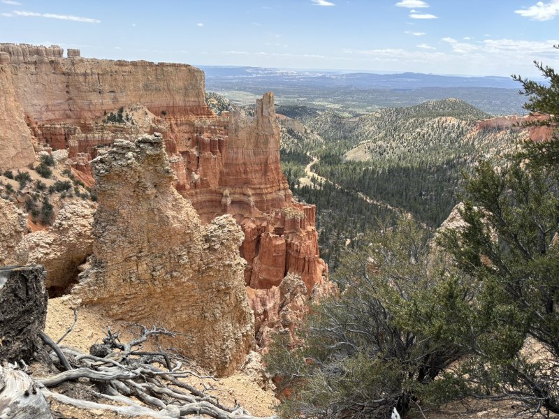
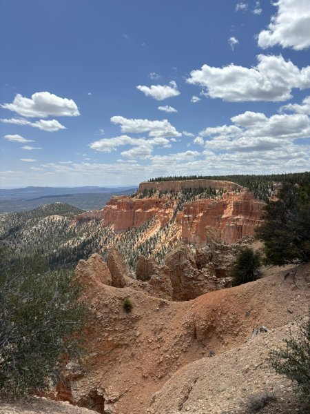
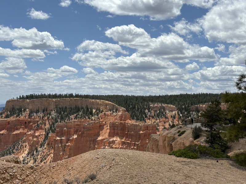
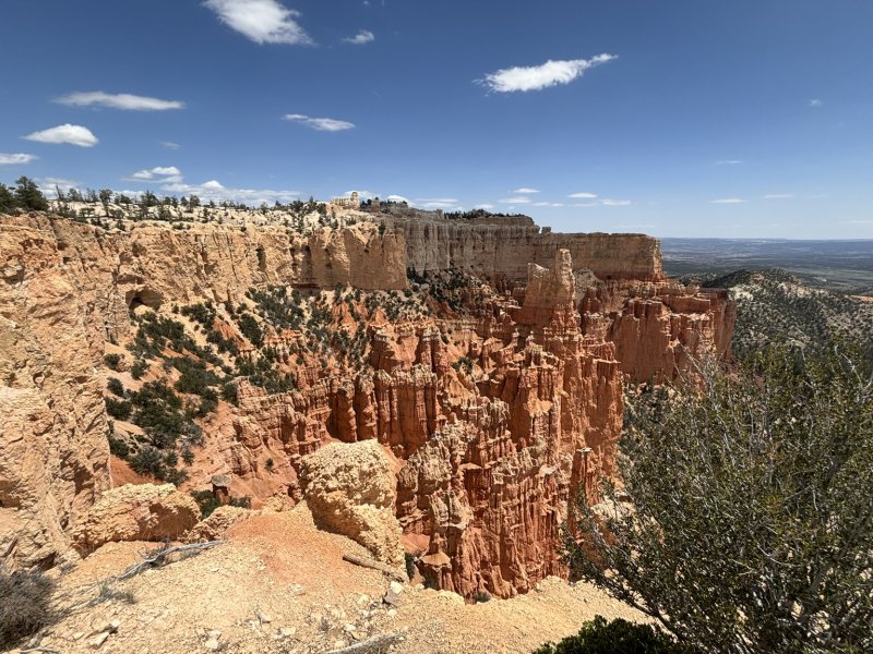
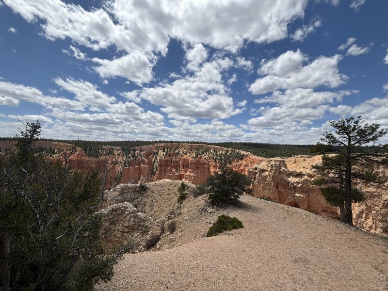
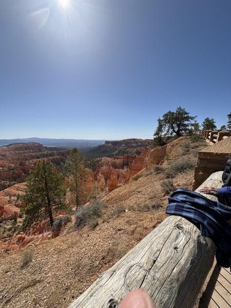
Day 2 of park exploration was decidedly lower key with all hiking being short jaunts along the amphitheater rims. We started at the far south end of the Bryce Canyon Scenic Drive at the Rainbow Point, Yovimpa Point, and Bristlecone Loop Trial which is a low key 1.4-mile loop with spectacular views to the northeast, southwest and south. For those not well versed in topographic maps, we stayed in the area where the contours were further apart, thus saving our thighs and calves from further abuse.
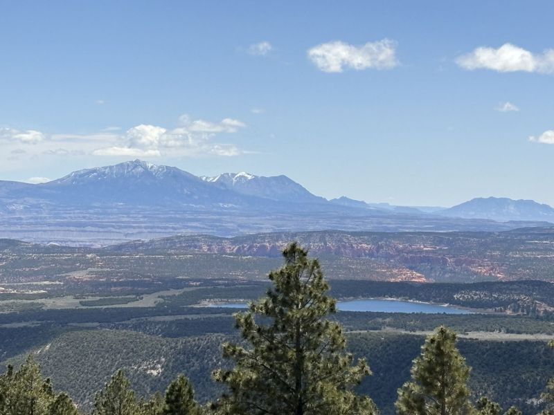
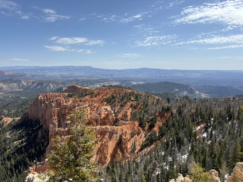
Heading back north, we stopped pretty much at every stop and overlook and OOHed and AHHed at the views. The picture set below includes those. We then stopped for an extended stay at the Natural Bridge Overlook for some pretty stupendous pictures and views. Continuing our travels north we stopped at Fairview Point and Piracy Point where there was a short rim walk of about 0.6 miles. Best part about hiking and walking was always the beer at the end of the day.
While staying at Ruby’s campground in the motorhome, we ate in with some great meals. Joni had made a large batch of Sangria and then a second batch which was well received. Joy and Joni had collaborated on menu items, and we ate like royalty. Mostly simple breakfast, lunch of cheese, crackers, cold meat, leftovers and dinners that included tri-tip and scalloped potatoes and other fine combos.
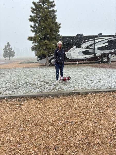
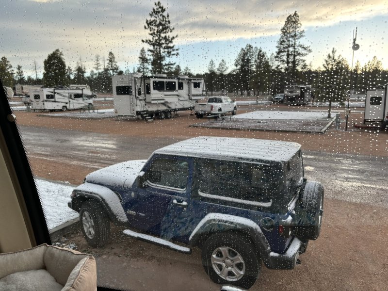
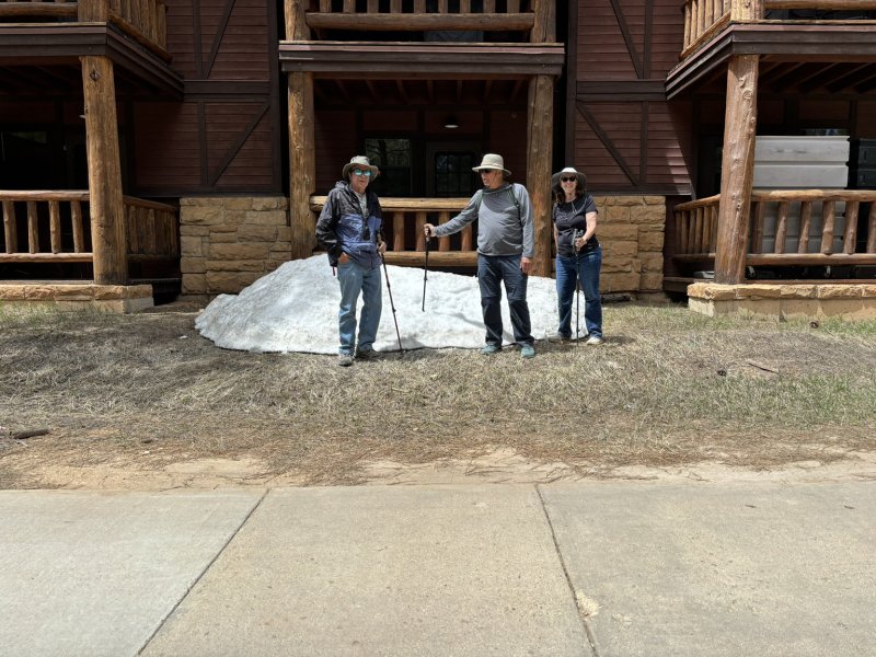
On the late afternoon and evening of the 4th, the weather started getting rough. The big RV was tossed. If not for the courage of the fearless crew and Sangria….. In any case, we had high winds and decreasing temperatures. We made a quick foray into the park on the morning of the 5th to stop at the park store and secure the obligatory knick-knacks then returned to the RV for a day of just hanging out. Larry and I tore into his wiper motor circuit which was not working and making travel in rain and snow somewhat unpleasant. We did not succeed in fixing it, but we did narrow the problem down.
The out of the gray of the western sky a slowly building snowstorm which because of the high winds and applying authors right to embellish, turned into a blizzard, garnered extreme interest for an hour or so.
Bryce Canyon – scenery, geology beer. All of the perks that pushed me into a 43-year career.
Posted inGeology, Travel and Scenery|Comments Off on Bryce Canyon National Park – May 4 – May 5, 2024
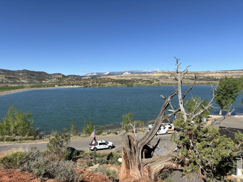
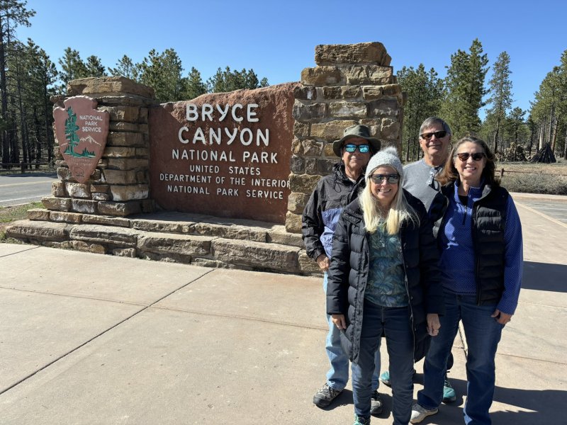
We met up with Joy and Larry at Las Vegas after driving north in the jeep and did a little Vegas sightseeing including trying out a beer garden right above the strip — very civilized and excellent beer selections. On leaving LV, we caravanned north to Bryce Canyon City where they had a reservation for the motorhome at Ruby’s RV Park and Campground (elev 7,661 ft asl +-). Based on the business names in the town, Ruby owns it all.
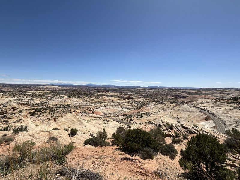
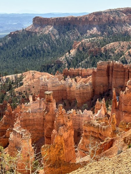
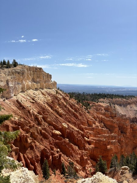
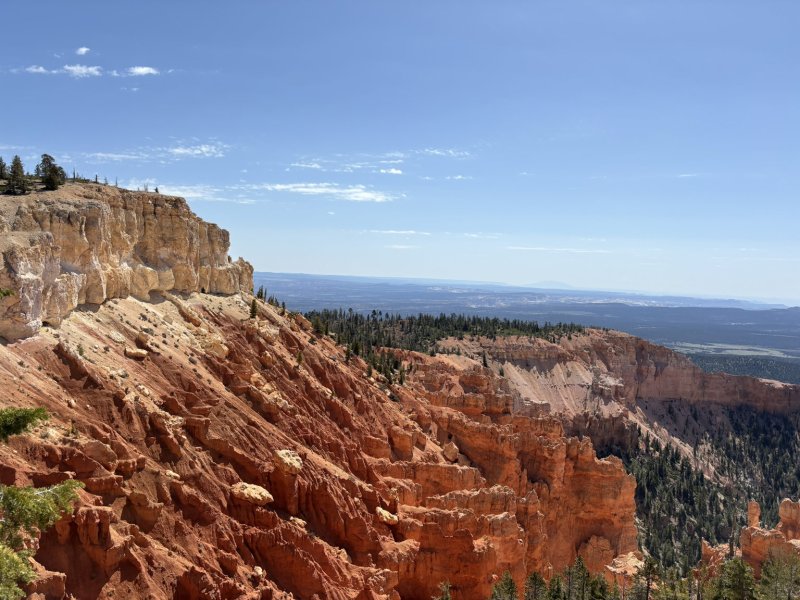
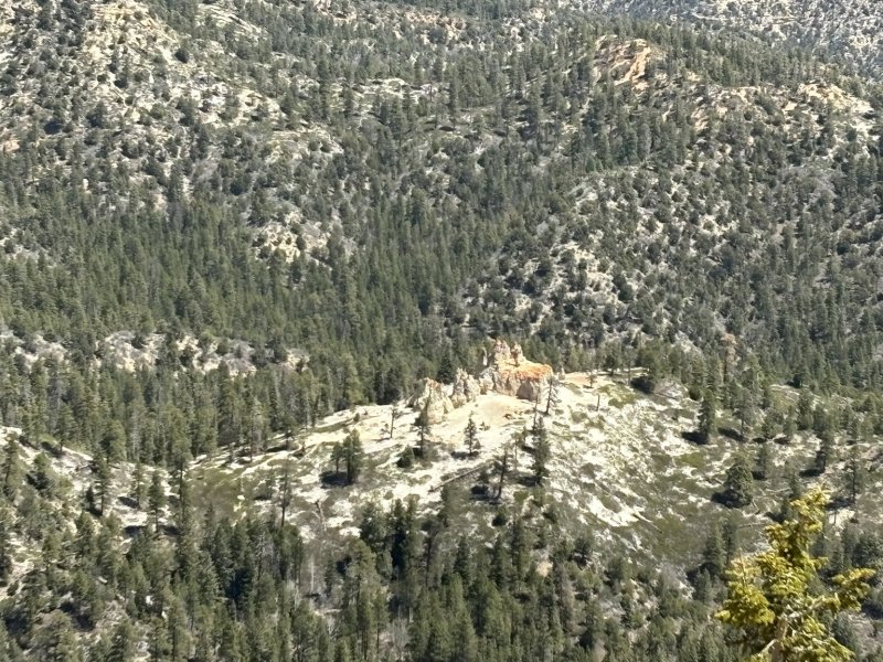
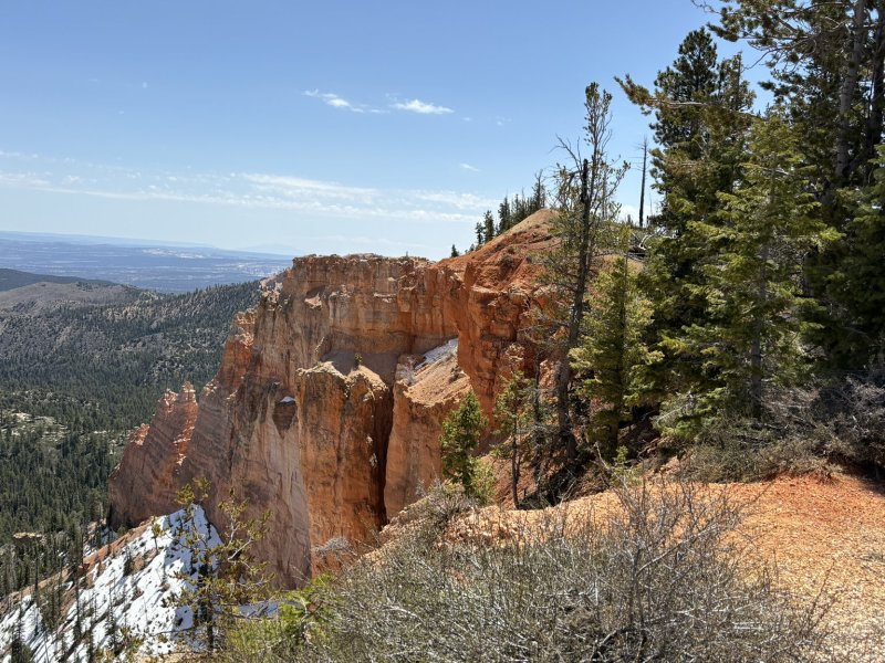
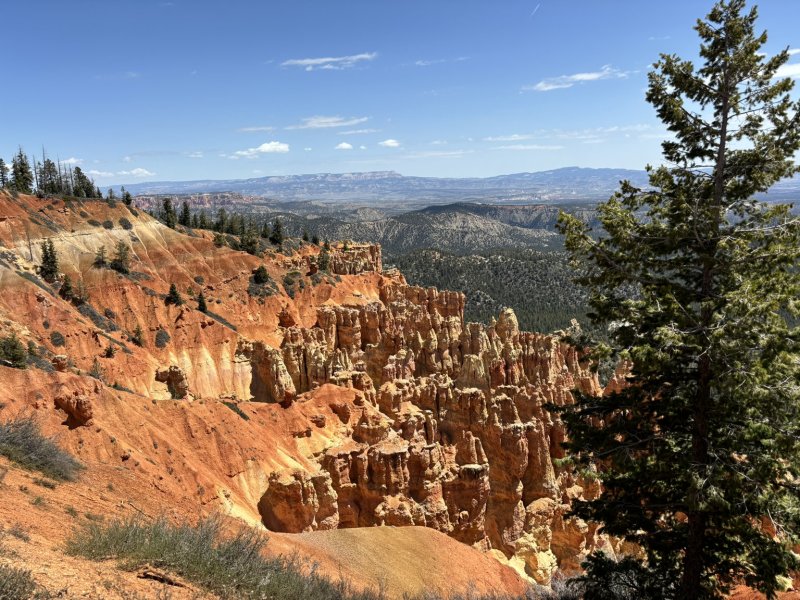
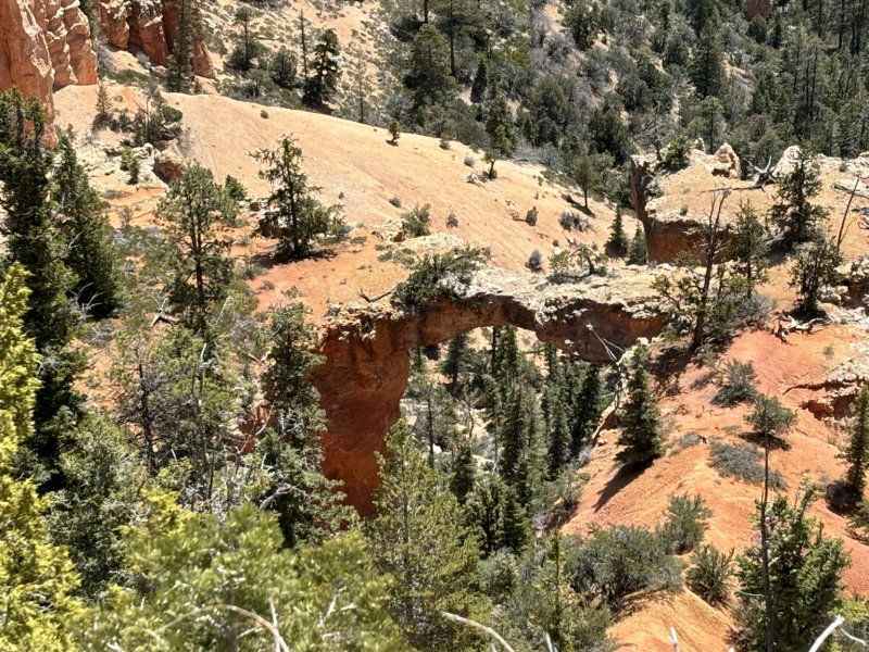
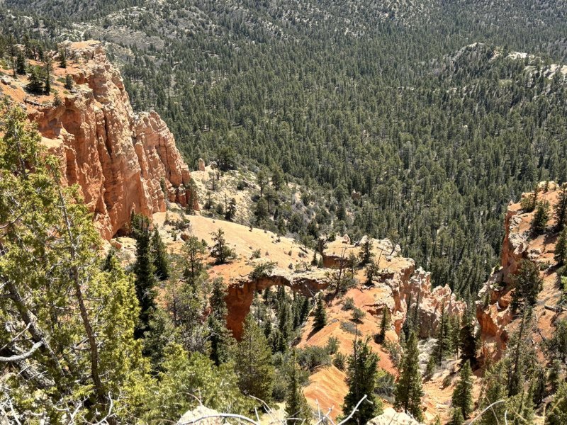
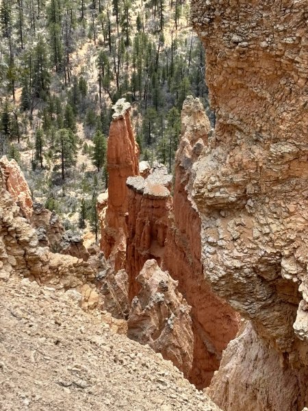
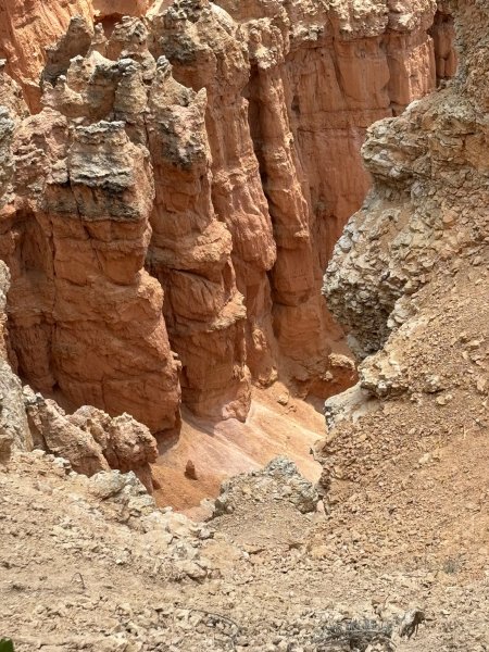
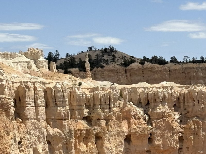
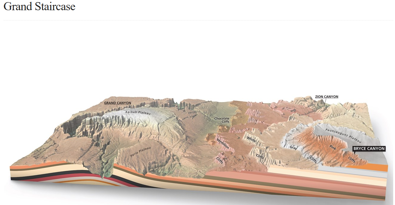
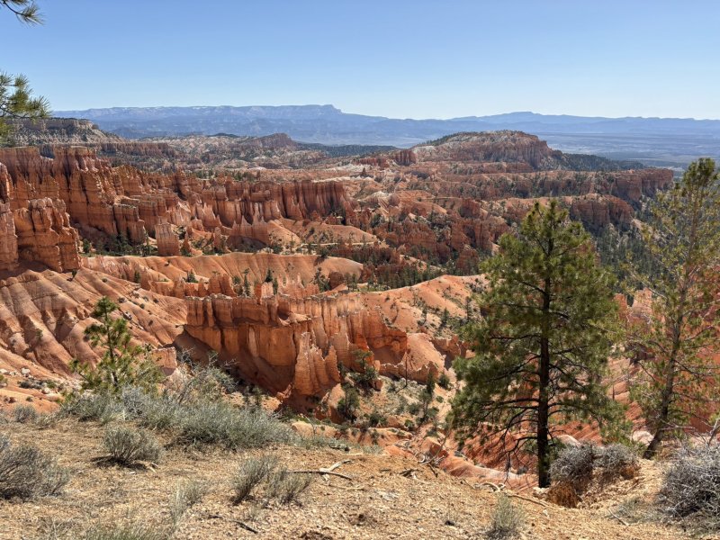
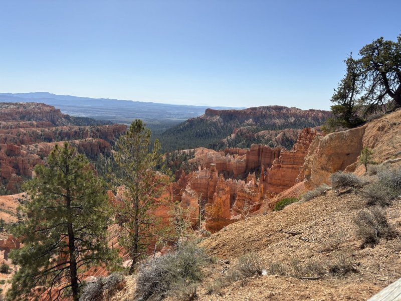
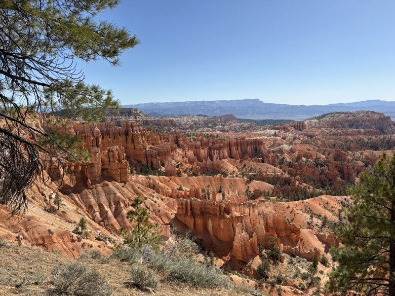
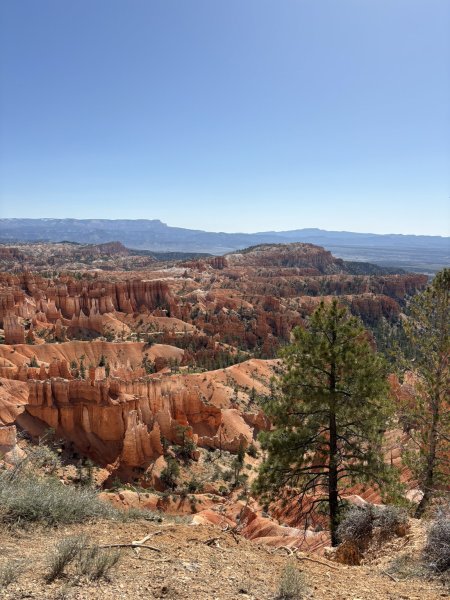
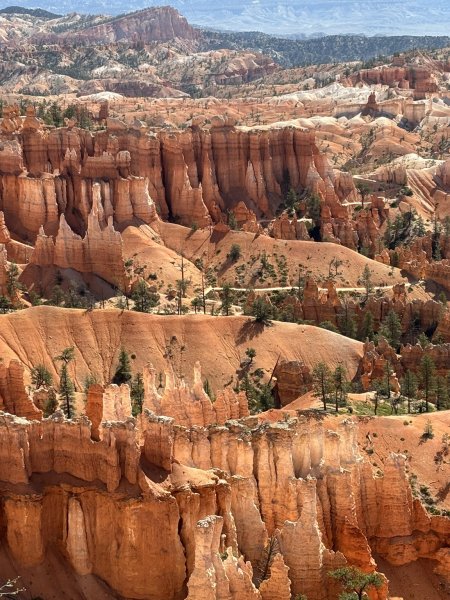
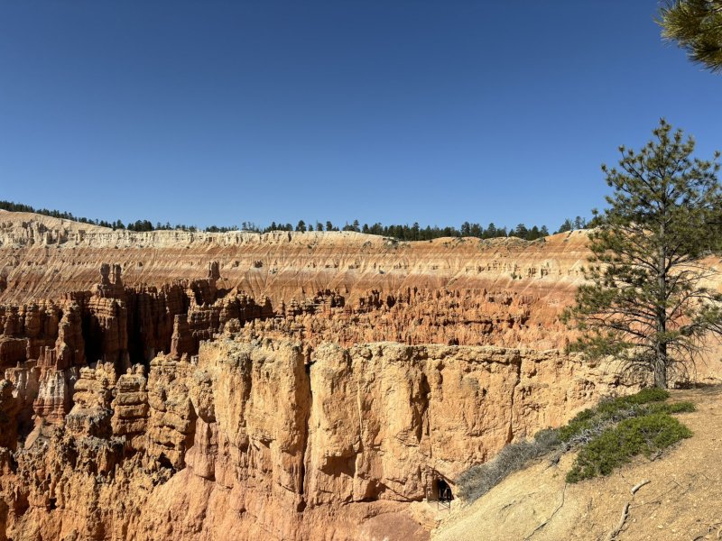
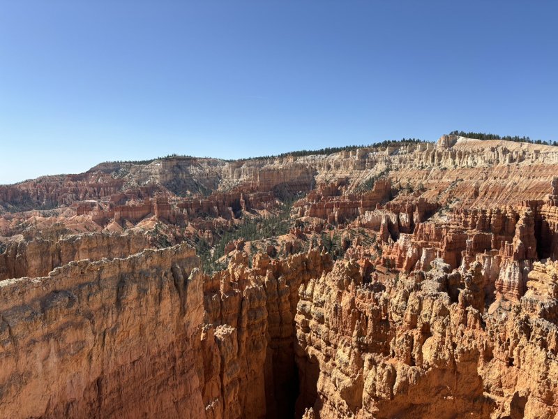
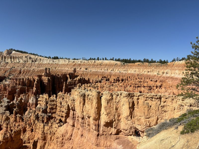
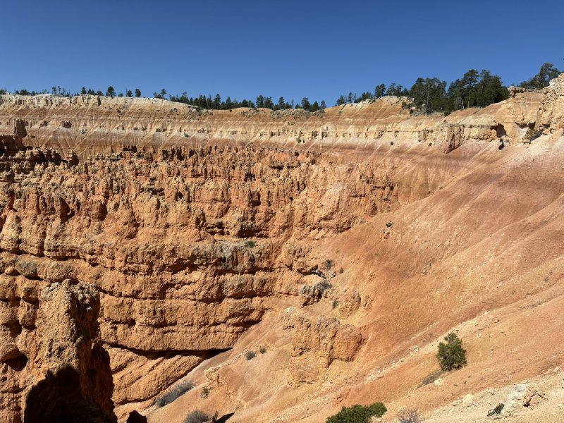
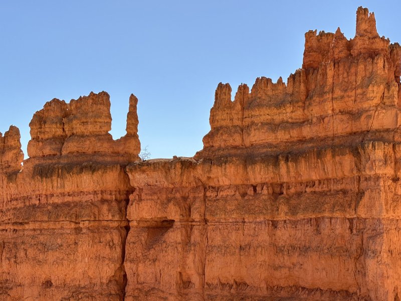
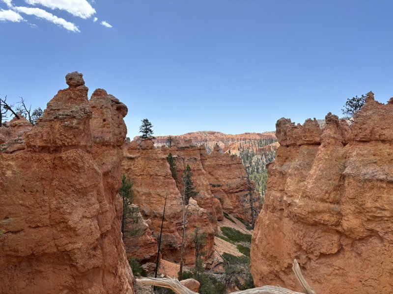
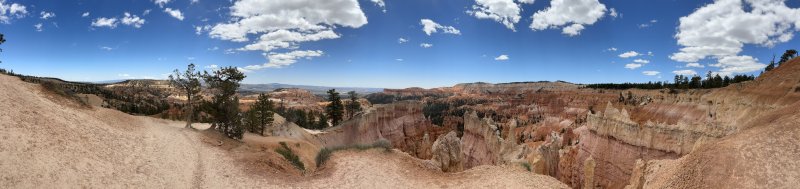
Bryce Canyon is famous for its hoodoos, expansive views from the large amphitheaters and the red rocks. The park is located at the top of the Grand Staircase (see picture below — south is on left and north to right) designated as the Pink Cliffs. Geologically it is home to some of the younger sedimentary rocks in the Colorado Plateau, deposited 50 to 30 mya in lakes and floodplains. The uppermost formation is the Claron formation which is predominately limestone and mudstone and the home of the hoodoos, natural amphitheaters, fins and walls that provide stunning views and hiking opportunities.
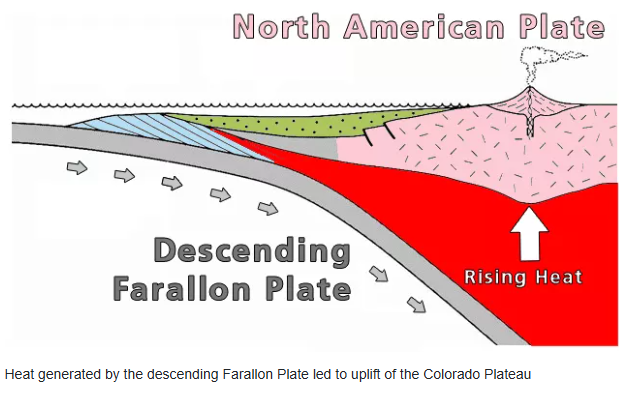
Hoodoos started life as flat lying layers of sedimentary materials deposited at or near sea level in lakes and floodplains. Keep in mind that the maximum elevation in the park is about 9,115 ft asl. How on God’s great flat earth did those rocks climb that high?? Tectonics baby!!
On the cartoon above, west is left, and east is right and there is about 1,000 miles between the east and west edge of the cartoon. As you read this, be aware that not all geologists wrap their arms around and hug this interpretation… but every science has its nay sayers. Would not be fun if we all shook our heads knowingly. Anyway, the Farallon Plate is one of the grandaddies of tectonic plates, at one time covering a significant area of the Pacific Ocean. It’s gone now, replaced by the Pacific Plate and a few others. But in its day, it was slowly and inexorably diving eastward under the North American Plate (the continental core) which was also moving westward and had its western boundary pretty much along the Interstate 15 corridor. To simplify it, think of shoving a pile of four or five pizza boxes under each other. As the first and second box go beneath the third and fourth, they rise up. Add a little heat to the mass and things get really exciting.
Anyway, back to hoodoos. This description is from the NPS geology section in the Bryce Canyon literature. The elevation in which Bryce Canyon is located receives both above freezing temperatures and below freezing temperatures over 170 nights out of the year. That is more than half of the days of the year in which Bryce Canyon reaches above/below freezing temperatures in the same night! This is crucial to creating the hoodoos. When water (from either rain or snow that has melted) seeps its way into the cracks in the rock, it resides there. Hours later, when Bryce Canyon is met with freezing temperatures, the water trapped inside the rock begins to freeze into ice. When water freezes into ice, it expands by 9%! This expansion into ice causes tremendous pressure on the surrounding rock, and thus causes it to break apart. This process is known as “ice wedging”, because the ice is literally wedging apart the rocks. From a plateau, eventually the rocks break down into walls, windows, and then as individual hoodoos.
Part of the beauty of the hoodoos comes from their strange patterns. The shape of the hoodoos is attributed to slight variances in the material which comprises the rock. If you recall from the “deposition” section above, there are multiple types of rocks that make up Bryce Canyon. All of the rocks contain abundant calcium carbonate (CaCO3), a mineral that dissolves when it comes into contact with even slightly acidic water. When it rains at Bryce Canyon, the (slightly) acidic rain is enough to dissolve the calcium carbonate that holds these rocks together and allows them to erode into their current shape (and continues to shape them). When you look at the Hoodoos you will notice some layers that jut out, and some that indent inwards. This is a result of the rocks having varying amounts of calcium carbonate cementation and that controls how easily dissolvable (or how resistant) that rock layer is.
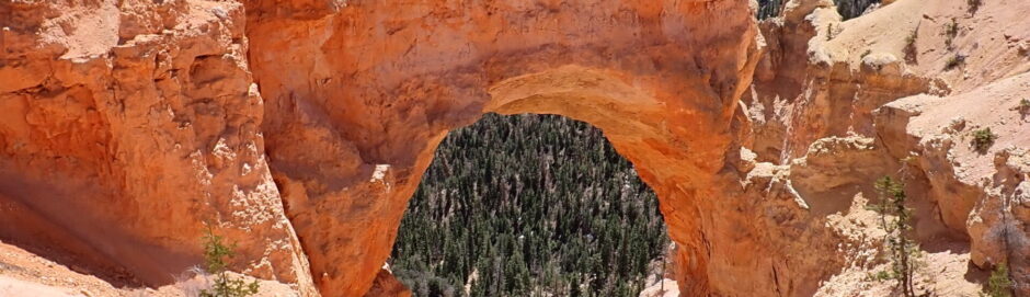
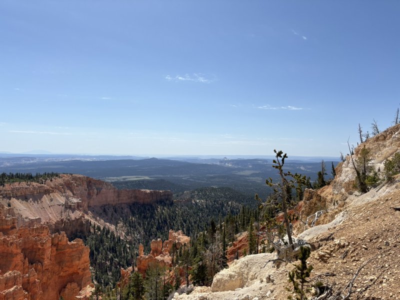
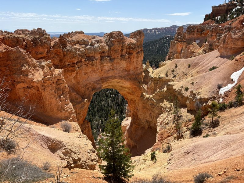
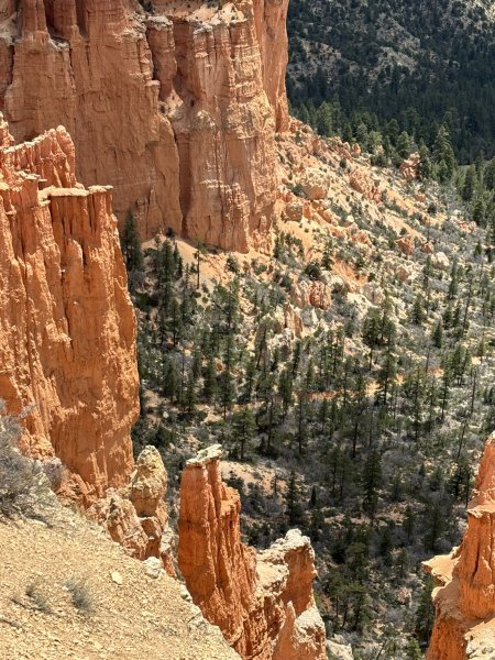
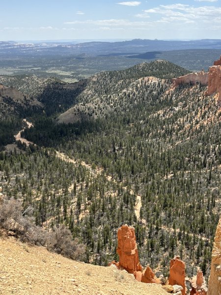
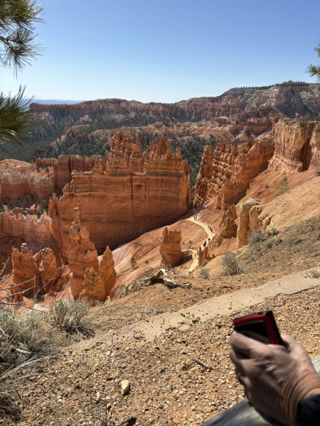
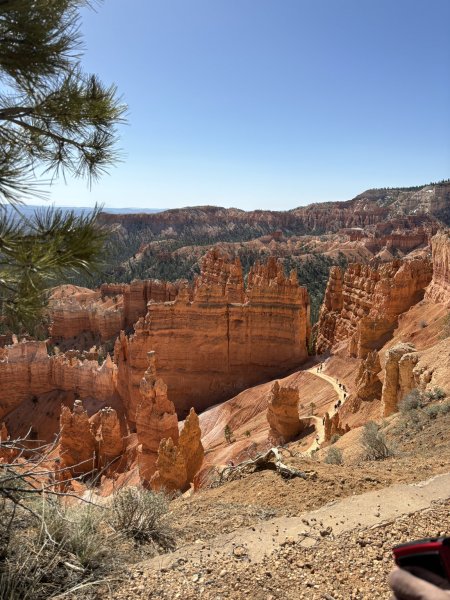
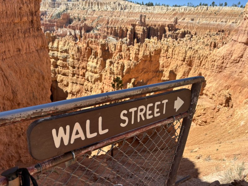
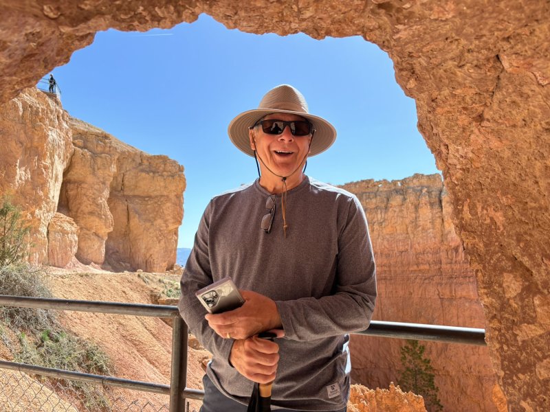
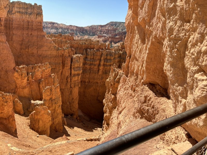
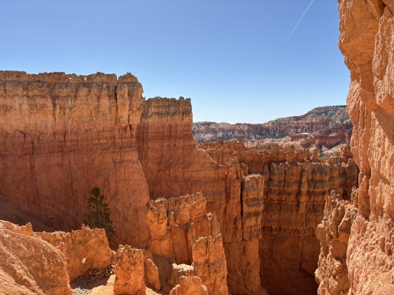
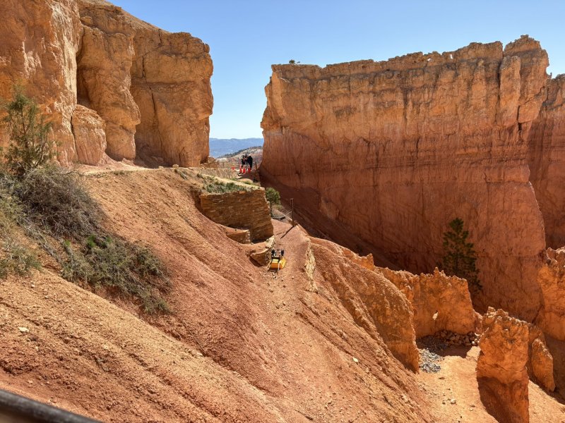
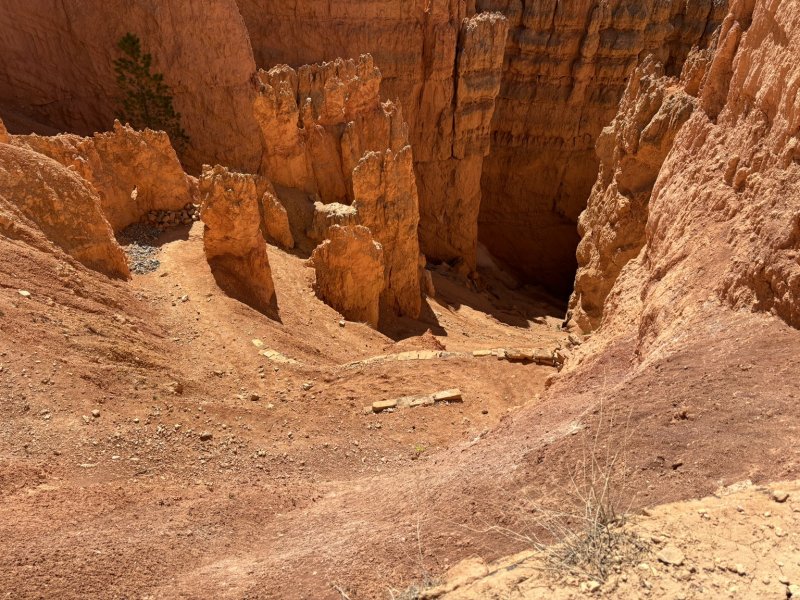
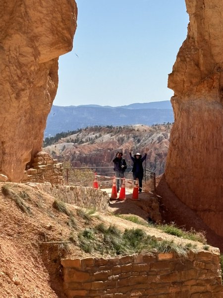
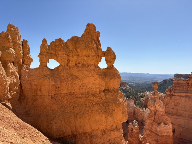
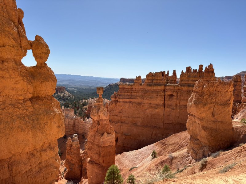
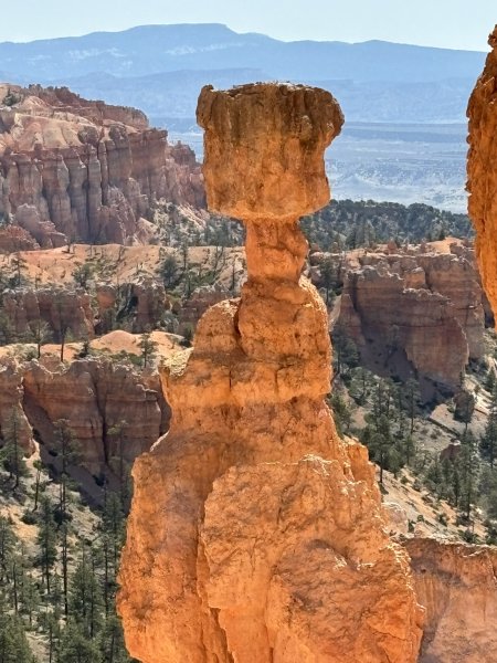
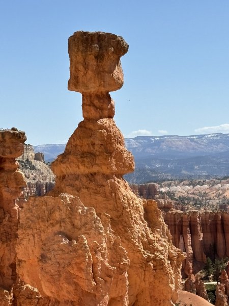
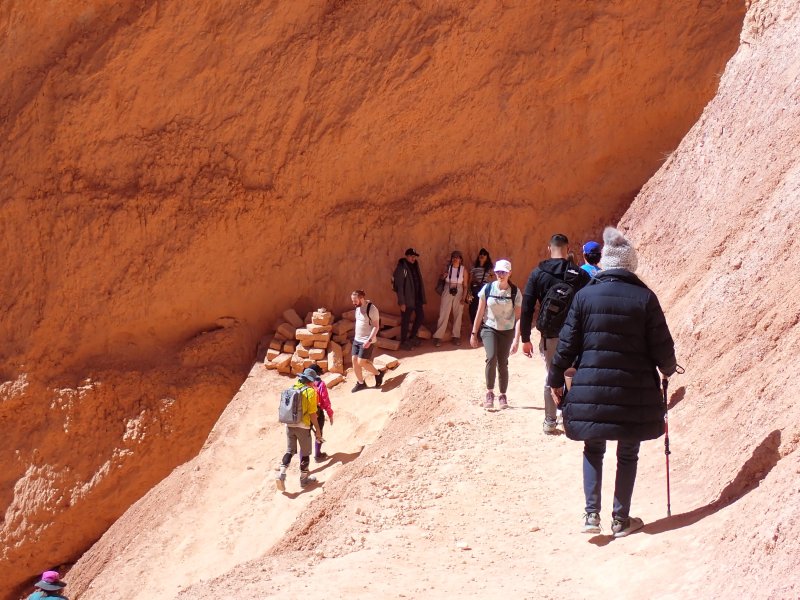
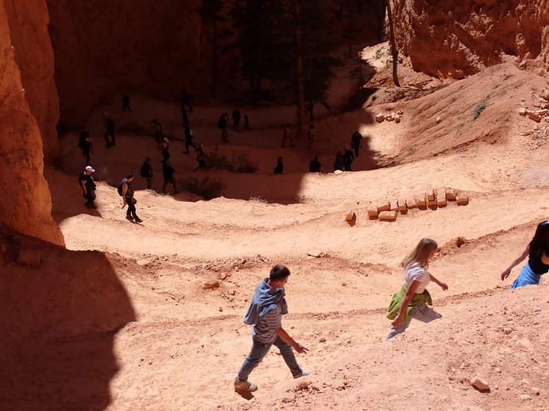
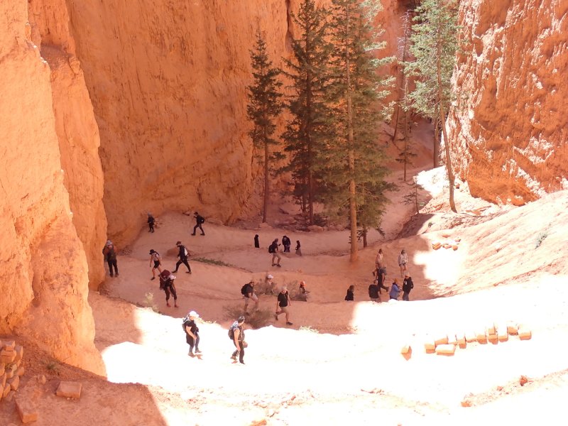
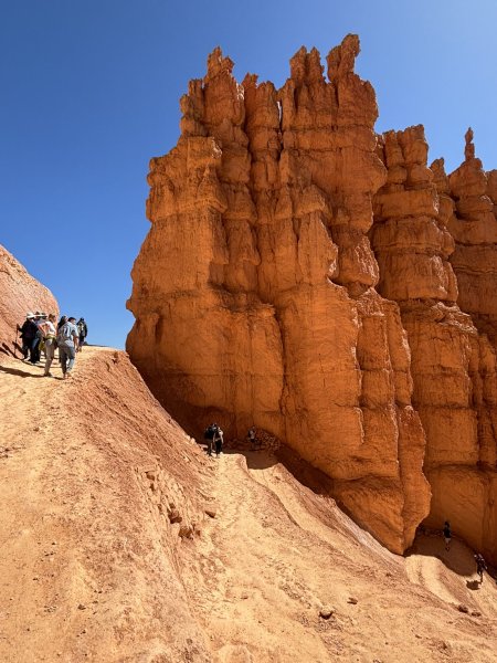
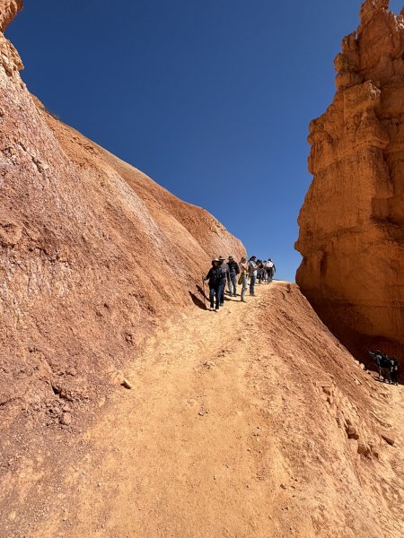
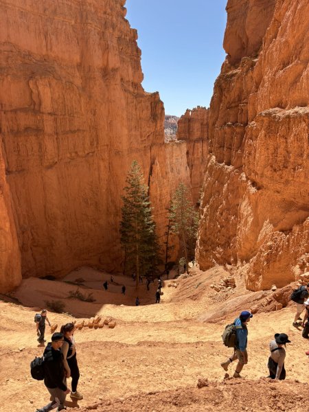
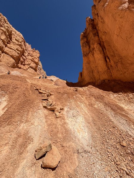
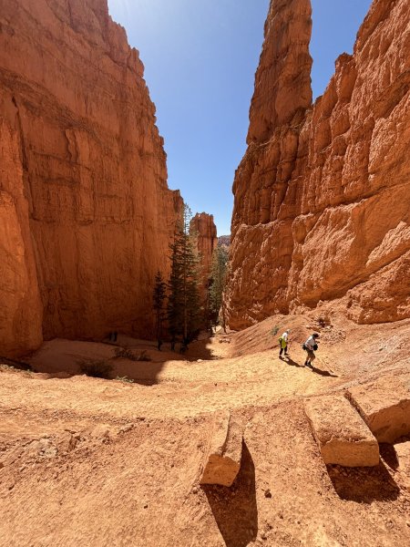
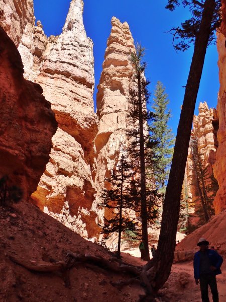
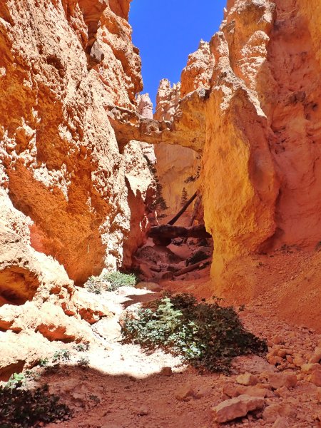
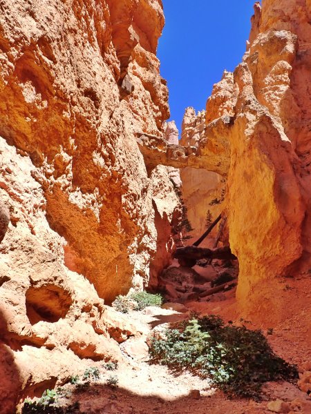
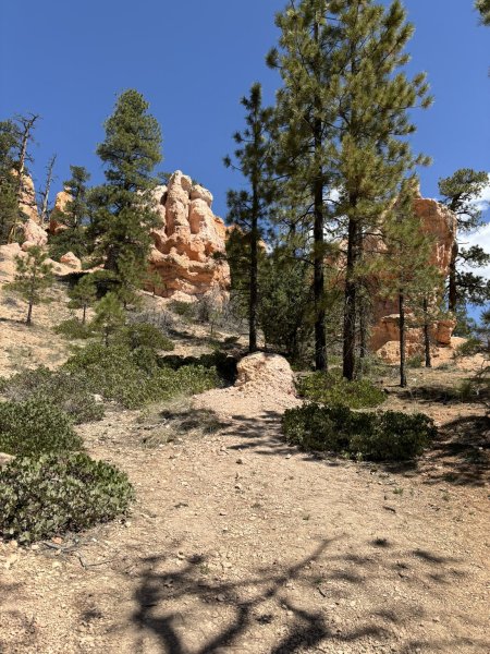
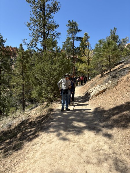
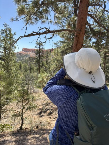
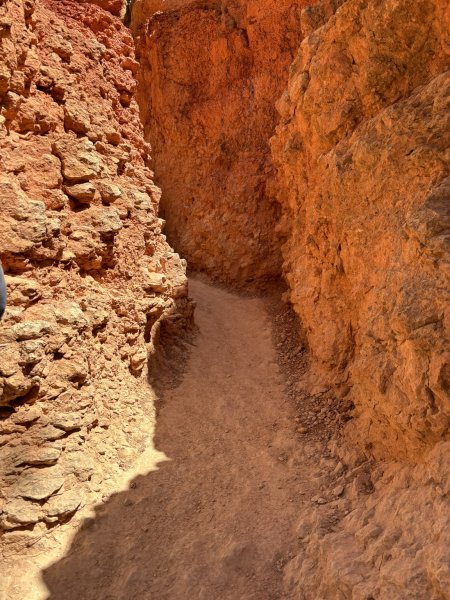
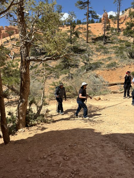
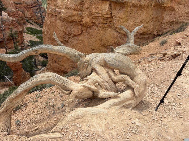
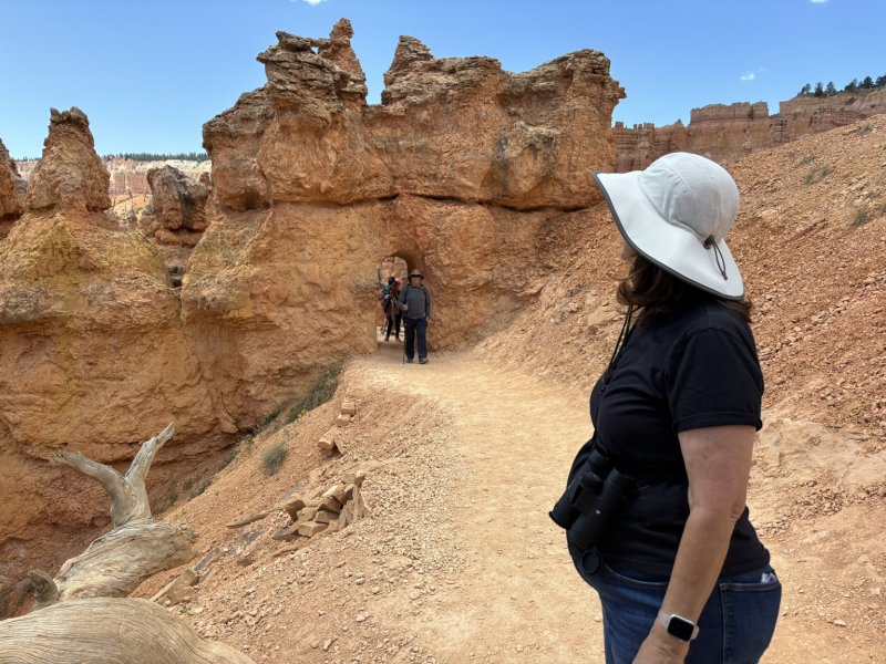
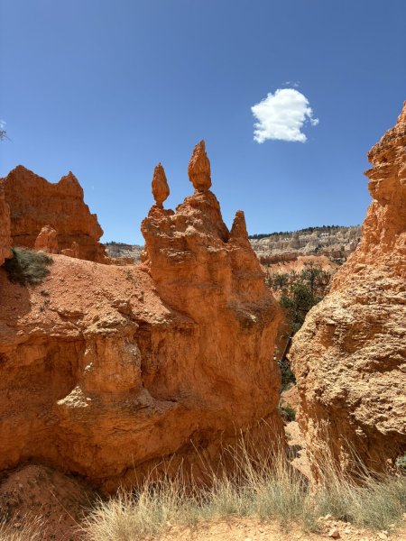
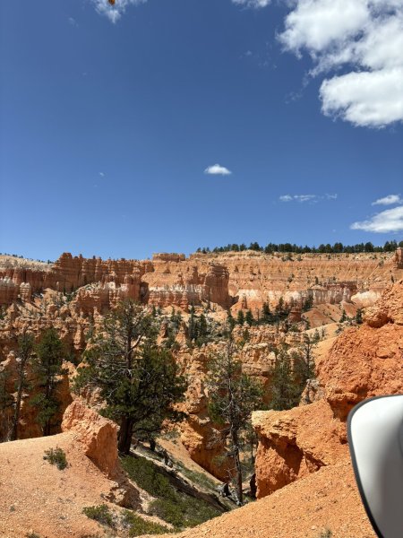
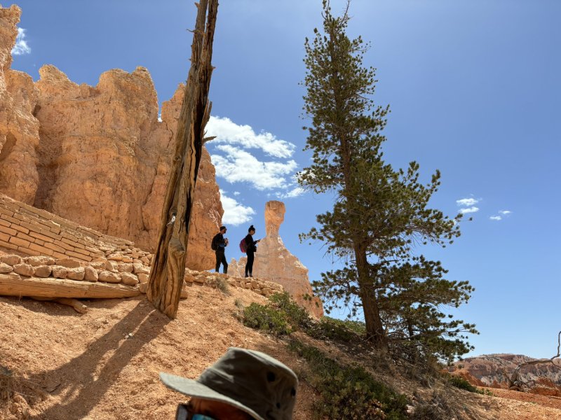
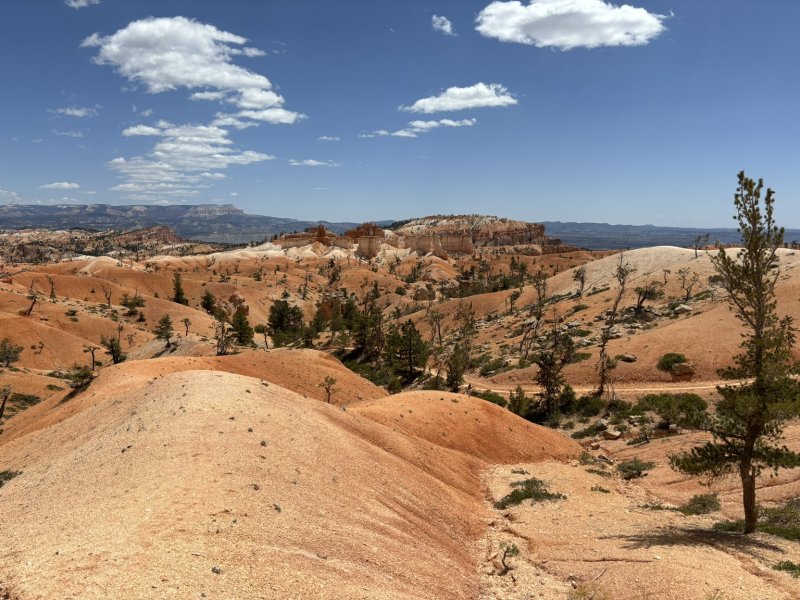
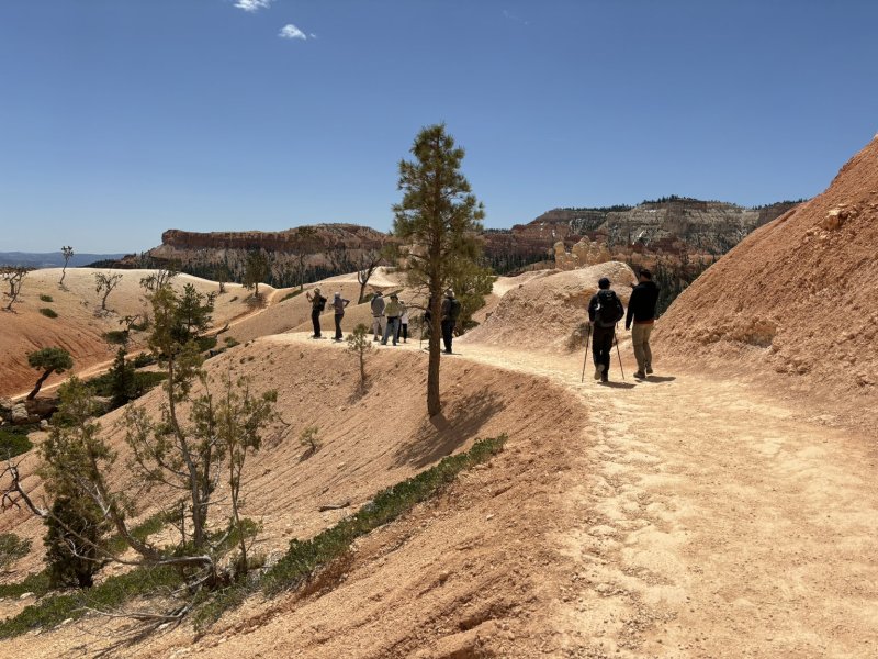
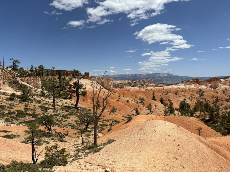
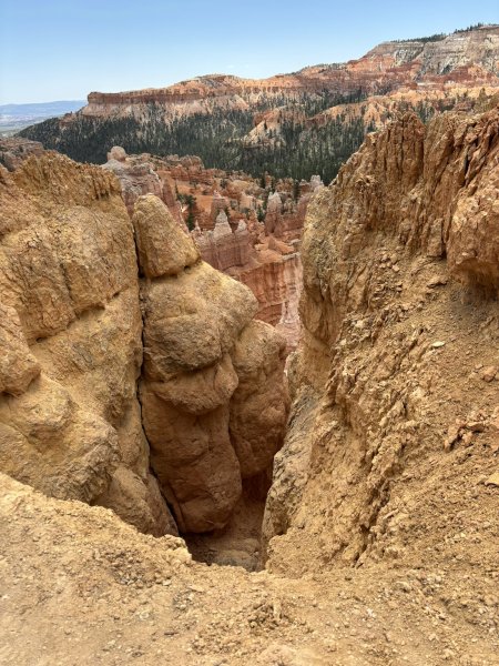
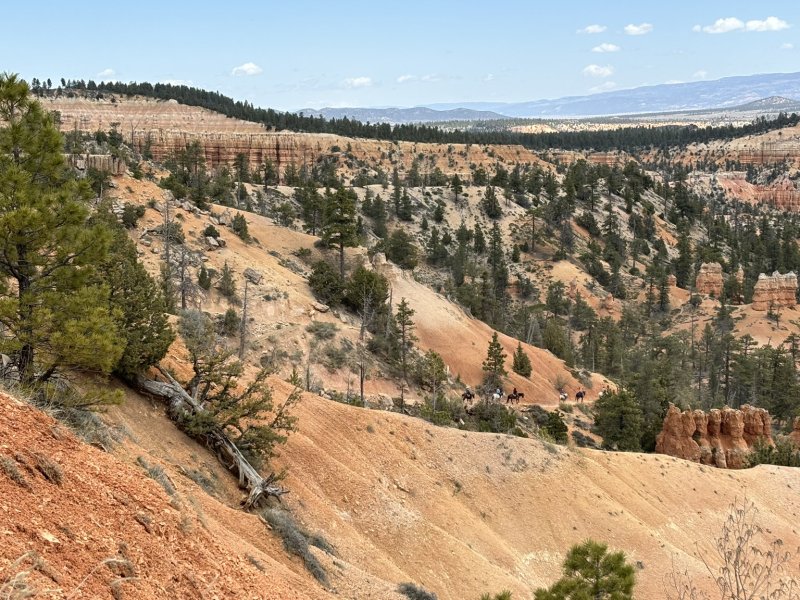
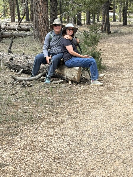
Almost all of the longer hikes in the park start at the top of the plateaus and work their way down through the hoodoos to the base of the Claron formation and then back up hill to the vehicle and beer and sandwiches. In what turned out to be a stroke of serendipity, due to weather changes, we did the longer hike that we had planned on our first full day in the park. We did the Navajo Loop and Queens Garden Trail which was a 3-mile 652-foot elevation change trail and then added the Sunrise Point to Sunset Point 1.1-mile trail to get back to the parking lot. All of the pictures below are of Day 1 in the park. Note the switchbacks, the closed Wall Street Trail and the natural bridges. A phenomenal hike with breathtaking scenery (literally on the hike up the cliffs).
Posted inGeology, Travel and Scenery|Comments Off on Bryce Canyon National Park – May 2 – May 3, 2024